1960s Maps of Humboldt County, California
Explore 26 historic maps of Humboldt County from the 1960s. These maps offer a rare glimpse into what life looked like during the 1960s — showing old roads, neighborhoods, homes, and landmarks that have changed or disappeared over time.
Whether you're researching your family's past, planning a metal detecting trip, or studying how Humboldt County's landscape evolved across the 1960s, these high-resolution maps are a powerful tool for exploring the history of this region.
- Focus on a specific era: All maps on this page are from the 1960s, giving you a focused view of this time period.
- See what’s changed: Compare century-old streets, trails, and buildings to today's modern landscape using overlays and satellite layers.
- Research with precision: Use these maps for genealogy, historical research, land use analysis, or educational projects.
- View, download, or print: Maps are fully viewable online in high resolution, and can be downloaded or printed for your own records.
Start exploring Humboldt County's history through authentic maps from the 1960s. This is your window into the past.
Humboldt County, CA maps
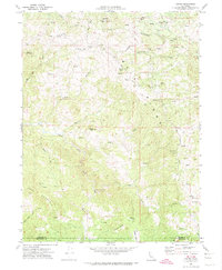
(26)- 1961 Map of Eureka
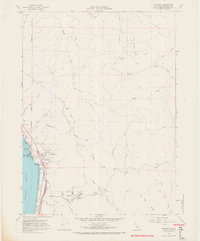
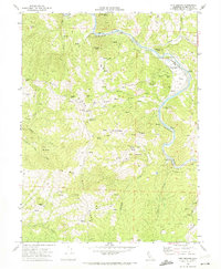
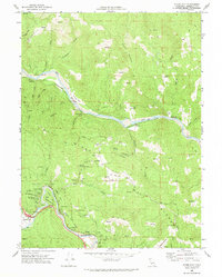
 1961 Eureka1961 Print · USGSThe Northern California coast and its deep redwood forests are mapped here at a time when the timber and rail industries defined the region. Researchers can trace historic family ranches and remote sites like Fort Dick, Table Bluff Lighthouse, and the Copper Creek Mine.2 unique versions available
 - 1963 Map of Weed
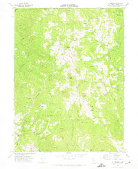
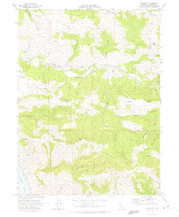
 1963 Weed1963 Print · USGSNorthern California during the early 1960s shows a landscape of steep mountain ranges and river-fed valleys at the height of the timber era. Researchers can trace the routes of the McCloud River RR, locate remote sites like the Holiday Mine, or find ancestral markers at the Scott Valley Cem.
 - 1966 Map of Crannell, 1968 Print
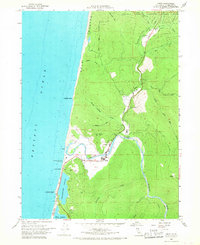
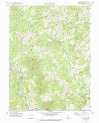
 1966 Crannell1968 Print · USGSCoastal Humboldt County is seen here in the mid-sixties as timber infrastructure and shoreline communities shaped the landscape. Trace the Old Railroad Grade through the hills or locate historic sites like McConnahas Mill and the settlement of Crannell.3 unique versions available
 - 1966 Map of Fern Canyon, 1968 Print
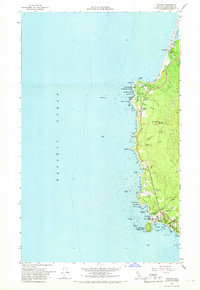
 1966 Fern Canyon1968 Print · USGSThe Humboldt County coastline and the redwoods are shown here in the mid-1960s, spanning the county line into Del Norte. You can trace early park access via the Zigzag Trail network leading to Fern Canyon and the Gold Bluffs beach.2 unique versions available
 - 1966 Map of Orick, 1968 Print
 1966 Orick1968 Print · USGSThe Humboldt County coast in the mid-1960s reveals a landscape of massive redwoods and tidal lagoons centered on the town of Orick. Researchers can trace the winding course of Redwood Creek past the County Fish Hatchery, Berry Glenn, and Gold Bluffs.2 unique versions available
 - 1966 Map of Rodgers Peak, 1968 Print
 1966 Rodgers Peak1968 Print · USGSThe Humboldt coast and the ancient redwood groves are documented here in the mid-sixties. Researchers can trace the Old Railroad Grade and locate the Howard Libbey Tree near the Grove of the Giants.2 unique versions available
 - 1966 Map of Trinidad, 1968 Print
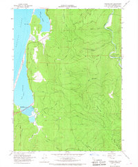
 1966 Trinidad1968 Print · USGSThe Humboldt County coast in the mid-sixties reveals a landscape of protected state parks and maritime activity. Genealogists and historians can trace local landmarks like Union Sch, the Trinidad Head Lighthouse, and the community at Big Lagoon.
 - 1969 Map of Taylor Peak, 1974 Print
 1969 Taylor Peak1974 Print · USGSHumboldt County ranching culture is well-documented in this late 1960s survey of the rugged ridges between the Bear and Mattole Rivers. Researchers can trace family-held lands like McClellan Ranch and Chase Ranch or locate the remote Cem near Hacketsville.
 - 1969 Map of Fort Seward, 1974 Print
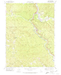
 1969 Fort Seward1974 Print · USGSHumboldt County’s river-and-rail corridor is captured here in the late sixties, where the Northwestern Pacific snakes along the Eel River. Genealogists and researchers can locate remote landmarks like Hubbard Station, the Hurlbutt Ranch, and the Woods Mine.2 unique versions available
 - 1969 Map of Cooskie Creek, 1974 Print
 1969 Cooskie Creek1974 Print · USGSCoastal Humboldt County is seen here in the late sixties, where the high ridges of the King Range drop directly into the sea. Researchers can trace remote paths like the Jeep Trail leading to the Point Gorda Lighthouse or the steep terrain of Sea Lion Gulch.3 unique versions available
 - 1969 Map of Redcrest, 1974 Print
 1969 Redcrest1974 Print · USGSCoastal Humboldt County was a landscape of timber and transit in the late sixties, where the river-bound railroad connected small mill towns. Trace the historic route of the Avenue of the Giants past Redcrest, Holmes, and the site of Strongs Station.2 unique versions available
 - 1969 Map of Briceland, 1974 Print
 1969 Briceland1974 Print · USGSHumboldt County’s southern timber and ranching country comes into focus in the late sixties, showcasing the remote headwaters of the Mattole River. Researchers can locate old community hubs like Briceland, trace family roots near Whitethorn Sch, or follow the trails along Gibson Ridge.4 unique versions available
 - 1969 Map of Cape Mendocino, 1974 Print
 1969 Cape Mendocino1974 Print · USGSThe westernmost edge of the California coast comes alive in this late 1960s record of Humboldt County. Researchers can trace the rugged shoreline from the U.S. Coast Guard Reservation to family landmarks like Cape Ranch and the site of the Ocean House.
 - 1969 Map of Bull Creek, 1974 Print
 1969 Bull Creek1974 Print · USGSHumboldt County at the end of the sixties reveals a landscape of massive redwood groves and high mountain ridges. Researchers can trace remote homesteads like Rainbow Ranch and Mann Ranch or locate the historic Bull Creek Cem deep in the woods.2 unique versions available
 - 1969 Map of Myers Flat, 1974 Print
 1969 Myers Flat1974 Print · USGSHumboldt County’s redwood forests and the Eel River corridor are captured here in the late sixties. Genealogists and historians can trace the Avenue of the Giants through Humboldt Redwoods State Park or locate the old rail stops at McCann and Fruitland.
 - 1969 Map of Ettersburg, 1974 Print
 1969 Ettersburg1974 Print · USGSHumboldt County’s remote Mattole River valley is captured here in the late sixties, showing a landscape of isolated ranching and steep timberlands. Researchers can trace historic property boundaries and old access routes like Thomas Road and Salmon Creek Road while locating landmarks such as Ettersburg and Phelps Ranch.3 unique versions available
 - 1969 Map of Blocksburg, 1974 Print
 1969 Blocksburg1974 Print · USGSHumboldt County ranching and rail life are preserved here in the late sixties, centered on the high ridges above the river. Genealogists and researchers can trace the Northwestern Pacific River rail corridor through Eel Rock or locate the Payton Ranch and Cem at Blocksburg.2 unique versions available
 - 1969 Map of Petrolia, 1974 Print
 1969 Petrolia1974 Print · USGSHumboldt County's remote coast is captured here in the late 1960s, centered on the historic oil-producing settlement of Petrolia. Researchers can trace old family landmarks and burial sites like Graves or locate State Historical Mon 543 First Oil Field in California near the Mattole River.
 - 1969 Map of Weott, 1974 Print
 1969 Weott1974 Print · USGSHumboldt County’s redwood corridor is documented here during the late sixties, showing the integration of state parklands with river settlements. You can trace the historic Northwestern Pacific line or locate landmarks like the Founders Tree and the Dyerville site.2 unique versions available
 - 1969 Map of Harris, 1974 Print
 1969 Harris1974 Print · USGSThe Humboldt and Mendocino county line is captured here in the late sixties, centered on the ranching community of Harris. Researchers can trace old family holdings and rural infrastructure through the Harris PO, Muller Ranch, and landmarks like Spruce Grove.2 unique versions available
 - 1969 Map of Capetown, 1974 Print
 1969 Capetown1974 Print · USGSCoastal Humboldt County is documented here in the late sixties as the region's ranching and river-valley geography remained largely intact. Researchers can trace family-named landmarks and rural outposts like Green Pond Ranch, Graves, and the settlement of Capetown.2 unique versions available
 - 1969 Map of Jewett Rock, 1974 Print
 1969 Jewett Rock1974 Print · USGSThe Eel River canyon and surrounding ridgelines of Humboldt County are captured here just before the 1970s. Trace the remote rail operations of the Northwestern Pacific and find family landmarks like White Ranch, Schroeder Rock, and the Kekawaka Sta.2 unique versions available
 - 1969 Map of Bridgeville, 1974 Print
 1969 Bridgeville1974 Print · USGSHumboldt County's river-cut canyons are captured here in the late sixties as life centered on the Van Duzen River corridor. Researchers can locate family landmarks at Bridgeville, the riverside Cem, and rural points like Schoolhouse Hill.2 unique versions available
 - 1969 Map of Shelter Cove, 1974 Print
 1969 Shelter Cove1974 Print · USGSThe Humboldt County coast was undergoing significant recreational and residential planning in the late sixties. Researchers can trace the street layouts of Shelter Cove and find remote sites like Kaluna Cliff, Queen Peak, and several inland Mines.3 unique versions available
 - 1969 Map of Alderpoint, 1974 Print
 1969 Alderpoint1974 Print · USGSThe Eel River canyon and surrounding ranches come into sharp focus in the late 1960s. Genealogists and local historians can trace the foundations of this community through family landmarks like Stockton Ranch, the Jewett Sch, and the Cain Rock Crossing.2 unique versions available
Showing maps 1-25 of 26
Top cities of Humboldt County
- Eureka historical maps
- Arcata historical maps
- McKinleyville historical maps
- Fortuna historical maps
- Fortuna historical maps
- Rio Dell historical maps
See more
Frequently asked questions
- What are the different types of historical maps available for Humboldt County?
- What is the oldest map of Humboldt County?
- Where can I purchase historical maps of Humboldt County for my home or office?
- Where can I download high-res historical maps of Humboldt County?
- Are there historical topographic maps available for Humboldt County?
- Is there historical aerial imagery available for Humboldt County?
- Where are historical maps of Humboldt County sourced from?