1990s Maps of Humboldt County, California
Explore 32 historic maps of Humboldt County from the 1990s. These maps offer a rare glimpse into what life looked like during the 1990s — showing old roads, neighborhoods, homes, and landmarks that have changed or disappeared over time.
Whether you're researching your family's past, planning a metal detecting trip, or studying how Humboldt County's landscape evolved across the 1990s, these high-resolution maps are a powerful tool for exploring the history of this region.
- Focus on a specific era: All maps on this page are from the 1990s, giving you a focused view of this time period.
- See what’s changed: Compare century-old streets, trails, and buildings to today's modern landscape using overlays and satellite layers.
- Research with precision: Use these maps for genealogy, historical research, land use analysis, or educational projects.
- View, download, or print: Maps are fully viewable online in high resolution, and can be downloaded or printed for your own records.
Start exploring Humboldt County's history through authentic maps from the 1990s. This is your window into the past.
Humboldt County, CA maps
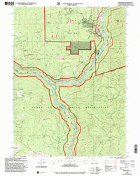
(32)- 1997 Map of Sims Mountain
 1997 Sims Mountain1997 Print · USGSHumboldt and Trinity counties are shown during the late 1990s, where the river-cut canyons meet the high ridges of the national forests. Researchers can trace the remote locations of Manzanita Ranch, Wise Station, and the Last Chance Trail through the wilderness.
 - 1997 Map of Shubrick Peak, 1999 Print
 1997 Shubrick Peak1999 Print · USGSThe Humboldt County coast in the late nineties is captured here as a wild landscape of ridges and ocean terraces. Researchers can trace remote features like the Landing Strip at Big Flat, the heights of Shubrick Peak, and the winding Mattole River.
 - 1997 Map of Shelter Cove, 1999 Print
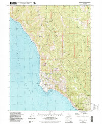 1997 Shelter Cove1999 Print · USGSCoastal Humboldt County meets the sea at Point Delgada in the late 1990s, where the King Range National Conservation Area protects the shoreline. Trace local infrastructure and recreation sites including the Pacific Landing Strip, Tolkan Campground, and Mines near Queen Peak.
 - 1997 Map of Mad River Buttes, 2001 Print
 1997 Mad River Buttes2001 Print · USGSHumboldt County’s river-cut backcountry is documented here during the late 1990s as the wilderness and ranching culture persisted in Northern California. Researchers can locate remote outposts like Three Cabins, trace family holdings at Mt View Ranch, and survey the steep terrain around Rooster Rock.
 - 1997 Map of Tish Tang Point, 2001 Print
 1997 Tish Tang Point2001 Print · USGSNorthwestern California's mountainous interior comes into focus during the late nineties, showcasing the interface between tribal lands and national forest. Trace historical trails and remote landmarks like Box Camp, Sign Board Gap, and the high ridges of the Trinity Alps Wilderness.
 - 1997 Map of Trinity Mountain, 2001 Print
 1997 Trinity Mountain2001 Print · USGSThe high backcountry of the Humboldt and Trinity county line comes into focus in the late nineties, showing a landscape defined by forest service outposts and ridgeline trails. Trace the locations of historic camps like Lipps Camp and One Mile Camp or landmarks like Graveyard Prairie.
 - 1997 Map of Black Lassic, 2001 Print
 1997 Black Lassic2001 Print · USGSThe high peaks of the Humboldt-Trinity county line are captured here in the late 1990s as the regional landscape supported seasonal ranching and timber work. Researchers can trace the drainages of the Van Duzen River and locate remote landmarks like Dutchman Camp, Senteney Rock, and Fingal Ranch.
 - 1997 Map of Lonesome Ridge, 2001 Print
 1997 Lonesome Ridge2001 Print · USGSThe high ridges and deep gulches of the tri-county border area are captured here in the late nineties. Local researchers can trace old camps and remote water sources like Loose Camp, Onion Lake, and the high-elevation Laird Meadow.
 - 1997 Map of Hopkins Butte, 2001 Print
 1997 Hopkins Butte2001 Print · USGSThe Humboldt County mountains in the late 1990s reveal a landscape of deep timber and historic mining claims. Researchers can trace the legacies of the Ferris Mine and Red Cap Central Mine alongside landmarks like Schnable Diggings and the Lockharts (Site).
 - 1997 Map of Blue Creek Mountain, 2001 Print
 1997 Blue Creek Mountain2001 Print · USGSHumboldt and Del Norte counties meet at this high-altitude wilderness boundary in the late nineties. Researchers can trace the remote drainage of Blue Creek and locate landmarks like Bear Pen Flat and the peaks along Lookout Point Ridge.
 - 1997 Map of Orleans, 2001 Print
 1997 Orleans2001 Print · USGSThe Klamath River canyon in the late nineties shows a landscape of family homesteads and mining history within Humboldt County. Researchers can locate the Orleans Ukonom Cem and trace legacy landholdings like the Hunter Little Ranch and Reece Homestead.
 - 1997 Map of Fish Lake, 2001 Print
 1997 Fish Lake2001 Print · USGSIn the northern California wilderness during the late nineties, this survey details the dense drainage of the Klamath River basin. Researchers can trace the Cedar Camp Road to find Wright Place (Site) and high lakes like Fish Lake.
 - 1997 Map of Dinsmore, 2001 Print
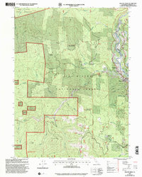
 1997 Dinsmore2001 Print · USGSThe mountain communities of the California coast range are documented here in the late nineties, centered on the river valleys of the Six Rivers National Forest. Researchers can trace the layout of Dinsmore and Mad River, including local landmarks like Southern Trinity High School and the Dinsmore-Humboldt County Airport.
 - 1997 Map of Maple Creek, 2001 Print
 1997 Maple Creek2001 Print · USGSHumboldt County ranching and timber lands are preserved here as they stood in the late twentieth century. Researchers can locate remote family landmarks like Ayers Cabin and Russ Ranch or trace the geography of high-country clearings such as Lake Prairie.
 - 1997 Map of Blake Mountain, 2001 Print
 1997 Blake Mountain2001 Print · USGSThe Humboldt and Trinity county borderlands come alive in this late-nineties survey of the high ridge country. Researchers can trace the legacy of remote outposts and water sources at Becker Cabin (Site), Skull Camp, and Happy Jack Spring.
 - 1997 Map of Salmon Mountain, 2001 Print
 1997 Salmon Mountain2001 Print · USGSThe Salmon Mountains high country is captured here in the late 1990s, where three national forests meet. Researchers can trace remote trails and peaks like Salmon Mountain, Mullens Camp, and Red Cap Prairie across this wilderness landscape.
 - 1997 Map of Willow Creek, 2001 Print
 1997 Willow Creek2001 Print · USGSWillow Creek and the Trinity River corridor are captured here during the late 1990s as the region balanced forest management with growing recreation. Genealogists and local historians can pinpoint Morton Ranch, Trinity Valley School, and the Willow Creek Airport.
 - 1997 Map of Hoopa, 2001 Print
 1997 Hoopa2001 Print · USGSHoopa Valley and the Trinity River corridor are captured here in the late 1990s as the heart of the reservation and national forest. Researchers can locate the Hoopa Valley Landing Strip, the historic Rain Rock, and family landmarks like Sugar Bowl Ranch.
 - 1997 Map of Alderpoint, 2001 Print
 1997 Alderpoint2001 Print · USGSThe Eel River valley in the late 1990s was a landscape of remote ranches and mountainous forest service land. Researchers can find old educational sites like Jewett Sch and family landmarks such as Ware Ranch or the Cain Rock Crossing.
 - 1997 Map of Showers Mountain, 2001 Print
 1997 Showers Mountain2001 Print · USGSHumboldt County’s high forest country is captured here during the late nineties, showing a landscape defined by timber and traditional ranching. Researchers can locate the Site of Fort Baker, the Schoolhouse Opening, and family sites like Stapp Ranch.
 - 1997 Map of Lord-Ellis Summit, 2001 Print
 1997 Lord-Ellis Summit2001 Print · USGSHumboldt County’s high ridges and creek valleys are documented here during the late 1990s, showing a mix of tribal, federal, and private lands. Researchers can locate the Redwood School, the Redwood Creek Ranch, and geographic markers like Lord-Ellis Summit.
 - 1997 Map of Weitchpec, 2001 Print
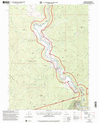
 1997 Weitchpec2001 Print · USGSNorthern California’s river canyon country is mapped here in the late nineties, documenting where the Klamath and Trinity Rivers meet. Genealogists can locate Essenpries Mill Cem (Site) and ancestral settlements like Weitchpec and Saints Rest Bar.
 - 1997 Map of Hennessy Peak, 2001 Print
 1997 Hennessy Peak2001 Print · USGSThe Trinity and Klamath rivers converge in this late-nineties survey of the Humboldt and Trinity county line. Trace the path of the South Fork Trinity River past Cedar Grove Ranch and the lookout at Hennessy Peak.
 - 1997 Map of Board Camp Mountain, 2001 Print
 1997 Board Camp Mountain2001 Print · USGSHumboldt County’s high country is captured here in the late 1990s, showcasing the timber and ranching landscape within the Six Rivers National Forest. Researchers can locate remote landmarks like Nolan Cabin, Deer Creek Ranch, and the summit of Board Camp Mountain.
 - 1997 Map of Grouse Mountain, 2001 Print
 1997 Grouse Mountain2001 Print · USGSHumboldt County’s high country is captured here during the late nineties, showing the remote forest lands and isolated dwellings of the era. Genealogists and local historians can trace family-named sites like Bartlett Ranch, McMillion Cabin, and the high-elevation Grouse Mountain Lookout.
Showing maps 1-25 of 32
Top cities of Humboldt County
- Eureka historical maps
- Arcata historical maps
- McKinleyville historical maps
- Fortuna historical maps
- Fortuna historical maps
- Rio Dell historical maps
See more
Frequently asked questions
- What are the different types of historical maps available for Humboldt County?
- What is the oldest map of Humboldt County?
- Where can I purchase historical maps of Humboldt County for my home or office?
- Where can I download high-res historical maps of Humboldt County?
- Are there historical topographic maps available for Humboldt County?
- Is there historical aerial imagery available for Humboldt County?
- Where are historical maps of Humboldt County sourced from?