1990s Maps of Lake County, California
Explore 40 historic maps of Lake County from the 1990s. These maps offer a rare glimpse into what life looked like during the 1990s — showing old roads, neighborhoods, homes, and landmarks that have changed or disappeared over time.
Whether you're researching your family's past, planning a metal detecting trip, or studying how Lake County's landscape evolved across the 1990s, these high-resolution maps are a powerful tool for exploring the history of this region.
- Focus on a specific era: All maps on this page are from the 1990s, giving you a focused view of this time period.
- See what’s changed: Compare century-old streets, trails, and buildings to today's modern landscape using overlays and satellite layers.
- Research with precision: Use these maps for genealogy, historical research, land use analysis, or educational projects.
- View, download, or print: Maps are fully viewable online in high resolution, and can be downloaded or printed for your own records.
Start exploring Lake County's history through authentic maps from the 1990s. This is your window into the past.
Lake County, CA maps
(40)- 1991 Map of Van Arsdale Reservoir
 1991 Van Arsdale Reservoir1991 Print · USGSThe Mendocino National Forest in the early 1990s is captured here, centered on the Eel River and the Lake County line. Genealogists and researchers can trace local landmarks like Hartstone Camp, Van Arsdale Reservoir, and Deadmans Flat.
 - 1991 Map of Upper Lake, 1995 Print
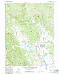 1991 Upper Lake1995 Print · USGSUpper Lake and the surrounding rancherias are shown here during the late twentieth century, before major changes to the valley drainage. You can trace local history through the Bloody Island Massacre Historical Marker, the Witter Springs P O, and several area schools like Union High Sch.
 - 1991 Map of Wilbur Springs, 1995 Print
 1991 Wilbur Springs1995 Print · USGSThe mining country of the California Coast Range comes into focus in the early nineties, centered on the mineral springs and mercury claims of the Colusa-Lake county line. Genealogists and historians can trace old claims at Abbott Mine or locate the remote Schoolhouse and early settlements like Deadshot.
 - 1993 Map of Clearlake Highlands
 1993 Clearlake Highlands1993 Print · USGSThe southeastern shores of Clear Lake come alive in the early nineties as residential growth transforms the waterfront. Researchers can trace the development of Clearlake Highlands, locate the Burns Valley School, and explore the protected wetlands of Anderson Marsh State Historical Park.
 - 1993 Map of Mount St. Helena
 1993 Mount St. Helena1993 Print · USGSThe high ridges where Sonoma, Lake, and Napa counties meet are captured here in the early nineties, showing a landscape of geothermal energy and protected wilderness. Researchers can trace historic property lines like Knights Grant and find old mining sites including Chicago Mine and Wall Street Mine.
 - 1993 Map of Highland Springs
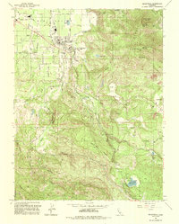
 1993 Highland Springs1993 Print · USGSLake County high country meets the fertile Big Valley in the early nineties, revealing a landscape of mountain peaks and water reservoirs. Trace the winding Hopland Grade Road across the county line or locate local landmarks like Lampson Field and Highland Springs.
 - 1993 Map of Detert Reservoir
 1993 Detert Reservoir1993 Print · USGSThe mining-scarred ridges of the Mayacmas Mountains come into focus in the early 1990s as they bridge Lake and Napa counties. Genealogists and historians can trace the locations of legendary quicksilver workings like the Oat Hill Mine and Silverado Mine near Table Mountain.
 - 1993 Map of Lower Lake
 1993 Lower Lake1993 Print · USGSLake County in the early nineties shows a landscape of expanding lakeside communities and rugged backcountry peaks. Genealogists and historians can trace the developments around Lower Lake, the grounds of Yuba College, and the rural site of Baker Mine.2 unique versions available
 - 1993 Map of Kelseyville
 1993 Kelseyville1993 Print · USGSThe Big Valley region and the volcanic peaks of the Mayacmas Mountains appear in clear detail during the early nineties. Researchers can trace the agricultural layout around Kelseyville, from the local Cem and High Sch to Geothermal Wells on the mountain ridges.
 - 1993 Map of Whispering Pines
 1993 Whispering Pines1993 Print · USGSLake County resort life and geothermal energy development meet in the early nineties near the Boggs Mtn State Forest. Researchers can trace the legacy of mineral water retreats at Harbin Springs and Anderson Springs or locate numerous Geothermal Wells on the mountain ridges.
 - 1993 Map of Middletown
 1993 Middletown1993 Print · USGSMiddletown and the surrounding ranch lands of southern Lake County are seen here in the early nineties. Genealogists and historians can trace the Cem and Historical Marker while exploring features like Hidden Valley Lake and the US Coast Guard Reservation.
 - 1993 Map of Asti
 1993 Asti1993 Print · USGSThe Alexander Valley and Russian River wine country come into focus in the early nineties. Genealogists and historians can trace the Northwestern Pacific rail line through Asti or locate landmarks like Our Lady of Carmel Church.
 - 1993 Map of The Geysers
 1993 The Geysers1993 Print · USGSThe Mayacmas Mountains in the early nineties show a unique landscape of geothermal energy production and deep-rooted mining history. Researchers can trace old mineral claims like the Silver Bear Mine and Socrates Mine alongside settlements like Mercuryville.
 - 1994 Map of Lakeport
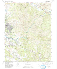
 1994 Lakeport1994 Print · USGSCoastal mountains meet the fertile Sacramento Valley in the 1990s, where the waters of Clear Lake define the western landscape. Researchers can trace the industrial footprint of the Sulphur Bank Mine, follow the Southern Pacific RR tracks, or locate old settlements like Fouts Springs and Lodoga.
 - 1996 Map of Elk Mountain, 2001 Print
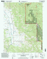
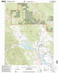
 1996 Elk Mountain2001 Print · USGSThe Mendocino and Lake county line runs through this mountainous forest landscape as it appeared in the mid-1990s. Researchers can locate early homesteading and industrial remains at York Cabin (Site) and Pfeiffer Mill (Site) or trace the high ridges from Elk Mountain to Bear Peak.
 - 1996 Map of Van Arsdale Reservoir, 2001 Print
 1996 Van Arsdale Reservoir2001 Print · USGSThe Eel River canyon and Mendocino National Forest are captured here in the mid-1990s, showing a rugged landscape of ranching outposts and water infrastructure. Genealogists and hikers can locate family landmarks like Ascherman Ranch or the Old Dashtell Place near Van Arsdale Reservoir.
 - 1996 Map of Crockett Peak, 2001 Print
 1996 Crockett Peak2001 Print · USGSThe high ridges of the Mendocino National Forest are captured in the late nineties, just as the area was being managed for its wilderness character. Trace historical sites like Marble Cabin (Site) and Milk Ranch along the slopes of Signal Peak and Crockett Peak.
 - 1996 Map of St. John Mountain, 2001 Print
 1996 St. John Mountain2001 Print · USGSGlenn County and the surrounding wilderness are captured here during the mid-1990s. Researchers can locate remote high-country landmarks like Meyers Cabin, trace the headwaters of Stony Creek, and find isolated spots such as Bonnie View and Upper Nye Camp.
 - 1996 Map of Bartlett Mountain, 2001 Print
 1996 Bartlett Mountain2001 Print · USGSLake County was characterized by high ridge ranching and forest management in the 1990s. Trace the local geography from the settlement of Nice up to historic landmarks like High Glade Lookout and the Jones Ranch.
 - 1996 Map of Lake Pillsbury, 2001 Print
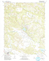
 1996 Lake Pillsbury2001 Print · USGSLake County's high forest country is centered on the waters of the Eel River in the late nineties. Local researchers can trace the locations of family holdings and mountain retreats like Faraway Ranch, Scott Dam, and the Lake Pillsbury Resort.
 - 1996 Map of Fouts Springs, 2001 Print
 1996 Fouts Springs2001 Print · USGSMendocino National Forest in the mid-nineties shows a landscape of remote ranger stations and high-mountain glades. Researchers can trace forest management and recreational history through sites like Fouts Springs, Red Rock Cabin, and Letts Lake.
 - 1996 Map of Potter Valley, 2001 Print
 1996 Potter Valley2001 Print · USGSPotter Valley in the late twentieth century remains a landscape of traditional ranching and high-mountain forest. Trace family histories at Potter Valley Cem or explore the geography of Potter Valley Rancheria and Pomo (Site).
 - 1996 Map of Bartlett Springs, 2001 Print
 1996 Bartlett Springs2001 Print · USGSLake County's high ridges and mineral springs are documented in the late twentieth century as they appeared within the Mendocino National Forest. Researchers can locate old mountain settlements and remote landmarks like Bartlett Springs, Newman Springs, and the Bartlett Cemetery.
 - 1996 Map of Potato Hill, 2001 Print
 1996 Potato Hill2001 Print · USGSThe Lake County wilderness is mapped here in the late twentieth century, showing the remote ridge-and-canyon country of the Mendocino National Forest. Researchers can locate isolated landmarks like Snow Mountain House and the geothermal waters of Crabtree Hot Springs.
 - 1996 Map of Upper Lake, 2001 Print
 1996 Upper Lake2001 Print · USGSUpper Lake and the Mendocino foothills appear in the mid-nineties as a landscape of tribal rancherias, historic springs, and valley agriculture. Genealogists can locate family landmarks like Witter Springs, Hunter Ranch, and the Union High Sch.
Showing maps 1-25 of 40
Top cities of Lake County
- Clearlake historical maps
- Lakeport historical maps
- Clearlake Riviera historical maps
- Kelseyville historical maps
- Lucerne historical maps
- Nice historical maps
See more
Frequently asked questions
- What are the different types of historical maps available for Lake County?
- What is the oldest map of Lake County?
- Where can I purchase historical maps of Lake County for my home or office?
- Where can I download high-res historical maps of Lake County?
- Are there historical topographic maps available for Lake County?
- Is there historical aerial imagery available for Lake County?
- Where are historical maps of Lake County sourced from?