Old Maps of Merced County, California
Explore 192 old maps of Merced County, spanning from 1893 to today. These high-resolution historic maps reveal how streets, neighborhoods, landmarks, and natural features evolved over time — perfect for genealogy, metal detecting, research, and local history exploration.
What you can do with these maps:
- See how Merced County changed over time: Compare historical maps to modern-day views to trace roads, homesites, rail lines & more.
- View detailed metadata: Each map includes creators, publishers, year, scale, and archive source.
- Overlay maps with satellite & LiDAR: Visualize the past alongside modern tools to explore terrain & human change.
- Trusted historical sources: Maps sourced from the USGS, Library of Congress, and other archives.
- Access maps your way: View online, download high-res files, or order prints for personal or research use.
Start exploring old maps of Merced County to uncover forgotten places, hidden landmarks, and the deep history beneath your feet.
Merced County, CA maps
(192)- 1893 Map of Sonora
 1893 Sonora1893 Print · USGSCovers Merced County, including Sonora, Jamestown, and other nearby areas
 - 1896 Map of Sonora
 1896 Sonora1896 Print · USGSCovers Merced County, including Sonora, Jamestown, and other nearby areas
 - 1897 Map of Sonora
 1897 Sonora1897 Print · USGSCovers Merced County, including Sonora, Jamestown, and other nearby areas8 unique versions available
 - 1898 Map of Sonora, 1932 Print
 1898 Sonora1932 Print · USGSCovers Merced County, including Sonora, Jamestown, and other nearby areas
 - 1913 Map of Dickenson
 1913 Dickenson1913 Print · USGSCovers Merced County, including Stanislaus County, United States, and other nearby areas
 - 1913 Map of Panoche
 1913 Panoche1913 Print · USGSCovers Merced County, including Dos Palos, South Dos Palos, and other nearby areas4 unique versions available
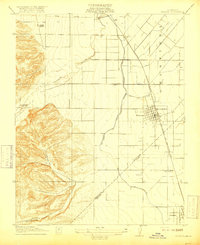
 - 1914 Map of Merced
 1914 Merced1914 Print · USGSCovers Merced County, including Merced, Bear Creek, and other nearby areas
 - 1915 Map of Owens Creek
 1915 Owens Creek1915 Print · USGSCovers Merced County, including Mariposa County, United States, and other nearby areas2 unique versions available
 - 1915 Map of La Grange, 1957 Print
 1915 La Grange1957 Print · USGSCovers Merced County, including La Grange, Stanislaus County, and other nearby areas
 - 1916 Map of Three Tree Flat
 1916 Three Tree Flat1916 Print · USGSCovers Merced County, including Stanislaus County, United States, and other nearby areas2 unique versions available
 - 1916 Map of Hopeton
 1916 Hopeton1916 Print · USGSCovers Merced County, including Merced, Bellevue Ranch, and other nearby areas
 - 1916 Map of Mitchell School
 1916 Mitchell School1916 Print · USGSCovers Merced County, including Turlock, Hatch, and other nearby areas
 - 1916 Map of Cressey
 1916 Cressey1916 Print · USGSCovers Merced County, including Livingston, Cressey, and other nearby areas
 - 1916 Map of Montpellier
 1916 Montpellier1916 Print · USGSCovers Merced County, including Montpelier, Stanislaus County, and other nearby areas2 unique versions available
 - 1916 Map of Santa Rita Bridge, 1948 Print
 1916 Santa Rita Bridge1948 Print · USGSCovers Merced County, including Santa Rita Park, Fresno County, and other nearby areas2 unique versions available
 - 1916 Map of Delta Ranch, 1948 Print
 1916 Delta Ranch1948 Print · USGSCovers Merced County, including Dos Palos Y, United States, and other nearby areas
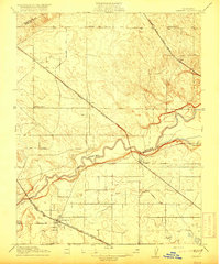
 - 1916 Map of Merced Falls, 1957 Print
 1916 Merced Falls1957 Print · USGSCovers Merced County, including Merced Falls, Mariposa County, and other nearby areas
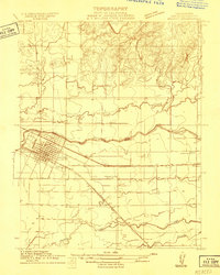
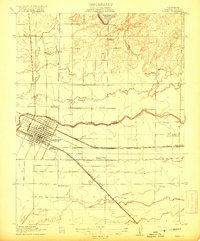
 - 1917 Map of Turlock
 1917 Turlock1917 Print · USGSCovers Merced County, including Turlock, Livingston, and other nearby areas
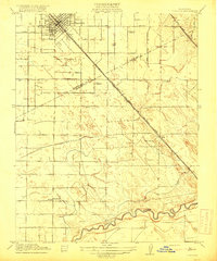
 - 1917 Map of Winton
 1917 Winton1917 Print · USGSCovers Merced County, including Atwater, Winton, and other nearby areas2 unique versions available
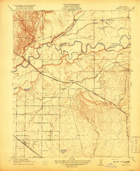
 - 1917 Map of Newman
 1917 Newman1917 Print · USGSCovers Merced County, including Newman, Gustine, and other nearby areas3 unique versions available
 - 1917 Map of Merced
 1917 Merced1917 Print · USGSCovers Merced County, including Merced, Bear Creek, and other nearby areas
 - 1918 Map of Snelling
 1918 Snelling1918 Print · USGSCovers Merced County, including Snelling, Stanislaus County, and other nearby areas3 unique versions available
 - 1918 Map of Arena
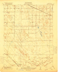 1918 Arena1918 Print · USGSCovers Merced County, including Atwater, Livingston, and other nearby areas2 unique versions available
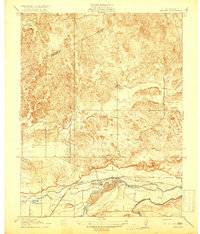
 - 1918 Map of Bliss Ranch
 1918 Bliss Ranch1918 Print · USGSCovers Merced County, including Madera County, United States, and other nearby areas2 unique versions available
 - 1918 Map of Owens Creek
 1918 Owens Creek1918 Print · USGSCovers Merced County, including Mariposa County, United States, and other nearby areas2 unique versions available
Showing maps 1-25 of 192
Top cities of Merced County
- Merced historical maps
- Los Banos historical maps
- Atwater historical maps
- Livingston historical maps
- Delhi historical maps
- Winton historical maps
See more
Frequently asked questions
- What are the different types of historical maps available for Merced County?
- What is the oldest map of Merced County?
- Where can I purchase historical maps of Merced County for my home or office?
- Where can I download high-res historical maps of Merced County?
- Are there historical topographic maps available for Merced County?
- Is there historical aerial imagery available for Merced County?
- Where are historical maps of Merced County sourced from?