1990s Maps of Modoc County, California
Explore 135 historic maps of Modoc County from the 1990s. These maps offer a rare glimpse into what life looked like during the 1990s — showing old roads, neighborhoods, homes, and landmarks that have changed or disappeared over time.
Whether you're researching your family's past, planning a metal detecting trip, or studying how Modoc County's landscape evolved across the 1990s, these high-resolution maps are a powerful tool for exploring the history of this region.
- Focus on a specific era: All maps on this page are from the 1990s, giving you a focused view of this time period.
- See what’s changed: Compare century-old streets, trails, and buildings to today's modern landscape using overlays and satellite layers.
- Research with precision: Use these maps for genealogy, historical research, land use analysis, or educational projects.
- View, download, or print: Maps are fully viewable online in high resolution, and can be downloaded or printed for your own records.
Start exploring Modoc County's history through authentic maps from the 1990s. This is your window into the past.
Modoc County, CA maps
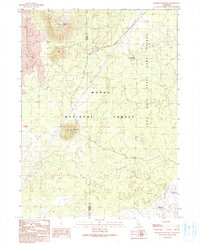
(135)- 1990 Map of Canby
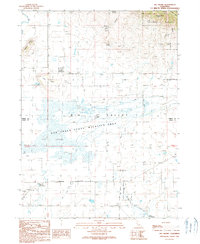
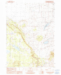
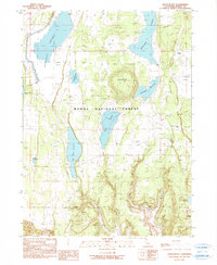
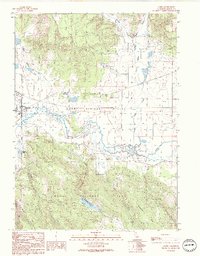 1990 Canby1990 Print · USGSUpper Modoc County in the early 1990s was a landscape where high-desert ranching met mountain timberlands. Researchers can trace the layout of Canby, locate the Arlington Sch, and find the geothermal activity at Kelley Hot Spring.
 - 1990 Map of Surprise Station
 1990 Surprise Station1990 Print · USGSNortheastern California's high plateau comes into focus here in the late twentieth century, showing a landscape shaped by the river and the reservation. You can locate the Chimney Rock Historical Mon, trace the North Fork Pit River, and find remote outposts like Surprise Station.
 - 1990 Map of Leonards Hot Springs
 1990 Leonards Hot Springs1990 Print · USGSSurprise Valley at the start of the nineties reveals a remote landscape of geothermal activity and seasonal lakebeds. Researchers can trace the infrastructure of the basin through the Causeway, Leonards Hot Springs, and the Surprise Valley Mineral Wells.
 - 1990 Map of McGinty Point
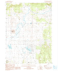
 1990 McGinty Point1990 Print · USGSGoose Lake was a shifting landscape of mud and water at the start of the 1990s. Researchers can trace the boundaries of the X L Ranch Indian Reservation, locate remote operations at Lakeshore Ranch, and follow the Causeway to McGinty Point.
 - 1990 Map of Alturas
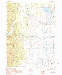
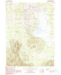
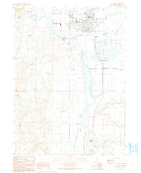 1990 Alturas1990 Print · USGSAlturas and the surrounding high desert wetlands are captured in detail during the late twentieth century. Researchers can trace the civic layout of the town, from the Alturas Rancheria to landmarks like Woods Place Dam and the Modoc High Sch.
 - 1990 Map of Larkspur Hills
 1990 Larkspur Hills1990 Print · USGSSurprise Valley's arid landscape is captured here in the late twentieth century, showing a region defined by its high-desert hydrology and water management. Researchers can trace seasonal water patterns at Upper Lake, Fee Reservoir, and the remote Poison Springs.
 - 1990 Map of Crank Mountain
 1990 Crank Mountain1990 Print · USGSThe high plateau of Modoc County is captured here in the late twentieth century, showing a landscape of volcanic buttes and critical water reservoirs. Researchers can locate the Happy Camp FS Station and trace paths through Sand Flat or up to the summit of Crank Mountain.
 - 1990 Map of Sugar Hill
 1990 Sugar Hill1990 Print · USGSThe Modoc high country is surveyed here in the late twentieth century, showing the rugged intersection of the Warner Mountains and the Goose Lake shoreline. Historians can pinpoint the Site of Fandango Massacre or trace mountain water sources like Briles Reservoir and Gaston Spring.
 - 1990 Map of Adin Pass
 1990 Adin Pass1990 Print · USGSThe northern High Sierra frontier in Modoc County is shown here in the 1990s as a working landscape of timber and mountain passes. Trace historical sites like the Conklin Sawmill (Site), the Lost Cabin Mine, and high-altitude water sources at Adin Summit Pond.
 - 1990 Map of Big Swamp
 1990 Big Swamp1990 Print · USGSBig Valley and the Modoc-Lassen county line are captured here in the early nineties, showing a landscape of wetlands and volcanic buttes. Researchers can trace the boundaries of Lookout Rancheria and locate geothermal landmarks like Kellog Hot Springs and Hot Springs.
 - 1990 Map of Mahogany Ridge
 1990 Mahogany Ridge1990 Print · USGSModoc County’s high-country ranching and tribal lands are meticulously detailed in this late twentieth-century study. Researchers can trace the water infrastructure of the XL Ranch Indian Res and remote sites like Big Sage Dam and Daphnedale Park.
 - 1990 Map of Likely
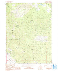
 1990 Likely1990 Print · USGSLikely and its surrounding rangelands are documented here in the early nineties, where the high Modoc plateau meets the irrigated South Fork valley. Researchers can trace the ranching landscape through landmarks like the South Fork Union Sch, the village Cem, and the isolated Depau settlement.
 - 1990 Map of Mc Ginty Reservoir
 1990 Mc Ginty Reservoir1990 Print · USGSUpper Modoc County is captured here in the 1980s, showing a landscape defined by ranching infrastructure and forest management. Researchers can trace the water network across Modoc National Forest, including McGinty Reservoir, Green Spring, and the borders of the X L Ranch Indian Reservation.
 - 1990 Map of Lauer Reservoir
 1990 Lauer Reservoir1990 Print · USGSModoc County in the late twentieth century was a landscape of high-altitude water management and national forest lands. Local researchers can trace the drainages of Davis Creek and Franklin Creek or locate the boundaries of the Modoc National Forest and Lauer Reservoir.
 - 1990 Map of Halls Canyon
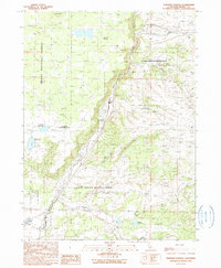
 1990 Halls Canyon1990 Print · USGSModoc County’s high country is captured here during the 1990s as the Pit River flows past Ostrom Point and the timberlands of the Modoc National Forest. Researchers can trace old 4WD routes to family-named landmarks like Nichols Spring or the Lookout Tower atop Fox Mountain.
 - 1990 Map of Pothole Valley
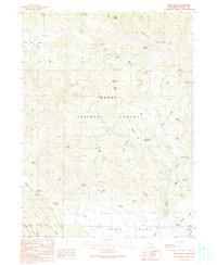
 1990 Pothole Valley1990 Print · USGSThe Modoc National Forest interior is captured here as it appeared in the late 1980s and early 1990s. Genealogists and historians can trace seasonal water sources and landmarks like Quaking Aspen Spring, Boles Meadow, and Blue Mountain.
 - 1990 Map of Lookout
 1990 Lookout1990 Print · USGSThe Big Valley region at the Modoc and Lassen county line appears here during the 1990s as a hub of riparian management and ranching life. Genealogists and researchers can trace local family landmarks and water infrastructure from Lookout to the Fulcher Dam and the Lookout Siding rail stop.
 - 1990 Map of Border Mountain
 1990 Border Mountain1990 Print · USGSThe volcanic high country of Northern California is mapped here in the late twentieth century. Researchers can trace the high-altitude features of the Modoc National Forest, from the Round Mountain Lookout to the Long Bell FS Station.
 - 1990 Map of Egg Lake
 1990 Egg Lake1990 Print · USGSIn the high country of Modoc County during the 1990s, this area shows a landscape defined by ranching heritage and forest management. Researchers can trace the Old R.R. Grade and locate historical sites like the Old Baker Cabin and the Ben Eberli Well.
 - 1990 Map of Hermit Butte
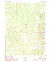
 1990 Hermit Butte1990 Print · USGSThe Modoc high country is captured here during the 1990s, showing a landscape of forest management and mountain recreation. Researchers can locate seasonal sites and landmarks like Big Lakes Camp (Site), Manzanita Lookout, and the Upper Rush Creek Campground.
 - 1990 Map of Beaver Mountain
 1990 Beaver Mountain1990 Print · USGSThe high borderlands of California and Oregon are mapped here in the late twentieth century, showing the intersection of two National Forests. Researchers can locate remote homesteading sites and survey markers like the Grizzlie Place (Site), Beaver Dam (Cabin), and State Bdy Mon #32.
 - 1990 Map of Jacks Butte
 1990 Jacks Butte1990 Print · USGSModoc County ranching and water management are front and center in this late-century survey of the high desert. Researchers can trace the legacy of local landholders at Hastings Ranch or locate water sources like Dobe Swale Reservoir and Pine Spring.
 - 1990 Map of Rattlesnake Butte
 1990 Rattlesnake Butte1990 Print · USGSModoc County's high-desert terrain is shown during a period of infrastructure expansion in the 1990s. Researchers can trace local landmarks like Delmorma School, the California Pines Airport, and water features like Donovan Reservoir.
 - 1990 Map of Payne Peak
 1990 Payne Peak1990 Print · USGSThe Warner Mountains in Modoc County are shown here in the late twentieth century, mapping the high ridgelines and forest recreation areas. Trace the geography of the Cedar Pass Ski Area, the campsites at Stough Reservoir Campground, and the heights of Payne Peak.
 - 1990 Map of Cedarville
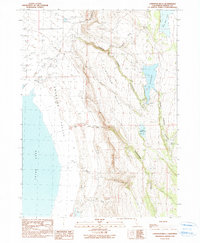
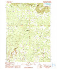
 1990 Cedarville1990 Print · USGSSurprise Valley life in the early 1990s centered on the junction of mountain runoff and high-desert basins. Local historians can trace the streets of Cedarville, locate the Cem, and see the footprint of the Cedarville Rancheria at the foot of the Warner Mountains.
Showing maps 1-25 of 135
Top cities of Modoc County
- Alturas historical maps
- Cedarville historical maps
- Adin historical maps
- Fort Bidwell historical maps
- Eagleville historical maps
Frequently asked questions
- What are the different types of historical maps available for Modoc County?
- What is the oldest map of Modoc County?
- Where can I purchase historical maps of Modoc County for my home or office?
- Where can I download high-res historical maps of Modoc County?
- Are there historical topographic maps available for Modoc County?
- Is there historical aerial imagery available for Modoc County?
- Where are historical maps of Modoc County sourced from?