Old Maps of Modoc County, California for Academic Research
Study the evolution of Modoc County with 574 high-resolution historic maps. Whether you're teaching, researching, or modeling changes in land use, these maps provide essential visual documentation of urban, environmental, and geographic change.
- Analyze long-term change: Track patterns in development, transportation, and natural features.
- Ideal for environmental or urban studies: Support academic projects with primary historical map data.
- Use in the classroom or lab: Educators and researchers rely on these maps to bring historical context to life.
These maps are a powerful tool for teaching, research, and visualizing how Modoc County has changed over the decades.
Modoc County, CA maps
(574)- 1886 Map of Alturas
 1886 Alturas1886 Print · USGSNortheastern California at the close of the nineteenth century was a territory of high-desert basins and isolated outposts. Researchers can trace early township developments and strategic sites like Fort Bidwell, the remote Old Indian Villages, and the mining camp at Hayden Hill.
 - 1886 Map of Modoc Lava Bed
 1886 Modoc Lava Bed1886 Print · USGSNortheastern California is surveyed here in the years following the Modoc War, showing the volcanic terrain of the Modoc Lava Bed and early river settlements. Trace pioneer history through Modoc Rifle Pits, a Ferry on the Pit River, and old outposts like Bieber and Lookout.
 - 1889 Map of Long Valley
 1889 Long Valley1889 Print · USGSNorthwestern Nevada was a land of high desert springs and remote outposts in the late nineteenth century. Researchers can trace the legacy of early military presence at Camp McGarry or locate crucial water sources like Massacre Lakes and Soldier Meadows.
 - 1892 Map of Modoc Lava-Bed
 1892 Modoc Lava-Bed1892 Print · USGSNortheastern California's volcanic terrain is meticulously charted in the 1890s, before modern irrigation altered the great northern basins. Genealogists and historians can locate early outposts like Burgettville, the Modoc Rifle Pit, and the high-altitude Ice Cave.7 unique versions available
 - 1892 Map of Alturas
 1892 Alturas1892 Print · USGSNortheastern California at the close of the nineteenth century reveals a landscape of high-desert outposts and military history. Genealogists and historians can trace the early foundations of Fort Bidwell, Cedarville, and the remote Old Indian Villages near the Pit River.7 unique versions available
 - 1951 Map of Clear Lake Reservoir, 1952 Print
 1951 Clear Lake Reservoir1952 Print · USGSModoc County's high-desert basins and water systems are captured in the early fifties, just as the wildlife refuge and reservoir reached their modern configuration. Researchers can trace the historic Emigrant Trail or locate legacy ranching sites like McNeil Ranch and Chandler Ranch.5 unique versions available
 - 1951 Map of Tulelake, 1953 Print
 1951 Tulelake1953 Print · USGSTule Lake and the Modoc plateau are captured in the early fifties during the height of the region's agricultural development. Genealogists and historians can trace the legacy of family ranching at Old Elliot Ranch or locate the historic Battle of Lands Ranch (Site) and Carr School.4 unique versions available
 - 1952 Map of Timber Mountain, 1954 Print
 1952 Timber Mountain1954 Print · USGSThe Modoc high country in the early fifties shows a rugged landscape of volcanic flows and forest industry. You can trace the Modoc War history at Captain Jacks Stronghold or locate logging era sites like Old Camp One and the Tionesta PO.5 unique versions available
 - 1952 Map of Hackamore, 1954 Print
 1952 Hackamore1954 Print · USGSHigh desert timberlands and volcanic peaks define the Modoc National Forest in the early fifties as the railroad connected remote outposts. Trace the rail-and-resource economy through Meares, the Pumice Brick Plant, and the complex of Hackamore Reservoir.4 unique versions available
 - 1954 Map of Vya, 1967 Print
 1954 Vya1967 Print · USGSThe tri-state corner of Nevada, Oregon, and California appears here in the mid-fifties, dominated by wildlife refuges and massive naval gunnery ranges. Trace isolated high-desert outposts like Vya and Soldier Meadow Ranch or find historic workings at the Ashdown Mine.3 unique versions available
 - 1954 Map of Alturas, 1968 Print
 1954 Alturas1968 Print · USGSThe Modoc Plateau and Surprise Valley appear in the mid-1950s as a landscape of remote ranching towns and vast wildlife refuges. Researchers can trace early settlements like Fort Bidwell, locate the McArthur Grain Elevator, and follow the Southern Pacific rail lines.4 unique versions available
 - 1958 Map of Alturas
 1958 Alturas1958 Print · USGSThe Modoc Plateau and Warner Mountains appear here during the late fifties, showcasing a landscape of high-desert ranching and volcanic terrain. Researchers can trace the rail-and-water economy through Alturas, Cedarville, and the Fort Bidwell Indian Res.2 unique versions available
 - 1958 Map of Vya
 1958 Vya1958 Print · USGSNorthwest Nevada and the tri-state border region are mapped here during the mid-fifties, showing a remote landscape of high desert ranches and sprawling antelope range. Trace historic operations like the Ashdown Mine, find local camps like Coyote Camp, and locate isolated outposts from Vya to Denio.2 unique versions available
 - 1961 Map of Canby, 1963 Print
 1961 Canby1963 Print · USGSUpper Modoc County in the early sixties shows a landscape of timber and transit where the Southern Pacific meets the Pit River. Genealogists and historians can locate the Kelly Grave, the Evans and Bailey Historical Monument, and the high-elevation Lost Cabin Mine.2 unique versions available
 - 1961 Map of Bieber, 1963 Print
 1961 Bieber1963 Print · USGSThe Pit River basin in the early sixties shows a landscape of rail junctions and high-desert wetlands. Genealogists and historians can trace the Lookout Rancheria, locate the Mountain View Cem, and study the rail connection at Nubieber.2 unique versions available
 - 1961 Map of Fall River Mills, 1963 Print
 1961 Fall River Mills1963 Print · USGSNortheastern California at the dawn of the 1960s reveals a unique landscape of volcanic lava beds and extensive river irrigation. Researchers can trace family history at Pine Grove Cemetery and Island School, or explore the complex waterways of Big Lake and the Fall River.2 unique versions available
 - 1961 Map of Alturas, 1963 Print
 1961 Alturas1963 Print · USGSAlturas and the surrounding high-desert valleys are captured in the early sixties as the regional rail and ranching economy thrived. Genealogists and historians can locate family landmarks like the Delmorma Sch, the Infernal Caverns Battlefield Memorial Marker, and the McArthur Grain Elevators.3 unique versions available
 - 1962 Map of Alturas
 1962 Alturas1962 Print · USGSThe high desert of Modoc and Siskiyou counties is shown in the early sixties as a hub of timber, rail, and agriculture. Genealogists and historians can trace rail-side life via the Southern Pacific RR, the Tionesta PO, and the McArthur Grain Elevator.
 - 1962 Map of Vya
 1962 Vya1962 Print · USGSThe Nevada and Oregon borderlands in the early sixties reveal a landscape of isolated ranching outposts and high-desert mining. Researchers can trace historic family holdings like the Denio Ranch or locate early mineral sites including the Mcadoo Mine and Iron King Mine.
 - 1962 Map of Crank Mountain, 1963 Print
 1962 Crank Mountain1963 Print · USGSModoc County’s timber and ranching country comes into focus in the early sixties, showing the remote outposts of the northern interior. Researchers can locate seasonal sites like Old Hulbert Place and Roberts Camp or trace the early Logging Road networks.2 unique versions available
 - 1962 Map of Davis Creek, 1964 Print
 1962 Davis Creek1964 Print · USGSModoc County ranching and tribal lands are meticulously detailed in this early 1960s survey of the Warner Mountains foothills. Genealogists and researchers can trace family landmarks and rural infrastructure from the XL Ranch Indian Reservation to the Cem at Davis Creek.2 unique versions available
 - 1962 Map of Adin, 1964 Print
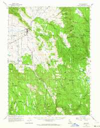 1962 Adin1964 Print · USGSThe northern reaches of Big Valley and the Modoc-Lassen border come into focus in the early sixties, showing a landscape defined by ranching and timber. Genealogists and researchers can trace family-named sites such as Knudsen Ranch, Dibble Place, and the Adin Cemetery.2 unique versions available
 - 1962 Map of Tule Mountain, 1964 Print
 1962 Tule Mountain1964 Print · USGSNortheastern California at the start of the 1960s reveals a landscape of high-elevation reservoirs and remote ranching outposts. Researchers can trace the Southern Pacific rail line past Likely Rancheria or locate old water sources like Warm Spring and Mud Lake.5 unique versions available
 - 1962 Map of Snake Lake, 1964 Print
 1962 Snake Lake1964 Print · USGSSurprise Valley ranching and the Modoc National Forest meet on this 1960s survey along the California-Nevada state line. Researchers can trace historical water use and high-desert infrastructure through Bare Ranch, the Bare Ranch Airport, and Sworinger Reservoir.4 unique versions available
 - 1962 Map of Big Sage Reservoir, 1964 Print
 1962 Big Sage Reservoir1964 Print · USGSNortheastern California ranching and water management come into focus in the early sixties within the Modoc National Forest. Researchers can trace old family holdings like Ingalls Swamp Ranch and survey critical water sources from the Big Sage Reservoir to Emigrant Spring.2 unique versions available
Showing maps 1-25 of 574
Top cities of Modoc County
- Alturas historical maps
- Cedarville historical maps
- Adin historical maps
- Fort Bidwell historical maps
- Eagleville historical maps
Frequently asked questions
- What are the different types of historical maps available for Modoc County?
- What is the oldest map of Modoc County?
- Where can I purchase historical maps of Modoc County for my home or office?
- Where can I download high-res historical maps of Modoc County?
- Are there historical topographic maps available for Modoc County?
- Is there historical aerial imagery available for Modoc County?
- Where are historical maps of Modoc County sourced from?