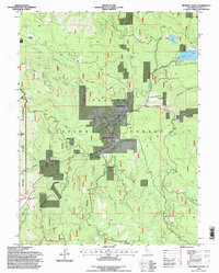
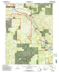
1990s Maps of Plumas County, California
Explore 64 historic maps of Plumas County from the 1990s. These maps offer a rare glimpse into what life looked like during the 1990s — showing old roads, neighborhoods, homes, and landmarks that have changed or disappeared over time.
Whether you're researching your family's past, planning a metal detecting trip, or studying how Plumas County's landscape evolved across the 1990s, these high-resolution maps are a powerful tool for exploring the history of this region.
- Focus on a specific era: All maps on this page are from the 1990s, giving you a focused view of this time period.
- See what’s changed: Compare century-old streets, trails, and buildings to today's modern landscape using overlays and satellite layers.
- Research with precision: Use these maps for genealogy, historical research, land use analysis, or educational projects.
- View, download, or print: Maps are fully viewable online in high resolution, and can be downloaded or printed for your own records.
Start exploring Plumas County's history through authentic maps from the 1990s. This is your window into the past.
Plumas County, CA maps
(64)- 1991 Map of Belden
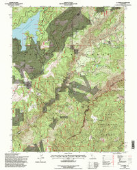
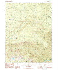 1991 Belden1991 Print · USGSThe high Sierra country of Plumas County is captured here in the early nineties, centered on the Feather River North Fork. You can trace the path of the Pacific Crest National Scenic Trail or locate historical mining sites like Morris Mine and Lott Mine.
 - 1991 Map of Humbug Valley
 1991 Humbug Valley1991 Print · USGSPlumas County high country in the early nineties reveals a landscape of isolated ranching and historic transit routes. Trace the path of the Humboldt Road or locate family sites like Baccala Ranch and Lemm Ranch near the meadows.
 - 1991 Map of Jonesville
 1991 Jonesville1991 Print · USGSThe high Sierra country of Butte County comes into focus in the early nineties, showing a landscape defined by mountain camps and alpine reservoirs. Genealogists and hikers can trace the Pacific Crest National Scenic Trail past Jonesville, Butte Creek House, and the remote Carr Mine.
 - 1991 Map of Humboldt Peak
 1991 Humboldt Peak1991 Print · USGSThe high Sierra Nevada backcountry of Tehama and Plumas counties is captured here in the early nineties. Researchers can trace the intersection of historic routes like the Lassen Trail and Humboldt Road near Humboldt Peak and Robbers Roost.
 - 1994 Map of Taylorsville, 1997 Print
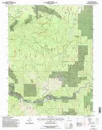
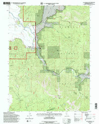 1994 Taylorsville1997 Print · USGSThe Plumas County high country is shown here in the 1990s, where ranching valleys meet the rugged Sierra. Genealogists and researchers can trace local landmarks from Taylorsville to remote sites like the Shim Flat Cem and King Solomon Mine.2 unique versions available
 - 1994 Map of Crescent Mills, 1997 Print
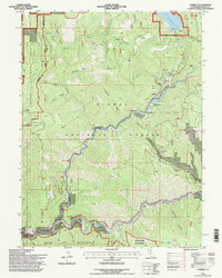
 1994 Crescent Mills1997 Print · USGSPlumas County is captured in the mid-nineties as a landscape of timber, rail, and high-altitude reservoirs. Researchers can trace the Union Pacific through Keddie and Paxton, or locate old mineral works like the Arcadia Mine and the Standard Mine.
 - 1994 Map of Canyondam, 1997 Print
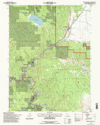
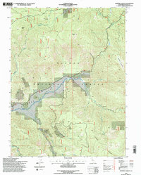
 1994 Canyondam1997 Print · USGSThe northern Sierra Nevada meets Lake Almanor in the 1990s, revealing a landscape of high-country timber and gold mining. Trace historic operations like the Goldstripe Mine, find the remote Dyer Mtn Lookout, or locate the lakeside Cem.2 unique versions available
 - 1994 Map of Genesee Valley, 1997 Print
 1994 Genesee Valley1997 Print · USGSThe Genesee Valley in the mid-1990s reveals a Sierra Nevada landscape shaped by mining and mountain water. Genealogists and historians can trace the local footprint through the Cem near Genesee, the Beardsley Mine, and crossings like Flournoy Bridge.2 unique versions available
 - 1994 Map of Dixie Mountain, 1997 Print
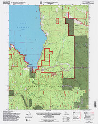
 1994 Dixie Mountain1997 Print · USGSThe high timberlands and wildlife preserves of Plumas County are captured here in the mid-1990s. Researchers can locate the Dixie Mountain Lookout, trace the Lookout Trail, and explore the shoreline of Frenchman Lake and Frenchman Cove.
 - 1994 Map of Caribou, 1997 Print
 1994 Caribou1997 Print · USGSThe North Fork Feather River canyon comes alive in the mid-1990s as a complex network of hydroelectric power and historic mining bars. Researchers can trace the Union Pacific line past old riverside settlements like Rich Bar, Belden, and Little Haven.
 - 1994 Map of Dogwood Peak, 1997 Print
 1994 Dogwood Peak1997 Print · USGSIn the mid-1990s, the Sierra Nevada backcountry of Plumas County remained a rugged terrain of mining claims and conservation trails. You can trace the Pacific Crest National Scenic Trail and locate the Little California Mine and Dejonah Creek Mine.
 - 1994 Map of American House, 1997 Print
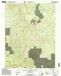
 1994 American House1997 Print · USGSThe Plumas National Forest interior is captured in the mid-1990s as a land of high peaks and historic mining claims. Researchers can trace the heritage of local homesteads and industry through the McIntosh Ranch Cemetery, Boehme Ranch, and the Sunnyside Mine.
 - 1994 Map of Twain, 1997 Print
 1994 Twain1997 Print · USGSThe North Fork Feather River canyon comes into sharp focus during the 1990s, revealing a landscape defined by its mining and railroad history. Researchers can locate remote sites like Seneca, trace the Union Pacific line to Paxton Siding, and find the Big Flat Cem.
 - 1994 Map of Babcock Peak, 1997 Print
 1994 Babcock Peak1997 Print · USGSThe Plumas National Forest high country comes to life in this mid-nineties survey of the Mount Hough area. Researchers can trace old mountain routes through Squaw Valley, locating historic points like Murdock Crossing (Ford) and Babcock Meadows.
 - 1994 Map of Diamond Mountain, 1997 Print
 1994 Diamond Mountain1997 Print · USGSThe high sierra of Lassen and Plumas counties is captured here in the 1990s, detailing a landscape of forestry and remote heritage sites. Researchers can find the Peter Lassen Grave, the Richmond School, and isolated outposts like Wheeler Sheep Camp.2 unique versions available
 - 1994 Map of Ferris Creek, 1997 Print
 1994 Ferris Creek1997 Print · USGSThe Plumas-Lassen county line runs through this high-country landscape during the mid-nineties, showing a region defined by mining and mountain forestry. Researchers can trace historic site locations like the Downing Cabin, Grey Goose Mine, and the steep Milford Grade.
 - 1994 Map of Mount Ingalls, 1998 Print
 1994 Mount Ingalls1998 Print · USGSPlumas County in the 1990s reveals a mountain landscape shaped by significant mining activity and forestry. Researchers can trace industrial history at the Walker Mine, locate the former settlement at Lovejoy (Site), or find a family Grave near Blakeless Creek.2 unique versions available
 - 1994 Map of La Porte, 1998 Print
 1994 La Porte1998 Print · USGSThe northern Sierra Nevada gold country is mapped here in the mid-1990s, capturing the rugged landscape of the Plumas National Forest. Genealogists can locate old mining settlements like Port Wine, Gibsonville, and Poverty Hill, alongside the Pine Grove Cem.
 - 1994 Map of Meadow Valley, 1998 Print
 1994 Meadow Valley1998 Print · USGSMeadow Valley and the surrounding Plumas National Forest are captured here in the mid-1990s, showcasing a landscape of high-country timber and historical mining. Researchers can trace the layout of Spanish Ranch, locate the Cem, and identify historical sites like the Pineleaf Mine and the Tollgate.
 - 1994 Map of Pulga, 1998 Print
 1994 Pulga1998 Print · USGSThe North Fork Feather River canyon comes into sharp focus during the 1990s as a hub of hydroelectric and rail infrastructure. Trace the historic route of the Scenic Byway past Pulga, Poe Dam, and remote mountain landmarks like Arch Rock.
 - 1994 Map of Reconnaissance Peak, 1998 Print
 1994 Reconnaissance Peak1998 Print · USGSThe Sierra Valley and Plumas National Forest come together in this mid-nineties survey of northeastern California. Researchers can trace the heritage of the Feather River National Scenic Byway, the Old Railroad Grade, and local landmarks like Marble Hot Springs.
 - 1994 Map of Johnsville, 1998 Print
 1994 Johnsville1998 Print · USGSHigh in the Sierras during the mid-nineties, this survey captures the legacy of the Gold Rush in Plumas Eureka State Park. Trace family roots and mining history at the Eureka Mill (Ruins), Cromberg Cem, and the old town of Johnsville.
 - 1994 Map of Beckwourth Pass, 1998 Print
 1994 Beckwourth Pass1998 Print · USGSThe Sierra Nevada meets the Great Basin during the mid-nineties, revealing the low-elevation transit corridor through Beckwourth Pass. Trace the intersection of the Chilcoot Tunnel and the historic Long Valley Mill.2 unique versions available
 - 1994 Map of Kettle Rock, 1998 Print
 1994 Kettle Rock1998 Print · USGSPlumas County is captured in the mid-1990s as a high-altitude landscape of timber and mining. Researchers can trace the footprint of the Engel Mine Upper Camp, locate isolated shelters like Browns Cabin, and follow the remote Diamond Mountain Motorway.2 unique versions available
 - 1994 Map of Mc Kesick Peak, 1998 Print
 1994 Mc Kesick Peak1998 Print · USGSThe high country of Lassen and Plumas counties is captured here in the mid-1990s as the Diamond Mountains descend into the high desert valley. Genealogists and historians can trace routes like the Doyle Grade and locate landmarks such as the Meadow View Forest Service Station or McKesick Peak.
Showing maps 1-25 of 64
Top cities of Plumas County
- Portola historical maps
- Chester historical maps
- Hamilton Branch historical maps
- Chilcoot–Venton historical maps
Frequently asked questions
- What are the different types of historical maps available for Plumas County?
- What is the oldest map of Plumas County?
- Where can I purchase historical maps of Plumas County for my home or office?
- Where can I download high-res historical maps of Plumas County?
- Are there historical topographic maps available for Plumas County?
- Is there historical aerial imagery available for Plumas County?
- Where are historical maps of Plumas County sourced from?