1940s Maps of Plumas County, California
Explore 5 historic maps of Plumas County from the 1940s. These maps offer a rare glimpse into what life looked like during the 1940s — showing old roads, neighborhoods, homes, and landmarks that have changed or disappeared over time.
Whether you're researching your family's past, planning a metal detecting trip, or studying how Plumas County's landscape evolved across the 1940s, these high-resolution maps are a powerful tool for exploring the history of this region.
- Focus on a specific era: All maps on this page are from the 1940s, giving you a focused view of this time period.
- See what’s changed: Compare century-old streets, trails, and buildings to today's modern landscape using overlays and satellite layers.
- Research with precision: Use these maps for genealogy, historical research, land use analysis, or educational projects.
- View, download, or print: Maps are fully viewable online in high resolution, and can be downloaded or printed for your own records.
Start exploring Plumas County's history through authentic maps from the 1940s. This is your window into the past.
Plumas County, CA maps
(5)- 1943 Map of Blairsden
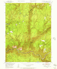
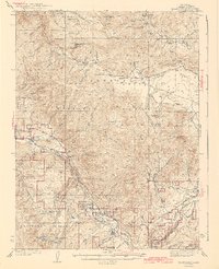 1943 Blairsden1943 Print · USGSThe High Sierra timber and mining districts are in full operation during the late 1930s as rail lines penetrate the mountain canyons. Genealogists and historians can trace industrial sites like Walkermine and the Plumas Eureka Mine or early lodges like Camp Wieland Feather River Lodge.3 unique versions available
 - 1948 Map of Mooreville Ridge, 1953 Print
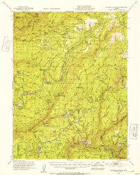 1948 Mooreville Ridge1953 Print · USGSThe northern Sierra Nevada at the end of the 1940s shows a landscape of deep canyons and timber camps. Locate family-named landmarks like McIntosh Ranch or trace the early industrial footprint of Brandy City and the Monte de Oro Mine.3 unique versions available
 - 1948 Map of Cascade, 1955 Print
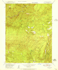 1948 Cascade1955 Print · USGSThe Sierra Nevada foothills on the Butte and Plumas county line are shown here in the late 1940s as a landscape of timber camps and river crossings. Researchers can trace the Feather River Railway and find named locations like Hansons Bar, Jackson Ranch, and Camp Eighteen.4 unique versions available
 - 1948 Map of American House, 1956 Print
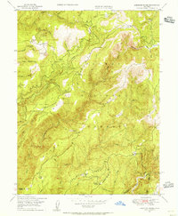 1948 American House1956 Print · USGSThe Plumas County high country in the late 1940s reveals a landscape of remote mountain ranches and legacy gold mines. Researchers can trace the heritage of American House, locate the Browns Hill Mine, and find family-named sites like McIntosh Ranch.3 unique versions available
 - 1948 Map of Strawberry Valley, 1957 Print
 1948 Strawberry Valley1957 Print · USGSThe Sierra Nevada gold country of Yuba and Sierra Counties is captured here just after the war, showing the rugged canyons of the Yuba River. Genealogists and historians can trace the locations of Brandy City, the Palace Mine, and river settlements like Cut Eye Fosters Bar.4 unique versions available
End of results
Showing maps 1-5 of 5
Top cities of Plumas County
- Portola historical maps
- Chester historical maps
- Hamilton Branch historical maps
- Chilcoot–Venton historical maps
Frequently asked questions
- What are the different types of historical maps available for Plumas County?
- What is the oldest map of Plumas County?
- Where can I purchase historical maps of Plumas County for my home or office?
- Where can I download high-res historical maps of Plumas County?
- Are there historical topographic maps available for Plumas County?
- Is there historical aerial imagery available for Plumas County?
- Where are historical maps of Plumas County sourced from?