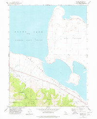
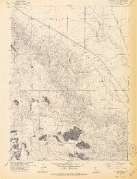
1970s Maps of Plumas County, California
Explore 37 historic maps of Plumas County from the 1970s. These maps offer a rare glimpse into what life looked like during the 1970s — showing old roads, neighborhoods, homes, and landmarks that have changed or disappeared over time.
Whether you're researching your family's past, planning a metal detecting trip, or studying how Plumas County's landscape evolved across the 1970s, these high-resolution maps are a powerful tool for exploring the history of this region.
- Focus on a specific era: All maps on this page are from the 1970s, giving you a focused view of this time period.
- See what’s changed: Compare century-old streets, trails, and buildings to today's modern landscape using overlays and satellite layers.
- Research with precision: Use these maps for genealogy, historical research, land use analysis, or educational projects.
- View, download, or print: Maps are fully viewable online in high resolution, and can be downloaded or printed for your own records.
Start exploring Plumas County's history through authentic maps from the 1970s. This is your window into the past.
Plumas County, CA maps
(37)- 1972 Map of Diamond Mtn
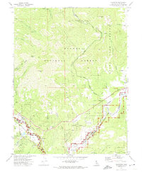
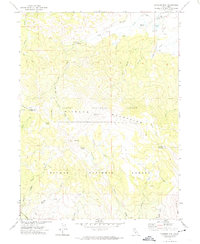 1972 Diamond Mtn1972 Print · USGSThe high Diamond Mountains in the early 1970s reveal a landscape of forest management and early pioneer history. Researchers can locate the Peter Lassen Grave, trace the Skyline Motorway, and find remote landmarks like Richmond Sch.3 unique versions available
 - 1972 Map of Crocker Mtn, 1973 Print
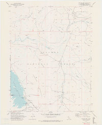 1972 Crocker Mtn1973 Print · USGSPlumas County high country in the early seventies shows a landscape of new reservoirs and old timber-and-rail routes. Researchers can trace the Old Railroad Grade past Clover Valley Ranch or locate early camp sites at Lake Davis.2 unique versions available
 - 1972 Map of Kettle Rock, 1974 Print
 1972 Kettle Rock1974 Print · USGSThe Plumas National Forest in the early 1970s shows a landscape of high-altitude mining and rugged timber access. Trace the industrial footprint of the Engel Mine Upper Camp or locate secluded landmarks like Browns Cabin and Taylor Lake.2 unique versions available
 - 1972 Map of Johnsville, 1974 Print
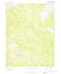
 1972 Johnsville1974 Print · USGSThe Sierra Nevada mining and timber heartland of Plumas County is captured here in the early seventies as the railroad era met modern recreation. Researchers can trace the industrial legacy of Johnsville through the Mammoth Mill (Ruins) and the Squirrel Creek Mine.
 - 1972 Map of Mt. Ingalls, 1974 Print
 1972 Mt. Ingalls1974 Print · USGSThe Plumas National Forest high country is documented here in the early 1970s, during a period when the region's industrial mining legacy was still clearly visible. Researchers can trace the infrastructure of the Walker Mine Ruins Tailings, locate the Lovejoy (Site), and follow the path of a Dismantled Tramway.
 - 1972 Map of Genesee Valley, 1974 Print
 1972 Genesee Valley1974 Print · USGSGenesee and the surrounding national forest are captured in the early 1970s, showcasing the remote mining and ranching geography of Plumas County. Researchers can trace historical sites like the Beardsley Mine, the Walker Mine, and the local Cem near the valley floor.
 - 1972 Map of Portola, 1974 Print
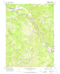
 1972 Portola1974 Print · USGSPortola and the Middle Fork Feather River valley are captured in the early seventies during a period of established mountain railroading and forest management. Genealogists and local historians can locate Shady Grove Cem, the community of Delleker, and the High Sch.
 - 1972 Map of Babcock Peak, 1974 Print
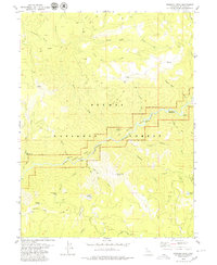
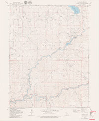
 1972 Babcock Peak1974 Print · USGSThe Plumas National Forest interior in the early 1970s shows a landscape of high peaks and timber-related transit. Trace the Old Railroad Grade through the mountains or locate specific water sources like Rocky Point Spring and the Notson Bridge.3 unique versions available
 - 1972 Map of Grizzly Valley, 1974 Print
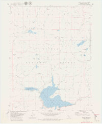
 1972 Grizzly Valley1974 Print · USGSThe high Sierra Nevada backcountry near Plumas comes into focus in the early seventies, dominated by the waters of Lake Davis. Researchers can trace vanished homesteads like Midway House (Site) and old mountain outposts at Sheep Camp.2 unique versions available
 - 1972 Map of Reconnaissance Peak, 1974 Print
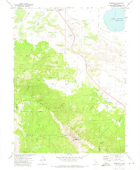
 1972 Reconnaissance Peak1974 Print · USGSThe Sierra Valley and Plumas National Forest come alive in the early seventies as the Western Pacific railroad threads through the wetlands. Genealogists and historians can trace the rail corridor between Beckwourth and Hawley or locate Marble Hot Springs.2 unique versions available
 - 1972 Map of Dixie Mountain, 1974 Print
 1972 Dixie Mountain1974 Print · USGSThe high Sierra country of Plumas County is mapped here in the early seventies, showing the remote peaks and timberlands before modern development. Outdoorsmen and historians can trace the network of Jeep Trails leading to Dixie Mountain, Dotta Neck, and the shores of Frenchman Cove.2 unique versions available
 - 1972 Map of Antelope Lake, 1974 Print
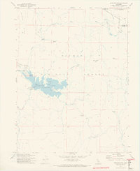 1972 Antelope Lake1974 Print · USGSThe high country of Plumas County is documented here in the early 1970s, shortly after the creation of the reservoir. Researchers can trace the locations of isolated forest outposts like Wemple Cabin and Harwood Cabin or the early layout of Antelope Lake.2 unique versions available
 - 1972 Map of Janesville, 1974 Print
 1972 Janesville1974 Print · USGSThe Honey Lake Valley and the Diamond Mountains meet in this early 1970s survey of Lassen County. Genealogists and historians can trace the local cemetery sites at Johnstonville Cem or locate family-named landmarks like Jim Peterson Hill and the community of Janesville.
 - 1972 Map of Blairsden, 1974 Print
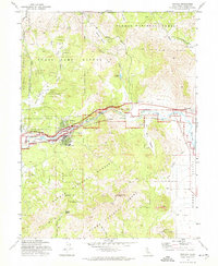
 1972 Blairsden1974 Print · USGSPlumas County life in the early 1970s centered on the rail-and-river corridor through the Mohawk Valley. Researchers can trace the Western Pacific Railroad as it passes the settlements of Blairsden, Graeagle, and Mabie.2 unique versions available
 - 1975 Map of Beckwourth Pass, 1977 Print
 1975 Beckwourth Pass1977 Print · USGSUpper Long Valley in the mid-seventies is a high Sierra corridor shaped by rail lines and ranching trails. Researchers can trace the Western Pacific Railroad through the Beckwourth Pass Tunnel and locate the historic Summit (Site).
 - 1977 Map of Squaw Valley Peak, 1978 Print
 1977 Squaw Valley Peak1978 Print · USGSPlumas County's high ridges and seasonal grazing lands are captured here in the late seventies. Researchers can trace the Old Railroad Grade past mountain landmarks like Stone Dairy Cabin, Jenkins Sheep Camp, and Squaw Peak.
 - 1977 Map of Ferris Creek, 1978 Print
 1977 Ferris Creek1978 Print · USGSThe Diamond Mountains straddle the Lassen and Plumas county line in the late seventies, showing a landscape of resource extraction and forest management. Genealogists and historians can locate remote landmarks like Johnson Mill, the Plinco Mine, and the high-elevation Lookout Tower.
 - 1977 Map of Constantia, 1978 Print
 1977 Constantia1978 Print · USGSLassen County at the Nevada border was a land of high peaks and rail corridors in the 1970s. Researchers can locate the mountain settlements of Constantia and Omira or trace the route of the Western Pacific Railroad past Zamboni Hot Springs.2 unique versions available
 - 1977 Map of Milford, 1978 Print
 1977 Milford1978 Print · USGSNorthern California's high desert basin and forest fringe meet in the late seventies near the Lassen and Plumas county line. Trace the rugged terrain of the Diamond Mountains to find the Corona Mine, Milford, and the Sierra Army Depot.
 - 1978 Map of Stony Ridge
 1978 Stony Ridge1978 Print · USGSThe high Sierra terrain meets the western edge of HONEY LAKE in the late 1970s, where military and ranching interests coexist. Genealogists and historians can trace family locations like Clark Ranch or locate the sprawling Sierra Army Depot boundary.
 - 1978 Map of Mc Kesick Peak
 1978 Mc Kesick Peak1978 Print · USGSThe Diamond Mountains and the high basin of Honey Lake define this California landscape in the late seventies. Researchers can trace the Western Pacific rail line or locate remote sites like Hall Cabin Spring and the Meadow View Forest Service Station.3 unique versions available
 - 1979 Map of Dogwood Peak
 1979 Dogwood Peak1979 Print · USGSThe Plumas National Forest in the late 1970s was a rugged landscape of steep river bars and isolated mining claims along the Middle Fork Feather River. Genealogists and historians can trace the locations of the Little California Mine, Sherman Bar, and Cleghorn Bar.3 unique versions available
 - 1979 Map of Bucks Lake
 1979 Bucks Lake1979 Print · USGSPlumas County high country in the late 1970s shows a landscape of alpine reservoirs and wilderness trails. Genealogists and hikers can trace the Pacific Crest National Scenic Trail as it passes Silver Lake, Bucks Lodge, and the historic Shenandoah Mine.2 unique versions available
 - 1979 Map of Caribou
 1979 Caribou1979 Print · USGSPlumas County's river canyons are shown in high detail during the late seventies, featuring the confluence of the Feather River forks. Genealogists and historians can trace the Pacific Western railroad line past Rich Bar, Belden, and Indian Bar.4 unique versions available
 - 1979 Map of Almanor
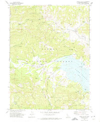
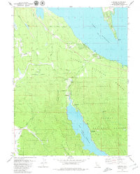 1979 Almanor1979 Print · USGSThe high Sierra timberlands of Plumas County are shown in the late 1970s, featuring the massive hydroelectric infrastructure connecting Lake Almanor and Butt Valley Reservoir. Genealogists and local historians can trace family-named sites like Keefer Ranch and the settlement at Prattville.2 unique versions available
Showing maps 1-25 of 37
Top cities of Plumas County
- Portola historical maps
- Chester historical maps
- Hamilton Branch historical maps
- Chilcoot–Venton historical maps
Frequently asked questions
- What are the different types of historical maps available for Plumas County?
- What is the oldest map of Plumas County?
- Where can I purchase historical maps of Plumas County for my home or office?
- Where can I download high-res historical maps of Plumas County?
- Are there historical topographic maps available for Plumas County?
- Is there historical aerial imagery available for Plumas County?
- Where are historical maps of Plumas County sourced from?