1940s Maps of San Bernardino County, California
Explore 68 historic maps of San Bernardino County from the 1940s. These maps offer a rare glimpse into what life looked like during the 1940s — showing old roads, neighborhoods, homes, and landmarks that have changed or disappeared over time.
Whether you're researching your family's past, planning a metal detecting trip, or studying how San Bernardino County's landscape evolved across the 1940s, these high-resolution maps are a powerful tool for exploring the history of this region.
- Focus on a specific era: All maps on this page are from the 1940s, giving you a focused view of this time period.
- See what’s changed: Compare century-old streets, trails, and buildings to today's modern landscape using overlays and satellite layers.
- Research with precision: Use these maps for genealogy, historical research, land use analysis, or educational projects.
- View, download, or print: Maps are fully viewable online in high resolution, and can be downloaded or printed for your own records.
Start exploring San Bernardino County's history through authentic maps from the 1940s. This is your window into the past.
San Bernardino County, CA maps
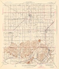
(68)- 1940 Map of Evey Canyon
 1940 Evey Canyon1940 Print · USGSThe foothills of the San Gabriel Mts meet the growing community of Claremont in this 1940s-era survey. Genealogists and local historians can trace the early road network of the valley and find mountain landmarks like the Norton Sch and Lower San Antonio Guard Station.3 unique versions available
 - 1940 Map of La Verne
 1940 La Verne1940 Print · USGSLa Verne and Claremont are captured here just before the mid-century population boom, showing a landscape defined by foothill canyons and early college campuses. Genealogists and historians can trace local landmarks like Scripps College, the Metropolitan Aqueduct, and Wolfskill Camp.4 unique versions available
 - 1940 Map of Camp Baldy
 1940 Camp Baldy1940 Print · USGSMount Baldy’s early high-altitude culture and canyon mining are frozen in time just before the mid-century. Researchers can trace the paths to the Gold Dollar Mine, locate the Camp Baldy Guard Station, and see the early route of Baldy Road.3 unique versions available
 - 1941 Map of Swarthout
 1941 Swarthout1941 Print · USGSThe high San Gabriel Mountains come into focus during the mid-1930s as a hub for scientific observation and mountain recreation. Researchers can trace the San Andreas Rift Zone or locate early forest outposts like Smithsonian Observatory and Prairie Fork Guard Sta.3 unique versions available
 - 1941 Map of Devore
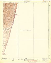
 1941 Devore1941 Print · USGSThe Cajon Pass area in the early 1940s reveals a landscape defined by critical rail lines and alluvial washes. Researchers can trace the development of infrastructure around Devore through landmarks like the Cajon Sch, Fontana Airport, and the Glenn Helen Infirmary.2 unique versions available
 - 1941 Map of Arrowhead
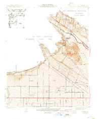
 1941 Arrowhead1941 Print · USGSSan Bernardino expanded toward the mountain front during the late thirties and early forties. Trace the complex rail networks of the Union Pacific and Pacific Electric through old neighborhoods like Ono, Muscoy, and Del Rosa.2 unique versions available
 - 1941 Map of Prado
 1941 Prado1941 Print · USGSSouthern California's inland corridor is captured here in the 1930s, showing the river valley before the dam changed the landscape forever. Trace the old routes of the Union Pacific through Prado and locate local landmarks like the Pellissier Ranch.2 unique versions available
 - 1942 Map of Camp Mohave
 1942 Camp Mohave1942 Print · USGSThe tri-state borderlands of Nevada, Arizona, and California are captured here in the early 1940s, highlighting a landscape of deep canyons and high-desert mining camps. Researchers can trace historic rail lines and find remote outposts like Searchlight, Nelson, and the riverfront Fort Mohave Indian Reservation.
 - 1942 Map of San Antonio
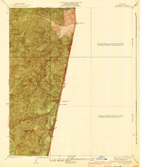
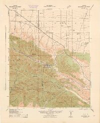 1942 San Antonio1942 Print · USGSThe high San Gabriel Mountains meet the Mojave Desert in the early 1940s, showing a rugged landscape of ranching and early mountain recreation. Genealogists and local historians can trace family lands like Smith Ranch and Nuss Ranch, or locate landmarks like the Smithsonian Observatory and Wrightwood.4 unique versions available
 - 1942 Map of Anaheim
 1942 Anaheim1942 Print · USGSOrange County's agricultural heart is captured mid-century during a period of rapid wartime development. Genealogists can locate family landmarks like Diamond Bar Ranch, local schools such as Alamitos Sch, and communities like Garden Grove or Stanton.2 unique versions available
 - 1942 Map of Ivanpah
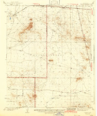
 1942 Ivanpah1942 Print · USGSThe Mojave Desert frontier comes into focus during the early war years, showing a landscape shaped by mining and rail. You can trace the path of the Union Pacific through remote stops like Nipton, Goodsprings, and the junction at Barnwell.
 - 1942 Map of Hesperia
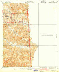
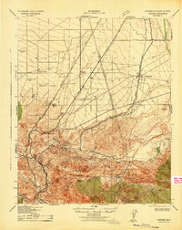 1942 Hesperia1942 Print · USGSSan Bernardino County ranchlands and mountain passes are captured here during the early years of the war. Genealogists and historians can trace the Atchison Topeka and Santa Fe rail line as it climbs toward Cajon Pass and the Cajon Summit Lookout.
 - 1942 Map of Corona and Vicinity
 1942 Corona and Vicinity1942 Print · USGSThe Riverside County citrus belt thrives in the early 1940s, showing a landscape defined by orchards and early suburban expansion. Researchers can trace the development of Norco around the Norconian Club or locate regional landmarks like La Sierra College.
 - 1942 Map of San Bernardino
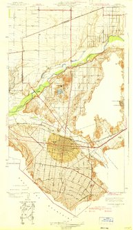
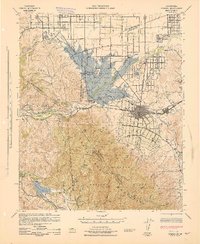
 1942 San Bernardino1942 Print · USGSThe San Bernardino Valley flourished as a railroad and citrus hub during the early years of the war. Researchers can trace the extensive tracks of the Atchison Topeka and Santa Fe, the National Orange Show grounds, and local landmarks like the Loma Linda Sanatorium.
 - 1942 Map of Kramer
 1942 Kramer1942 Print · USGSThe high desert comes into focus in the 1930s and 40s as rail transit and early aviation began to shape this corner of San Bernardino. You can trace the Atchison Topeka and Santa Fe tracks through Amargo or find the remote Blake Ranch and Kramer.2 unique versions available
 - 1942 Map of Shadow Mountains
 1942 Shadow Mountains1942 Print · USGSThe High Desert at the start of the war reveals a landscape of isolated homesteads and early aviation landmarks. Genealogists and desert historians can locate family outposts like Walton Place and Hess Ranch or trace the early Palmdale Victorville Road.2 unique versions available
 - 1942 Map of Ontario and Vicinity
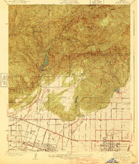
 1942 Ontario and Vicinity1942 Print · USGSThe Inland Empire is shown at a pivotal moment in the early 1940s, when orange groves and vineyards still dominated the landscape between the mountains and the valley floor. Researchers can trace the rail corridors of the SOUTHERN PACIFIC and the Pacific Electric while locating old neighborhood markers like Narod, Sunsweet, and the Sierra Vista Sch.2 unique versions available
 - 1942 Map of Amboy
 1942 Amboy1942 Print · USGSSan Bernardino's high desert reveals its rail-and-road bones in the 1940s as transcontinental traffic pulses along the iconic route 66. Researchers can trace the water sources and small stations that made desert life possible, from Bonanza King Well and Wilhelm Camp to the rail stops at Amboy and Cadiz.
 - 1942 Map of Corona, 1947 Print
 1942 Corona1947 Print · USGSRiverside County at the dawn of the 1940s reveals a unique mix of agricultural roots, mountain canyons, and significant regional infrastructure projects. Genealogists and local historians can trace the early street plans of Corona and Norco, or locate landmarks like the East Vale Sch and the Santiago Reservoir.2 unique versions available
 - 1943 Map of Center Hills
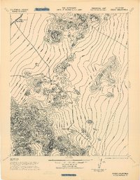
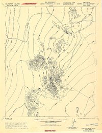 1943 Center Hills1943 Print · USGSSan Bernardino County served as a critical training ground for the California-Arizona Maneuver Area during the war. Military researchers can trace the tactical terrain of the Center Hills and the neighboring Turtle Mts on this provisional army sheet.
 - 1943 Map of Amboy
 1943 Amboy1943 Print · USGSThe Mojave Desert during the Second World War reveals a landscape of critical military training and vital rail infrastructure. Genealogists and historians can trace desert outposts like Bolo Station, the industrial Lime Mine Refinery, and the wartime 3rd Armd Div Camp.
 - 1943 Map of Fontana
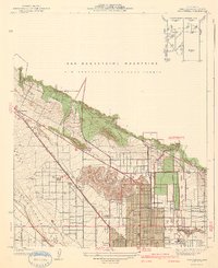
 1943 Fontana1943 Print · USGSThe Inland Empire is shown here in the early 1940s, revealing a landscape defined by industrial expansion and extensive rail corridors. Trace the growth of Fontana and Rialto through early landmarks like the South Fontana Sta, Glen Avon Ch, and the numerous Quarries of the Jurupa Mountains.3 unique versions available
 - 1943 Map of Corona
 1943 Corona1943 Print · USGSThe Santa Ana River valley during the mid-forties shows a landscape shaped by water management and early inland growth. Trace the development of Corona and Norco alongside the massive Prado Dam and local landmarks like the East Vale Sch.
 - 1943 Map of Giers Basin
 1943 Giers Basin1943 Print · USGSThe Colorado River borderlands come into focus during the early years of the war, when this area served as a military maneuver zone. Researchers can locate desert water sources like Mohave Spring and Screwbean Spring or trace the early footprint of Parker Dam.
 - 1943 Map of Essex
 1943 Essex1943 Print · USGSThe California desert terrain is documented during World War II for military maneuver training. Genealogists and desert historians can locate the Gold Fleece Mine and critical water sources like Honeymoon Spring and the Reservoir at Essex.
Showing maps 1-25 of 68
Top cities of San Bernardino County
- Fontana historical maps
- Ontario historical maps
- Rancho Cucamonga historical maps
- Victorville historical maps
- Rialto historical maps
- Hesperia historical maps
See more
Frequently asked questions
- What are the different types of historical maps available for San Bernardino County?
- What is the oldest map of San Bernardino County?
- Where can I purchase historical maps of San Bernardino County for my home or office?
- Where can I download high-res historical maps of San Bernardino County?
- Are there historical topographic maps available for San Bernardino County?
- Is there historical aerial imagery available for San Bernardino County?
- Where are historical maps of San Bernardino County sourced from?