1960s Maps of San Bernardino County, California
Explore 30 historic maps of San Bernardino County from the 1960s. These maps offer a rare glimpse into what life looked like during the 1960s — showing old roads, neighborhoods, homes, and landmarks that have changed or disappeared over time.
Whether you're researching your family's past, planning a metal detecting trip, or studying how San Bernardino County's landscape evolved across the 1960s, these high-resolution maps are a powerful tool for exploring the history of this region.
- Focus on a specific era: All maps on this page are from the 1960s, giving you a focused view of this time period.
- See what’s changed: Compare century-old streets, trails, and buildings to today's modern landscape using overlays and satellite layers.
- Research with precision: Use these maps for genealogy, historical research, land use analysis, or educational projects.
- View, download, or print: Maps are fully viewable online in high resolution, and can be downloaded or printed for your own records.
Start exploring San Bernardino County's history through authentic maps from the 1960s. This is your window into the past.
San Bernardino County, CA maps
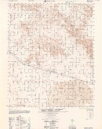
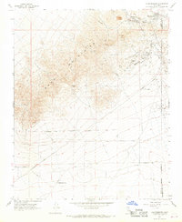
(30)- 1960 Map of Trona
 1960 Trona1960 Print · USGSThe Mojave Desert at mid-century reveals a landscape of massive military installations and industrial mineral works. Researchers can trace the heritage of mining and ranching at Ashford Mill, Randsburg, and Paxton Ranch while following the Old Spanish Trail.2 unique versions available
 - 1960 Map of Bagdad
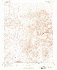
 1960 Bagdad1960 Print · USGSThe Mojave Desert interior in the late fifties is captured here through its remote rail stops and volcanic landmarks. Researchers can trace the Atchison Topeka and Santa Fe line to find Bagdad, the Orange Blossom Mine, and the Amboy Crater cinder cone.
 - 1960 Map of Santa Ana
 1960 Santa Ana1960 Print · USGSSouthern California's coastal plains and inland deserts meet in this mid-century survey of the burgeoning Orange and Riverside county corridors. Researchers can trace the layout of early freeway systems, find tribal lands like the Soboba Indian Reservation, and locate military landmarks such as March Field.2 unique versions available
 - 1960 Map of Kingman
 1960 Kingman1960 Print · USGSThe high desert landscape of the Arizona-Nevada border comes alive in the mid-twentieth century, showcasing the rise of recreation alongside deep-rooted mining history. Genealogists and historians can trace the roots of towns like Kingman and Oatman, or locate remote sites like the Lucky Dutchman Mine and Santa Claus.3 unique versions available
 - 1964 Map of Kingston Peak
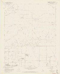
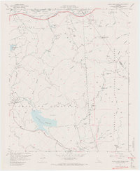
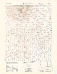 1964 Kingston Peak1964 Print · USGSThe high desert of San Bernardino County comes into focus in the 1960s, showcasing a landscape of remote mining claims and vital water sources. Trace the history of mineral extraction at the Eastern Star Mine or locate desert landmarks like Kingston Spring and Coyote Holes.
 - 1964 Map of Yorba Linda, 1965 Print
 1964 Yorba Linda1965 Print · USGSOrange County's northern hills were transitioning from oil derricks to suburban neighborhoods in the mid-sixties. Local researchers can trace early school sites like Richard M Nixon Sch, explore the grounds of La Vida Mineral Springs, or locate old landmarks in Sleepy Hollow.3 unique versions available
 - 1965 Map of Santa Ana
 1965 Santa Ana1965 Print · USGSSouthern California is captured in a decade of rapid growth, showing the coastal expansion from Santa Ana down to Oceanside. Genealogists and historians can trace the mid-century development of places like Garden Grove or the rural reaches of Escondido and the Palomar Observatory.
 - 1965 Map of Cady Mountains, 1979 Print
 1965 Cady Mountains1979 Print · USGSThe Mojave Desert interior comes into focus during the mid-1950s, centered on the critical rail siding at Hector. Researchers can trace the industrial landscape of the era through the Atchison Topeka and Santa Fe line and remote desert workings like the Logan Mine and Preston Mine.
 - 1966 Map of San Bernardino
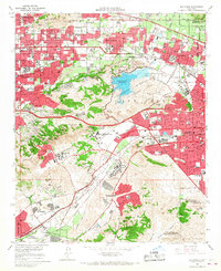
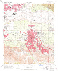
 1966 San Bernardino1966 Print · USGSThe San Bernardino Valley and Mojave Desert met during a period of massive military and suburban growth in the mid-sixties. Genealogists and historians can trace the development of Edwards Air Force Base, old desert mines like the Bagdad Chase Mine, and mountain communities near Big Bear Lake.
 - 1966 Map of San Dimas, 1967 Print
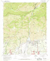
 1966 San Dimas1967 Print · USGSThe San Gabriel Valley suburbs were expanding rapidly in the mid-sixties, encircling the high ground of the San Jose Hills. Genealogists and researchers can trace the institutional growth of the era at Cal Poly, Pacific State Hospital, and Sacred Heart Ch.4 unique versions available
 - 1966 Map of Cucamonga Peak, 1968 Print
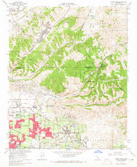
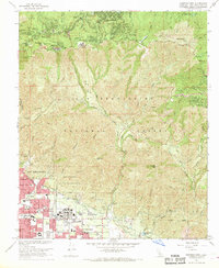
 1966 Cucamonga Peak1968 Print · USGSSan Bernardino County in the mid-sixties shows a landscape of transition where the high peaks of the San Gabriel Mountains meet the expanding foothill towns. Trace the early development of Alta Loma and Etiwanda or locate mountain landmarks like Kelly Camp and Chaffey Union Jr College.9 unique versions available
 - 1966 Map of Devore, 1968 Print
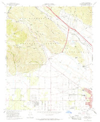 1966 Devore1968 Print · USGSSan Bernardino's mountain foothills and the bustling rail corridor of Cajon Canyon are captured here in the mid-1960s. Researchers can trace the legacy of local aviation at Gilfillan Airport, locate historic schools like Trapp Sch, and follow the complex rail network of the Union Pacific through Devore.6 unique versions available
 - 1966 Map of Guasti, 1969 Print
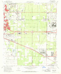 1966 Guasti1969 Print · USGSThe Inland Empire is shown at a pivotal moment of industrial and suburban growth in the mid-1960s. Genealogists and researchers can locate family-named landmarks like the John Rains House, the historic Guasti settlement, and local centers like Mission Bell Ch.4 unique versions available
 - 1967 Map of Black Star Canyon, 1968 Print
 1967 Black Star Canyon1968 Print · USGSThe Santa Ana Mountains in the late sixties reveal a landscape defined by mining operations and new infrastructure. Researchers can trace resource extraction at the Black Star Coal Mine and locate landmarks like Beeks Place or the Rocket Fuel Test Site.7 unique versions available
 - 1967 Map of Keller Peak, 1968 Print
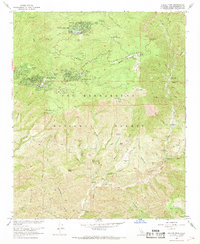 1967 Keller Peak1968 Print · USGSThe San Bernardino mountains in the late sixties reveal a landscape of high-altitude resorts and youth camps. Researchers can trace the development of Running Springs and Arrowbear Lake or locate old sites like Camp Cedar Crest and Music Camp.3 unique versions available
 - 1967 Map of Klinker Mountain, 1968 Print
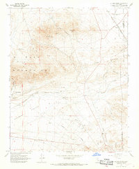
 1967 Klinker Mountain1968 Print · USGSThe high desert of San Bernardino County comes into focus in the 1960s, showing a landscape defined by mining, rail, and ancient sites. Researchers can trace the Southern Pacific railroad past Searles Station or locate Petroglyphs in the Lava Mountains.2 unique versions available
 - 1967 Map of Mt. Baldy, 1968 Print
 1967 Mt. Baldy1968 Print · USGSThe foothills and high peaks of the San Gabriel Mountains meet the expanding orange groves and suburbs of the San Bernardino Valley in the late sixties. Researchers can trace the development of Claremont and Upland alongside mountain landmarks like the Padua Hills Theater, San Antonio Dam, and Mt Baldy.5 unique versions available
 - 1967 Map of Harrison Mtn., 1968 Print
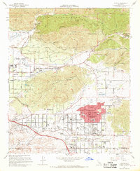
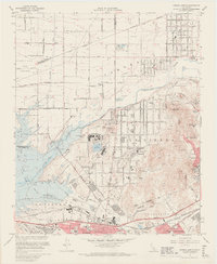
 1967 Harrison Mtn.1968 Print · USGSSan Bernardino and the surrounding foothills are captured in the late sixties as suburban development reached the edge of the national forest. Trace the grounds of Patton State Hospital, the San Manuel Indian Reservation, and mountain communities like Rimforest and Fredalba.5 unique versions available
 - 1967 Map of Yucaipa, 1968 Print
 1967 Yucaipa1968 Print · USGSThe Yucaipa Valley is captured in the late 1960s during a period of rapid suburban expansion near the foothills of the San Bernardino Mountains. Researchers can trace development through old schools like Yucaipa High Sch and landmarks such as the Crafton Hills Airport.4 unique versions available
 - 1967 Map of El Paso Peaks, 1968 Print
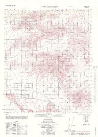
 1967 El Paso Peaks1968 Print · USGSThe Mojave Desert high country comes alive in the late sixties as mining remnants and rail lines intersect. Researchers can trace the Southern Pacific route, locate the Yellow Aster Mill (Ruins), and find remote water sources like Haggin Well.5 unique versions available
 - 1967 Map of Prado Dam, 1968 Print
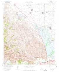 1967 Prado Dam1968 Print · USGSSan Bernardino County at the height of the 1960s reveals a landscape balancing massive flood control projects with institutional expansion. Trace the historic Yorba Slaughter Adobe and the grounds of Boys Republic near the rising Prado Dam.5 unique versions available
 - 1967 Map of Johannesburg, 1968 Print
 1967 Johannesburg1968 Print · USGSThe mining camps of the Rand Mountains are captured in the late sixties, showing the enduring footprint of the Yellow Aster Mine. Researchers can trace the early layout of California City and the historic streets of Randsburg and Johannesburg near Fiddler Gulch.2 unique versions available
 - 1967 Map of Redlands, 1969 Print
 1967 Redlands1969 Print · USGSRedlands and its surrounding citrus communities are captured in the late sixties, a period of significant suburban expansion in San Bernardino County. Researchers can trace the layout of Norton Air Force Base, find local landmarks like the University of Redlands, or locate family sites near Harlem Springs and Bryn Mawr.6 unique versions available
 - 1967 Map of Corona North, 1969 Print
 1967 Corona North1969 Print · USGSRiverside and Corona are captured in the late sixties as suburban development begins to encircle established naval and state institutions. Researchers can trace the layout of La Sierra College, the historic Lake Norconian, and the sprawling Prado Flood Control Basin.6 unique versions available
 - 1967 Map of Ontario, 1969 Print
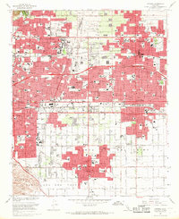 1967 Ontario1969 Print · USGSThe Pomona Valley at the height of the 1960s suburban boom shows a dense landscape of industry, academia, and transit. Researchers can trace the layout of the Claremont Colleges, find historic resting places like Palomares Cem, and locate the expansive Ontario International Airport.3 unique versions available
Showing maps 1-25 of 30
Top cities of San Bernardino County
- Fontana historical maps
- Ontario historical maps
- Rancho Cucamonga historical maps
- Victorville historical maps
- Rialto historical maps
- Hesperia historical maps
See more
Frequently asked questions
- What are the different types of historical maps available for San Bernardino County?
- What is the oldest map of San Bernardino County?
- Where can I purchase historical maps of San Bernardino County for my home or office?
- Where can I download high-res historical maps of San Bernardino County?
- Are there historical topographic maps available for San Bernardino County?
- Is there historical aerial imagery available for San Bernardino County?
- Where are historical maps of San Bernardino County sourced from?