1990s Maps of Santa Barbara County, California
Explore 43 historic maps of Santa Barbara County from the 1990s. These maps offer a rare glimpse into what life looked like during the 1990s — showing old roads, neighborhoods, homes, and landmarks that have changed or disappeared over time.
Whether you're researching your family's past, planning a metal detecting trip, or studying how Santa Barbara County's landscape evolved across the 1990s, these high-resolution maps are a powerful tool for exploring the history of this region.
- Focus on a specific era: All maps on this page are from the 1990s, giving you a focused view of this time period.
- See what’s changed: Compare century-old streets, trails, and buildings to today's modern landscape using overlays and satellite layers.
- Research with precision: Use these maps for genealogy, historical research, land use analysis, or educational projects.
- View, download, or print: Maps are fully viewable online in high resolution, and can be downloaded or printed for your own records.
Start exploring Santa Barbara County's history through authentic maps from the 1990s. This is your window into the past.
Santa Barbara County, CA maps
(43)- 1991 Map of Old Man Mountain
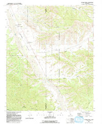
 1991 Old Man Mountain1991 Print · USGSHigh in the coastal ranges during the late eighties, this survey captures the intersection of Santa Barbara and Ventura counties. Trace family-named landmarks like Upper Hartman Ranch or the peak of Old Man Mountain and the headwaters of Matilija Creek.2 unique versions available
 - 1991 Map of Cuyama Peak
 1991 Cuyama Peak1991 Print · USGSVentucopa and the upper Cuyama Valley are documented in the early nineties, showing a landscape defined by sharp canyons and forest service outposts. Researchers can trace land use through the Cuyama Peak Lookout, the small settlement of Burges, and the winding Cuyama River.2 unique versions available
 - 1991 Map of Rancho Nuevo Creek
 1991 Rancho Nuevo Creek1991 Print · USGSBackcountry Ventura and Santa Barbara counties are shown in the early nineties, centered on the protected lands of the Dick Smith Wilderness. Trace remote trails and campsites like Tinta Campground, Rancho Nuevo Campground, and the high peak of Lizard Head.
 - 1991 Map of Ballinger Canyon
 1991 Ballinger Canyon1991 Print · USGSThe high-desert terrain of Kern and San Luis Obispo counties is captured here in the early nineties, dominated by the San Andreas Rift Zone. Researchers can trace old land grants like the Cuyama Grant and find quiet locales like Adobe and Stubblefield.
 - 1993 Map of San Nicolas Island
 1993 San Nicolas Island1993 Print · USGSSan Nicolas Island in the early nineties serves as a key military outpost and offshore landmark. Researchers can trace the layout of the U. S. Naval Reservation, the central Landing Strip, and coastal features like Dutch Harbor.
 - 1993 Map of Santa Rosa Island
 1993 Santa Rosa Island1993 Print · USGSSanta Rosa Island and the Santa Barbara coast appear in detail during the early nineties. Researchers can trace the submarine topography of the Patton Escarpment and locate coastal landmarks like South Point and Bechers Bay.
 - 1995 Map of Hurricane Deck, 2000 Print
 1995 Hurricane Deck2000 Print · USGSSanta Barbara’s backcountry is shown here in the mid-nineties as a preserved wilderness of high ridges and canyon camps. Trace remote locations like Hurricane Deck, Painted Rock, and Montgomery Potrero along the Sisquoc River corridor.
 - 1995 Map of Taylor Canyon, 2000 Print
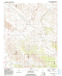
 1995 Taylor Canyon2000 Print · USGSThe Cuyama Valley in the mid-1990s reveals a landscape of massive historical land grants and isolated ranching outposts. Researchers can trace the boundaries of the Cuyama Grant and locate remote sites like Spanish Ranch and the Landing Strip.
 - 1995 Map of Bald Mountain, 2000 Print
 1995 Bald Mountain2000 Print · USGSSanta Barbara County's wilderness interior is documented here in the mid-1990s, focusing on the remote canyons and river basins of the national forest. Researchers can trace historic backcountry sites like the Manzana Schoolhouse Campsite and follow the Hurricane Deck Trail across the ridgelines.
 - 1995 Map of Peak Mountain, 2000 Print
 1995 Peak Mountain2000 Print · USGSThe high Sierra Madre range and Cuyama Valley meet in the 1990s, revealing a landscape of historical ranch grants and rugged wilderness. Genealogists and hikers can trace the Cuyama Grant boundaries or locate remote sites like Caliente Ranch and McPherson Peak.
 - 1995 Map of San Rafael Mountain, 2000 Print
 1995 San Rafael Mountain2000 Print · USGSSanta Barbara County’s high backcountry is detailed here in the mid-nineties, showing the rugged trail networks of the San Rafael Wilderness. Local historians can trace old sites like Davy Cabin, the San Marcos Grant boundary, and a remote Mine near Lazarro Canyon.
 - 1995 Map of Carpinteria, 2000 Print
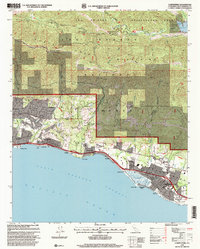 1995 Carpinteria2000 Print · USGSThe Santa Barbara coast and its rugged mountain backdrop are captured here in the mid-1990s as the region's agricultural and suburban identities merged. Genealogists and historians can trace families across the Carpinteria Cemetery or locate historic transit points like Old Town and the Southern Pacific line.
 - 1995 Map of Goleta, 2000 Print
 1995 Goleta2000 Print · USGSThe Santa Barbara coast during the mid-nineties shows a mix of academic expansion and historic land grants. Researchers can trace the layout of the U of Cal Santa Barbara, the operations at Santa Barbara Airport, and the grounds of Goleta Cem.
 - 1995 Map of Tepusquet Canyon, 2000 Print
 1995 Tepusquet Canyon2000 Print · USGSSanta Barbara's interior backcountry comes into focus in the mid-1990s, where historic Spanish land grants meet the national forest. Genealogists and local historians can trace family ties at the Ontiveros Cem or find remote sites like Ruiz Grave and the Goodchild Ranch.
 - 1995 Map of Ballinger Canyon, 2000 Print
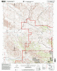 1995 Ballinger Canyon2000 Print · USGSHigh-desert ranchlands and tectonic fault lines define the tri-county borderlands in the mid-nineties. Trace old land grant boundaries like the Cuyama Grant and remote outposts such as Adobe and Padrone.
 - 1995 Map of Old Man Mountain, 2000 Print
 1995 Old Man Mountain2000 Print · USGSThe Santa Barbara and Ventura County high country comes into focus in the 1990s as a landscape of remote trails and historic ranching boundaries. You can trace the Monte Arido Trail to Hartman Ranch or locate the distinct borders of the Los Prietos y Najalayegua Grant.
 - 1995 Map of New Cuyama, 2000 Print
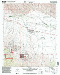 1995 New Cuyama2000 Print · USGSThe Cuyama Valley in the mid-1990s shows a landscape of ranching, oil infrastructure, and the company-town roots of New Cuyama. Researchers can trace the Cuyama Grant, locate the Phosphate Mine, and follow the Rocky Ridge Trail into the national forest.
 - 1995 Map of Figueroa Mountain, 2000 Print
 1995 Figueroa Mountain2000 Print · USGSSanta Barbara's backcountry is captured here in the mid-nineties, showing a rugged terrain of national forest peaks and historic land grants. Genealogists and historians can locate old outposts like Tunnel Ranch or trace early mining activity at Redrock Mine and Peacock Mine.
 - 1995 Map of Huasna Peak, 2000 Print
 1995 Huasna Peak2000 Print · USGSCoastal California ranching and rugged canyons are captured here in the mid-1990s as the wilderness met the rising waters of the reservoir. Researchers can locate family outposts like Porter Ranch and Oakley Ranch, or trace the remote Deer Trail Mine.
 - 1995 Map of Fox Mountain, 2000 Print
 1995 Fox Mountain2000 Print · USGSSanta Barbara County in the mid-1990s is captured here as a landscape of wild backcountry and high-altitude ranching. Researchers can trace the remote Big Pine Buckhorn Road through the Dick Smith Wilderness to Santa Barbara Canyon Ranch and Cox Flat.
 - 1995 Map of Santa Ynez, 2000 Print
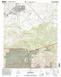 1995 Santa Ynez2000 Print · USGSSanta Barbara County ranching and tribal lands are meticulously detailed in the mid-nineties. You can trace family estates and local landmarks like the Juan y Lolita Ranch, Santa Ynez Union High School, and the Santa Ynez Indian Res.
 - 1995 Map of Tajiguas, 2000 Print
 1995 Tajiguas2000 Print · USGSThe Santa Barbara coastline in the mid-nineties shows a landscape of rugged canyons and historic Spanish land grants. Researchers can trace coastal development near Tajiguas and Capitan or locate local landmarks like the Tajiguas Ranch and Refugio Creek.
 - 1995 Map of Solvang, 2000 Print
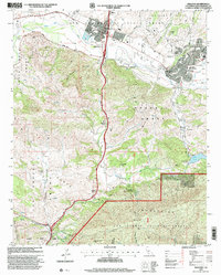 1995 Solvang2000 Print · USGSThe Santa Ynez Valley in the mid-nineties shows a unique transition from historic Spanish land grants to modern community life. Researchers can trace family-named estates and landmarks like Alisal Ranch, the historic Mission Santa Ines, and the junction at Las Cruces.
 - 1995 Map of Santa Barbara, 2000 Print
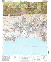
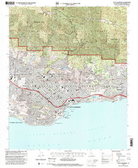 1995 Santa Barbara2000 Print · USGSSanta Barbara and Montecito are shown in the mid-nineties as the city's historic core meets the rising Los Padres foothills. Researchers can trace local landmarks like the Santa Barbara Mission, Stearns Wharf, and the Andree Clark Bird Refuge.
 - 1995 Map of Madulce Peak, 2000 Print
 1995 Madulce Peak2000 Print · USGSSanta Barbara County’s backcountry is charted in the mid-nineties as a network of trails and high-elevation camps. Follow the Madulce Trail to find Madulce Campsite, or trace the remote reaches of Don Victor Valley and Loma Pelona.
Showing maps 1-25 of 43
Top cities of Santa Barbara County
- Santa Maria historical maps
- Santa Barbara historical maps
- Lompoc historical maps
- Lompoc historical maps
- Orcutt historical maps
- Goleta historical maps
See more
Frequently asked questions
- What are the different types of historical maps available for Santa Barbara County?
- What is the oldest map of Santa Barbara County?
- Where can I purchase historical maps of Santa Barbara County for my home or office?
- Where can I download high-res historical maps of Santa Barbara County?
- Are there historical topographic maps available for Santa Barbara County?
- Is there historical aerial imagery available for Santa Barbara County?
- Where are historical maps of Santa Barbara County sourced from?