1960s Maps of Santa Barbara County, California
Explore 30 historic maps of Santa Barbara County from the 1960s. These maps offer a rare glimpse into what life looked like during the 1960s — showing old roads, neighborhoods, homes, and landmarks that have changed or disappeared over time.
Whether you're researching your family's past, planning a metal detecting trip, or studying how Santa Barbara County's landscape evolved across the 1960s, these high-resolution maps are a powerful tool for exploring the history of this region.
- Focus on a specific era: All maps on this page are from the 1960s, giving you a focused view of this time period.
- See what’s changed: Compare century-old streets, trails, and buildings to today's modern landscape using overlays and satellite layers.
- Research with precision: Use these maps for genealogy, historical research, land use analysis, or educational projects.
- View, download, or print: Maps are fully viewable online in high resolution, and can be downloaded or printed for your own records.
Start exploring Santa Barbara County's history through authentic maps from the 1960s. This is your window into the past.
Santa Barbara County, CA maps
(30)- 1960 Map of Long Beach
 1960 Long Beach1960 Print · USGSCoastal California at the height of post-war expansion reveals a dense network of suburban growth and maritime industry. Trace the development of the South Bay and inland neighborhoods like Lakewood Village, or explore the topography of Santa Catalina Island and Los Angeles Harbor.2 unique versions available
 - 1960 Map of Bakersfield
 1960 Bakersfield1960 Print · USGSThe Southern San Joaquin Valley at mid-century reveals a complex landscape of petroleum development and massive irrigation projects. Researchers can trace the rail lines of the Southern Pacific, explore oil-era landmarks like Oil City, and locate early settlements including Allensworth and Pixley.2 unique versions available
 - 1962 Map of Caliente Mtn
 1962 Caliente Mtn1962 Print · USGSThe ranching and petroleum frontiers of the early 1960s meet in this survey of the San Luis Obispo and Santa Barbara county line. Researchers can trace remote family holdings like Chimineas Ranch and the industrial layout of the Russell Ranch Oil Field.
 - 1962 Map of Santa Maria
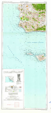 1962 Santa Maria1962 Print · USGSCoastal Santa Barbara County and its offshore islands are shown here during the early years of the Space Age. Researchers can trace the rail corridor of the Southern Pacific or locate local landmarks like Los Coches Mine and Solvang.
 - 1962 Map of Bakersfield, 1969 Print
 1962 Bakersfield1969 Print · USGSThe Southern San Joaquin Valley is shown in the 1960s as a bustling intersection of petroleum production, irrigation agriculture, and mountain recreation. Researchers can trace the rail lines of the Southern Pacific through the valley or locate early desert developments like California City and Tehachapi.4 unique versions available
 - 1964 Map of New Cuyama, 1965 Print
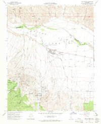 1964 New Cuyama1965 Print · USGSThe mid-century oil and ranching town of New Cuyama is documented here during its postwar development in the Cuyama Valley. Researchers can trace the local community infrastructure, from the Cuyama Valley High Sch and Landing Strip to the remote Branch Canyon Campground in the forest.3 unique versions available
 - 1964 Map of Fox Mountain, 1965 Print
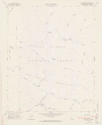
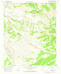
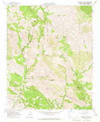
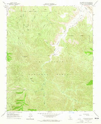 1964 Fox Mountain1965 Print · USGSThe backcountry of Santa Barbara County is captured here in the mid-1960s, showing a rugged landscape of national forest and high mountain peaks. You can trace early ranching and recreation sites like the Santa Barbara Canyon Ranch, the Willow Campground, and water sources such as Olive Spring.3 unique versions available
 - 1964 Map of Bates Canyon, 1965 Print
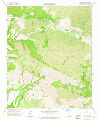
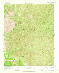
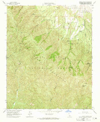 1964 Bates Canyon1965 Print · USGSThe Sierra Madre backcountry is captured here in the mid-1960s, showing a landscape of rugged national forest trails and early campgrounds. Researchers can trace the Foothill Cem or locate historic outposts like the White Oaks Guard Station.4 unique versions available
 - 1964 Map of Bald Mountain, 1965 Print
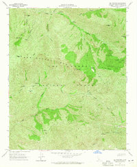
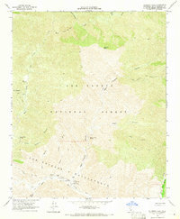
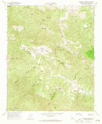
 1964 Bald Mountain1965 Print · USGSThe wilderness of the San Rafael Mountains comes into focus in the mid-1960s, showing a remote backcountry accessible only by pack trails and forest roads. Researchers can locate early camps and landmarks like Nira Campground, Ruins along the river, and a lonely Grave near Wellman Canyon.5 unique versions available
 - 1964 Map of Big Pine Mtn, 1965 Print
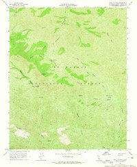
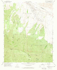
 1964 Big Pine Mtn1965 Print · USGSThe San Rafael Mountains of the mid-sixties are captured here during a critical era of conservation and forest management. Researchers can trace the early layout of the Sisquoc Condor Sanctuary and locate remote outposts like the Alamar Guard Sta and Big Pine Campground.4 unique versions available
 - 1964 Map of Hurricane Deck, 1965 Print
 1964 Hurricane Deck1965 Print · USGSSanta Barbara County’s remote wilderness is captured here in the mid-1960s, showing the primitive trail systems through the Los Padres National Forest. Researchers can locate remote outposts like the South Fork Guard Station and unique landmarks such as Painted Rock.4 unique versions available
 - 1964 Map of Cuyama, 1965 Print
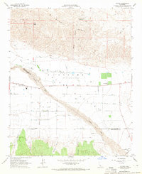 1964 Cuyama1965 Print · USGSThe high desert landscape of the Santa Barbara and San Luis Obispo border comes into focus during the mid-1960s. Researchers can trace the development of the Cuyama Valley through its complex grid of wells, the settlement of Cuyama, and water features like Willow Spring.3 unique versions available
 - 1964 Map of Foxen Canyon, 1965 Print
 1964 Foxen Canyon1965 Print · USGSIn the mid-1960s, the Santa Barbara backcountry remained a territory of historic land grants and early oil production. Genealogists and historians can trace family land at Rancho Tinaquaic or locate the Foxen Adobe (Site) and Foxen Canyon Cem.2 unique versions available
 - 1964 Map of Zaca Lake, 1965 Print
 1964 Zaca Lake1965 Print · USGSThe San Rafael Mountains of Santa Barbara County are captured here in the mid-1960s, showing a landscape of remote canyons and historic ranching outposts. Genealogists and researchers can locate family landmarks like Tunnel Ranch, the Asphaltum Mine, and early sites like Birabent.3 unique versions available
 - 1964 Map of Hildreth Peak, 1965 Print
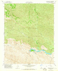
 1964 Hildreth Peak1965 Print · USGSSanta Barbara's mountain backcountry is captured in the mid-1960s, showing the intersection of historic land grants and forest service infrastructure. You can trace early access routes to the Ogilvy Ranch, Pendola Guard Station, and geothermal features like Agua Caliente Spring.4 unique versions available
 - 1964 Map of Madulce Peak, 1965 Print
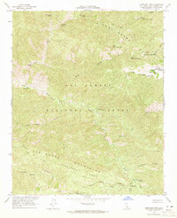
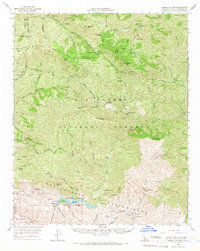
 1964 Madulce Peak1965 Print · USGSSanta Barbara County’s interior canyons and high peaks are captured here in the mid-1960s. Researchers can locate remote backcountry sites including the Madulce Guard Station, Bill Faris Campground, and the high summit of Madulce Peak 6536.2 unique versions available
 - 1964 Map of Tepusquet Canyon, 1965 Print
 1964 Tepusquet Canyon1965 Print · USGSSanta Barbara County’s interior canyons appear in detail in the mid-1960s, showing a network of ranching roads and forest camps. Researchers can trace local lineage at the Ontiveros Cem and Ruiz Grave or locate the Goodchild Ranch and Tepusquet Peak.2 unique versions available
 - 1964 Map of Manzanita Mtn, 1965 Print
 1964 Manzanita Mtn1965 Print · USGSSanta Barbara County’s rugged backcountry is documented in the mid-1960s just as fire management and remote recreation shaped the forest landscape. Researchers can locate isolated landmarks like the White Elephant Mine and primitive sites such as Wagon Flat Campground or Horseshoe Spring.4 unique versions available
 - 1964 Map of Salisbury Potrero, 1965 Print
 1964 Salisbury Potrero1965 Print · USGSThe high Sierra Madre backcountry in the mid-1960s shows a landscape of remote grazing potreros and early conservation efforts. Researchers can trace historic ranching sites like Salisbury Potrero and the protected Sisquoc Condor Sanctuary.3 unique versions available
 - 1964 Map of Peak Mountain, 1965 Print
 1964 Peak Mountain1965 Print · USGSRanching and resource exploration define this Santa Barbara high country during the mid-sixties. Genealogists and hikers can trace historic land holdings like those of the Heirs of Cesario Lataillade or locate remote springs and camps such as Richardson Spring and Aliso Campground.4 unique versions available
 - 1964 Map of Salisbury Canyon, 1966 Print
 1964 Salisbury Canyon1966 Print · USGSThe high Cuyama Valley and Sierra Madre mountains are captured in the mid-sixties during a peak of local oil production. Genealogists and historians can trace ranching and industry through landmarks like Cuyama Ranch, the Cuyama Oil Field, and Snedden.
 - 1964 Map of Gibraltar Dam, 1966 Print
 1964 Gibraltar Dam1966 Print · USGSSanta Barbara's backcountry is captured here during the mid-sixties, centered on the critical water management of the Gibraltar Reservoir. Researchers can trace remote forest outposts like Ogilvy Ranch, the Gibraltar Mine, and early conservation sites like the Sisquoc Condor Sanctuary.2 unique versions available
 - 1964 Map of Little Pine Mountain, 1966 Print
 1964 Little Pine Mountain1966 Print · USGSBackcountry Santa Barbara in the mid-1960s reveals a landscape of critical water infrastructure and forest service outposts. Researchers can trace the path of the Santa Barbara Water Tunnel and locate historical sites like Gibraltar Mine or the Happy Hollow Guard Sta.4 unique versions available
 - 1965 Map of Bald Mountain
 1965 Bald Mountain1965 Print · USGSSanta Barbara County’s backcountry comes alive in the mid-1960s, showing a remote wilderness of mountain ranges and river canyons. Genealogists and hikers can trace historic trail networks like the Mule Trail and find isolated sites such as Water Canyon Camp and Nira Camp.
 - 1966 Map of Gaviota
 1966 Gaviota1966 Print · USGSThe Gaviota coast of Santa Barbara County is captured here in the mid-1960s, showing the intersection of the Santa Ynez Mountains and the Pacific. Genealogists and historians can trace the paths of the Southern Pacific railroad and Highway 101 through coastal settlements like Tajiguas and Orella.
Showing maps 1-25 of 30
Top cities of Santa Barbara County
- Santa Maria historical maps
- Santa Barbara historical maps
- Lompoc historical maps
- Lompoc historical maps
- Orcutt historical maps
- Goleta historical maps
See more
Frequently asked questions
- What are the different types of historical maps available for Santa Barbara County?
- What is the oldest map of Santa Barbara County?
- Where can I purchase historical maps of Santa Barbara County for my home or office?
- Where can I download high-res historical maps of Santa Barbara County?
- Are there historical topographic maps available for Santa Barbara County?
- Is there historical aerial imagery available for Santa Barbara County?
- Where are historical maps of Santa Barbara County sourced from?