2020s Maps of Yreka, California
Explore 4 historic maps of Yreka from the 2020s. These maps offer a rare glimpse into what life looked like during the 2020s — showing old roads, neighborhoods, homes, and landmarks that have changed or disappeared over time.
Whether you're researching your family's past, planning a metal detecting trip, or studying how Yreka's landscape evolved across the 2020s, these high-resolution maps are a powerful tool for exploring the history of this region.
- Focus on a specific era: All maps on this page are from the 2020s, giving you a focused view of this time period.
- See what’s changed: Compare century-old streets, trails, and buildings to today's modern landscape using overlays and satellite layers.
- Research with precision: Use these maps for genealogy, historical research, land use analysis, or educational projects.
- View, download, or print: Maps are fully viewable online in high resolution, and can be downloaded or printed for your own records.
Start exploring Yreka's history through authentic maps from the 2020s. This is your window into the past.
Yreka, CA maps
(4)- 2021 Map of Badger Mountain, 2021 Print
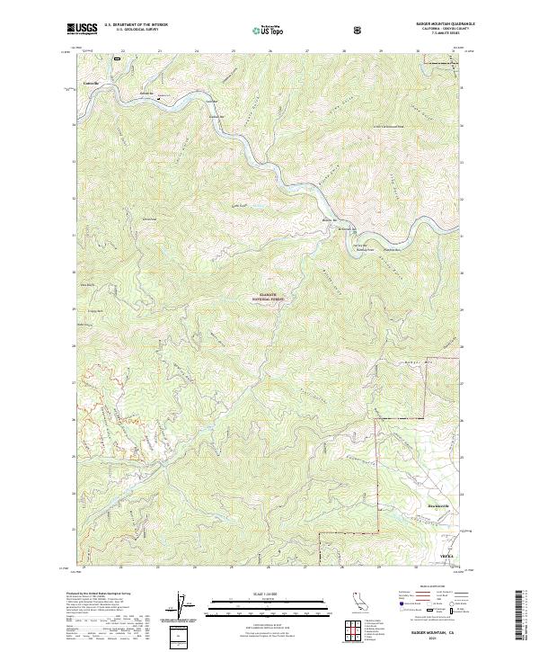 2021 Badger Mountain2021 Print · USGSSiskiyou County's gold-mining legacy is preserved in this survey of the Klamath River corridor and the northern outskirts of Yreka. Local historians can trace early riverfront sites like Kanaka Bar and Masonic Bar or locate the Kanaka Cem.
 - 2022 Map of Yreka, 2022 Print
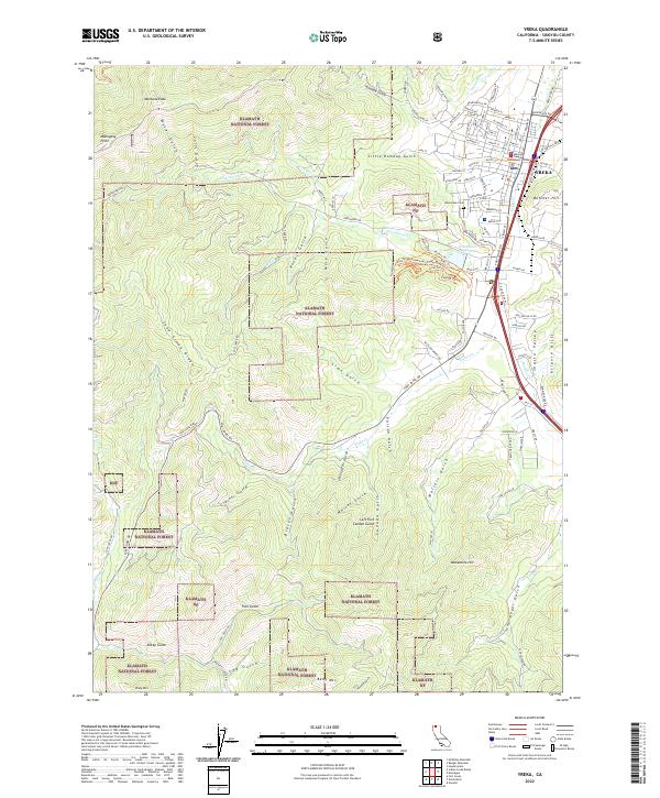 2022 Yreka2022 Print · USGSThe city of Yreka stands at the edge of the Klamath National Forest in this contemporary look at Siskiyou County. Local researchers can trace the city's civic heart at the Siskiyou County Courthouse or explore the many named drainages like Walters Gulch and Humbug Gulch.
 - 2022 Map of Montague, 2022 Print
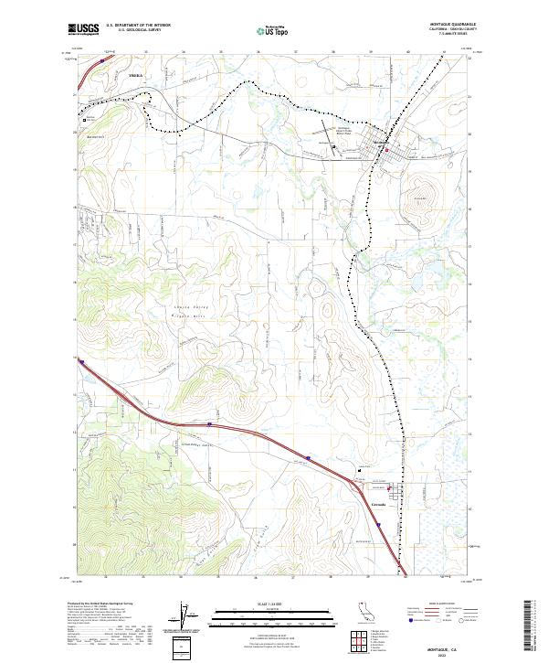 2022 Montague2022 Print · USGSSiskiyou County's high-valley floor is captured here in the modern era, showing the relationship between the regional hubs of Yreka and Montague. Local researchers can trace family landmarks and historical burial sites like Butcher Hill Cem and Julien Cem alongside the waters of the Shasta River.
 - 2022 Map of Hawkinsville, 2022 Print
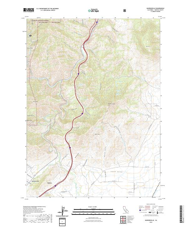 2022 Hawkinsville2022 Print · USGSSiskiyou County's high country and river valleys come to life in this survey of the northern edge of the Shasta Valley. Trace the winding paths of the Shasta River Canyon and locate the historic settlement at Hawkinsville or the rugged outcrops of Paradise Craggy.
End of results
Showing maps 1-4 of 4
Top cities near Yreka
Frequently asked questions
- What are the different types of historical maps available for Yreka?
- What is the oldest map of Yreka?
- Where can I purchase historical maps of Yreka for my home or office?
- Where can I download high-res historical maps of Yreka?
- Are there historical topographic maps available for Yreka?
- Is there historical aerial imagery available for Yreka?
- Where are historical maps of Yreka sourced from?