1950s Maps of Tulare County, California
Explore 74 historic maps of Tulare County from the 1950s. These maps offer a rare glimpse into what life looked like during the 1950s — showing old roads, neighborhoods, homes, and landmarks that have changed or disappeared over time.
Whether you're researching your family's past, planning a metal detecting trip, or studying how Tulare County's landscape evolved across the 1950s, these high-resolution maps are a powerful tool for exploring the history of this region.
- Focus on a specific era: All maps on this page are from the 1950s, giving you a focused view of this time period.
- See what’s changed: Compare century-old streets, trails, and buildings to today's modern landscape using overlays and satellite layers.
- Research with precision: Use these maps for genealogy, historical research, land use analysis, or educational projects.
- View, download, or print: Maps are fully viewable online in high resolution, and can be downloaded or printed for your own records.
Start exploring Tulare County's history through authentic maps from the 1950s. This is your window into the past.
Tulare County, CA maps
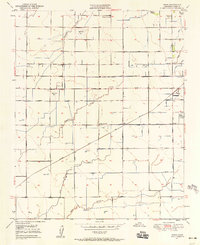
(74)- 1950 Map of Waukena
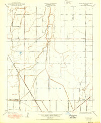 1950 Waukena1950 Print · USGSThe rural stretch between Kings and Tulare Counties comes into focus in this mid-century edition, based on earlier surveys of the valley's irrigation. Genealogists and historians can trace the foundations of the Waukena community and locate old landmarks like Lakeside School and Aurora School.
 - 1950 Map of Burris Park
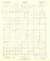
 1950 Burris Park1950 Print · USGSMid-century Kings and Tulare counties come alive in this survey of the irrigated San Joaquin Valley. Researchers can trace ancestral property near River Bend School, follow the Southern Pacific Railroad, or locate the historic Burris Park.
 - 1950 Map of Sausalito School
 1950 Sausalito School1950 Print · USGSTulare County's agricultural heartland is captured here at mid-century, showing the early infrastructure of the San Joaquin Valley. Genealogists and historians can trace the locations of rural schoolhouses like Sausalito Sch and Zion Sch near the Southern Pacific tracks.
 - 1950 Map of Visalia
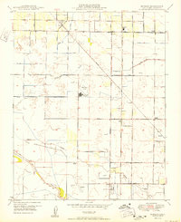
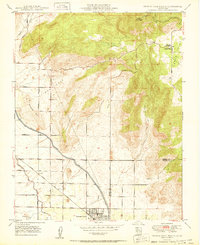
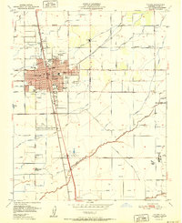
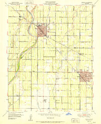
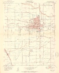 1950 Visalia1950 Print · USGSVisalia and the surrounding Tulare County farmland are shown here during a period of significant mid-century growth and agricultural development. Genealogists and local historians can trace the legacy of Tagus Ranch, locate dozens of local schools like Veva Blunt School, and follow the complex irrigation system of Mill Creek.2 unique versions available
 - 1950 Map of Alpaugh
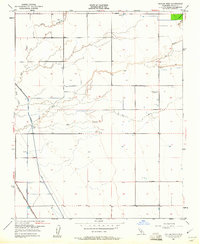
 1950 Alpaugh1950 Print · USGSTulare County's agricultural heartland is documented here during the mid-century, showing a landscape defined by irrigation and rail. Genealogists and historians can trace the early footprints of Alpaugh and find rail stops like Angiola and Stoil along the Atchison Topeka and Santa Fe line.
 - 1950 Map of Monson
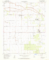
 1950 Monson1950 Print · USGSAgriculture and aviation define this Tulare County landscape at the mid-century point, where rail lines and irrigation ditches connect rural communities. Researchers can trace early schools like Chatham School and local landmarks such as Sequoia Field (Airport) and Yettem.
 - 1950 Map of Traver
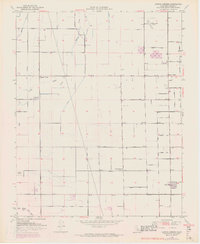
 1950 Traver1950 Print · USGSMid-century Tulare County is defined here by its intricate irrigation network and the railroad spine of the San Joaquin Valley. Genealogists and local historians can trace the early footprints of Traver and London, or locate rural landmarks like the Tulare Duck Club and Wilson Sch.
 - 1950 Map of Goshen
 1950 Goshen1950 Print · USGSCentral California agricultural life is centered on the Goshen rail hub and the surrounding ranch lands at mid-century. Genealogists can locate family-named landmarks like Colpien Ranch and several rural schoolhouses, including Tagus Ranch School and Delta View School.
 - 1950 Map of Orange Cove South
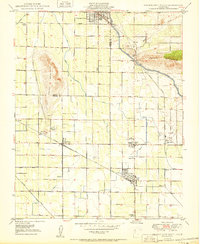 1950 Orange Cove South1950 Print · USGSTulare County's agricultural heartland is documented here at mid-century, revealing a dense grid of irrigation canals and rail lines. Genealogists and historians can locate family landmarks such as Smith Mtn Cemetery, Mt Olive School, and the busy rail hubs of Sultana and Cutler.
 - 1950 Map of Orange Cove North
 1950 Orange Cove North1950 Print · USGSOrange Cove and the surrounding citrus groves are shown at mid-century as the local irrigation and rail networks reached their peak. Researchers can trace the path of the Atchison Topeka and Santa Fe railroad or locate the Saint Rita Indian Mission near Squaw Valley.
 - 1950 Map of Pixley
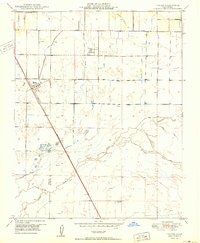
 1950 Pixley1950 Print · USGSAgricultural life in Tulare County thrived along the rail lines at mid-century. Genealogists and historians can trace the early footprints of Pixley and Earlimart along the Southern Pacific tracks and the banks of Deer Creek.
 - 1950 Map of Exeter, 1952 Print
 1950 Exeter1952 Print · USGSTulare County's agricultural heartland is documented here at a mid-century peak, showing the irrigation-driven growth of the San Joaquin Valley. Researchers can trace family history through local landmarks like Linnel PO, the Deep Creek Cem, and rural schools such as Outside Creek Sch.3 unique versions available
 - 1950 Map of Ivanhoe, 1952 Print
 1950 Ivanhoe1952 Print · USGSThe Tulare County citrus belt comes alive in the early fifties, showing the complex web of irrigation and rail that powered the valley. Genealogists and rail historians can trace the paths of three different railroads serving the settlements of Seville, Ivanhoe, and Hillmaid.4 unique versions available
 - 1950 Map of Paige, 1958 Print
 1950 Paige1958 Print · USGSThe Tulare County countryside comes into focus at mid-century, showing an agricultural landscape deeply shaped by irrigation and rail. Genealogists and researchers can trace rural school locations like Buena Vista Sch, the grounds of Colpien Ranch, and the path of the Santa Fe railroad.2 unique versions available
 - 1950 Map of Taylor Weir, 1961 Print
 1950 Taylor Weir1961 Print · USGSTulare County’s agricultural heartland is captured here at mid-century, showcasing the critical water systems of the San Joaquin Valley. Researchers can trace the path of the Atchison Topeka and Santa Fe and locate the Elk Bayou Sch (Abandoned) and Taylor Weir.3 unique versions available
 - 1950 Map of Woodville, 1963 Print
 1950 Woodville1963 Print · USGSTulare County's agricultural heartland is documented here in the early fifties, showing the intricate irrigation and social infrastructure of the San Joaquin Valley. Researchers can trace the layout of Woodville, locate the Woodville Farm Labor Supply Center, and find rural landmarks like Lairds Corner and the Harmony Sch (Abandoned).3 unique versions available
 - 1950 Map of Tulare, 1971 Print
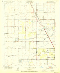
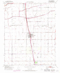
 1950 Tulare1971 Print · USGSTulare's mid-century landscape is defined by its role as a San Joaquin Valley rail and irrigation hub. Researchers can trace the development of the County Fairgrounds and Oakland Colony, or locate landmarks like Tulare Cemetery and Rankin Airfield.2 unique versions available
 - 1950 Map of Cairns Corner, 1971 Print
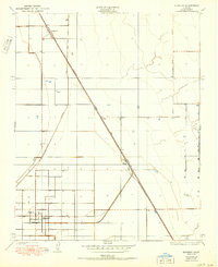
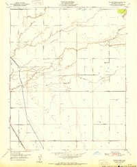
 1950 Cairns Corner1971 Print · USGSTulare County's agricultural heartland was already well-defined by the mid-twentieth century, dominated by extensive irrigation and a rigid road grid. Researchers can trace the footprints of rural education and industry at the Prairie Center Sch (Aban'd) or investigate local aviation history at Rankin Airfield and Cairns Corner.3 unique versions available
 - 1950 Map of Tipton, 1971 Print
 1950 Tipton1971 Print · USGSTipton and the surrounding Central Valley ranch lands are shown at mid-century as the railroad and river systems defined local life. Genealogists and historians can locate the Tipton Cem, the southern siding at Quail, and the course of the Tule River.2 unique versions available
 - 1951 Map of Taylor Weir
 1951 Taylor Weir1951 Print · USGSTulare County's agricultural heartland is captured here in the early fifties, showing the complex water management system of the San Joaquin Valley. Genealogists and local historians can trace irrigation history through Taylor Weir and find vanished landmarks like the Elk Bayou Sch (Abandoned).
 - 1951 Map of Tipton
 1951 Tipton1951 Print · USGSCentral Valley agriculture and the rail economy define this part of Tulare County at mid-century. Genealogists can locate family holdings near Tipton and Quail, or trace the winding courses of Mitchell Slough and the Tule River.
 - 1951 Map of Tulare
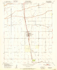
 1951 Tulare1951 Print · USGSMid-century Tulare was a bustling agricultural and rail center at the intersection of two major western railroads. Genealogists and historians can trace the foundations of the community through the Tulare Cemetery, St Aloysius Sch, and the Old Peoples Home.2 unique versions available
 - 1951 Map of Reedley
 1951 Reedley1951 Print · USGSIn the fertile San Joaquin Valley during the early 1950s, the agricultural landscape between Reedley and Dinuba was shaped by the Kings River. Genealogists and local historians can trace family roots through numerous country schools like Kings River School and small settlements such as Delft Colony.
 - 1951 Map of Paige
 1951 Paige1951 Print · USGSTulare County's agricultural heartland is documented here in the early 1950s as a sophisticated network of canals and rails. Genealogists and historians can trace family properties near rural schools like Buena Vista Sch or follow the Atchison Topeka and Santa Fe tracks through Paige.
 - 1951 Map of Cairns Corner
 1951 Cairns Corner1951 Print · USGSTulare County's agricultural heartland is documented here in the early fifties, showcasing a landscape of irrigation sloughs and rural aviation hubs. Genealogists and local historians can trace family-named corners like Cairns Corner and find the Prairie Center Sch (Aban'd).2 unique versions available
Showing maps 1-25 of 74
Top cities of Tulare County
- Visalia historical maps
- Porterville historical maps
- Tulare historical maps
- Dinuba historical maps
- Exeter historical maps
- Lindsay historical maps
See more
Frequently asked questions
- What are the different types of historical maps available for Tulare County?
- What is the oldest map of Tulare County?
- Where can I purchase historical maps of Tulare County for my home or office?
- Where can I download high-res historical maps of Tulare County?
- Are there historical topographic maps available for Tulare County?
- Is there historical aerial imagery available for Tulare County?
- Where are historical maps of Tulare County sourced from?