1980s Maps of Tulare County, California
Explore 57 historic maps of Tulare County from the 1980s. These maps offer a rare glimpse into what life looked like during the 1980s — showing old roads, neighborhoods, homes, and landmarks that have changed or disappeared over time.
Whether you're researching your family's past, planning a metal detecting trip, or studying how Tulare County's landscape evolved across the 1980s, these high-resolution maps are a powerful tool for exploring the history of this region.
- Focus on a specific era: All maps on this page are from the 1980s, giving you a focused view of this time period.
- See what’s changed: Compare century-old streets, trails, and buildings to today's modern landscape using overlays and satellite layers.
- Research with precision: Use these maps for genealogy, historical research, land use analysis, or educational projects.
- View, download, or print: Maps are fully viewable online in high resolution, and can be downloaded or printed for your own records.
Start exploring Tulare County's history through authentic maps from the 1980s. This is your window into the past.
Tulare County, CA maps
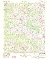
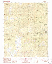
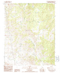
(57)- 1982 Map of Fresno, 1983 Print
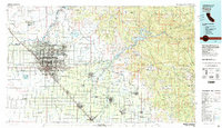 1982 Fresno1983 Print · USGSThe San Joaquin Valley's agricultural and urban landscape is captured here in the early eighties as Fresno expanded northward. Researchers can trace the rail lines of the Southern Pacific RR and identify landmarks like Raisin City and Kingsburg.2 unique versions available
 - 1982 Map of Mt. Langley, 1983 Print
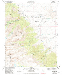 1982 Mt. Langley1983 Print · USGSThe high eastern Sierra and Alabama Hills appear here in the early eighties. Outdoor researchers can trace the routes to Mount Langley and find established sites like Whitney Portal Campground and Movie Flat.
 - 1982 Map of Ninemile Canyon, 1983 Print
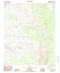
 1982 Ninemile Canyon1983 Print · USGSNinemile Canyon and the surrounding high desert terrain are captured in the early 1980s as a critical junction for regional water infrastructure. Researchers can trace the path of the Los Angeles Second Aqueduct through Sand Canyon and locate remote mining prospects near Sawtooth Peak.
 - 1983 Map of Little Lake
 1983 Little Lake1983 Print · USGSThe volcanic corridor of Rose Valley in the early 1980s reveals a landscape defined by heavy infrastructure and geologic history. Trace the complex path of the Los Angeles Aqueduct past Fossil Falls and the industrial Cinder Pits near Little Lake.2 unique versions available
 - 1984 Map of Mt. Williamson, 1985 Print
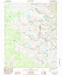
 1984 Mt. Williamson1985 Print · USGSThe high Sierra crest stands at the junction of three major federal lands in the early 1980s. Hikers and climbers can trace established routes over Forester Pass, locate the remote Anvil Camp, and study the alpine waters of Lake Helen of Troy.
 - 1985 Map of Mt. Clarence King
 1985 Mt. Clarence King1985 Print · USGSThe High Sierra backcountry of Fresno and Inyo counties comes into focus during the mid-1980s, documenting the routes through Kings Canyon. Hikers and historians can trace the Pacific Crest National Scenic Trail and locate remote landmarks like Charlotte Lake and Glen Pass.
 - 1985 Map of Mt. Kaweah
 1985 Mt. Kaweah1985 Print · USGSThe High Sierra backcountry of Tulare County is captured here in the mid-1980s as it appeared to wilderness travelers and park rangers. Hikers and historians can trace the intersection of the Pacific Crest Trail and the High Sierra Trail near Junction Meadow.2 unique versions available
 - 1985 Map of Kearsarge Peak
 1985 Kearsarge Peak1985 Print · USGSThe eastern Sierra Nevada high country comes alive in this mid-eighties survey of Inyo County. Hikers and historians can trace the paths of the John Muir Trail past Sardine Lake or locate old water sources like Boron Springs and McGann Springs.
 - 1985 Map of Mount Whitney
 1985 Mount Whitney1985 Print · USGSThe High Sierra backcountry is documented in the mid-1980s during a period of expanding wilderness protection and peak mountaineering interest. Hikers and historians can trace the classic routes of the John Muir Trail past Mount Whitney, Crabtree Meadow, and Tulainyo Lake.
 - 1985 Map of Mt. Brewer
 1985 Mt. Brewer1985 Print · USGSThe High Sierra wilderness is captured in the mid-1980s at the intersection of two major national parks and several massive mountain divides. Hikers and historians can trace the iconic John Muir Trail past Caltech Peak and the high waters of Lake South America.
 - 1986 Map of Dennison Peak
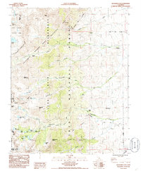
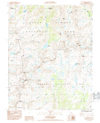
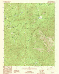
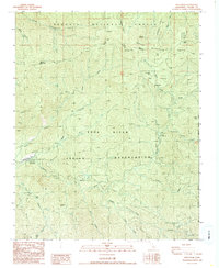
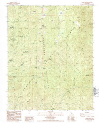
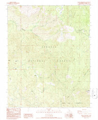
 1986 Dennison Peak1986 Print · USGSThe Tulare County high country comes into focus in the mid-1980s, bridging the gap between park and forest lands. Researchers can trace historic mountain sites like Peck Cabin, the Good Hope Mines, and subterranean landmarks such as Clough Cave.3 unique versions available
 - 1986 Map of Johnsondale
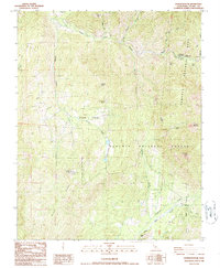
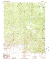
 1986 Johnsondale1986 Print · USGSThe Tulare County high country comes into focus in the mid-1980s, documenting the forest town of Johnsondale and its surrounding groves. Researchers can locate the Thompson Camp (Site), the scout grounds at Camp Whitsett, and protected stands like Packsaddle Grove.2 unique versions available
 - 1986 Map of Lamont Peak
 1986 Lamont Peak1986 Print · USGSThe high Sierra Nevada backcountry near the Tulare and Inyo county lines was a landscape of remote peaks and wilderness trails in the mid-eighties. Hikers and historians can trace the original path of the Pacific Crest National Scenic Trail as it passes Chimney Peak and the Heliport.2 unique versions available
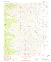
 - 1986 Map of Posey, 1987 Print
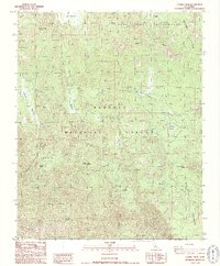
 1986 Posey1987 Print · USGSThe Southern Sierra Nevada high country near the Tulare-Kern county line comes into focus in the mid-1980s. Researchers can locate family outposts like Burton Ranch, explore the area around the Tungstore Mine, or trace the seasonal tracts at Sugarloaf Village.2 unique versions available
 - 1986 Map of California Hot Springs, 1987 Print
 1986 California Hot Springs1987 Print · USGSCalifornia Hot Springs and the surrounding Sequoia National Forest are captured here in the mid-1980s before modern development. You can trace early foothill history through the Eagle Hotel, local sites like Thompson Camp, and the Bull Pony Mine Prospects.2 unique versions available
 - 1986 Map of Solo Peak, 1987 Print
 1986 Solo Peak1987 Print · USGSTulare County in the mid-1980s was a landscape of remote mountain camps and timber history before modern development changed many Sierra access points. Trace early landmarks like Smith Mill (Site), Wheatons, and the high-elevation Redwood Camp.
 - 1986 Map of Kernville, 1987 Print
 1986 Kernville1987 Print · USGSThe Kern River canyon comes into sharp focus during the mid-eighties as a hub for both hydroelectric power and mountain recreation. Researchers can trace the development of Kernville and Riverkern or locate industrial sites like the Powerhouse.2 unique versions available
 - 1986 Map of Tobias Peak, 1987 Print
 1986 Tobias Peak1987 Print · USGSThe Greenhorn Mountains and Sequoia National Forest are captured here in the mid-1980s, showcasing a landscape of high-country summer tracts and historical mining. Researchers can locate remote sites like the Sugarloaf Saw Mill, the Betty Lou Mine, and the Spear Creek Summer Home Tract.2 unique versions available
 - 1986 Map of Sacatar Canyon, 1987 Print
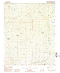
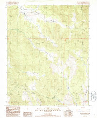 1986 Sacatar Canyon1987 Print · USGSThe Tulare County high country comes into focus in the mid-1980s, revealing a landscape of remote airstrips and high-elevation meadows. Researchers can trace land use through the Sacatar Airstrip, several Open Pit Mine sites, and Kennedy Meadows.2 unique versions available
 - 1986 Map of Cannell Peak, 1987 Print
 1986 Cannell Peak1987 Print · USGSHigh Sierra backcountry in the mid-eighties was a landscape of remote granite domes and isolated forest outposts. Researchers can trace historic grazing lands and forest service activity at Cannell Meadow Forest Service Sta, Potato Patch, and the high meadows of Bartolas Country.2 unique versions available
 - 1986 Map of Kaweah, 1987 Print
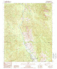
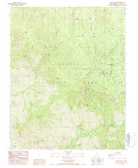
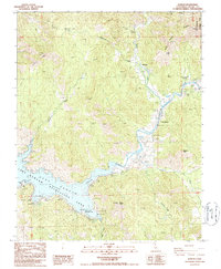 1986 Kaweah1987 Print · USGSThe foothills of the Sierra Nevada meet the reservoir waters in the mid-1980s, capturing the community of Three Rivers and the gateway to Sequoia National Park. Researchers can trace old family landmarks at Mankins Flat, locate a hillside Cem, or study the shoreline at Lake Kaweah.2 unique versions available
 - 1986 Map of Chickencoop Canyon, 1987 Print
 1986 Chickencoop Canyon1987 Print · USGSTulare County's foothills in the mid-1980s reveal a landscape of seasonal ranching and mineral exploration. Researchers can trace the Van Gordon Trail to landmarks like Hinds Cabin, the Fire Tower, and several old mining Prospects.2 unique versions available
 - 1987 Map of Bonita Meadows
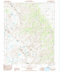
 1987 Bonita Meadows1987 Print · USGSSequoia National Forest in the late 1980s reveals a high-country landscape of managed forests and wilderness preservation. Trace the network of seasonal camps and administrative sites like the Well Work Center, Paloma Meadows, and the Blackrock Visitor Information Sta.3 unique versions available
 - 1987 Map of Giant Forest
 1987 Giant Forest1987 Print · USGSThe High Sierra of Tulare County is captured here in the late eighties as the park's mid-century infrastructure meets its ancient groves. Trace the paths around the General Sherman Tree, find the camps at Potwisha, and locate the remote Crystal Cave in the canyon depths.
 - 1987 Map of Shadequarter Mtn
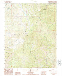 1987 Shadequarter Mtn1987 Print · USGSTulare County's high Sierra foothills are mapped here in the late eighties, showing the meeting of major national parks and forests. Researchers can trace remote history through the Advance Ruins, the Shadequarter Lookout, and old 4WD tracks.
Showing maps 1-25 of 57
Top cities of Tulare County
- Visalia historical maps
- Porterville historical maps
- Tulare historical maps
- Dinuba historical maps
- Exeter historical maps
- Lindsay historical maps
See more
Frequently asked questions
- What are the different types of historical maps available for Tulare County?
- What is the oldest map of Tulare County?
- Where can I purchase historical maps of Tulare County for my home or office?
- Where can I download high-res historical maps of Tulare County?
- Are there historical topographic maps available for Tulare County?
- Is there historical aerial imagery available for Tulare County?
- Where are historical maps of Tulare County sourced from?