1920s Maps of Tulare County, California
Explore 44 historic maps of Tulare County from the 1920s. These maps offer a rare glimpse into what life looked like during the 1920s — showing old roads, neighborhoods, homes, and landmarks that have changed or disappeared over time.
Whether you're researching your family's past, planning a metal detecting trip, or studying how Tulare County's landscape evolved across the 1920s, these high-resolution maps are a powerful tool for exploring the history of this region.
- Focus on a specific era: All maps on this page are from the 1920s, giving you a focused view of this time period.
- See what’s changed: Compare century-old streets, trails, and buildings to today's modern landscape using overlays and satellite layers.
- Research with precision: Use these maps for genealogy, historical research, land use analysis, or educational projects.
- View, download, or print: Maps are fully viewable online in high resolution, and can be downloaded or printed for your own records.
Start exploring Tulare County's history through authentic maps from the 1920s. This is your window into the past.
Tulare County, CA maps
(44)- 1921 Map of Squaw Valley
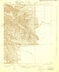
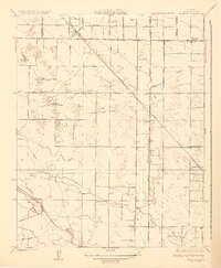
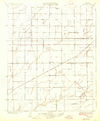
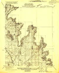 1921 Squaw Valley1921 Print · USGSSettlement and irrigation transform the Sierra foothills in the early twenties as the citrus industry takes root. Genealogists and historians can trace the early grid of Orange Cove and the development of the Citrus Cove School along the Atchison Topeka and Santa Fe line.
 - 1921 Map of Stokes Mountain, 1957 Print
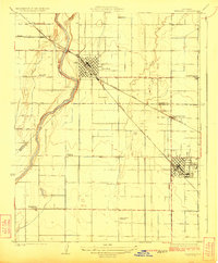
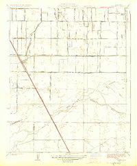
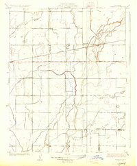
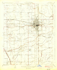
 1921 Stokes Mountain1957 Print · USGSTulare County's foothills come into focus in the early 1920s as agriculture and transport infrastructure began to define the landscape. Local historians can trace the foundations of the rural community through the Elda School and the tracks of the A. T. & S. F. railroad near Stokes Mountain.
 - 1922 Map of Trimmer
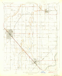
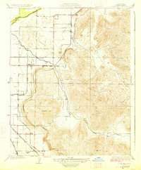
 1922 Trimmer1922 Print · USGSThe foothills of eastern Fresno County meet the San Joaquin Valley floor during a period of booming citrus and rail development. Researchers can trace early family-run rangelands and specialized sites like the Wahtoke Winery, the Sunnyside Mine, and the Sycamore Creek Indian School.
 - 1923 Map of Sultana
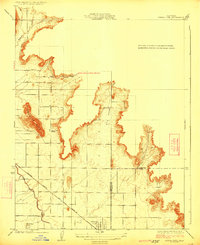
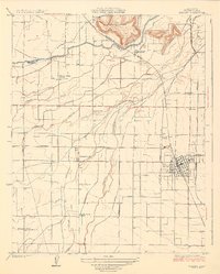
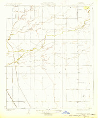
 1923 Sultana1923 Print · USGSCentral Valley agriculture and rail lines dominate the landscape during the early 1920s. Genealogists can trace family footprints near Sultana, Orosi, and Cutler, or locate rural school sites like Mt Olive School.
 - 1924 Map of Reedley
 1924 Reedley1924 Print · USGSIn the fertile San Joaquin Valley during the 1920s, the fruit-growing region hummed with activity along the Kings River. Genealogists and historians can trace the development of Reedley and Dinuba while locating rural landmarks like Smith Mountain School and the Advent Church.
 - 1924 Map of Selma
 1924 Selma1924 Print · USGSThe San Joaquin Valley's agricultural heartland is captured here in the early 1920s, dominated by the rail corridor connecting Selma and Kingsburg. Family historians can locate rural landmarks like the Danish Church, Swedish Mission, and Walnut School.
 - 1924 Map of Citrus Cove
 1924 Citrus Cove1924 Print · USGSIn the early 1920s, the citrus-growing region at the edge of the Sierra foothills was just beginning its expansion. Researchers can trace the development of Orange Cove and the path of the Atchison Topeka and Santa Fe railroad near Citrus Cove School.2 unique versions available
 - 1924 Map of Dinuba
 1924 Dinuba1924 Print · USGSThe Central Valley meets the Sierra foothills in the early twenties, showing a landscape defined by new canals and citrus groves. Genealogists can locate family holdings like Stair Ranch and dozens of country schools, including the Sycamore Creek Indian School and Great Western School.5 unique versions available
 - 1924 Map of Stokes Mountain
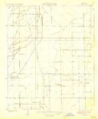
 1924 Stokes Mountain1924 Print · USGSTulare County's eastern foothills come into sharp focus during the early twenties as the region's agricultural and school districts took shape. Genealogists and historians can trace the local landscape near Stokes Mountain, the Elda School, and the A. T. & S. F. rail line.3 unique versions available
 - 1925 Map of Rocky Hill
 1925 Rocky Hill1925 Print · USGSTulare County in the mid-1920s reveals a sophisticated network of irrigation and electric rail servicing the eastern San Joaquin Valley. Researchers can trace early school sites like Lindcove School and the infrastructure of the Visalia Electric and Sides Siding.
 - 1925 Map of Tulare
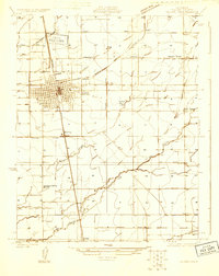 1925 Tulare1925 Print · USGSTulare and its surrounding agricultural colonies are captured here in the mid-twenties as the valley's irrigation and rail networks expanded. Researchers can trace the development of small settlements like Burling and Elba alongside early landmarks such as the Oakland Colony School.
 - 1925 Map of Tipton
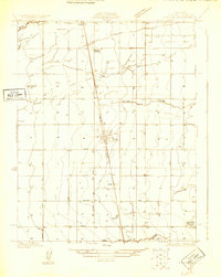 1925 Tipton1925 Print · USGSThe agricultural landscape surrounding Tipton was still taking shape in the mid-twenties as the Southern Pacific railroad spurred growth. Family historians can locate rural landmarks like Hanby School, Edendale School, and the early route of Vineyard Road.
 - 1926 Map of Goshen
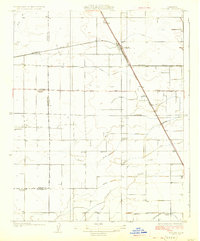 1926 Goshen1926 Print · USGSThe San Joaquin Valley was a landscape defined by rail and irrigation in the mid-1920s. Genealogists can locate rural schoolhouses like Packwood School and Manzanillo School while tracing the Southern Pacific tracks near Goshen.3 unique versions available
 - 1926 Map of Burris Park
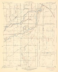 1926 Burris Park1926 Print · USGSCentral Valley farmland and the meandering Kings River define this 1920s landscape at the meeting of Kings, Fresno, and Tulare counties. Genealogists can locate rural schoolhouses like Oakvale School and trace early irrigation via the Peoples Ditch.3 unique versions available
 - 1926 Map of Quincy School
 1926 Quincy School1926 Print · USGSThe foothills of the southern San Joaquin Valley come into focus in the mid-1920s as early infrastructure began to define the rural landscape. Trace the location of the Quincy School and follow the route of the Delano-Woody Road across the White River.2 unique versions available
 - 1926 Map of Ivanhoe
 1926 Ivanhoe1926 Print · USGSAgricultural Tulare County comes into sharp focus during the mid-twenties as railroads and irrigation canals transformed the valley floor. Researchers can trace the path of the Visalia Electric line and locate early landmarks like Stone Corral School and Hillmaid (Redbanks).3 unique versions available
 - 1926 Map of Exeter
 1926 Exeter1926 Print · USGSTulare County's citrus and grape heartland is captured in the mid-twenties as an intricate web of irrigation and electric rail. Genealogists and researchers can trace rural life through family-named landmarks like Mineral King Ranch and several country schools including Deep Creek School and Outside Creek School.3 unique versions available
 - 1927 Map of Traver
 1927 Traver1927 Print · USGSThe rail-driven landscape of the southern San Joaquin Valley comes into focus here in the mid-1920s. Genealogists and researchers can trace rural school districts like Kennedy School and early infrastructure along the Southern Pacific through Traver.2 unique versions available
 - 1927 Map of Cairns Corner
 1927 Cairns Corner1927 Print · USGSTulare County's agricultural heartland is documented here in the mid-twenties, showcasing the vital irrigation and rail networks of the San Joaquin Valley. Genealogists and local historians can trace family locations near Cairns Corner, Porters, and several rural schoolhouses like Prairie Center School.2 unique versions available
 - 1927 Map of Monson
 1927 Monson1927 Print · USGSTulare County's agricultural heartland is documented here in the late 1920s as a thriving network of rail lines and rural schools. Genealogists can trace family footprints near Monson, Yettem, and several local landmarks like Chatham School and the St Johns River.2 unique versions available
 - 1927 Map of Remnoy
 1927 Remnoy1927 Print · USGSKings County farming and irrigation networks are shown here in the mid-twenties as the valley's water systems were being formalized. Genealogists and local historians can locate several rural landmarks including Wayne School, King School, and the Southern Pacific stop at Remnoy.2 unique versions available
 - 1927 Map of Rocky Hill
 1927 Rocky Hill1927 Print · USGSIn the late 1920s, this Tulare County landscape shows the intricate marriage of irrigation and rail that built the valley's citrus belt. Genealogists and historians can trace the exact locations of the Lind Cove School, the Merryman station, and the path of the Visalia Electric railroad.3 unique versions available
 - 1927 Map of Lake View School
 1927 Lake View School1927 Print · USGSTulare County's agricultural heartland is documented here during the mid-1920s as irrigation systems began to reshape the San Joaquin Valley. Genealogists and local historians can locate early rural landmarks like Lake View School, the Taylor Weir, and the Elk Bayou School along the Tule River.2 unique versions available
 - 1927 Map of Paige
 1927 Paige1927 Print · USGSTulare County's agricultural heartland is captured in the mid-twenties as the valley's irrigation and rail networks expanded. Researchers can locate several rural schoolhouses like Linder School and trace the path of the Atchison Topeka and Santa Fe through Paige.2 unique versions available
 - 1927 Map of Visalia
 1927 Visalia1927 Print · USGSVisalia and the surrounding Tulare County plains appear here in the mid-1920s as a thriving agricultural hub defined by its complex water and rail networks. Researchers can locate early rural landmarks like Willow School, the stop at Tagus, and the Mooneys Grove parkland.3 unique versions available
Showing maps 1-25 of 44
Top cities of Tulare County
- Visalia historical maps
- Porterville historical maps
- Tulare historical maps
- Dinuba historical maps
- Exeter historical maps
- Lindsay historical maps
See more
Frequently asked questions
- What are the different types of historical maps available for Tulare County?
- What is the oldest map of Tulare County?
- Where can I purchase historical maps of Tulare County for my home or office?
- Where can I download high-res historical maps of Tulare County?
- Are there historical topographic maps available for Tulare County?
- Is there historical aerial imagery available for Tulare County?
- Where are historical maps of Tulare County sourced from?