Old Maps of Mineral County, Colorado for Genealogy
Trace your family roots with 192 historic maps of Mineral County. These high-res maps reveal old neighborhoods, homesites, landmarks, and streets — helping you uncover where your ancestors lived and how the area evolved over time.
- Explore historic neighborhoods: Identify where your relatives may have lived in the 1800s or 1900s.
- Compare maps over time: Trace the changes in streets, buildings, and landmarks for multi-generational research.
- Perfect for genealogy & ancestry research: Used by family historians and researchers to map out lineage and migration.
These maps are an incredible resource for exploring your personal connection to Mineral County's past.
Mineral County, CO maps
(192)- 1905 Map of San Cristobal, 1963 Print
 1905 San Cristobal1963 Print · USGSThe high peaks of the San Juan Mountains are recorded here just after the turn of the century as mining and high-altitude ranching shaped the area. Researchers can trace the layout of early settlements like Whitecross and Sherman or locate the Lakemans Fishponds near the Continental Divide.
 - 1907 Map of San Cristobal
 1907 San Cristobal1907 Print · USGSHinsdale and Mineral counties are shown during the early years of the national forest system, following the Continental Divide through high alpine peaks. Genealogists and researchers can trace the locations of mining-era settlements like Whitecross and Carson, or remote sites like Lakemans Fishponds.5 unique versions available
 - 1913 Map of Summitville, 1962 Print
 1913 Summitville1962 Print · USGSThe high San Juan Mountains at the turn of the century are captured here, from the gold-mining district at Summitville to the ranchlands of the Navajo River valley. Genealogists and historians can trace early school sites like Blanco School and working mines including the Asiatic Mine and Forest King Mine.
 - 1914 Map of Creede
 1914 Creede1914 Print · USGSMineral County mining camps and silver-era infrastructure are preserved in this pre-war survey. Genealogists and historians can trace industrial landmarks like the Nelson Tunnel alongside early settlements including Bachelor, Sunnyside, and Spar City.3 unique versions available
 - 1915 Map of Summitville
 1915 Summitville1915 Print · USGSSouthern Colorado mining and timber operations are captured here during the early twentieth century. Researchers can trace remote mining claims like the Asiatic Mine, mountain schools such as Blanco School, and the path of the Logging RR.4 unique versions available
 - 1916 Map of Creede
 1916 Creede1916 Print · USGSThe silver boom of the San Juan Mountains is in full swing on this 1910s survey of the upper Rio Grande. Researchers can trace mining claims and tunnels at Bachelor, locate the Emma Mine, or find the old Pfeiffer School near Granger.3 unique versions available
 - 1924 Map of Pagosa Springs, 1958 Print
 1924 Pagosa Springs1958 Print · USGSArchuleta County comes into focus in the 1920s as a vital mountain corridor defined by the San Juan and Piedra rivers. Genealogists and historians can trace the Denver and Rio Grande Western rail line and discover remote schoolhouses like Stollsteimer School and O'Neal Park School.2 unique versions available
 - 1927 Map of Pagosa Springs
 1927 Pagosa Springs1927 Print · USGSThe high country of the San Juan Mountains comes into focus in the 1920s as ranching and rail reach into the river valleys. Genealogists and historians can trace the Denver and Rio Grande Western line through Pagosa Junction and locate old rural hubs like Yellowjacket School.3 unique versions available
 - 1945 Map of Durango
 1945 Durango1945 Print · USGSSouthwest Colorado and Northern New Mexico at mid-century are defined by the high peaks of the San Juan Range and the tribal lands of the Southern Ute. Genealogists and historians can trace the paths of the D & R G W RR and locate local landmarks like Animas City and the Blanco Basin School.3 unique versions available
 - 1953 Map of Durango, 1963 Print
 1953 Durango1963 Print · USGSThe high peaks of the San Juan Mountains and the Colorado mining country are shown here as they appeared in the early fifties. Genealogists and local historians can trace the rail lines of the D & R G W RR and locate historic mining camps like Silverton, Ouray, and Old Ophir.
 - 1954 Map of Durango
 1954 Durango1954 Print · USGSSouthern Colorado in the mid-1950s was defined by high-altitude mining towns and the expansion of water storage in the San Luis Valley. Trace the narrow-gauge Denver & Rio Grande Western RR as it connects Durango to mountain outposts like Silverton and Creede.2 unique versions available
 - 1957 Map of Wolf Creek Pass, 1959 Print
 1957 Wolf Creek Pass1959 Print · USGSThe high San Juan peaks and ranching valleys are captured here in the late fifties, just as mountain access and national forest management were expanding. Researchers can trace historic family-named sites like Hott Ranch or locate the Red Ryder Rodeo Grounds and Treasure Guard Station.6 unique versions available
 - 1957 Map of Spar City, 1959 Print
 1957 Spar City1959 Print · USGSThe San Juan Mountains of southern Colorado are captured here in the late 1950s, centered on the high-country settlement of Spar City. Researchers can trace old mining infrastructure at the Emma Mine and Denver Tunnel, or follow the Elliot Pack Trail across the Continental Divide.5 unique versions available
 - 1959 Map of Creede, 1961 Print
 1959 Creede1961 Print · USGSMineral County mining peaks in the late fifties as the Denver and Rio Grande Western rail line reaches deep into the mountains. Genealogists and historians can trace numerous silver claims and local landmarks like the Amethyst Mine, the Historical Cem, and Fremont Sch No 1.6 unique versions available
 - 1959 Map of Bristol Head, 1961 Print
 1959 Bristol Head1961 Print · USGSHinsdale and Mineral Counties are shown here during the late fifties, dominated by high-altitude ranching and the remnants of pioneer stage lines. Researchers can trace old mountain routes like the Slumgullion Pass and locate historic sites such as Rambouillet and the Powderhorn Old Stage Sta (Ruins).7 unique versions available
 - 1961 Map of Durango
 1961 Durango1961 Print · USGSThe high San Juan country in the early sixties is shown here as a network of historic mining towns and early reservoir projects. Genealogists and researchers can trace the Denver & Rio Grande Western RR as it connects Durango, Silverton, and Arboles.
 - 1963 Map of Durango
 1963 Durango1963 Print · USGSThe San Juan Mountains and San Luis Valley are captured here in the early 1950s as mining, rail, and tribal lands shaped the region. Researchers can trace the Denver & Rio Grande Western RR through high-country towns like Telluride and Silverton, or locate landmarks such as the Asiatic Mine.
 - 1964 Map of Oakbrush Ridge, 1967 Print
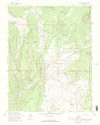 1964 Oakbrush Ridge1967 Print · USGSThe high San Juan Forest country near the Hinsdale and Archuleta county line is captured here in the mid-1960s. Researchers can locate remote high-altitude landmarks like Piedra Guard Station, Singing Pines Ranch, and the Debs Community Hall.4 unique versions available
 - 1964 Map of Little Squaw Creek, 1967 Print
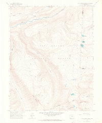 1964 Little Squaw Creek1967 Print · USGSHinsdale and Mineral counties are shown here in the mid-1960s as a high-mountain wilderness split by the Continental Divide. Trace the remote network of a Stock Driveway and Pack Trails connecting Ruby Lake, River Hill, and Trout Lake.5 unique versions available
 - 1964 Map of Workman Creek, 1967 Print
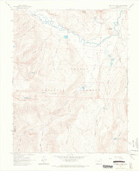 1964 Workman Creek1967 Print · USGSHigh in the San Juan Mountains during the mid-sixties, this survey captures the winding Rio Grande and Antelope Park. Trace backcountry landmarks like Sulphur Tunnel, the Stock Driveway, and alpine waters at Love Lake.3 unique versions available
 - 1964 Map of Pagosa Peak, 1968 Print
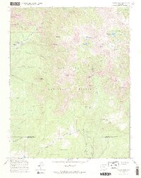 1964 Pagosa Peak1968 Print · USGSThe high country of the San Juan National Forest is revealed here in the mid-sixties, showing the remote high-altitude ranching and water infrastructure of the era. Researchers can trace the paths of the Piedra Ditch and Fourmile Stock Trail between sites like Cade Ranch and Piedra Falls.3 unique versions available
 - 1966 Map of Durango
 1966 Durango1966 Print · USGSSouthwestern Colorado and the New Mexico borderlands are shown here in the mid-1960s, a time when the narrow-gauge rail network still tied the high peaks to the valley floor. Researchers can trace the Denver & Rio Grande Western Railroad between settlements like Silverton, Antonito, and Pagosa Springs.2 unique versions available
 - 1966 Map of Elwood Pass, 1968 Print
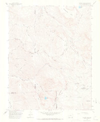 1966 Elwood Pass1968 Print · USGSHigh in the San Juan Mountains during the mid-sixties, this survey captures the intersection of four counties along the Continental Divide. Researchers can trace remote alpine routes like the Stock Driveway and locate the historic Black Diamond Mine or McCormick Cabin.4 unique versions available
 - 1967 Map of South Fork West, 1968 Print
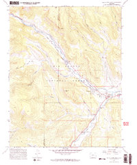 1967 South Fork West1968 Print · USGSThe confluence of the Rio Grande and its south fork comes alive in the late sixties, showing a landscape defined by ranching and the railroad. Researchers can trace the Denver and Rio Grande Western line past Riverside Ranch to the mountain community of South Fork.4 unique versions available
 - 1967 Map of Mesa Mountain, 1969 Print
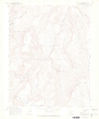 1967 Mesa Mountain1969 Print · USGSThe high La Garita Mountains of the late sixties are defined here by remote mining claims and alpine stock routes. Trace high-country history along the La Garita Stock Driveway or locate the Sky City Mine near Wannamaker Creek.3 unique versions available
Showing maps 1-25 of 192
Top cities of Mineral County
Frequently asked questions
- What are the different types of historical maps available for Mineral County?
- What is the oldest map of Mineral County?
- Where can I purchase historical maps of Mineral County for my home or office?
- Where can I download high-res historical maps of Mineral County?
- Are there historical topographic maps available for Mineral County?
- Is there historical aerial imagery available for Mineral County?
- Where are historical maps of Mineral County sourced from?