Old Maps of Rio Blanco County, Colorado for Academic Research
Study the evolution of Rio Blanco County with 489 high-resolution historic maps. Whether you're teaching, researching, or modeling changes in land use, these maps provide essential visual documentation of urban, environmental, and geographic change.
- Analyze long-term change: Track patterns in development, transportation, and natural features.
- Ideal for environmental or urban studies: Support academic projects with primary historical map data.
- Use in the classroom or lab: Educators and researchers rely on these maps to bring historical context to life.
These maps are a powerful tool for teaching, research, and visualizing how Rio Blanco County has changed over the decades.
Rio Blanco County, CO maps
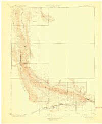
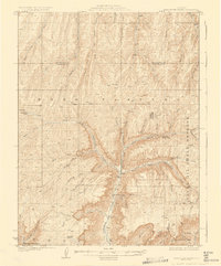
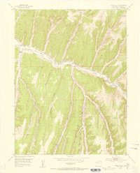
(489)- 1885 Map of East Tavaputs
 1885 East Tavaputs1885 Print · USGSEastern Utah in the mid-1880s was a landscape of massive plateaus and vital rail corridors. Researchers can trace the path of the Denver and Rio Grande Western through the Grand River Valley or locate water sources like Asphalt Creek and Bitter Water Creek.6 unique versions available
 - 1885 Map of Ashley
 1885 Ashley1885 Print · USGSThe Uinta Basin in the mid-1880s was a landscape defined by the winding Green River and the high peaks of the eastern Uintas. Researchers can trace early outposts like White Rocks and settlements such as Ashley and Ouray.5 unique versions available
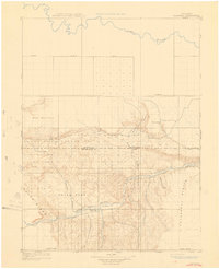
 - 1906 Map of Grand Hogback, 1959 Print
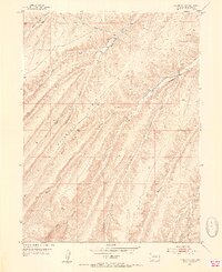
 1906 Grand Hogback1959 Print · USGSGarfield County at the turn of the century shows a frontier landscape defined by the rugged Grand Hogback and the vital Colorado River corridor. Researchers can trace early rail stops and rural outposts like Dinner Sta, Antlers, and the riverside town of Silt.
 - 1907 Map of Rangely, 1955 Print
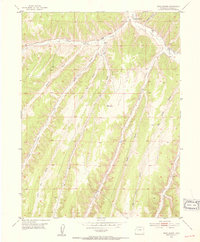
 1907 Rangely1955 Print · USGSNorthwestern Colorado at the turn of the century is captured here in a period of early frontier settlement and reconnaissance. Researchers can trace the river-fed outposts of Rangely and Angora or locate landmarks like Blue Mountain and Raven Park.
 - 1907 Map of Jensen, 1957 Print
 1907 Jensen1957 Print · USGSEastern Utah and the Colorado borderlands are shown here at the turn of the century as a frontier of river crossings and ranching outposts. Trace the early Stage Road to Dragon or locate the historic Ferry at Jensen near Dinosaur National Monument.
 - 1907 Map of White River, 1957 Print
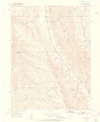
 1907 White River1957 Print · USGSNorthwestern Colorado at the start of the century was a frontier of isolated river valleys and sprawling cattle range. Genealogists can trace early landmarks like Maybell P O, the Keystone Ranch, and the river crossing at Thornburgh Bridge.
 - 1910 Map of Danforth Hills
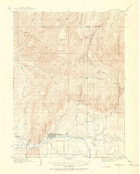
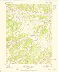
 1910 Danforth Hills1910 Print · USGSNorthwest Colorado is surveyed here in the early 1900s, showing a landscape defined by the rugged Danforth Hills and the early ranching outposts of Routt and Rio Blanco counties. Genealogists can locate family holdings like Edinger's Ranch and Maudlin's Ranch or trace the early post offices at Lay PO and Hamilton PO.
 - 1910 Map of Jensen
 1910 Jensen1910 Print · USGSThe Utah-Colorado borderlands come alive in the first decade of the twentieth century, showing the early development of the Uinta Basin. Genealogists and historians can locate early river crossings at the ferry sites near Jensen or trace the road to Dragon Stage Road.2 unique versions available
 - 1910 Map of Grand Hogback
 1910 Grand Hogback1910 Print · USGSGarfield and Rio Blanco counties appear at the height of the early railroad era, defined by the towering spine of the Grand Hogback. Local historians can trace the early rail stops and river settlements like Rio Blanco, Antlers, and Dinner Sta.3 unique versions available
 - 1910 Map of White River
 1910 White River1910 Print · USGSNorthwest Colorado is captured here in the early twentieth century as a landscape of remote river valleys and high plateaus. Local historians can trace early crossings like Thornburgh Bridge and old outposts such as Maybell P O and Keystone Ranch.2 unique versions available
 - 1910 Map of Rangely
 1910 Rangely1910 Print · USGSNorthwestern Colorado at the turn of the century reveals a landscape of isolated outposts and cattle country along the river basins. Genealogists and researchers can trace the early footprints of Rangely, Angora, and Boxelder near the White River.2 unique versions available
 - 1912 Map of Meeker, 1954 Print
 1912 Meeker1954 Print · USGSThe White River valley near Meeker comes alive in the early twentieth century, showing a landscape of pioneer ranching and early rural schooling. Researchers can locate family landmarks like the Uehlein Ranch and trace the footprints of the Powell Park School or Coal Creek School.2 unique versions available
 - 1914 Map of Meeker
 1914 Meeker1914 Print · USGSThe White River valley in northwestern Colorado appears here just before the First World War, when ranching and small rural schoolhouses defined the landscape. Researchers can trace early family homesteads like Valentine Ranch and James Ranch or locate the Powell Park School.
 - 1925 Map of Parachute Creek, 1965 Print
 1925 Parachute Creek1965 Print · USGSThe Roan Plateau in the mid-1920s was a center for early energy exploration and high-country ranching. Genealogists and historians can trace industrial outposts like Washington Shale Camp and local education at Granlee School across this mountain landscape.
 - 1927 Map of Parachute Creek
 1927 Parachute Creek1927 Print · USGSThe Book Plateau is shown here during the 1920s oil shale boom, prior to modern industrial development. Researchers can find early industrial outposts like Columbia Shale Camp, the Granlee School, and pioneer sites such as Summers Cabin.3 unique versions available
 - 1927 Map of Glenwood Springs, 1956 Print
 1927 Glenwood Springs1956 Print · USGSGarfield County’s mountain interior comes to life in the 1920s, showing the high-country settlements and early forest service infrastructure across the Colorado River valley. Genealogists can trace family footprints at Sweetwater Lake Sch, the Shoshone Power Plant, and remote outposts like Hip Roof Cabin.3 unique versions available
 - 1929 Map of Highmore
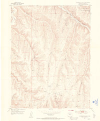
 1929 Highmore1929 Print · USGSGarfield County’s high plateau country is captured here in the late twenties during a period of mountain ranching and early energy exploration. Researchers can find old homesteads like Denton Cabin, the Good Hope Shale Camp, and the original Highmore PO site.3 unique versions available
 - 1930 Map of Glenwood Springs
 1930 Glenwood Springs1930 Print · USGSGlenwood Springs and the Colorado River corridor are captured here during the late prohibition era, showing the region's transition into a center for power and rail transport. Researchers can trace the Denver and Rio Grande Western Railroad to Dotsero or find remote outposts like Hip Roof Cabin and Transfer Springs Ranger Sta.4 unique versions available
 - 1952 Map of Wolf Ridge, 1953 Print
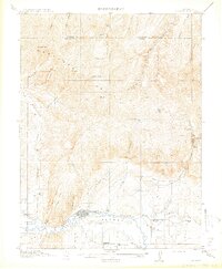
 1952 Wolf Ridge1953 Print · USGSThe Colorado plateau of Rio Blanco County is shown during the early 1950s, a period defined by remote ranching and essential water management. Researchers can trace local landmarks like Ryan School and the 84 Ranch or follow the paths of Corral Gulch and Wolf Ridge.7 unique versions available
 - 1952 Map of Yankee Gulch, 1954 Print
 1952 Yankee Gulch1954 Print · USGSRio Blanco County at the start of the fifties shows a high-altitude landscape where travel followed the topography. Map collectors can trace the long Wagon Road and locate family-named sites like Duckett Ranch and Reigle Ranch.6 unique versions available
 - 1952 Map of Rio Blanco, 1954 Print
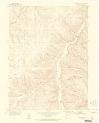
 1952 Rio Blanco1954 Print · USGSDeep in the Western Slope during the early fifties, this area centers on the small settlement of Rio Blanco. Local historians can trace the Rio Blanco School, the Rio Blanco Mine, and the original path of the Government Road.5 unique versions available
 - 1952 Map of Rock School, 1954 Print
 1952 Rock School1954 Print · USGSIn the early fifties, this section of Rio Blanco County was a landscape of remote ranchlands and deep canyons. Researchers can locate the landmark Rock School along Piceance Creek and trace the rugged courses of Black Sulphur Creek and Hunter Creek.6 unique versions available
 - 1952 Map of Jessup Gulch, 1954 Print
 1952 Jessup Gulch1954 Print · USGSRio Blanco County ranching culture and early resource extraction are captured here in the early fifties. Genealogists can trace family landmarks like the Walter Oldland Ranch, Redd Ranch, and the Stewart School.6 unique versions available
 - 1952 Map of Greasewood Gulch, 1954 Print
 1952 Greasewood Gulch1954 Print · USGSRio Blanco County in the early fifties shows a landscape of wildlife research and emerging energy exploration. Trace early industrial footprints and remote outposts like the Little Hills Game Experiment Station, Magnolia Camp, and various Gas Wells.6 unique versions available
 - 1952 Map of Square S Ranch, 1954 Print
 1952 Square S Ranch1954 Print · USGSRio Blanco County ranching country is documented in the early fifties, showing a landscape of deep gulches and isolated outposts. Researchers can locate Square S Ranch, the Miller Hill Cem, and the prominent Dudley Bluffs.5 unique versions available
Showing maps 1-25 of 489
Top cities of Rio Blanco County
Frequently asked questions
- What are the different types of historical maps available for Rio Blanco County?
- What is the oldest map of Rio Blanco County?
- Where can I purchase historical maps of Rio Blanco County for my home or office?
- Where can I download high-res historical maps of Rio Blanco County?
- Are there historical topographic maps available for Rio Blanco County?
- Is there historical aerial imagery available for Rio Blanco County?
- Where are historical maps of Rio Blanco County sourced from?