1960s Maps of Rio Blanco County, Colorado
Explore 66 historic maps of Rio Blanco County from the 1960s. These maps offer a rare glimpse into what life looked like during the 1960s — showing old roads, neighborhoods, homes, and landmarks that have changed or disappeared over time.
Whether you're researching your family's past, planning a metal detecting trip, or studying how Rio Blanco County's landscape evolved across the 1960s, these high-resolution maps are a powerful tool for exploring the history of this region.
- Focus on a specific era: All maps on this page are from the 1960s, giving you a focused view of this time period.
- See what’s changed: Compare century-old streets, trails, and buildings to today's modern landscape using overlays and satellite layers.
- Research with precision: Use these maps for genealogy, historical research, land use analysis, or educational projects.
- View, download, or print: Maps are fully viewable online in high resolution, and can be downloaded or printed for your own records.
Start exploring Rio Blanco County's history through authentic maps from the 1960s. This is your window into the past.
Rio Blanco County, CO maps
(66)- 1960 Map of Leadville
 1960 Leadville1960 Print · USGSThe Colorado high country in the mid-fifties comes alive through its mining camps, river valleys, and rail lines. Trace the industrial legacy of the Climax Molybdenum Mine and explore the alpine reaches of the Camp Hale Military Reservation.2 unique versions available
 - 1960 Map of Craig
 1960 Craig1960 Print · USGSNorthwest Colorado in the 1950s is a landscape of mountain summits and industrial growth at the headwaters of the West. Genealogists and historians can trace rail-town development along the Denver and Salt Lake line, while locating Uranium Mines and settlements like Craig, Meeker, and Steamboat Springs.
 - 1960 Map of Vernal
 1960 Vernal1960 Print · USGSNortheastern Utah was a rugged frontier of mineral extraction and federal conservation in the mid-twentieth century. Genealogists and historians can trace the growth of Vernal, locate Gilsonite mining operations near Bonanza, and explore the 1950s boundaries of Dinosaur National Monument.
 - 1960 Map of Grand Junction
 1960 Grand Junction1960 Print · USGSThe Grand Junction area at the dawn of the 1960s shows a landscape of river-valley agriculture and high-plateau extraction. Researchers can trace the path of the dismantled railroad and find vanished sites like Watson and Sego.2 unique versions available
 - 1962 Map of Leadville
 1962 Leadville1962 Print · USGSThe Colorado high country in the early sixties was a rugged landscape of mining camps, military training grounds, and emerging ski towns. Researchers can trace the legacy of Camp Hale, locate the Molybdenum mine near Leadville, and follow the Denver and Rio Grande Western RR through the canyons.
 - 1962 Map of Grand Junction
 1962 Grand Junction1962 Print · USGSThe Western Slope of the early sixties comes into focus here, showing the irrigation-driven growth of the valley and the surrounding high desert. Trace the path of the Denver and Rio Grande Western RR or locate old outposts like Atchee and Dragon.
 - 1962 Map of Craig
 1962 Craig1962 Print · USGSNorthwest Colorado in the early sixties is a land of high-elevation ranching and remote river valleys. Genealogists and historians can trace the Denver and Rio Grande Western rail lines and locate early settlements like Hahns Peak, Meeker, and Juniper Springs.
 - 1962 Map of Rangely NE, 1965 Print
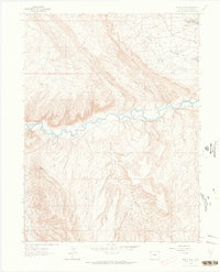
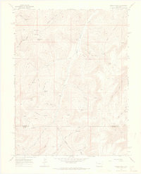
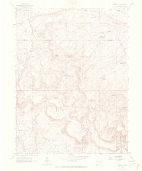 1962 Rangely NE1965 Print · USGSRio Blanco and Moffat counties were centers of industrial exploration in the early 1960s. Researchers can trace the footprint of the Rangely Oil Field and numerous water features like Burning Mine Reservoir and Spooky Mountain.2 unique versions available
 - 1962 Map of Rangely, 1965 Print
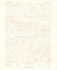
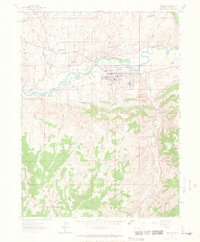 1962 Rangely1965 Print · USGSThe White River valley in northwestern Colorado is seen here during its mid-century industrial peak. Researchers can trace the layout of the town of Rangely and its surrounding resource camps like California Camp, Texas Camp, and Levison Camp.4 unique versions available
 - 1962 Map of Cactus Reservoir, 1965 Print
 1962 Cactus Reservoir1965 Print · USGSThe Rio Blanco and Moffat County borderlands appear in the early sixties as a rugged intersection of industrial mining and desert water management. Researchers can locate the Staley-Gordon Mine on the White River or trace trails across Hatch Flats and Coal Ridge.2 unique versions available
 - 1962 Map of Mellen Hill, 1965 Print
 1962 Mellen Hill1965 Print · USGSNorthwestern Colorado’s high desert meets mid-century industrial expansion in the early sixties. Trace the intersection of protected land at Dinosaur National Monument with the oil infrastructure of Rangel Field and Raven Ridge.
 - 1962 Map of Calamity Ridge, 1965 Print
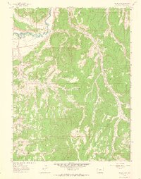
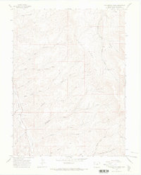
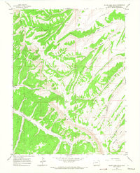
 1962 Calamity Ridge1965 Print · USGSRio Blanco County’s high country is captured here in the early sixties, showing a landscape defined by seasonal camps and drainage basins. Researchers can locate remote outposts like Hogner Cabin and Caldwell Camp or trace the Jeep Trails along Calamity Ridge.2 unique versions available
 - 1962 Map of Gillam Draw, 1965 Print
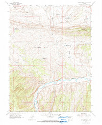
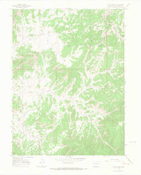
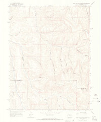
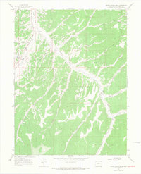
 1962 Gillam Draw1965 Print · USGSRio Blanco County's high-desert landscape was transitioning into an active energy corridor in the early sixties. Researchers can trace the legacy of remote homesteading and industry through landmarks like Hefley Cabin, the Oil Rim, and the White River.2 unique versions available
 - 1962 Map of Divide Creek, 1965 Print
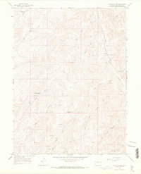
 1962 Divide Creek1965 Print · USGSThe White River valley in the early sixties was a landscape defined by water management and mineral potential. Researchers can trace early ranching infrastructure through Divide Creek Detention Dam and settlements like Angora.2 unique versions available
 - 1962 Map of Banty Point, 1965 Print
 1962 Banty Point1965 Print · USGSRio Blanco County’s energy landscape is captured here during the height of mid-century petroleum production. Researchers can trace industrial settlements like California Camp and Texas Camp alongside the specialized infrastructure of the Rangely Oil Field.2 unique versions available
 - 1964 Map of Grand Junction
 1964 Grand Junction1964 Print · USGSThe Colorado-Utah borderlands are shown here in the mid-1960s, a period when the river-valley settlements and high-desert rail outposts defined the region. Researchers can trace the legacy of remote camps like Atchee and Dragon or follow the agricultural expansion around Grand Junction and Fruita.
 - 1964 Map of Craig
 1964 Craig1964 Print · USGSNorthwestern Colorado's high country is captured here during the mid-sixties, from the Yampa River valley to the high peaks of the Park Range. Local researchers can trace the Denver and Rio Grande Western rail line and locate Uranium Mines near Lay.
 - 1964 Map of Leadville
 1964 Leadville1964 Print · USGSColorado's high country is captured here during the mid-1960s, showing the intersection of mining history and mountain transport. Trace the legacy of high-altitude industry at the Climax Molybdenum Mine or follow the rails of the Colorado and Southern Ry past Leadville.
 - 1964 Map of Texas Creek, 1968 Print
 1964 Texas Creek1968 Print · USGSRio Blanco County's high-country terrain and energy landscape are captured here in the mid-1960s. Trace the early gas industry through scattered Gas Wells and Drill Holes along the Dragon Douglas Trail and Texas Creek.3 unique versions available
 - 1964 Map of Brushy Point, 1968 Print
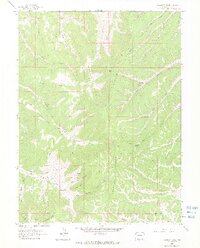
 1964 Brushy Point1968 Print · USGSRio Blanco and Garfield Counties are captured in the mid-1960s, showing a remote landscape of high points and deep canyons. Researchers can locate specific water sources and landmarks like Brushy Point Spring, Scare Mountain, and the Trail Canyon Lodge Trail.4 unique versions available
 - 1964 Map of Philadelphia Creek, 1968 Print
 1964 Philadelphia Creek1968 Print · USGSRio Blanco County ranching and water rights take center stage in this mid-sixties survey of the Colorado backcountry. Researchers can trace historic stock routes and water sources like Hefley Cow Camp, Philadelphia Creek, and Big Ridge.
 - 1964 Map of East Evacuation Creek, 1968 Print
 1964 East Evacuation Creek1968 Print · USGSThe Colorado plateau at the Rio Blanco and Garfield county line is mapped here in the mid-1960s, revealing a landscape of deep canyons and oil exploration. Trace historical land use through isolated Drill Holes, unnamed Ruins, and the drainage of East Evacuation Creek.2 unique versions available
 - 1964 Map of Water Canyon, 1968 Print
 1964 Water Canyon1968 Print · USGSRio Blanco County's high-country draws and energy infrastructure are captured here in the mid-1960s. Genealogists and historians can trace the early industrial footprint of Gas Wells and Drill Holes near landmarks like State Bridge and Water Canyon.3 unique versions available
 - 1964 Map of Black Cabin Gulch, 1968 Print
 1964 Black Cabin Gulch1968 Print · USGSRio Blanco County during the mid-sixties reveals a landscape of high plateaus and resource exploration. Researchers can trace early ranching and mining footprints through features like Dillon, the Landing Strip, and numerous prospects along Wagonroad Ridge.3 unique versions available
 - 1964 Map of White Coyote Draw, 1968 Print
 1964 White Coyote Draw1968 Print · USGSRio Blanco County ranching and energy exploration are captured here in the mid-1960s. Researchers can locate isolated homesteads like Brady Ranch and Mitchel Place, alongside ancient Pictographs and early oil and gas infrastructure.3 unique versions available
Showing maps 1-25 of 66
Top cities of Rio Blanco County
Frequently asked questions
- What are the different types of historical maps available for Rio Blanco County?
- What is the oldest map of Rio Blanco County?
- Where can I purchase historical maps of Rio Blanco County for my home or office?
- Where can I download high-res historical maps of Rio Blanco County?
- Are there historical topographic maps available for Rio Blanco County?
- Is there historical aerial imagery available for Rio Blanco County?
- Where are historical maps of Rio Blanco County sourced from?