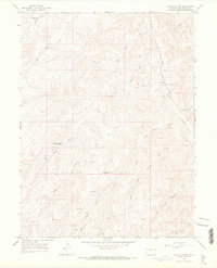
1964 Map of Water Canyon
USGS Topo · Published 1968About this map
Water Canyon and its complex network of seasonal draws define this high-altitude landscape of Rio Blanco County during the mid-1960s. The region is characterized by an extensive energy extraction infrastructure, marked by numerous Gas Wells and scattered Drill Holes throughout the terrain. Transportation follows the natural contours of the land, with the Dragon Road and Douglas Pass Road providing primary access, supported by various Jeep Trails. Water management is vital in this arid environment, evidenced by the Johnson Draw Reservoir, Big Horse Draw Reservoir, and West Fourmile Reservoir. A few notable landmarks indicate localized development along the watercourses, including the State Bridge and a Pumping Sta near Douglas Creek. This survey provides a clear view of the industrial footprint on the Colorado landscape before modern expansion, capturing the placement of storage bins and gravel pits essential to the local economy.
Find a feature on this map
24 named features on this map. Tap any name to fly to it.
Don’t see what you’re looking for? This feature index may not catch every label — zoom into the map to look around manually.
Map Details
Editions of this 1964 Water Canyon Map
3 editions found
Other maps of this area

1907 · Rangely
USGS Topo · 1:125,000

1910 · Rangely
USGS Topo · 1:125,000

1954 · Vernal
USGS Topo · 1:250,000

1956 · Grand Junction
USGS Topo · 1:250,000

1958 · Vernal
USGS Topo · 1:250,000

1959 · Grand Junction
USGS Topo · 1:250,000

1960 · Vernal
USGS Topo · 1:250,000

1960 · Grand Junction
USGS Topo · 1:250,000

1962 · Grand Junction
USGS Topo · 1:250,000
1962 · Rangely
USGS Topo · 1:24,000