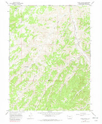
1964 Map of Water Canyon
USGS Topo · Published 1982About this map
Douglas Creek carves through this high-altitude landscape in Rio Blanco County, defining the primary drainage corridor for the surrounding draws and canyons. By the mid-1960s, the area had become a hub for energy exploration, evidenced by the numerous labels for Gas Wells and Drill Holes scattered across the terrain. Vital infrastructure like the Pumping Sta and a high-pressure Pipeline near State Bridge highlight the industrial transition of this Western Slope region.
Find a feature on this map
25 named features on this map. Tap any name to fly to it.
Don’t see what you’re looking for? This feature index may not catch every label — zoom into the map to look around manually.
Map Details
Editions of this 1964 Water Canyon Map
3 editions found
Other maps of this area

1907 · Rangely
USGS Topo · 1:125,000

1910 · Rangely
USGS Topo · 1:125,000

1954 · Vernal
USGS Topo · 1:250,000

1956 · Grand Junction
USGS Topo · 1:250,000

1958 · Vernal
USGS Topo · 1:250,000

1959 · Grand Junction
USGS Topo · 1:250,000

1960 · Vernal
USGS Topo · 1:250,000

1960 · Grand Junction
USGS Topo · 1:250,000

1962 · Grand Junction
USGS Topo · 1:250,000
1962 · Rangely
USGS Topo · 1:24,000