Old Maps of Tallahassee, Florida for Metal Detecting
Plan your next treasure hunt with 61 historic maps of Tallahassee. Find old homesites, ghost towns, trails, and gathering spots that may be lost to time — perfect for identifying promising metal detecting locations.
- Locate forgotten sites: Uncover places like long-lost settlements, abandoned rail lines, or gathering spots.
- Plan better hunts: Use map overlays combined with LiDAR or satellite views to narrow in on historically rich areas.
- Made for detectorists: Thousands of hobbyists use these maps to discover relics, coins, and hidden history.
Use these historic maps to boost your research and find new opportunities beneath the surface of Tallahassee.
Tallahassee, FL maps
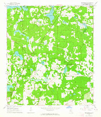
(61)- 1940 Map of Tallahassee, 1958 Print
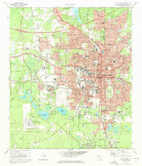
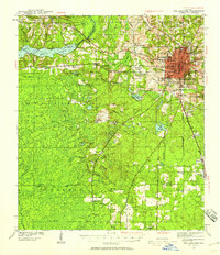 1940 Tallahassee1958 Print · USGSFlorida's capital city and the surrounding Leon County pine forests are captured here just before the mid-century expansion. Genealogists and local historians can trace rural communities like Hilliardville and Woodville alongside landmarks like Richardson Sch and Lake Talquin.2 unique versions available
 - 1942 Map of Tallahassee
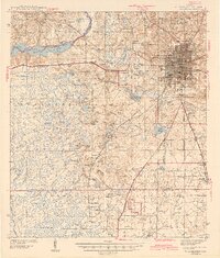
 1942 Tallahassee1942 Print · USGSTallahassee and the surrounding Leon County area appear here in the early 1940s, balancing its role as a college town with the wilderness of the Apalachicola National Forest. Researchers can trace the rural church and school networks of Woodville and Spring Hill, or locate early campus footprints for Florida State College for Women.
 - 1943 Map of Tallahassee
 1943 Tallahassee1943 Print · USGSMid-century Tallahassee and the eastern edge of the Apalachicola National Forest appear here in the years just before post-war suburban growth. Genealogists can trace rural communities through landmarks like Florida Agricultural and Mechanical College, Hilliardville, and the Gum Pond Sch.2 unique versions available
 - 1954 Map of Lafayette, 1955 Print
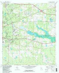
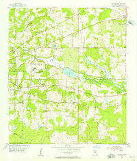 1954 Lafayette1955 Print · USGSLeon County at mid-century shows a landscape of institutional growth and established rural hamlets east of the capital. Researchers can trace the lineage of local congregations at Shady Grove Ch and New Zion Ch or locate the Ward Sch and Southfield Cem.3 unique versions available
 - 1954 Map of Woodville, 1956 Print
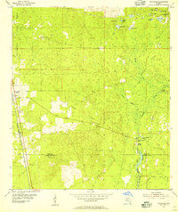 1954 Woodville1956 Print · USGSThe Leon and Wakulla county line area in the mid-1950s reveals a landscape defined by the karst hydrology of the St Marks River. Local historians can trace the paths of the Seaboard Air Line railroad and locate old family burial grounds like Rhodes Cem and Godwin Cem.2 unique versions available
 - 1954 Map of Tallahassee, 1967 Print
 1954 Tallahassee1967 Print · USGSThe Florida Panhandle and South Georgia are captured here during a period of mid-century growth and military expansion. Researchers can trace the development of Panama City, the footprint of Tyndall Air Force Base, and the rail lines of the Atlantic Coast Line.4 unique versions available
 - 1959 Map of Tallahassee
 1959 Tallahassee1959 Print · USGSFlorida's Panhandle and the Big Bend region appear here in the mid-fifties, showing a landscape defined by its great river systems and developing coast. Trace the early layout of Panama City, the expansive Apalachicola National Forest, and the coastal St Marks Lighthouse.
 - 1960 Map of Tallahassee
 1960 Tallahassee1960 Print · USGSThe Florida Panhandle and southern Georgia are captured here in the mid-twentieth century, showing a region defined by its rivers and military installations. Genealogists and historians can trace the growth of Tallahassee or locate coastal landmarks like the St Marks Lighthouse and Tyndall Air Force Base.
 - 1963 Map of Bradfordville, 1964 Print
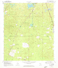
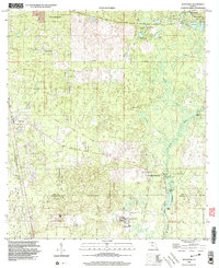
 1963 Bradfordville1964 Print · USGSNorth of Tallahassee in the early sixties, this area shows a landscape of traditional communities and numerous named ponds. Genealogists and historians can locate family landmarks like the Bradford-Eppes Cem and long-standing congregations at Pisgah Ch or St Philips Ch.
 - 1963 Map of Lake Jackson, 1964 Print
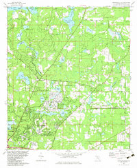
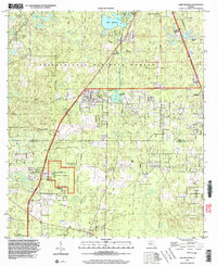
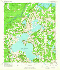 1963 Lake Jackson1964 Print · USGSNorth of Tallahassee in the early sixties, this area shows the initial wave of suburban growth around Lake Jackson. Genealogists and local historians can trace early subdivisions like Harbinwood Estates and rural landmarks such as St Marks Ch and the Seaboard Air Line railroad.
 - 1969 Map of Midway, 1972 Print
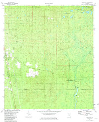
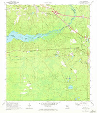 1969 Midway1972 Print · USGSThe Ochlockonee River valley and Lake Talquin come into focus during the late sixties, showing the quiet transition between the Apalachicola National Forest and rural settlements. Genealogists can locate family landmarks like Mt Moriah Ch, Norfleet, and several cemeteries scattered across the Gadsden county line.2 unique versions available
 - 1969 Map of Lake Munson, 1972 Print
 1969 Lake Munson1972 Print · USGSThe pine forests and wetlands south of Tallahassee are captured in the late sixties, showcasing the rural communities of Leon and Wakulla counties. Genealogists can locate family landmarks like St Peters Ch, Zion Hill Ch, and the settlement of Woodville along the Seaboard Coast Line.2 unique versions available
 - 1970 Map of Tallahassee, 1972 Print
 1970 Tallahassee1972 Print · USGSTallahassee is shown during a period of rapid expansion in the early seventies, balancing its role as a state capital and university hub. Genealogists can locate family landmarks from the Governor's Mansion to the Roselawn Cemetery and Bond Sch.4 unique versions available
 - 1978 Map of Bainbridge, 1980 Print
 1978 Bainbridge1980 Print · USGSIn the late seventies, this Georgia-Florida borderland was defined by the confluence of the Flint and Chattahoochee rivers. Trace the region's infrastructure via the Seaboard Coast Line Railroad and find sites like Bainbridge State Hospital.
 - 1979 Map of Tallahassee, 1980 Print
 1979 Tallahassee1980 Print · USGSFlorida's capital and the Gulf coast are captured here in the late seventies, showing the region's balance between urban growth and massive protected wetlands. Researchers can trace the routes of the Apalachicola Northern Railroad or locate small inland hubs like Sopchoppy, Panacea, and Hosford.
 - 1981 Map of Woodville, 1982 Print
 1981 Woodville1982 Print · USGSThe Leon and Wakulla county borderlands are shown here in the early eighties, centered on the historic site of the Natural Bridge Battlefield. Trace the path of the Seaboard Coast Line or locate family markers at Rhodes Cem and Godwin Cem.2 unique versions available
 - 1982 Map of Lafayette, 1983 Print
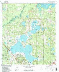
 1982 Lafayette1983 Print · USGSEastern Leon County comes alive in the early eighties as the capital city meets the wetlands of Lake Lafayette. Genealogists and historians can trace local landmarks like St Peter Cem Ch, the Seminole Fish Hatchery, and the Federal Correctional Institution.2 unique versions available
 - 1982 Map of Lake Jackson, 1983 Print
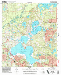
 1982 Lake Jackson1983 Print · USGSNorth of Tallahassee in the early eighties, this area balances a growing suburban footprint with its ancient foundations at the Lake Jackson Mounds. Genealogists and historians can locate early family landmarks and estates, from El Destinado to Memory Gardens Cem and St Matthews Ch.2 unique versions available
 - 1982 Map of Bradfordville, 1983 Print
 1982 Bradfordville1983 Print · USGSNorth of Tallahassee in the early eighties, this area shows a transition from rural homesteads to modern suburban expansion. Genealogists and local historians can locate many family-named landmarks including Bradford-Eppes Cem, Lester Island, and the St Philips Cem.
 - 1988 Map of Tallahassee
 1988 Tallahassee1988 Print · USGSThe Florida Panhandle and South Georgia are captured here in the late eighties, showing the expansion of the regional highway network and coastal growth. Genealogists and historians can trace rail lines like the Seaboard System Railroad or locate family roots in Blountstown, Graceville, or Crawfordville.2 unique versions available
 - 1999 Map of Tallahassee, 2000 Print
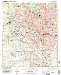 1999 Tallahassee2000 Print · USGSTallahassee at the close of the century shows a bustling state capital and academic hub surrounded by the southern pines. Researchers can trace historic sites like the Old City Cemetery, schools including Leon High Sch, and the grounds of Florida State University.
 - 1999 Map of Woodville, 2003 Print
 1999 Woodville2003 Print · USGSThe Leon County pine woods and springs are documented here at the close of the twentieth century. Researchers can trace the Forbes Purchase Line and locate local landmarks like Rhodes Cem and the Natural Bridge Battlefield State Historic Site.
 - 1999 Map of Lafayette, 2003 Print
 1999 Lafayette2003 Print · USGSTallahassee and its eastern suburbs are shown at the turn of the millennium as urban growth meets the sprawling wetlands of Lake Lafayette. Genealogists and local historians can trace the grounds of St Peter Cemetery, Lincoln High Sch, and the Federal Correctional Institution.
 - 1999 Map of Lake Munson, 2003 Print
 1999 Lake Munson2003 Print · USGSThe southern edge of the state capital meets the dense pines of the national forest in the late twentieth century. Researchers can trace historic property boundaries along the Forbes Purchase Line and locate rural landmarks like St Peters Ch or the community of Woodville.
 - 1999 Map of Lake Jackson, 2003 Print
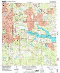
 1999 Lake Jackson2003 Print · USGSTallahassee's northward expansion into Leon County is caught here at a moment of transition in the late nineties. Genealogists and researchers can trace local family landmarks and institutional roots at Memory Gardens Cem, El Destinado, and St Pauls Ch.
Showing maps 1-25 of 61
Top cities near Tallahassee
Top neighborhoods of Tallahassee
- Macon historical maps
- Perkins historical maps
- Oak Knoll Estates historical maps
- Saint Peter historical maps
- Lafayette historical maps
- Four Points historical maps
See more
Frequently asked questions
- What are the different types of historical maps available for Tallahassee?
- What is the oldest map of Tallahassee?
- Where can I purchase historical maps of Tallahassee for my home or office?
- Where can I download high-res historical maps of Tallahassee?
- Are there historical topographic maps available for Tallahassee?
- Is there historical aerial imagery available for Tallahassee?
- Where are historical maps of Tallahassee sourced from?