1950s Maps of Augusta, Georgia
Explore 19 historic maps of Augusta from the 1950s. These maps offer a rare glimpse into what life looked like during the 1950s — showing old roads, neighborhoods, homes, and landmarks that have changed or disappeared over time.
Whether you're researching your family's past, planning a metal detecting trip, or studying how Augusta's landscape evolved across the 1950s, these high-resolution maps are a powerful tool for exploring the history of this region.
- Focus on a specific era: All maps on this page are from the 1950s, giving you a focused view of this time period.
- See what’s changed: Compare century-old streets, trails, and buildings to today's modern landscape using overlays and satellite layers.
- Research with precision: Use these maps for genealogy, historical research, land use analysis, or educational projects.
- View, download, or print: Maps are fully viewable online in high resolution, and can be downloaded or printed for your own records.
Start exploring Augusta's history through authentic maps from the 1950s. This is your window into the past.
Augusta, GA maps
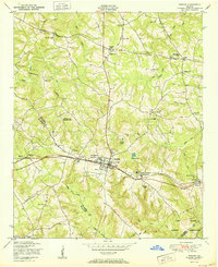
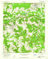
(19)- 1950 Map of Hephzibah
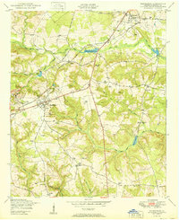 1950 Hephzibah1950 Print · USGSRichmond County in the early post-war era reveals a landscape of kaolin mining and deep-rooted rural communities. Researchers can trace family history through a wealth of landmarks like Albion Kaolin Chalk Mine, Adams Grove Church, and Bugs Cemetery.
 - 1950 Map of Storys Millpond
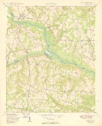
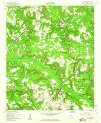
 1950 Storys Millpond1950 Print · USGSEastern Georgia's rural Burke County landscape is documented here in the mid-twentieth century, showing a community built around local churches and watermills. Family researchers can trace ancestral ties through sites like Gresham Cemetery, Winters School, and Storys Millpond.2 unique versions available
 - 1950 Map of Grovetown
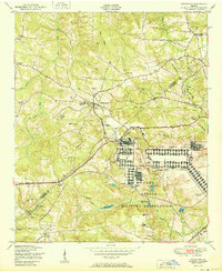 1950 Grovetown1950 Print · USGSGrovetown and the surrounding Georgia countryside are shown in detail at the dawn of the 1950s as the local landscape transitioned. Genealogists and historians can trace family locations through the Beale Family Cemetery, Jerusalem Church and School, and the sprawling Camp Gordon Military Reservation.
 - 1950 Map of Keysville
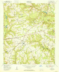
 1950 Keysville1950 Print · USGSBrier Creek and the surrounding farm country of Burke and Jefferson counties are shown here just after the war. Genealogists and historians can trace family-named sites like Pol Hill Cemetery, the Boggs Academy campus, and rural centers like Keysville and St Clair.2 unique versions available
 - 1950 Map of Harlem
 1950 Harlem1950 Print · USGSHarlem and its surrounding rail-side settlements are captured here at mid-century, just as the regional landscape was being reshaped by postwar growth. Genealogists can locate family-named landmarks like Walker Cemetery, Bynum Cemetery, and the Adams Chapel Church.
 - 1950 Map of Avondale
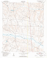
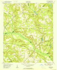 1950 Avondale1950 Print · USGSEastern Georgia's rural and military landscape is captured here in the years following World War II. Genealogists can trace family footprints through numerous local landmarks like Silver Run Church, Reeves School, and the Patterson Cemetery near the banks of Brier Creek.
 - 1950 Map of Augusta West
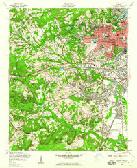
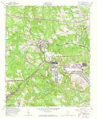
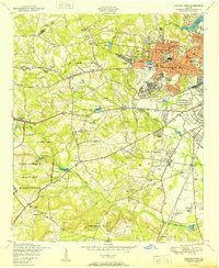 1950 Augusta West1950 Print · USGSMid-century Augusta shows the post-war shift from military hubs to suburban growth west of the city center. Genealogists and historians can trace family-named sites like Chavours Cemetery, Lombards Mill Pond, and the Augusta Arsenal.
 - 1953 Map of Blythe
 1953 Blythe1953 Print · USGSBlythe and the surrounding Georgia countryside are captured here in the early postwar era as military expansion met traditional rural life. Genealogists and local researchers can trace family landmarks like Rachels Cemetery, Hoods Chapel School, and the settlement at Ellwood.
 - 1953 Map of Athens, 1966 Print
 1953 Athens1966 Print · USGSGeorgia's Piedmont and Savannah River borderlands come alive in this mid-century survey of the region surrounding Athens and Augusta. Trace the rail-and-river economy through the Georgia RR and landmarks like the Fort Gordon Military Reservation.3 unique versions available
 - 1954 Map of Augusta
 1954 Augusta1954 Print · USGSThe Savannah River valley and South Carolina Midlands are captured here during a period of post-war growth. Researchers can trace the rail-and-river economy through the Southern RR corridor and locate historic settlements like Aiken, Orangeburg, and Sumter.
 - 1957 Map of Hephzibah, 1960 Print
 1957 Hephzibah1960 Print · USGSHephzibah and southern Richmond County are shown in the late fifties, during a decade of post-war change. Genealogists can trace family lines through numerous rural landmarks like Chalk Mine Mem Ch, Graham Sch, and the Georgia and Florida rail line.3 unique versions available
 - 1957 Map of Avondale, 1960 Print
 1957 Avondale1960 Print · USGSThe rural borderlands of Richmond and McDuffie counties are documented here in the mid-fifties, dominated by the Fort Gordon Military Reservation. Genealogists can trace numerous family burial sites like Adams Cem and Smith Cem alongside landmarks like Nortons Millrace.3 unique versions available
 - 1957 Map of Augusta West, 1960 Print
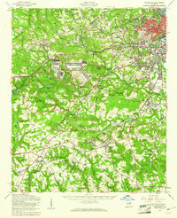
 1957 Augusta West1960 Print · USGSAugusta's western expansion and the massive military presence at the edge of the city are captured here in the late fifties. Researchers can trace the development of Daniel Field, identify numerous country churches like Bartons Chapel, and locate family sites such as Walton Cem.4 unique versions available
 - 1957 Map of Hephzibah, 1961 Print
 1957 Hephzibah1961 Print · USGSThe outskirts of Augusta and the expanding Fort Gordon military site characterize this mid-century look at Richmond County. Local historians can trace old family sites and rural institutions like Hancock Millpond, Second Ebenezer Ch, and the State Training School.2 unique versions available
 - 1957 Map of Augusta, 1966 Print
 1957 Augusta1966 Print · USGSThe Savannah River and Santee basins are captured here during a period of massive military and industrial expansion in the late fifties. Genealogists can trace family footprints across Four Hole Swamp or near the Savannah River Plant.3 unique versions available
 - 1957 Map of Grovetown, 1973 Print
 1957 Grovetown1973 Print · USGSColumbia County and the outskirts of the Fort Gordon Military Reservation are captured here in the late fifties. Genealogists and local historians can locate Hill Cem, trace the Georgia Railroad through Grovetown, and find rural landmarks like Steiner Grove Ch.4 unique versions available
 - 1958 Map of Augusta
 1958 Augusta1958 Print · USGSThe borderlands between Georgia and South Carolina come alive in the 1950s, showing the early footprint of the Savannah River Plant. Genealogists and historians can trace rail-dependent towns and rural landmarks from Orangeburg to the Fort Jackson Military Reservation.
 - 1958 Map of Athens
 1958 Athens1958 Print · USGSNorth-central Georgia and the Savannah River valley are captured in the late fifties, showing the region as the new reservoirs were filling. Researchers can trace historic rail lines like the Georgia RR and locate rural landmarks such as Social Circle, Graves Mountain, and the Fort Gordon Military Reservation.
 - 1959 Map of Athens
 1959 Athens1959 Print · USGSNortheast Georgia and the South Carolina borderlands appear here in the mid-fifties, during a decade of infrastructure growth. Genealogists and historians can trace the rail-and-river geography of towns like Social Circle, the sprawl of Fort Gordon Military Reservation, and the newly formed Clark Hill Reservoir.
End of results
Showing maps 1-19 of 19
Top cities near Augusta
- North Augusta historical maps
- Grovetown historical maps
- Hephzibah historical maps
- Harlem historical maps
- Appling historical maps
Top neighborhoods of Augusta
- Gordon Park historical maps
- Eastview historical maps
- Ellwood historical maps
- McBean historical maps
- Pine Heights historical maps
- Colony Park historical maps
See more
Frequently asked questions
- What are the different types of historical maps available for Augusta?
- What is the oldest map of Augusta?
- Where can I purchase historical maps of Augusta for my home or office?
- Where can I download high-res historical maps of Augusta?
- Are there historical topographic maps available for Augusta?
- Is there historical aerial imagery available for Augusta?
- Where are historical maps of Augusta sourced from?