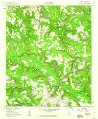
1957 Map of Avondale
USGS Topo · Published 1960About this map
Fort Gordon Military Reservation occupies a massive portion of this landscape, where the borders of Richmond, Columbia, McDuffie, Burke, and Jefferson counties converge. The terrain is defined by the winding course of Brier Creek and its many tributaries, including Headstall Creek and Boggy Gut Creek. Unlike the more urbanized areas nearby, this territory remains largely rural and forested, marked by small settlements like Avondale and Woodland.
Find a feature on this map
33 named features on this map. Tap any name to fly to it.
Don’t see what you’re looking for? This feature index may not catch every label — zoom into the map to look around manually.
Map Details
Editions of this 1957 Avondale Map
3 editions found
Other maps of this area

1919 · Gough
USGS Topo · 1:62,500

1920 · Stapleton
USGS Topo · 1:62,500

1922 · Harlem
USGS Topo · 1:62,500

1922 · Hephzibah
USGS Topo · 1:62,500

1948 · Hephzibah
USGS Topo · 1:62,500

1948 · Harlem
USGS Topo · 1:62,500

1948 · Stapleton
USGS Topo · 1:62,500

1948 · Gough
USGS Topo · 1:62,500

1948 · Blythe
USGS Topo · 1:24,000

1948 · Harlem
USGS Topo · 1:24,000