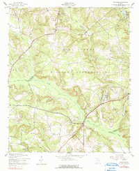
1957 Map of Avondale
USGS Topo · Published 1991About this map
The Fort Gordon Military Reservation occupies a massive footprint across this mid-century landscape, influencing the development and preservation of the surrounding rural terrain. The area is defined by the headwaters and winding courses of Brier Creek, Headstall Creek, and Reedy Creek, which create a complex drainage system through the borderlands of several Georgia counties. Small rural pockets like Avondale and the area near Woodland Ch persist alongside military boundaries, marked by family burial grounds such as Adams Cem, Neal Cem, and Patterson Cem. The presence of Nortons Millrace and several ponds, including George Claussen Pond and Leitner Pond, suggests a long history of water management and local industry. A unique survey marker, the County Line Monument, stands as a formal record of the intersecting boundaries of Columbia, McDuffie, and Richmond counties.
Find a feature on this map
31 named features on this map. Tap any name to fly to it.
Don’t see what you’re looking for? This feature index may not catch every label — zoom into the map to look around manually.
Map Details
Editions of this 1957 Avondale Map
3 editions found
Other maps of this area

1919 · Gough
USGS Topo · 1:62,500

1920 · Stapleton
USGS Topo · 1:62,500

1922 · Harlem
USGS Topo · 1:62,500

1922 · Hephzibah
USGS Topo · 1:62,500

1948 · Hephzibah
USGS Topo · 1:62,500

1948 · Harlem
USGS Topo · 1:62,500

1948 · Stapleton
USGS Topo · 1:62,500

1948 · Gough
USGS Topo · 1:62,500

1948 · Blythe
USGS Topo · 1:24,000

1948 · Harlem
USGS Topo · 1:24,000