1960s Maps of Augusta, Georgia
Explore 10 historic maps of Augusta from the 1960s. These maps offer a rare glimpse into what life looked like during the 1960s — showing old roads, neighborhoods, homes, and landmarks that have changed or disappeared over time.
Whether you're researching your family's past, planning a metal detecting trip, or studying how Augusta's landscape evolved across the 1960s, these high-resolution maps are a powerful tool for exploring the history of this region.
- Focus on a specific era: All maps on this page are from the 1960s, giving you a focused view of this time period.
- See what’s changed: Compare century-old streets, trails, and buildings to today's modern landscape using overlays and satellite layers.
- Research with precision: Use these maps for genealogy, historical research, land use analysis, or educational projects.
- View, download, or print: Maps are fully viewable online in high resolution, and can be downloaded or printed for your own records.
Start exploring Augusta's history through authentic maps from the 1960s. This is your window into the past.
Augusta, GA maps
(10)- 1961 Map of Augusta
 1961 Augusta1961 Print · USGSThe South Carolina lowcountry and CSRA appear here in the early sixties, during a period of massive military and industrial growth. Researchers can trace the development of the Savannah River Plant or locate legacy landmarks like Nelson Ferry and Magnolia Cemetery.2 unique versions available
 - 1962 Map of Augusta
 1962 Augusta1962 Print · USGSThe South Carolina and Georgia borderlands are seen here in the early sixties, showing the rise of the Savannah River Plant and the expansion of Fort Jackson. Researchers can trace old rail lines like the Southern Railway and find landmarks such as St. Pauls Church or the Santee Canal.
 - 1963 Map of Athens
 1963 Athens1963 Print · USGSGeorgia's Piedmont and the Savannah River valley are captured in the early sixties as major reservoirs and military installations reshaped the landscape. Researchers can trace the development of Clark Hill Reservoir, locate the Fort Gordon Military Reservation, and find historic towns like Social Circle and Eatonton.
 - 1964 Map of Mc Bean, 1965 Print
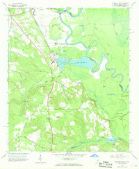
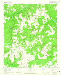 1964 Mc Bean1965 Print · USGSBurke County during the mid-1960s was a landscape of creek-side settlements and active rail lines along the Central of Georgia corridor. Researchers can trace ancestral locations at Knight Cem, Cosnahan Cem, and rural parishes like Mt Zion Ch.2 unique versions available
 - 1964 Map of Martinez, 1966 Print
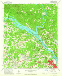 1964 Martinez1966 Print · USGSThe Savannah River borderlands in the mid-1960s reveal a mix of hydroelectric engineering and growing Georgia suburbs. Genealogists and historians can trace family sites at Abilene Ch, Martinez Sch, and the riverside Augusta City Lock and Dam.4 unique versions available
 - 1964 Map of North Augusta, 1966 Print
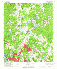 1964 North Augusta1966 Print · USGSNorth Augusta and the riverfront borderlands of South Carolina and Georgia are captured here in the mid-1960s during a period of suburban expansion. Genealogists can locate family-named sites like Hammond Cem, Mealing Grove Ch, and the traces of an Old Railroad Grade.5 unique versions available
 - 1965 Map of Jackson, 1967 Print
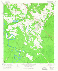 1965 Jackson1967 Print · USGSAiken County and the Georgia border are captured here during the mid-sixties, a period defined by the expansion of the Atomic Energy Commission reservation. Genealogists can trace family landmarks like Susan Union Cem, Wesley Chapel, and the community of Jackson.3 unique versions available
 - 1965 Map of Mechanic Hill, 1968 Print
 1965 Mechanic Hill1968 Print · USGSThe Savannah River bottomlands south of Augusta appear in the mid-sixties as a landscape of rural cemeteries and emerging industry. Genealogists and historians can trace family-named sites like Twiggs Cem and Broome Cem or the industrial footprint of Bush Field.4 unique versions available
 - 1965 Map of Augusta East, 1968 Print
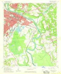 1965 Augusta East1968 Print · USGSThe riverfront communities of Augusta and North Augusta are captured here in the mid-sixties at a peak of industrial and rail activity. Researchers can trace the extensive rail lines of the Southern Railway or locate landmarks like Paine College and Union Station.4 unique versions available
 - 1965 Map of Shell Bluff Landing, 1968 Print
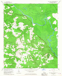 1965 Shell Bluff Landing1968 Print · USGSThe Savannah River borderlands in the 1960s reveal the intersection of federal atomic energy sites and rural Georgia life. Researchers can trace family history through sites like Daniel Grove Ch, Allens Chapel, and the historic Shell Bluff Landing.3 unique versions available
End of results
Showing maps 1-10 of 10
Top cities near Augusta
- North Augusta historical maps
- Grovetown historical maps
- Hephzibah historical maps
- Harlem historical maps
- Appling historical maps
Top neighborhoods of Augusta
- Gordon Park historical maps
- Eastview historical maps
- Ellwood historical maps
- McBean historical maps
- Pine Heights historical maps
- Colony Park historical maps
See more
Frequently asked questions
- What are the different types of historical maps available for Augusta?
- What is the oldest map of Augusta?
- Where can I purchase historical maps of Augusta for my home or office?
- Where can I download high-res historical maps of Augusta?
- Are there historical topographic maps available for Augusta?
- Is there historical aerial imagery available for Augusta?
- Where are historical maps of Augusta sourced from?