Old Maps of Blaine County, Idaho for Hiking & Exploration
Hike through history with 496 historic maps of Blaine County. Explore old trails, ghost towns, and forgotten backroads — perfect for outdoor adventurers and local explorers.
- Rediscover forgotten places: Map out old mining camps, roads, and footpaths that no longer exist on modern maps.
- Layer with modern tools: Combine with LiDAR or satellite views to plan hikes through historical terrain.
- Made for exploration: Popular among hikers, overlanders, and local history lovers.
Use these maps to find adventure and explore the hidden past of Blaine County.
Blaine County, ID maps
(496)- 1895 Map of Hailey, 1954 Print
 1895 Hailey1954 Print · USGSThe Wood River Valley was coming into its own in the 1890s as a hub for rail transport and early tourism. Researchers can trace the early path of the Union Pacific R R as it connected Hailey to Ketchum, passing through Gimlet and several remote hot springs like Guyer.2 unique versions available
 - 1897 Map of Hailey
 1897 Hailey1897 Print · USGSCentral Idaho in the late nineteenth century was a land of high peaks and river-valley railroads. Trace the early layout of Hailey and Ketchum, the path of the Union Pacific, and landmarks like Guyer Hot Springs.3 unique versions available
 - 1900 Map of Sawtooth
 1900 Sawtooth1900 Print · USGSThe high Idaho backcountry was a hub of hard-rock mining and remote outposts during the late 1890s. Genealogists and historians can trace the foundations of silver-era camps like Carrietown and Vienna or locate industrial sites like the Silver King Mine and Columbia Mill.4 unique versions available
 - 1935 Map of MacKay
 1935 MacKay1935 Print · USGSCuster County was a rugged center of mining and irrigation in the mid-1930s. Genealogists and historians can trace high-altitude homesteads and industry through Mackay, the Star O Hope Mine, and rural schools like Franklin Sch.
 - 1954 Map of Pocatello, 1963 Print
 1954 Pocatello1963 Print · USGSSoutheast Idaho in the mid-1950s reveals a landscape shaped by massive water reclamation and mountain forests. Researchers can trace the development of the Fort Hall Indian Reservation or locate specific landmarks like the Arbon P O and Emerson School.4 unique versions available
 - 1955 Map of Idaho Falls, 1963 Print
 1955 Idaho Falls1963 Print · USGSThe Snake River Plain and its surrounding volcanic peaks are captured in the late fifties, showing the region's unique mix of nuclear research and high-desert ranching. Trace the industrial footprint of the National Reactor Testing Station or find old mining sites like Empire Mine.5 unique versions available
 - 1955 Map of Hailey, 1968 Print
 1955 Hailey1968 Print · USGSCentral Idaho in the mid-fifties reveals a landscape transitioning from deep-rooted silver mining to a burgeoning outdoor economy. Researchers can trace the legacy of the Union Pacific line, the remote Triumph Mine, and original airfield layouts at Mountain Home Air Force Base.4 unique versions available
 - 1957 Map of Bellevue, 1959 Print
 1957 Bellevue1959 Print · USGSThe Wood River Valley and Bennett Hills are captured here in the late fifties, showing a landscape defined by mining, ranching, and the Union Pacific rail line. Genealogists can trace family-named sites like Stewart Ranch, find the Timmerman Cem, or locate the historic Apache Mill.2 unique versions available
 - 1957 Map of Blaine, 1959 Print
 1957 Blaine1959 Print · USGSCamas County is captured here in the late fifties as a high-altitude agricultural and mining hub. Researchers can trace family history through the Manard Cemetery, several rural schoolhouses like Willow Creek School, and the Union Pacific rail stops at Blaine and Macon.3 unique versions available
 - 1957 Map of Bellevue, 1973 Print
 1957 Bellevue1973 Print · USGSBellevue and the surrounding Wood River Valley are captured here in the late fifties, showcasing the area's transition from a mining hub to a ranching landscape. Researchers can trace old mine sites like the Minnie Moore, locate the Timmerman Cem, or identify historic crossings such as Stanton Crossing.
 - 1958 Map of Idaho Falls
 1958 Idaho Falls1958 Print · USGSEastern Idaho in the late fifties showcases the rapid expansion of agricultural and scientific outposts across its volcanic plains. Researchers can locate remote sites like Atomic City, mineral interests at White Knob Mine, and the cultural grounds of St Marys Mission.2 unique versions available
 - 1958 Map of Pocatello
 1958 Pocatello1958 Print · USGSSoutheastern Idaho in the late fifties was a landscape of expanding reservoirs and historic trails. Genealogists and historians can trace the Old Oregon Trail, locate the Bannock Creek Indian Day School, and study the many Union Pacific rail sidings.2 unique versions available
 - 1959 Map of Hailey
 1959 Hailey1959 Print · USGSThe Sawtooth range and high desert plains of Southern Idaho are captured here during a period of mining and military growth. Genealogists and historians can locate mining sites like Triumph Mine, early settlements such as Idaho City, and the Mountain Home Air Force Base.2 unique versions available
 - 1959 Map of Lake Walcott, 1961 Print
 1959 Lake Walcott1961 Print · USGSSouthern Idaho in the late fifties was defined by the intersection of industrial progress and wildlife preservation along the Snake River. Researchers can trace the Union Pacific line through Hawley, locate the Cotterel (Site), and see the Minidoka Dam in its mid-century state.
 - 1959 Map of Yale, 1961 Print
 1959 Yale1961 Print · USGSThe Snake River valley in the late fifties was a place of remote ranches and conservation efforts along the Minidoka National Wildlife Refuge. Researchers can locate legacy family holdings like Fenstermaker Ranch or trace the Union Pacific rail line through Wapi.2 unique versions available
 - 1960 Map of Muldoon Canyon, 1961 Print
 1960 Muldoon Canyon1961 Print · USGSThe Pioneer Mountains during the early sixties were a landscape defined by high-altitude mining and national forest management. Trace the legacy of extraction at the Muldoon site, the Idaho Muldoon Mine, and the Eagle Bird Mine.3 unique versions available
 - 1960 Map of Grouse, 1961 Print
 1960 Grouse1961 Print · USGSAntelope Valley in the early 1960s was a landscape of remote mountain ranches and fading mining camps. Researchers can trace the heritage of vanished settlements at Martin (Site) or locate family landmarks like the Brockie Ranch and Antelope Cem.2 unique versions available
 - 1960 Map of Copper Basin, 1962 Print
 1960 Copper Basin1962 Print · USGSCuster County ranching and mining high country is captured here during the early sixties. Genealogists and local historians can locate the Barton Cem, the Mackay Fish Hatchery, and remote outposts like the Corral Creek Cow Camp.2 unique versions available
 - 1962 Map of Hailey
 1962 Hailey1962 Print · USGSCentral Idaho in the early sixties showcases a landscape of high-altitude ranching and mining at the foot of the Sawtooth Mountains. Genealogists and historians can trace the rail-and-river economy through the Union Pacific Railroad corridor and explore old mining sites like the Triumph Mine or Silver Star Queens Mine.
 - 1963 Map of Alturas Lake, 1965 Print
 1963 Alturas Lake1965 Print · USGSThe Sawtooth Valley in the mid-1960s was a landscape defined by high-elevation lakes and the remnants of old mining camps. Researchers can locate the historic Sawtooth City (Site), trace the Sawtooth Cem, and see early recreation at Smiley Creek Lodge.3 unique versions available
 - 1964 Map of Frenchman Creek, 1965 Print
 1964 Frenchman Creek1965 Print · USGSThe Sawtooth Range in the mid-1960s reveals a high-country landscape still bearing the deep imprints of its mining heritage. You can trace the remnants of local industry at Vienna, the Vienna Mine, and nearby Ruins along the headwaters of the Salmon River.3 unique versions available
 - 1964 Map of Snowyside Peak, 1966 Print
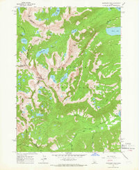 1964 Snowyside Peak1966 Print · USGSThe high Sawtooth summits of the mid-1960s reveal a landscape of glacial lakes and county boundaries at the headwaters of the Payette River. Trace the early access routes to Alturas Lake, the remote prospect at Eureka Gulch, and the Alturas Inlet Campground.4 unique versions available
 - 1964 Map of Marshall Peak, 1966 Print
 1964 Marshall Peak1966 Print · USGSThe Idaho backcountry in the mid-1960s was a landscape of high alpine peaks and isolated mining claims. Genealogists and historians can locate remote operations like the Silver King Mine and Pilgrim Mine or trace trails through the Ross Fork Basin.2 unique versions available
 - 1967 Map of Meridian Peak, 1971 Print
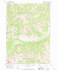 1967 Meridian Peak1971 Print · USGSCuster County was a land of high-altitude pack trails and forest boundaries during the late 1960s. Genealogists and historians can trace the remote Prospect site and early navigation routes like the Jeep Trail near Meridian Peak.2 unique versions available
 - 1967 Map of Rock Roll Canyon, 1971 Print
 1967 Rock Roll Canyon1971 Print · USGSThe high peaks of the Boulder Mountains are captured here during the late sixties, where the Sawtooth National Forest and Challis National Forest intersect. Genealogists and researchers can trace high-altitude pack trails leading to Trail Creek Summit or locate early wilderness landmarks like Park Creek Campground and Lake Creek Lakes.2 unique versions available
Showing maps 1-25 of 496
Top cities of Blaine County
- Hailey historical maps
- Ketchum historical maps
- Bellevue historical maps
- Sun Valley historical maps
- Carey historical maps
Frequently asked questions
- What are the different types of historical maps available for Blaine County?
- What is the oldest map of Blaine County?
- Where can I purchase historical maps of Blaine County for my home or office?
- Where can I download high-res historical maps of Blaine County?
- Are there historical topographic maps available for Blaine County?
- Is there historical aerial imagery available for Blaine County?
- Where are historical maps of Blaine County sourced from?