1970s Maps of Blaine County, Idaho
Explore 44 historic maps of Blaine County from the 1970s. These maps offer a rare glimpse into what life looked like during the 1970s — showing old roads, neighborhoods, homes, and landmarks that have changed or disappeared over time.
Whether you're researching your family's past, planning a metal detecting trip, or studying how Blaine County's landscape evolved across the 1970s, these high-resolution maps are a powerful tool for exploring the history of this region.
- Focus on a specific era: All maps on this page are from the 1970s, giving you a focused view of this time period.
- See what’s changed: Compare century-old streets, trails, and buildings to today's modern landscape using overlays and satellite layers.
- Research with precision: Use these maps for genealogy, historical research, land use analysis, or educational projects.
- View, download, or print: Maps are fully viewable online in high resolution, and can be downloaded or printed for your own records.
Start exploring Blaine County's history through authentic maps from the 1970s. This is your window into the past.
Blaine County, ID maps
(44)- 1970 Map of Horton Peak, 1973 Print
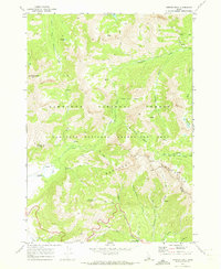 1970 Horton Peak1973 Print · USGSThe Sawtooth and Boulder Mountains of central Idaho are shown here during the early seventies as a high-altitude wilderness of forest service outposts and pack routes. Researchers can locate the Horton Peak Lookout, trace the Pack Trails around Champion Lakes, and find the remote Pole Creek Guard Station.3 unique versions available
 - 1970 Map of Galena Peak, 1973 Print
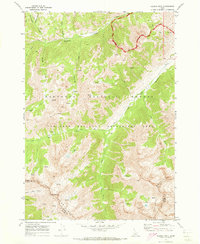 1970 Galena Peak1973 Print · USGSThe Boulder Mountains of central Idaho are shown here in the early 1970s, tracing the headwaters of the Salmon River. Researchers can locate high-altitude Mines near Galena Peak or follow the Pack Trails along Germania Creek and Jack Creek.2 unique versions available
 - 1970 Map of Easley Hot Springs, 1973 Print
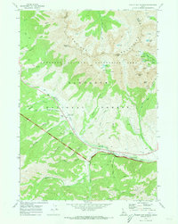 1970 Easley Hot Springs1973 Print · USGSThe high basins and river valleys of Blaine and Custer counties are captured here in the early seventies, just as modern recreation was taking hold. Discover old outposts and seasonal camps like Russian John Guard Station, the Boulder (Site), and Easley Hot Springs.3 unique versions available
 - 1970 Map of Dollarhide Mtn, 1973 Print
 1970 Dollarhide Mtn1973 Print · USGSThe Idaho backcountry in the early seventies reveals a landscape shaped by high-country mining and seasonal ranching. Local historians can trace the legacy of remote camps and mineral claims like Carrietown, the Silver Star Mine, and Gooding Cow Camp.
 - 1970 Map of Galena, 1973 Print
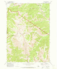 1970 Galena1973 Print · USGSThe high central Idaho backcountry is documented here during the early 1970s, as the Sawtooth region transitioned into a major recreation area. Outdoor researchers and genealogists can trace early routes over Galena Summit, find the Galena Pioneer Cem, or follow old pack trails to Miner Lake.3 unique versions available
 - 1970 Map of Baker Peak, 1973 Print
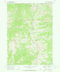 1970 Baker Peak1973 Print · USGSThe Smoky Mountains of Camas and Blaine Counties are shown in great detail during the early 1970s. Explorers and historians can trace the high-altitude Pack Trail network connecting landmarks like Baker Peak, Baker Lake, and the aptly named Lost Shirt Trail.2 unique versions available
 - 1970 Map of Buttercup Mtn, 1973 Print
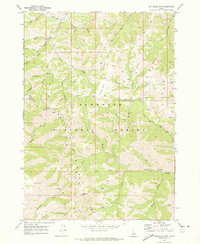 1970 Buttercup Mtn1973 Print · USGSBlaine and Camas counties are seen here in the early 1970s, showcasing the high-elevation backcountry of the Sawtooth National Forest. Historical researchers can locate old mining sites like the Buttercup Mine and trace early routes through Placer Flat and Lupine Gulch.2 unique versions available
 - 1970 Map of Boyle Mountain, 1973 Print
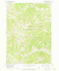 1970 Boyle Mountain1973 Print · USGSBlaine County's high-elevation terrain is captured here in the early 1970s, showcasing the wilderness management of the Sawtooth National Forest. Researchers can trace old mountain routes and mining sites like the Alden Trail and various Prospects.2 unique versions available
 - 1972 Map of Schodde Well, 1975 Print
 1972 Schodde Well1975 Print · USGSHigh desert ranching meets volcanic geology in this 1970s survey of southern Idaho. Trace the remote water sources and cattle infrastructure essential to this landscape, from Schodde Well to the expansive Wapi Lava Flow.
 - 1972 Map of North Laidlaw Butte, 1975 Print
 1972 North Laidlaw Butte1975 Print · USGSThe volcanic landscape of southern Idaho is captured in the early seventies, where lava flows meet high desert terrain. Researchers can trace remote infrastructure like the Hollow Top Landing Strip and isolated water sources such as Ellsworth Well and Snowdrift Reservoir.
 - 1972 Map of Antelope Lake, 1975 Print
 1972 Antelope Lake1975 Print · USGSThe high desert along the Blaine County line is captured here in the early seventies, showing a landscape defined by volcanic geology. Researchers can trace the massive Great Rift and locate remote water sources like Antelope Lake and the Road Lake Waterhole.
 - 1972 Map of Rattlesnake Butte, 1975 Print
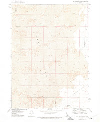 1972 Rattlesnake Butte1975 Print · USGSThe volcanic landscape of the Snake River Plain in the early seventies reveals a remote region where the Lava Flow meets the high desert. Researchers can trace the rugged topography around Rattlesnake Butte and find signs of open-range ranching at a Corral and remote Well.
 - 1972 Map of Split Top, 1975 Print
 1972 Split Top1975 Print · USGSBlaine and Bingham counties are captured in the early 1970s, showcasing a remote landscape of high-desert water management and ranching. Trace early landmarks such as Packsaddle Butte, the Ruins near the county line, and scattered cisterns.
 - 1972 Map of Bear Trap Cave, 1975 Print
 1972 Bear Trap Cave1975 Print · USGSBlaine County was a landscape of volcanic activity and remote backcountry trails in the early seventies. Geologists and explorers can trace the extent of the massive Lava Flow and locate remote features like Bear Trap Cave and the Bear Trap Landing Strip.
 - 1972 Map of Mule Butte, 1976 Print
 1972 Mule Butte1976 Print · USGSBlaine County in the early 1970s reveals a raw volcanic landscape dominated by the Great Rift and dark Lava flows. Geologists and local explorers can trace primitive routes like the Bear Trap Jeep Trail or find landmarks like Mule Butte.
 - 1972 Map of Little Park, 1976 Print
 1972 Little Park1976 Print · USGSBlaine County ranching and volcanic geology meet in the early 1970s at the edge of the Snake River Plain. Trace the historic monument boundary and find remote water sources like Indian Well and the Laidlaw Park Holding Corral.
 - 1972 Map of Pratt Butte, 1976 Print
 1972 Pratt Butte1976 Print · USGSThe volcanic Snake River Plain comes into sharp focus in the early 1970s, revealing a landscape defined by the Great Rift. Geologists and researchers can trace the extent of Lava flows, locate the Devils Caldron, and find isolated water sources like Heifer Reservoir.
 - 1972 Map of Bear Park SW, 1976 Print
 1972 Bear Park SW1976 Print · USGSSouthern Idaho in the early seventies is revealed through its stark volcanic geology at the boundary of Minidoka Co and Blaine Co. Researchers can trace the precise extent of the Lava flows across this segment of the Snake River Plain.2 unique versions available
 - 1972 Map of Minidoka, 1976 Print
 1972 Minidoka1976 Print · USGSMinidoka appears as a vital rail settlement in the early 1970s, positioned along the historic route of the Union Pacific. Researchers can trace the rural infrastructure of the era, from the local Landing Strip to the grid of 1100 North Road and family-named routes like Cherry Road.
 - 1972 Map of Mosby Well, 1976 Print
 1972 Mosby Well1976 Print · USGSThe Snake River Plain high desert is captured here in the early 1970s, showing a landscape defined by its remote water sources. Researchers can trace the isolated network of a Jeep Trail leading to essential outposts like Mosby Well and Gasten Beattie Well.
 - 1972 Map of Bear Den Butte, 1976 Print
 1972 Bear Den Butte1976 Print · USGSThe volcanic Snake River Plain is captured here in the early 1970s, showing the high-desert landscape of Minidoka County. Researchers can trace remote livestock waterings at Cream Can Lake and Aspitarte Lake or locate landmarks like Bear Den Butte and Lava Point.
 - 1972 Map of Mosby Butte, 1976 Print
 1972 Mosby Butte1976 Print · USGSPower County was a landscape of volcanic isolation in the early seventies, defined by the geological scars of the Great Rift. Researchers can trace the path of a remote Jeep Trail past landmarks like Sullivans Cave and the Bear Trap Lava Tube.
 - 1972 Map of Bear Park East, 1976 Print
 1972 Bear Park East1976 Print · USGSThe volcanic terrain of Blaine County is captured here in the early seventies, dominated by the stark geology of the Great Rift. Geologists and explorers can trace unique landforms like Fissure Cave, Bear Park Butte, and numerous subterranean Cracks.
 - 1972 Map of Laidlaw Butte, 1976 Print
 1972 Laidlaw Butte1976 Print · USGSThe volcanic Snake River Plain is captured here in the early 1970s, marking the intersection of Blaine, Lincoln, and Minidoka counties. Trace remote water sources like Baird Reservoir and landmarks like Laidlaw Butte via early Jeep Trails.
 - 1972 Map of Sunset Lake, 1976 Print
 1972 Sunset Lake1976 Print · USGSThe Idaho backcountry at the start of the 1970s reveals a vast, undeveloped landscape where Butte, Blaine, and Bingham counties converge. Researchers can trace the minimal paths of a Jeep Trail reaching out toward Sunset Lake and Rock Corral Butte.
Showing maps 1-25 of 44
Top cities of Blaine County
- Hailey historical maps
- Ketchum historical maps
- Bellevue historical maps
- Sun Valley historical maps
- Carey historical maps
Frequently asked questions
- What are the different types of historical maps available for Blaine County?
- What is the oldest map of Blaine County?
- Where can I purchase historical maps of Blaine County for my home or office?
- Where can I download high-res historical maps of Blaine County?
- Are there historical topographic maps available for Blaine County?
- Is there historical aerial imagery available for Blaine County?
- Where are historical maps of Blaine County sourced from?