
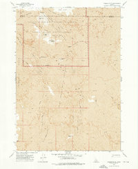
1972 Map of Bear Den Butte
USGS Topo · Published 1976About this map
The Lava flows of the Snake River Plain dominate this 1970s landscape, creating a stark volcanic corridor that separates the western rangelands from the eastern buttes. Stretching across the Blaine Co Minidoka Co line, the map reveals a reliance on water management in an arid environment, marked by a series of small, scattered catchments such as Bowl Reservoir, Purdy Reservoir, and Moline Res. These features, along with the numerous namesake lakes like Guts Lake and Cream Can Lake, illustrate the vital role of seasonal water sources for livestock and local land use.
Find a feature on this map
25 named features on this map. Tap any name to fly to it.
Don’t see what you’re looking for? This feature index may not catch every label — zoom into the map to look around manually.
Map Details
Editions of this 1972 Bear Den Butte Map
This is the sole edition of this map. No revisions or reprints were ever made.
Other maps of this area

1955 · Idaho Falls
USGS Topo · 1:250,000

1958 · Idaho Falls
USGS Topo · 1:250,000

1972 · North Laidlaw Butte
USGS Topo · 1:24,000

1972 · Little Park
USGS Topo · 1:24,000

1972 · Bear Park SW
USGS Topo · 1:24,000

1972 · Laidlaw Lake
USGS Topo · 1:24,000

1972 · Laidlaw Butte
USGS Topo · 1:24,000

1972 · Bottleneck Lake
USGS Topo · 1:24,000

1972 · Bear Park West
USGS Topo · 1:24,000
1973 · Fissure Butte
USGS Topo · 1:24,000