
1972 Map of Split Top
USGS Topo · Published 1975About this map
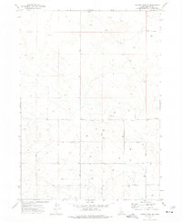
Split Top and Packsaddle Butte define the topography of this high-desert landscape in the early 1970s. The region is characterized by a reliance on collected and pumped water, evidenced by numerous cisterns, caves, and isolated water sources like Houghland Well and Packsaddle Well. The presence of small reservoirs such as Houghland Res No 1 and Clear Lake Res indicates a managed water system essential for livestock or survival in this arid environment.
Find a feature on this map
20 named features on this map. Tap any name to fly to it.
Don’t see what you’re looking for? This feature index may not catch every label — zoom into the map to look around manually.
Map Details
Editions of this 1972 Split Top Map
This is the sole edition of this map. No revisions or reprints were ever made.
Other maps of this area

1955 · Idaho Falls
USGS Topo · 1:250,000

1958 · Idaho Falls
USGS Topo · 1:250,000

1972 · Antelope Lake
USGS Topo · 1:24,000

1972 · Mosby Well
USGS Topo · 1:24,000

1972 · Mosby Butte
USGS Topo · 1:24,000

1972 · Sunset Lake
USGS Topo · 1:24,000

1972 · Serviceberry Butte
USGS Topo · 1:24,000

1973 · Rock Butte
USGS Topo · 1:24,000
1973 · Coffee Point SW
USGS Topo · 1:24,000
1973 · Coffee Point
USGS Topo · 1:24,000