1970s Maps of Boise County, Idaho
Explore 29 historic maps of Boise County from the 1970s. These maps offer a rare glimpse into what life looked like during the 1970s — showing old roads, neighborhoods, homes, and landmarks that have changed or disappeared over time.
Whether you're researching your family's past, planning a metal detecting trip, or studying how Boise County's landscape evolved across the 1970s, these high-resolution maps are a powerful tool for exploring the history of this region.
- Focus on a specific era: All maps on this page are from the 1970s, giving you a focused view of this time period.
- See what’s changed: Compare century-old streets, trails, and buildings to today's modern landscape using overlays and satellite layers.
- Research with precision: Use these maps for genealogy, historical research, land use analysis, or educational projects.
- View, download, or print: Maps are fully viewable online in high resolution, and can be downloaded or printed for your own records.
Start exploring Boise County's history through authentic maps from the 1970s. This is your window into the past.
Boise County, ID maps
(29)- 1970 Map of Ola, 1974 Print
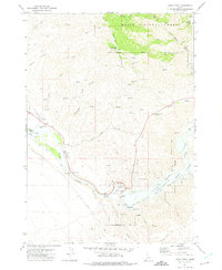
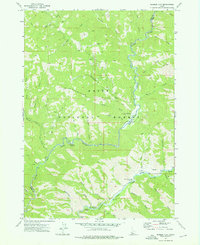
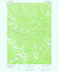
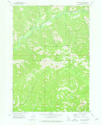
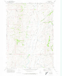 1970 Ola1974 Print · USGSThe small settlement of Ola is documented in the 1970s, positioned at the scenic confluence of Squaw Creek and Ola Creek. Local historians can trace the early community via the Cem, the Roadside Rest, and the rugged Jeep Trail winding through the Boise National Forest.
 - 1970 Map of Webb Creek, 1974 Print
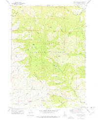
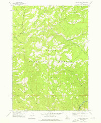
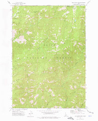
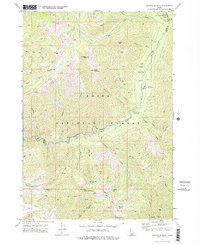
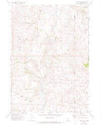 1970 Webb Creek1974 Print · USGSThe Gem and Boise County line comes alive in the early seventies, showing a high-country landscape shaped by water and early industry. Trace the primitive Saddler Trail or locate mining history at the Liberty Mine and Timber Butte.
 - 1972 Map of Bull Trout Point, 1975 Print
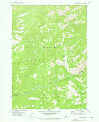
 1972 Bull Trout Point1975 Print · USGSThe high divide of the Sawtooth range in the early 1970s shows a landscape of mountain trails and alpine lakes. Researchers can trace historic access routes to prospects, remote campgrounds, and the headwaters of Dead Man Creek and Bull Trout Lake.2 unique versions available
 - 1972 Map of Boise North, 1975 Print
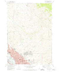 1972 Boise North1975 Print · USGSBoise and Garden City expand into the Idaho foothills during the early seventies, showing a growing urban grid meeting the national forest. Researchers can trace neighborhood development and local history through landmarks like Lowell Sch, the Old Military Reservation, and Stewart Gulch.3 unique versions available
 - 1972 Map of Lucky Peak, 1975 Print
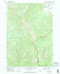
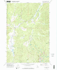
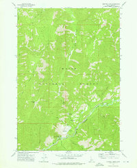
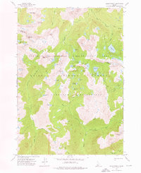
 1972 Lucky Peak1975 Print · USGSThe Boise River valley and the slopes of Shaw Mountain were centers of mining and water engineering in the 1970s. Researchers can trace the Oregon Trail, locate old diggings at the Adelmann Mine, and explore the infrastructure of the Lucky Peak Dam.
 - 1972 Map of Robie Creek, 1975 Print
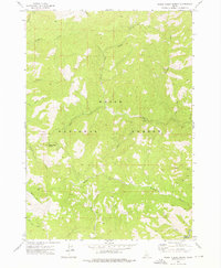
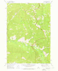
 1972 Robie Creek1975 Print · USGSThe Boise Front was a rugged crossroads of mining and recreation in the early seventies, where jeep trails and pack routes crisscrossed the high ridges. Modern researchers can trace the locations of the Bumblebee Mine, Davidson Ranch, and historic mountain crossings like Aldape Summit.2 unique versions available
 - 1972 Map of Banner Summit, 1975 Print
 1972 Banner Summit1975 Print · USGSThe Sawtooth mountains of Idaho were a wilderness of high-altitude lakes and mining claims in the early seventies. Trace backcountry routes like the Thatcher Trail to find remote landmarks such as the Mines on Copper Mountain or the waters of Bull Trout Lake.
 - 1972 Map of Rabbit Creek Summit, 1976 Print
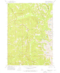
 1972 Rabbit Creek Summit1976 Print · USGSThe Boise National Forest wilderness in the early 1970s is captured here, centered on the high divide at Rabbit Creek Summit. Trace remote backcountry routes like the Pack Trail as they cross Rabbit Creek and Meadow Creek.
 - 1972 Map of Barber Flat, 1976 Print
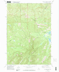
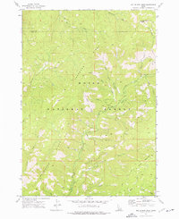
 1972 Barber Flat1976 Print · USGSThe Boise National Forest backcountry in the early 1970s reveals a landscape of pack trails and remote river outposts. Researchers can trace historic access routes like the Hungarian Pack Trail and locate sites such as the Barber Flat Forest Service Station and local Hot Springs.
 - 1972 Map of Big Owl Creek, 1976 Print
 1972 Big Owl Creek1976 Print · USGSThe Boise National Forest backcountry in the early 1970s is captured here, showing the remote watershed where Boise and Elmore counties meet. Researchers can trace historical land use through Dredge Tailings and find local landmarks like the Beaver Creek Forest Service Station and Edna Creek Campground.
 - 1972 Map of Bear River, 1976 Print
 1972 Bear River1976 Print · USGSThe Boise National Forest backcountry in the early seventies shows a wilderness of river canyons and high-elevation trails. Researchers can trace the historic North Fork Boise River corridor to find the Deer Park Guard Sta and Robert E Lee Campground.
 - 1972 Map of Cache Creek, 1976 Print
 1972 Cache Creek1976 Print · USGSThe Boise National Forest backcountry in the early 1970s is shown here as a wilderness of high meadows and pack trails. Trace the routes of the EIGHTMILE PACK TRAIL to the Sack Creek Campground or locate the Transfer Cabin (Site) near Mace Meadows.
 - 1972 Map of Tyee Mountain, 1976 Print
 1972 Tyee Mountain1976 Print · USGSThe high country of the Boise National Forest is charted here in the early 1970s, showing a remote landscape of summits and pack trails. Trace the paths near Tyee Mountain or follow the waters of the South Fork Payette River and Crooked River.
 - 1972 Map of Miller Mtn East, 1976 Print
 1972 Miller Mtn East1976 Print · USGSThe high country of the Boise National Forest is charted in the 1970s, showing a remote landscape of pack trails and prominent peaks. Trace the routes of the Pack Trail or locate family landmarks near Miller Mountain and Eightmile Creek.
 - 1972 Map of Stanley Lake, 1976 Print
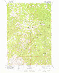
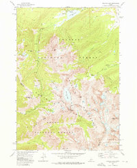 1972 Stanley Lake1976 Print · USGSThe Sawtooth Wilderness in the early 1970s is a high-altitude landscape of glaciers and granite. Trace old mining remnants at the Greenback Mine or follow pack trails past Sawtooth Lake and Lady Face Falls.
 - 1972 Map of Scott Creek, 1976 Print
 1972 Scott Creek1976 Print · USGSCentral Idaho in the early seventies was a landscape of deep timber and forest management. Trace high-country routes like the Packsaddle Trail and find backcountry landmarks including the Deadwood Lookout and Center Camp Corral.
 - 1972 Map of Swanholm Peak, 1976 Print
 1972 Swanholm Peak1976 Print · USGSHigh in the Boise National Forest during the early 1970s, this area shows the intersection of former mining operations and wilderness management. You can trace the remnants of Graham (Site) and Graham Mill (Site) or locate the Graham Landing Strip near the river.
 - 1972 Map of Eightmile Mtn, 1976 Print
 1972 Eightmile Mtn1976 Print · USGSThe Boise National Forest in the early seventies shows a landscape of river-carved canyons and remote forest outposts. You can trace the South Fork Payette River to find Bonnerille Hot Springs, the Warm Springs Landing Strip, and early recreational sites.
 - 1972 Map of Sunset Mtn., 1976 Print
 1972 Sunset Mtn.1976 Print · USGSThe Boise National Forest in the early seventies shows a high-country landscape shaped by old mining claims and forest lookouts. Map collectors and researchers can trace the routes to Pilot Peak Lookout, several mines, and historic camps like Bad Bear Campground.3 unique versions available
 - 1972 Map of Edaho Mountain, 1976 Print
 1972 Edaho Mountain1976 Print · USGSThe Sawtooth range in the early seventies shows a landscape where motorized and pack animal travel intersect along the South Fork Payette River. Trace high-country routes to isolated landmarks like the X Prospect at Picket Mtn and the remote Taylor Spring.2 unique versions available
 - 1972 Map of Mount Everly, 1976 Print
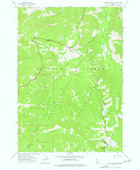
 1972 Mount Everly1976 Print · USGSThe Sawtooth Wilderness in the early seventies remained a primitive landscape defined by glacial lakes and rugged summits. Researchers can trace the high-country trail systems through Tenlake Basin and locate remote waters like Spangle Lake and Benedict Lake.
 - 1972 Map of Grandjean, 1976 Print
 1972 Grandjean1976 Print · USGSThe Sawtooth mountains of the early seventies come alive in this survey of the river valleys and high alpine lakes near the Boise and Challis border. Trace the primitive infrastructure of the day, from the Forest Service Station at Grandjean to Sacajawea Hot Springs and the network of Pack Trails.3 unique versions available
 - 1972 Map of Nahneke Mtn, 1976 Print
 1972 Nahneke Mtn1976 Print · USGSThe Sawtooth high country in the early seventies remained a landscape of remote pack trails and legacy mining sites. Researchers can trace the remnants of backcountry industry at the Overlook Mill (Ruins) or locate alpine landmarks like Nahneke Mtn and The Hole.2 unique versions available
 - 1972 Map of Miller Mtn West, 1976 Print
 1972 Miller Mtn West1976 Print · USGSThe Boise National Forest area in the early seventies shows a wilderness of steep ridges and high-country drainages. Trace the early trails and remote family-named landmarks like Miller Mountain, Deadwood Ridge, and Miller Fence Creek.2 unique versions available
 - 1972 Map of Jackson Peak, 1976 Print
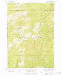
 1972 Jackson Peak1976 Print · USGSBoise National Forest in the early seventies shows a wilderness of high peaks and river forks before extensive modern development. Researchers can trace historic access routes via Pack Trails and Jeep Trails to landmarks like Jennie Lake and Jackson Peak.
Showing maps 1-25 of 29
Top cities of Boise County
- Robie Creek historical maps
- Horseshoe Bend historical maps
- Idaho City historical maps
- Crouch historical maps
- Placerville historical maps
Frequently asked questions
- What are the different types of historical maps available for Boise County?
- What is the oldest map of Boise County?
- Where can I purchase historical maps of Boise County for my home or office?
- Where can I download high-res historical maps of Boise County?
- Are there historical topographic maps available for Boise County?
- Is there historical aerial imagery available for Boise County?
- Where are historical maps of Boise County sourced from?