1950s Maps of Boise County, Idaho
Explore 20 historic maps of Boise County from the 1950s. These maps offer a rare glimpse into what life looked like during the 1950s — showing old roads, neighborhoods, homes, and landmarks that have changed or disappeared over time.
Whether you're researching your family's past, planning a metal detecting trip, or studying how Boise County's landscape evolved across the 1950s, these high-resolution maps are a powerful tool for exploring the history of this region.
- Focus on a specific era: All maps on this page are from the 1950s, giving you a focused view of this time period.
- See what’s changed: Compare century-old streets, trails, and buildings to today's modern landscape using overlays and satellite layers.
- Research with precision: Use these maps for genealogy, historical research, land use analysis, or educational projects.
- View, download, or print: Maps are fully viewable online in high resolution, and can be downloaded or printed for your own records.
Start exploring Boise County's history through authentic maps from the 1950s. This is your window into the past.
Boise County, ID maps
(20)- 1953 Map of Banks, 1955 Print
 1953 Banks1955 Print · USGSThe confluence of the Payette River forks defines this mid-century survey of Boise and Valley counties. Genealogists can trace the rural mountain life of the early fifties through the High Valley Sch (Aband), Pinehurst Church, and the settlement of Banks.3 unique versions available
 - 1953 Map of Montour, 1956 Print
 1953 Montour1956 Print · USGSThe Payette River valley in the early fifties shows a landscape of reclamation and resource extraction. Researchers can trace the rail corridor of the Union Pacific or locate early mining sites like the Gem State Mine and the Sweet Cemetery.3 unique versions available
 - 1954 Map of Boise North, 1957 Print
 1954 Boise North1957 Print · USGSBoise and Garden City are captured in the mid-fifties as the city began to climb the foothills and expand along the river. Genealogists and local historians can locate early institutions like the Soldiers Home, Collister Sch, and the Boise City Canal.2 unique versions available
 - 1954 Map of Boise, 1958 Print
 1954 Boise1958 Print · USGSBoise and the surrounding Idaho foothills are captured here in the mid-fifties, just as suburban expansion began meeting the rugged edge of the Boise National Forest. Researchers can trace the Old Oregon Trail, locate the State Penitentiary, and find long-established schools like St Marys Sch.2 unique versions available
 - 1955 Map of Baker, 1964 Print
 1955 Baker1964 Print · USGSThe Oregon-Idaho borderlands are captured here in the mid-fifties as the Snake River underwent massive changes from dam construction. Trace the Oregon Trail Memorial Monument near Baker, find early mines like Virtue Mine, and follow the Union Pacific Railroad through Huntington.4 unique versions available
 - 1955 Map of Hailey, 1968 Print
 1955 Hailey1968 Print · USGSCentral Idaho in the mid-fifties reveals a landscape transitioning from deep-rooted silver mining to a burgeoning outdoor economy. Researchers can trace the legacy of the Union Pacific line, the remote Triumph Mine, and original airfield layouts at Mountain Home Air Force Base.4 unique versions available
 - 1955 Map of Boise, 1977 Print
 1955 Boise1977 Print · USGSThe Treasure Valley and Owyhee uplands are shown in detail during the mid-fifties, capturing the region's transition into a major agricultural and urban hub. Researchers can trace the Union Pacific line through Nampa, explore the volcanic Jordan Craters, or locate the historic mining district of Silver City.
 - 1957 Map of Cartwright Canyon, 1959 Print
 1957 Cartwright Canyon1959 Print · USGSThe foothills north of Boise during the late 1950s remained a terrain of remote ranching and timber access. Researchers can trace the original route of Horseshoe Bend Road and locate family landmarks like Dobson Ranch and Stack Rock.4 unique versions available
 - 1957 Map of Horseshoe Bend, 1959 Print
 1957 Horseshoe Bend1959 Print · USGSThe Payette River valley comes alive in the late fifties, showing a landscape of rail-fed industry and mountain settlements. Trace the timber and transit heritage at Horseshoe Bend, the Pioneer Cemetery, and the riverside Union Pacific line.3 unique versions available
 - 1957 Map of Placerville, 1959 Print
 1957 Placerville1959 Print · USGSIn the Idaho mountains during the late 1950s, this area shows a landscape transformed by the search for gold. Genealogists and historians can locate mining landmarks like Quartzburg, the Gold Hill Mine, and the old cemeteries near Centerville.3 unique versions available
 - 1957 Map of Pioneerville, 1959 Print
 1957 Pioneerville1959 Print · USGSThe Idaho Basin’s gold mining legacy is on full display here during the late fifties, centered on the settlement of Pioneerville. Genealogists and historians can trace lode claims and ranch sites like Arbaugh Ranch or the Washington Mill.4 unique versions available
 - 1957 Map of Warm Springs Point, 1959 Print
 1957 Warm Springs Point1959 Print · USGSBoise County was a center of resource extraction and forest management in the late fifties. Researchers can trace the legacy of mining through Tailings along Grimes Creek or locate landmarks like Holcomb Guard Station and Warm Springs Point.4 unique versions available
 - 1957 Map of Shafer Butte, 1959 Print
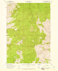 1957 Shafer Butte1959 Print · USGSThe Boise Ridge comes into focus in the late 1950s as a burgeoning recreational and media hub. Researchers can trace the early development of Bogus Basin State Park and locate historic communication sites like the KBOI-TV Towers near Shafer Butte.4 unique versions available
 - 1957 Map of Harris Creek Summit, 1959 Print
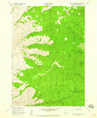 1957 Harris Creek Summit1959 Print · USGSBoise County mining and forest lands are captured in the late fifties as the high country remained a frontier of resource extraction. Researchers can locate specific workings like the Belshazzar Mine and Mountain Chief Mine along the steep slopes of the Boise Ridge.3 unique versions available
 - 1957 Map of Idaho City, 1959 Print
 1957 Idaho City1959 Print · USGSIdaho City and the surrounding Boise Basin are shown here in the late fifties, revealing a landscape defined by its mining legacy. Genealogists and historians can trace local landmarks like Boot Hill Cem, the Gold Hill Mine, and the historic Spanish Trail.3 unique versions available
 - 1957 Map of Challis, 1964 Print
 1957 Challis1964 Print · USGSCentral Idaho in the late fifties and early sixties remains a territory of remote mining camps and high-mountain ranger stations. Trace historic mining operations like the Lucky Boy Mine or locate isolated homesteads including Robinson Bar Ranch and Allison Ranch.3 unique versions available
 - 1958 Map of Boise
 1958 Boise1958 Print · USGSThe Treasure Valley and Snake River Plain come alive in the mid-fifties as the rail-and-river economy transitions into a modern agricultural hub. Trace the Union Pacific lines through Nampa or locate remote landmarks like Initial Point and the Rockville settlement.2 unique versions available
 - 1959 Map of Baker
 1959 Baker1959 Print · USGSThe Oregon and Idaho borderlands come alive in the late fifties, showing the rugged corridor along the Snake River and the high peaks of the Wallowa Mountains. Researchers can trace the legacy of the Union Pacific railroad or locate historic mining sites like the Flagstaff Mine and Virtue Mine.2 unique versions available
 - 1959 Map of Hailey
 1959 Hailey1959 Print · USGSThe Sawtooth range and high desert plains of Southern Idaho are captured here during a period of mining and military growth. Genealogists and historians can locate mining sites like Triumph Mine, early settlements such as Idaho City, and the Mountain Home Air Force Base.2 unique versions available
 - 1959 Map of Garden Valley, 1961 Print
 1959 Garden Valley1961 Print · USGSGarden Valley and the Boise National Forest are captured here in the late fifties, showcasing a landscape of river-valley ranching and mountain mining. Trace historical gold and silver prospects like the Klondike Mine or find the remote Grimes Pass School.2 unique versions available
End of results
Showing maps 1-20 of 20
Top cities of Boise County
- Robie Creek historical maps
- Horseshoe Bend historical maps
- Idaho City historical maps
- Crouch historical maps
- Placerville historical maps
Frequently asked questions
- What are the different types of historical maps available for Boise County?
- What is the oldest map of Boise County?
- Where can I purchase historical maps of Boise County for my home or office?
- Where can I download high-res historical maps of Boise County?
- Are there historical topographic maps available for Boise County?
- Is there historical aerial imagery available for Boise County?
- Where are historical maps of Boise County sourced from?