1950s Maps of Owyhee County, Idaho
Explore 31 historic maps of Owyhee County from the 1950s. These maps offer a rare glimpse into what life looked like during the 1950s — showing old roads, neighborhoods, homes, and landmarks that have changed or disappeared over time.
Whether you're researching your family's past, planning a metal detecting trip, or studying how Owyhee County's landscape evolved across the 1950s, these high-resolution maps are a powerful tool for exploring the history of this region.
- Focus on a specific era: All maps on this page are from the 1950s, giving you a focused view of this time period.
- See what’s changed: Compare century-old streets, trails, and buildings to today's modern landscape using overlays and satellite layers.
- Research with precision: Use these maps for genealogy, historical research, land use analysis, or educational projects.
- View, download, or print: Maps are fully viewable online in high resolution, and can be downloaded or printed for your own records.
Start exploring Owyhee County's history through authentic maps from the 1950s. This is your window into the past.
Owyhee County, ID maps
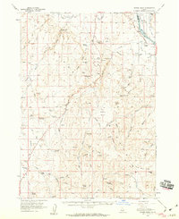
(31)- 1950 Map of Oreana
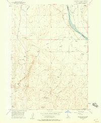
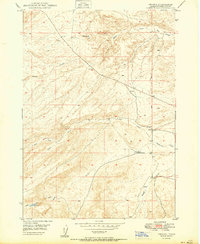 1950 Oreana1950 Print · USGSOreana and the Owyhee desert are captured here at the start of the fifties, showing the remote settlement patterns of southern Idaho. Genealogists and historians can locate the Oreana School, the local PO, and landmarks like Fossil Butte or the Cem.
 - 1950 Map of Indian Butte
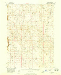
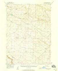
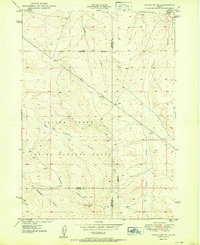 1950 Indian Butte1950 Print · USGSThe high Idaho desert south of the Snake River is captured here in the mid-century, defined by its role as a sprawling Aerial Gunnery Range. Researchers can trace old routes like the Castleford Road and explore landmarks like Indian Butte.
 - 1951 Map of Glenns Ferry
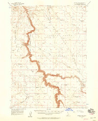
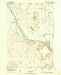
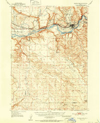 1951 Glenns Ferry1951 Print · USGSThe Snake River valley in the early fifties was a vital corridor of rail and river history. Genealogists and historians can trace the legacy of the Oregon Short Line and locate landmarks like Three Island Crossing and McGinness Ranch.
 - 1955 Map of McDermitt
 1955 McDermitt1955 Print · USGSNorthern Nevada in the mid-fifties shows a landscape of mining camps and vast cattle ranges. Trace the early footprints of Tuscarora or the remote Cordero Mine and National Mine tucked into the high desert peaks.3 unique versions available
 - 1955 Map of Jordan Valley, 1963 Print
 1955 Jordan Valley1963 Print · USGSThe high desert of Malheur County comes alive in the mid-1950s, showing the isolated ranching outposts and deep canyons along the Idaho border. Researchers can trace the remote reaches of the Owyhee River, the cattle town of Jordan Valley, and mining landmarks like War Eagle Mountain.3 unique versions available
 - 1955 Map of Twin Falls, 1963 Print
 1955 Twin Falls1963 Print · USGSThe Magic Valley flourished in the mid-1950s as a sophisticated network of irrigation and rail lines connected high-desert outposts. Researchers can trace the engineering of the Milner-Gooding Canal, the remote Murphy Hot Springs, and the Union Pacific rail network.3 unique versions available
 - 1955 Map of Wells, 1966 Print
 1955 Wells1966 Print · USGSNortheastern Nevada's high basin-and-range country is documented here in the mid-fifties, showing a landscape of remote ranching outposts and massive federal forest lands. Researchers can locate the early mining districts at Delano Mines and trace the paths of the Southern Pacific railroad through settlements like Deeth and Cobre.4 unique versions available
 - 1955 Map of Hailey, 1968 Print
 1955 Hailey1968 Print · USGSCentral Idaho in the mid-fifties reveals a landscape transitioning from deep-rooted silver mining to a burgeoning outdoor economy. Researchers can trace the legacy of the Union Pacific line, the remote Triumph Mine, and original airfield layouts at Mountain Home Air Force Base.4 unique versions available
 - 1955 Map of Boise, 1977 Print
 1955 Boise1977 Print · USGSThe Treasure Valley and Owyhee uplands are shown in detail during the mid-fifties, capturing the region's transition into a major agricultural and urban hub. Researchers can trace the Union Pacific line through Nampa, explore the volcanic Jordan Craters, or locate the historic mining district of Silver City.
 - 1956 Map of Crater Rings SW, 1957 Print
 1956 Crater Rings SW1957 Print · USGSMilitary aviation and tactical training grounds define this Idaho desert landscape in the mid-fifties. Researchers can trace the development of Mountain Home Air Force Base and its Gunnery Range alongside a remote Jeep Trail and the C J Strike Res.3 unique versions available
 - 1956 Map of Big Hill, 1958 Print
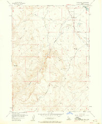
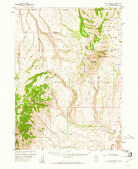
 1956 Big Hill1958 Print · USGSHigh-desert ranching country in Owyhee County comes to life in this mid-fifties survey of the plateaus and drainages. Researchers can trace early routes through the backcountry at Wickahoney Crossing, Hole in Rock, and the remote Deer Water Spring.2 unique versions available
 - 1956 Map of Blue Butte, 1958 Print
 1956 Blue Butte1958 Print · USGSOwyhee County's high desert was defined by military ranges and volcanic landmarks during the 1950s. Trace the boundaries of the Aerial Gunnery Range or locate remote water sources like Pot Hole Reservoir and Pot Hole Creek.2 unique versions available
 - 1956 Map of Winter Camp, 1958 Print
 1956 Winter Camp1958 Print · USGSThe Owyhee plateau of the mid-1950s reveals a sparse landscape defined by deep river gorges and military testing grounds. Trace the isolated paths of the Roberson Trail and Miller Road past Winter Camp and Bruneau Canyon.2 unique versions available
 - 1957 Map of Jordan Valley
 1957 Jordan Valley1957 Print · USGSThe high-desert borderlands of Oregon and Idaho appear in the mid-fifties as a world of remote cattle ranches and mining claims. Researchers can trace historic family-named locations like Bowden Ranch and Riddle alongside the South Mountain Mining Company.
 - 1957 Map of Walters Butte, 1958 Print
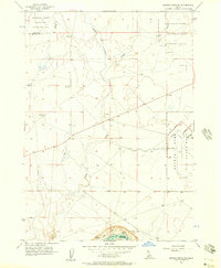
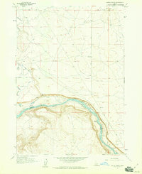
 1957 Walters Butte1958 Print · USGSIn the Snake River canyon during the late 1950s, this area shows a sharp transition from high desert buttes to irrigated farmland. Genealogists and historians can trace the foundations of Melba, the location of the Glendale School, and the historic crossing at Walters Ferry.3 unique versions available
 - 1957 Map of Opalene Gulch, 1958 Print
 1957 Opalene Gulch1958 Print · USGSOwyhee County's high desert meets the river's edge in the late fifties, showcasing a complex irrigation landscape of canals and siphons. Genealogists and historians can locate the Opalene School, the Boy Scout Camp, and remote outposts like Upper Rats Nest Spring.2 unique versions available
 - 1957 Map of Wilson Peak, 1958 Print
 1957 Wilson Peak1958 Print · USGSOwyhee County at the end of the fifties is a landscape of high peaks and vital irrigation systems along the southern banks of the Snake River. Genealogists and historians can trace local landmarks like Wilson Cemetery, the Wilson Community Hall, and several remote mining Prospect sites.2 unique versions available
 - 1957 Map of Wilder, 1959 Print
 1957 Wilder1959 Print · USGSIn the late 1950s, the western Idaho borderlands near Homedale were defined by a complex irrigation network of canals and laterals. Researchers can trace the Union Pacific line through Wilder or locate the Arena Valley School and Fargo Cemetery.3 unique versions available
 - 1957 Map of Initial Point, 1959 Print
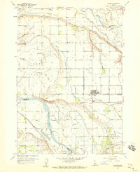
 1957 Initial Point1959 Print · USGSThe high desert south of Nampa was defined by vital survey markers and irrigation projects in the late fifties. You can locate the Initial Point survey monument and trace the Snake River past the Priest Ranch and a local Ferry.4 unique versions available
 - 1957 Map of Sands Basin, 1959 Print
 1957 Sands Basin1959 Print · USGSThe Owyhee backcountry in the late fifties shows a landscape of remote ranches and vital water sources before modern development changed the range. Genealogists and local historians can trace family sites like Bush Ranch and French John Hill, or find the old Opalene School and Boy Scout Camp.
 - 1957 Map of Elk Mountain, 1961 Print
 1957 Elk Mountain1961 Print · USGSThe high desert border between Nevada and Idaho is captured here in the late fifties, a landscape of isolated ranches and national forest. Trace early access routes and landmarks like O'Neil Ranch, the Pole Creek Ranger Sta, and Red Elephant Butte.3 unique versions available
 - 1958 Map of Wells
 1958 Wells1958 Print · USGSNortheastern Nevada's high desert and mountain ranges are documented here in the late fifties as the regional rail and ranching economy thrived. Genealogists and historians can trace the paths of the Southern Pacific railroad to remote stations at Cobre and Metropolis, or locate the high-altitude Delno Mines.
 - 1958 Map of Twin Falls
 1958 Twin Falls1958 Print · USGSThe Magic Valley and Snake River Plain are captured here in the late fifties, showcasing a region defined by transformative irrigation projects and desert military ranges. Researchers can trace the Union Pacific rail lines and locate small outlying settlements like Wickahoney, Rogerson, and Hollister.2 unique versions available
 - 1958 Map of Boise
 1958 Boise1958 Print · USGSThe Treasure Valley and Snake River Plain come alive in the mid-fifties as the rail-and-river economy transitions into a modern agricultural hub. Trace the Union Pacific lines through Nampa or locate remote landmarks like Initial Point and the Rockville settlement.2 unique versions available
 - 1958 Map of Jordan Valley
 1958 Jordan Valley1958 Print · USGSSoutheast Oregon and Southwest Idaho are documented here during the mid-fifties, showing a landscape of remote cattle ranches and volcanic badlands. Genealogists and historians can trace family operations like the Bowden Ranch or locate the Pleasant Valley School and the South Mountain Mining Company.2 unique versions available
Showing maps 1-25 of 31
Top cities of Owyhee County
Frequently asked questions
- What are the different types of historical maps available for Owyhee County?
- What is the oldest map of Owyhee County?
- Where can I purchase historical maps of Owyhee County for my home or office?
- Where can I download high-res historical maps of Owyhee County?
- Are there historical topographic maps available for Owyhee County?
- Is there historical aerial imagery available for Owyhee County?
- Where are historical maps of Owyhee County sourced from?