1960s Maps of Owyhee County, Idaho
Explore 15 historic maps of Owyhee County from the 1960s. These maps offer a rare glimpse into what life looked like during the 1960s — showing old roads, neighborhoods, homes, and landmarks that have changed or disappeared over time.
Whether you're researching your family's past, planning a metal detecting trip, or studying how Owyhee County's landscape evolved across the 1960s, these high-resolution maps are a powerful tool for exploring the history of this region.
- Focus on a specific era: All maps on this page are from the 1960s, giving you a focused view of this time period.
- See what’s changed: Compare century-old streets, trails, and buildings to today's modern landscape using overlays and satellite layers.
- Research with precision: Use these maps for genealogy, historical research, land use analysis, or educational projects.
- View, download, or print: Maps are fully viewable online in high resolution, and can be downloaded or printed for your own records.
Start exploring Owyhee County's history through authentic maps from the 1960s. This is your window into the past.
Owyhee County, ID maps
(15)- 1961 Map of Wells
 1961 Wells1961 Print · USGSNortheastern Nevada's high basin and range country is captured here during the early sixties, showing the vital rail corridors and ranching outposts. Researchers can trace the heritage of remote settlements like Metropolis, locate the Delano Mines, and follow the path of the Southern Pacific through the Pequop Mountains.
 - 1962 Map of Boise
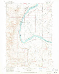
 1962 Boise1962 Print · USGSThe Treasure Valley at the start of the sixties reveals a landscape of expanding towns and complex irrigation networks along the Snake River. Genealogists and historians can trace the foundations of modern Idaho through markers like Initial Point, the mining history of Silver City, and the early infrastructure of Lucky Peak Dam.
 - 1962 Map of Hailey
 1962 Hailey1962 Print · USGSCentral Idaho in the early sixties showcases a landscape of high-altitude ranching and mining at the foot of the Sawtooth Mountains. Genealogists and historians can trace the rail-and-river economy through the Union Pacific Railroad corridor and explore old mining sites like the Triumph Mine or Silver Star Queens Mine.
 - 1964 Map of Hat Peak, 1966 Print
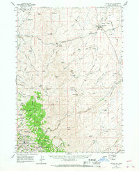
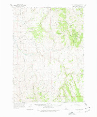
 1964 Hat Peak1966 Print · USGSThe high-desert borderlands of Elko County and Owyhee County are captured here in the mid-1960s, showing the early infrastructure of the Duck Valley Indian Reservation. Trace the rugged water-management network of the era, from remote landmarks like Hat Peak and Butte Spring to the winding South Fork Owyhee River.2 unique versions available
 - 1965 Map of Triangle, 1967 Print
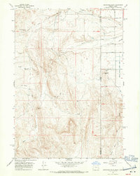
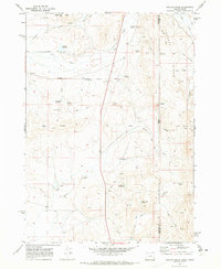
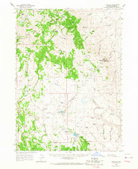 1965 Triangle1967 Print · USGSHigh-desert ranching and mining operations in Owyhee County are captured here in the mid-sixties. Trace the rugged connectivity of the French Grade, find the remote Afterthought Mine, and locate isolated backcountry points like Triangle and its Triangle Airstrip.2 unique versions available
 - 1965 Map of Rooster Comb Peak, 1967 Print
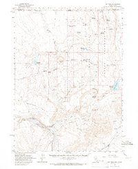
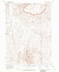
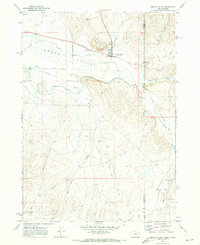
 1965 Rooster Comb Peak1967 Print · USGSThe Owyhee mining district was still deeply marked by its boom-town heritage when this mid-century survey was conducted. Historians can trace the legacy of silver mining through sites like Wagontown and a high density of named claims including Dewey Mine and Negro Mine.2 unique versions available
 - 1965 Map of Silver City, 1968 Print
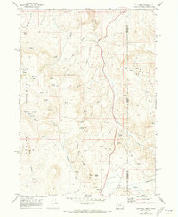
 1965 Silver City1968 Print · USGSSilver City and the Owyhee mining districts are captured here in the mid-sixties, mapping a landscape of historic gold and silver claims. Researchers can pinpoint early settlement locations like Ruby City, the Pioneer Cemetery, and numerous mines including the Poorman and Trade Dollar Mine.
 - 1965 Map of Flint Creek, 1977 Print
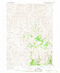
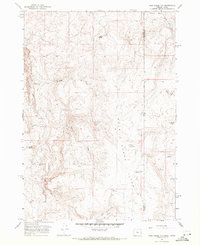
 1965 Flint Creek1977 Print · USGSOwyhee County's high-desert mining country is captured here during the mid-sixties, showing a landscape defined by remote claims and rugged mountain ridges. Genealogists and historians can trace old mining operations like the Nellie Ann Mine and Silver Queen Mine or locate the settlement of Flint.
 - 1967 Map of Graveyard Point, 1970 Print
 1967 Graveyard Point1970 Print · USGSEastern Oregon's arid borderlands come into focus in the late sixties, showcasing a landscape of high-desert irrigation and early historical sites. Researchers can find the Graveyard Point Historical Marker and trace the paths of Succor Creek and Sage Basin Creek.2 unique versions available
 - 1967 Map of Rockville, 1971 Print
 1967 Rockville1971 Print · USGSThe Oregon-Idaho borderlands in the late 1960s reveal a landscape of remote settlements and early transit history near Rockville. Genealogists and historians can trace the Rockville Cem, the Rockville Sch, and the historical Stage Station Site.
 - 1967 Map of Pole Creek Top, 1971 Print
 1967 Pole Creek Top1971 Print · USGSThe Oregon and Idaho borderlands appear in the late sixties as a land of high-elevation basins and remote water management. Trace early ranching infrastructure and remote terrain features such as Spanish Charlie Basin, Mitzi Reservoir, and Antelope Spring.
 - 1967 Map of Adrian, 1971 Print
 1967 Adrian1971 Print · USGSThe Oregon-Idaho border along the Snake River is captured here in the late sixties, showing a landscape defined by irrigation and the rail line. Researchers can trace the Union Pacific tracks through Adrian and Napton, or locate rural landmarks like Big Bend School and Brown Butte.2 unique versions available
 - 1969 Map of Hooker Creek, 1973 Print
 1969 Hooker Creek1973 Print · USGSThe Oregon-Idaho state line comes to life in this late-sixties survey of the high desert ranching country. Genealogists and historians can trace the foundations of the remote Sheaville and Hook settlements alongside reservoirs like Chevally and Last Chance.
 - 1969 Map of Sheaville, 1973 Print
 1969 Sheaville1973 Print · USGSThe Oregon-Idaho borderlands are captured in the late sixties, showing a landscape shaped by ranching and high-desert water sources. Researchers can find historical locations like Camp Lyons (Site), the settlement at Sheaville, and the Coal Mine in the Coal Mine Basin.2 unique versions available
 - 1969 Map of Jordan Valley, 1973 Print
 1969 Jordan Valley1973 Print · USGSJordan Valley and the high desert borderlands appear here in the late sixties, capturing the ranching infrastructure of Malheur County. Genealogists and historians can trace local landmarks like the Pleasant Valley Sch, the Cem, and the Rodeo Grounds.
End of results
Showing maps 1-15 of 15
Top cities of Owyhee County
Frequently asked questions
- What are the different types of historical maps available for Owyhee County?
- What is the oldest map of Owyhee County?
- Where can I purchase historical maps of Owyhee County for my home or office?
- Where can I download high-res historical maps of Owyhee County?
- Are there historical topographic maps available for Owyhee County?
- Is there historical aerial imagery available for Owyhee County?
- Where are historical maps of Owyhee County sourced from?