1930s Maps of Shoshone County, Idaho
Explore 4 historic maps of Shoshone County from the 1930s. These maps offer a rare glimpse into what life looked like during the 1930s — showing old roads, neighborhoods, homes, and landmarks that have changed or disappeared over time.
Whether you're researching your family's past, planning a metal detecting trip, or studying how Shoshone County's landscape evolved across the 1930s, these high-resolution maps are a powerful tool for exploring the history of this region.
- Focus on a specific era: All maps on this page are from the 1930s, giving you a focused view of this time period.
- See what’s changed: Compare century-old streets, trails, and buildings to today's modern landscape using overlays and satellite layers.
- Research with precision: Use these maps for genealogy, historical research, land use analysis, or educational projects.
- View, download, or print: Maps are fully viewable online in high resolution, and can be downloaded or printed for your own records.
Start exploring Shoshone County's history through authentic maps from the 1930s. This is your window into the past.
Shoshone County, ID maps
(4)- 1932 Map of Trout Creek, 1955 Print
 1932 Trout Creek1955 Print · USGSThe Clark Fork River corridor in the 1930s shows a landscape of mountain rail travel and early forest management. Genealogists and historians can locate rural schools like Ayers School, local industry at Tuscor Mill, and old mining sites such as the Jack White Mine.
 - 1935 Map of Trout Creek, 1949 Print
 1935 Trout Creek1949 Print · USGSThe Clark Fork valley and the mining districts of Shoshone County are caught in high detail in the 1930s. Genealogists and historians can trace rail-side schools like Tuscor Sch, the operations at Jack Waite Mine, and old settlements from Noxon to Mace.
 - 1936 Map of Boehls Butte
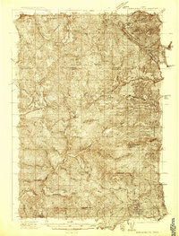 1936 Boehls Butte1936 Print · USGSThe timbered highlands of Shoshone and Clearwater counties are shown here in the mid-1930s before modern road development. Researchers can trace remote pioneer sites like Mix Cabin and identify fire-watch stations such as Bertha Hill Lookout and Boehls Butte.3 unique versions available
 - 1936 Map of Trout Creek
 1936 Trout Creek1936 Print · USGSThe Clark Fork valley and the Bitterroot mountains are captured here in the mid-1930s, showing a landscape defined by timber and mining. Researchers can trace the industrial footprint of the Tuscor Mill, remote operations like the Jack Waite Mine, and old mountain schools such as Flat Sch.2 unique versions available
End of results
Showing maps 1-4 of 4
Top cities of Shoshone County
- Kellogg historical maps
- Pinehurst historical maps
- Osburn historical maps
- Wallace historical maps
- Mullan historical maps
- Smelterville historical maps
See more
Frequently asked questions
- What are the different types of historical maps available for Shoshone County?
- What is the oldest map of Shoshone County?
- Where can I purchase historical maps of Shoshone County for my home or office?
- Where can I download high-res historical maps of Shoshone County?
- Are there historical topographic maps available for Shoshone County?
- Is there historical aerial imagery available for Shoshone County?
- Where are historical maps of Shoshone County sourced from?