1980s Maps of Shoshone County, Idaho
Explore 46 historic maps of Shoshone County from the 1980s. These maps offer a rare glimpse into what life looked like during the 1980s — showing old roads, neighborhoods, homes, and landmarks that have changed or disappeared over time.
Whether you're researching your family's past, planning a metal detecting trip, or studying how Shoshone County's landscape evolved across the 1980s, these high-resolution maps are a powerful tool for exploring the history of this region.
- Focus on a specific era: All maps on this page are from the 1980s, giving you a focused view of this time period.
- See what’s changed: Compare century-old streets, trails, and buildings to today's modern landscape using overlays and satellite layers.
- Research with precision: Use these maps for genealogy, historical research, land use analysis, or educational projects.
- View, download, or print: Maps are fully viewable online in high resolution, and can be downloaded or printed for your own records.
Start exploring Shoshone County's history through authentic maps from the 1980s. This is your window into the past.
Shoshone County, ID maps
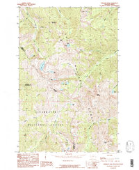
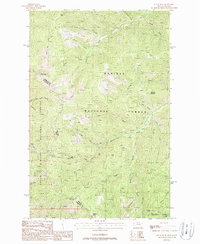
(46)- 1981 Map of Little Goat Mountains
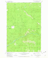 1981 Little Goat Mountains1981 Print · USGSShoshone and Clearwater counties met in these high timberlands during the early eighties, where the national forest boundaries intersect. Researchers can trace remote mountain geography through named sites like Blue Heaven Cabin, Clugs Jumpoff, and Morris Saddle.3 unique versions available
 - 1981 Map of St Maries
 1981 St Maries1981 Print · USGSThe timber and rail hub of St. Maries is captured here in the early 1980s as the river-and-rail economy defined the Panhandle. Researchers can trace historic transport corridors including the Union Pacific tracks and remote landings along the St Joe River and Chatcolet Lake.2 unique versions available
 - 1981 Map of Missoula West
 1981 Missoula West1981 Print · USGSThe Bitterroot Valley and the rugged Bitterroot Range are captured here in the early 1980s, documenting the expansion of Missoula and its outlying timber and river towns. Researchers can trace the Burlington Northern rail corridors or locate remote landmarks like Lolo Hot Springs and Lolo Pass.2 unique versions available
 - 1981 Map of Pinchot Butte, 1982 Print
 1981 Pinchot Butte1982 Print · USGSThe timberlands and river canyons of northern Idaho are captured here in the early eighties, showcasing the intersection of the St Joe National Forest and the Clearwater drainage. Researchers can locate remote sites like the Mary Mix Cabin (Site), trace the shores of Dworshak Reservoir, and identify landmarks like Hershey Bar.2 unique versions available
 - 1981 Map of Potlatch, 1982 Print
 1981 Potlatch1982 Print · USGSLatah County and the northern Nez Perce Reservation are shown here in the early 1980s, documenting the rail-and-river network of the Idaho panhandle. Researchers can trace historic transport lines like the Burlington Northern and find remote landmarks such as the Gold Hill Mine and Potato Hill.2 unique versions available
 - 1982 Map of Headquarters, 1983 Print
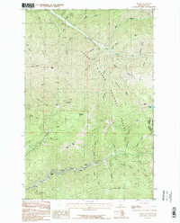
 1982 Headquarters1983 Print · USGSClearwater County's timber and mining country is captured here in the early 1980s, centered on the company town of Headquarters and the historic gold-rush area of Pierce. Genealogists and researchers can trace remote settlements and work sites like Hollywood, New Boehls, and the Oxford Mine.
 - 1984 Map of Sandpoint
 1984 Sandpoint1984 Print · USGSThe Idaho Panhandle in the early 1980s shows a landscape of deep lakes and working forests centered on the rail hub of Sandpoint. Researchers can trace the legacy of regional industry through the Spokane International rail lines and mining sites like the Gold Coin Mine and Sulphide Mine.2 unique versions available
 - 1985 Map of Straight Peak
 1985 Straight Peak1985 Print · USGSThe Montana-Idaho border comes alive in the mid-1980s, documenting the high-country divide within the Lolo National Forest. Trace the remote watersheds of the Bitterroot range, from the heights of Straight Peak to the waters of Trio Lakes and Heart Lake.
 - 1985 Map of Kellogg East
 1985 Kellogg East1985 Print · USGSThe Silver Valley corridor in the 1980s reveals a landscape defined by the South Fork Coeur d'Alene River. Researchers can trace industrial sites like the Tailings near Shont and explore the historic layout of Kellogg, Wardner, and Osburn.2 unique versions available
 - 1985 Map of Prichard
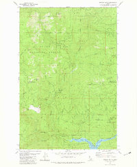
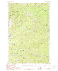
 1985 Prichard1985 Print · USGSShoshone County’s timbered interior is captured here in the mid-1980s, centered on the winding Coeur d'Alene River. Genealogists and local historians can trace the remote settlements of Prichard and Keller, or locate early industrial markers like the Loading Bridge and various named gulches.
 - 1985 Map of Kellogg West
 1985 Kellogg West1985 Print · USGSShoshone County mining towns and river valleys are captured here in the mid-1980s as industry shaped the landscape. Researchers can trace the development of Kellogg and Smelterville, or locate specific landmarks like Mc Lead Hill and the Shoshone County Airport.2 unique versions available
 - 1985 Map of Grizzly Mountain
 1985 Grizzly Mountain1985 Print · USGSShoshone County, Idaho, is documented here in the mid-1980s as a landscape of deep timber and steep ridges within the Coeur d'Alene National Forest. Trace the winding Coeur d'Alene River and locate family-named landmarks like Grizzly Mountain and Character Peak.
 - 1985 Map of Murray
 1985 Murray1985 Print · USGSThe Shoshone County highlands are captured here in the mid-1980s, revealing a landscape shaped by mining and forest management. Researchers can trace the extensive Dredge Tailings near Prichard or locate remote landmarks like Jack Waite Forks and the Montana Idaho Trail.
 - 1985 Map of St. Joe
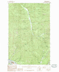
 1985 St. Joe1985 Print · USGSThe St. Joe River valley in the Idaho panhandle was a rugged landscape of ridges and timber at the mid-eighties. Researchers can trace the river's winding path past the settlement of St Joe, locate Urquhart Lake, and identify family-named landmarks like Honey Jones Peak.
 - 1985 Map of Burke
 1985 Burke1985 Print · USGSThe high Canyon Creek corridor of Shoshone County comes alive in the mid-1980s, documenting a landscape where mining life and mountain terrain meet. Researchers can pinpoint historic settlements like Burke, Black Bear, and Gem or trace early extraction sites near Tiger Peak.2 unique versions available
 - 1985 Map of Cataldo
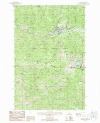
 1985 Cataldo1985 Print · USGSIn the mid-1980s, the Coeur d'Alene River valley around Shoshone County remained a landscape defined by its historic mission and riverfront settlements. Researchers can trace the grounds of Old Mission State Park, the layout of Cataldo, and the riverside community of Kingston.
 - 1985 Map of Bumblebee Peak
 1985 Bumblebee Peak1985 Print · USGSShoshone County, Idaho, is depicted in the mid-1980s as a densely forested mountain region managed by the Forest Service. Trace the network of timber-access trails and remote drainages like Devils Gorge Creek and Gimlet Creek near the Bumblebee Meadow Campground.
 - 1985 Map of Osburn
 1985 Osburn1985 Print · USGSShoshone County’s mining and mountain corridors are captured here in the mid-1980s as they weave through the Idaho interior. Researchers can trace the path of Beaver Creek from the settlement of Delta down to Osburn, or locate high crossings at Kings Pass and Dobson Pass.
 - 1985 Map of Steamboat Creek
 1985 Steamboat Creek1985 Print · USGSShoshone County is captured here in the mid-eighties as a dense network of mountain drainages and national forest land. Researchers can trace the winding Coeur D'Alene River or locate landmarks like Steamboat Peak and the Wood Rat Trail.
 - 1987 Map of Coeur D'Alene
 1987 Coeur D'Alene1987 Print · USGSNorthern Idaho in the late eighties shows a landscape of deep-water lakes and heavy industry where the timber and mining economies meet growing valley settlements. Genealogists and historians can trace the footprints of the Sunshine Mine, the rail sidings at Corbin Junction, and the historic Old Mission State Park.3 unique versions available
 - 1988 Map of Mullan
 1988 Mullan1988 Print · USGSThe Silver Valley mining district comes into sharp focus during the late 1980s, centered on the industrial town of Mullan. Researchers can trace the extensive footprints of the Lucky Friday Mine, Star Mine, and Atlas Mine alongside the historic Old RR Grade.
 - 1988 Map of Sherlock Peak
 1988 Sherlock Peak1988 Print · USGSThe Idaho-Montana borderlands come alive in the late eighties, showing a wilderness of river canyons and high mountain peaks. You can trace the rugged Pack Trail network to the Gold Nugget Mine or locate the solitary Grave along the St Joe River.
 - 1988 Map of Black Peak
 1988 Black Peak1988 Print · USGSThe high timberlands of the Montana-Idaho border are captured in the late eighties, documenting the intersection of three national forests. Mineral hunters and historians can locate numerous Prospects, the Duthie (Site) settlement, and landmarks like Black Peak.
 - 1988 Map of Thompson Pass
 1988 Thompson Pass1988 Print · USGSThe Bitterroot Range crest in the late eighties serves as a backdrop for high-altitude mining and timber land. Researchers can trace historic crossing points at Thompson Pass and Glidden Pass or locate alpine features like Revett Lake.
 - 1988 Map of Peggy Peak
 1988 Peggy Peak1988 Print · USGSThe high peaks and drainages of the Idaho panhandle are captured in the late twentieth century as they appeared within the St Joe National Forest. Hikers and historians can trace the intricate Pack Trail network connecting landmarks like Peggy Peak and Elk Prairie.
Showing maps 1-25 of 46
Top cities of Shoshone County
- Kellogg historical maps
- Pinehurst historical maps
- Osburn historical maps
- Wallace historical maps
- Mullan historical maps
- Smelterville historical maps
See more
Frequently asked questions
- What are the different types of historical maps available for Shoshone County?
- What is the oldest map of Shoshone County?
- Where can I purchase historical maps of Shoshone County for my home or office?
- Where can I download high-res historical maps of Shoshone County?
- Are there historical topographic maps available for Shoshone County?
- Is there historical aerial imagery available for Shoshone County?
- Where are historical maps of Shoshone County sourced from?