1990s Maps of Shoshone County, Idaho
Explore 78 historic maps of Shoshone County from the 1990s. These maps offer a rare glimpse into what life looked like during the 1990s — showing old roads, neighborhoods, homes, and landmarks that have changed or disappeared over time.
Whether you're researching your family's past, planning a metal detecting trip, or studying how Shoshone County's landscape evolved across the 1990s, these high-resolution maps are a powerful tool for exploring the history of this region.
- Focus on a specific era: All maps on this page are from the 1990s, giving you a focused view of this time period.
- See what’s changed: Compare century-old streets, trails, and buildings to today's modern landscape using overlays and satellite layers.
- Research with precision: Use these maps for genealogy, historical research, land use analysis, or educational projects.
- View, download, or print: Maps are fully viewable online in high resolution, and can be downloaded or printed for your own records.
Start exploring Shoshone County's history through authentic maps from the 1990s. This is your window into the past.
Shoshone County, ID maps
(78)- 1990 Map of Faset Peak, 1991 Print
 1990 Faset Peak1991 Print · USGSThe high ridges of Shoshone and Bonner counties are documented here in the early 1990s as the national forests were managed for both timber and recreation. Researchers can trace the winding Ermine Ridge Trail, locate the INDEPENDENCE site, and follow the drainages of Spruce Creek.
 - 1990 Map of Bechtel Butte, 1991 Print
 1990 Bechtel Butte1991 Print · USGSThe timbered highlands of Northern Idaho are captured here as they appeared in the early 1990s at the intersection of three counties. Local historians can trace the headwaters of the St Maries River and locate features like the Race Track near Bechtel Butte.
 - 1990 Map of Crystal Peak, 1991 Print
 1990 Crystal Peak1991 Print · USGSShoshone and Benewah counties meet along these high Idaho ridges as they appeared in the early nineties. Researchers can trace the remote network of fire-watch trails leading to Crystal Lookout Tower and summits like Santa Peak and Renfro Peak.
 - 1990 Map of Lamb Peak, 1991 Print
 1990 Lamb Peak1991 Print · USGSThe deep forest of the Coeur d'Alene backcountry comes alive in this 1990s record of Shoshone and Kootenai Counties. Researchers can trace historic access routes like the Magee-Bear Trail and locate isolated landmarks like the Magee Historic Site and Erickson Ranch.
 - 1990 Map of Clarkia, 1991 Print
 1990 Clarkia1991 Print · USGSThe Idaho Panhandle's timber and mining country comes to life in the 1990s as the St Maries River carves through these mountains. Genealogists and researchers can trace the settlement of Clarkia, find Jims Spur, or locate the extensive Dredge Tailings along the valley floor.
 - 1992 Map of Thompson Falls, 1993 Print
 1992 Thompson Falls1993 Print · USGSNorthwest Montana in the early nineties is defined here by the winding Clark Fork and its major impoundments. Researchers can trace the river-valley settlements of Noxon, Trout Creek, and Thompson Falls or locate mining sites like the Copper King Mine.
 - 1994 Map of Wallace
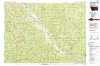
 1994 Wallace1994 Print · USGSThe Bitterroot Mountains and the mining heart of the Silver Valley are captured here in the mid-1990s. Researchers can locate active and historic mineral operations such as the Argentine Mine and Last Chance Mines, while tracing the Milwaukee Road through the high passes.
 - 1994 Map of Pinchot Butte, 1997 Print
 1994 Pinchot Butte1997 Print · USGSThe deep timberlands of Shoshone and Clearwater counties are shown in the 1990s as a maze of forest trails and river valleys. Trace the landscape from Pinchot Butte down to the Dworshak Reservoir, passing the Mary Mix Cabin (Site) and New Boehls.
 - 1994 Map of Hoodoo Pass, 1997 Print
 1994 Hoodoo Pass1997 Print · USGSThe high Bitterroot divide between Idaho and Montana is captured here in the mid-1990s, where national forest boundaries meet at the crest. Researchers can trace the remote network of ridge roads and alpine waters, from the Radio Tower at Hoodoo Pass to the headwaters of the North Fork Clearwater River.
 - 1994 Map of Chamberlain Mtn, 1997 Print
 1994 Chamberlain Mtn1997 Print · USGSShoshone and Clearwater counties are shown in the mid-1990s, where the high ridges of the Panhandle and North Central Idaho meet. Researchers can trace historical footprints at Klug Cabin, find the remote Clearwater Mine, and locate old mountain camps at Chamberlain Meadows.
 - 1994 Map of Anthony Peak, 1997 Print
 1994 Anthony Peak1997 Print · USGSThe high country of Shoshone and Clearwater counties is captured in the mid-nineties, showing a landscape of managed forests and alpine peaks. Researchers can trace the headwaters of the Potlatch River and locate remote landmarks like Anthony Peak and Telephone Booth Hill.
 - 1994 Map of Buzzard Roost, 1997 Print
 1994 Buzzard Roost1997 Print · USGSShoshone and Clearwater counties meet in this high-altitude wilderness in the mid-1990s, where National Forest boundaries converge. Researchers can locate remote backcountry landmarks like Chicadee Cabin, the Devils Pulpit, and the Little North Fork Clearwater River.
 - 1994 Map of Bechtel Butte, 1997 Print
 1994 Bechtel Butte1997 Print · USGSIn the 1990s, the St Joe National Forest remained a remote landscape of timber and waterways at the intersection of Shoshone, Latah, and Clearwater counties. Researchers can trace the drainage of the St Maries River and locate landmarks like Sherwin Point and Badger Meadows.
 - 1994 Map of Bacon Peak, 1997 Print
 1994 Bacon Peak1997 Print · USGSThe Idaho Panhandle wilderness comes into focus in the 1990s at the meeting point of the St. Joe and Clearwater National Forests. Researchers can trace the high-mountain hydrology of Five Lakes Butte, Bacon Peak, and the protected waters of the Scenic River corridor.
 - 1994 Map of Mallard Peak, 1997 Print
 1994 Mallard Peak1997 Print · USGSThe high divide of the Idaho Panhandle is documented here in the mid-nineties, where the St Joe and Clearwater forests converge. Hikers and researchers can trace the alpine terrain of the Mallard Larkins Pioneer Area, locating remote summits like Mallard Peak and the sapphire waters of Heart Lake.
 - 1994 Map of Pole Mountain, 1997 Print
 1994 Pole Mountain1997 Print · USGSShoshone County and Clearwater County met along these remote ridges during the mid-1990s, where high-altitude wilderness remained largely untouched. Hikers and researchers can trace backcountry routes like the Avery North Fork and locate alpine features such as Cliff Lake and Scribner Peak.
 - 1994 Map of Grice Ridge, 1997 Print
 1994 Grice Ridge1997 Print · USGSThe high timber country of the Idaho Panhandle is captured here in the mid-1990s as it spans the Shoshone and Clearwater county lines. Forest historians and researchers can trace the locations of Camp 40 (Site) and Freezout Camp near the divide of Grice Ridge.
 - 1995 Map of Calder, 1997 Print
 1995 Calder1997 Print · USGSThe St Joe River corridor in the 1990s reveals a landscape of high-country forestry and riverside settlement in northern Idaho. Local historians can trace the Old Railroad Grade past Calder and find landmarks like Spooky Butte or the Gaging Station.
 - 1995 Map of Mastodon Mountain, 1997 Print
 1995 Mastodon Mountain1997 Print · USGSShoshone County's rugged backcountry is mapped here in the mid-nineties, showing the high summits and deep canyons of the St Joe National Forest. Trace the historical mining footprint at Franklin Mine and find remote high-country landmarks like Nud Lookout on Dunn Peak.
 - 1995 Map of Huckleberry Mountain, 1997 Print
 1995 Huckleberry Mountain1997 Print · USGSShoshone County is captured here in the mid-1990s, revealing a landscape of steep timbered ridges and fire lookouts. Researchers can trace the drainages of Mica Creek and Bussel Creek or locate the high Lookout station atop Huckleberry Mountain.
 - 1995 Map of Marble Creek, 1997 Print
 1995 Marble Creek1997 Print · USGSThe St Joe River corridor in the mid-1990s reveals a landscape shaped by timber and topography within the St Joe National Forest. Genealogists and historians can trace the Old RR Grade through Herrick or find named landmarks like Cemetery Ridge and Big Creek Cabin.
 - 1995 Map of Sherlock Peak, 1997 Print
 1995 Sherlock Peak1997 Print · USGSThe Montana-Idaho border highlands are revealed in this mid-nineties survey, showing the confluence of three national forests. Researchers can trace historical high-country land use through the Gold Nugget Mine and the remote Grave Heller Creek site.
 - 1995 Map of Merry Creek, 1997 Print
 1995 Merry Creek1997 Print · USGSShoshone County during the mid-nineties shows a landscape defined by the timber industry and historical transportation routes. Genealogists and historians can trace the foundations of Clarkia and locate industrial remnants like the Sawmill and the Old RR Grade.
 - 1995 Map of Shefoot Mountain, 1997 Print
 1995 Shefoot Mountain1997 Print · USGSShoshone County’s high forest reaches are captured in the mid-1990s, revealing a landscape shaped by early rail engineering and mountain peaks. Trace the winding Old RR Grade through its mountain Tunnels or locate isolated Prospects and a Grave near Kelly Pinnacle.
 - 1995 Map of Crystal Peak, 1997 Print
 1995 Crystal Peak1997 Print · USGSHigh in the Panhandle mountains during the mid-nineties, this survey captures the timberlands where Benewah and Shoshone counties meet. Researchers can trace the ridgelines from Gold Ridge to Blackwell Hump or locate the site of the Crystal Peak Lookout.
Showing maps 1-25 of 78
Top cities of Shoshone County
- Kellogg historical maps
- Pinehurst historical maps
- Osburn historical maps
- Wallace historical maps
- Mullan historical maps
- Smelterville historical maps
See more
Frequently asked questions
- What are the different types of historical maps available for Shoshone County?
- What is the oldest map of Shoshone County?
- Where can I purchase historical maps of Shoshone County for my home or office?
- Where can I download high-res historical maps of Shoshone County?
- Are there historical topographic maps available for Shoshone County?
- Is there historical aerial imagery available for Shoshone County?
- Where are historical maps of Shoshone County sourced from?