1960s Maps of Shoshone County, Idaho
Explore 35 historic maps of Shoshone County from the 1960s. These maps offer a rare glimpse into what life looked like during the 1960s — showing old roads, neighborhoods, homes, and landmarks that have changed or disappeared over time.
Whether you're researching your family's past, planning a metal detecting trip, or studying how Shoshone County's landscape evolved across the 1960s, these high-resolution maps are a powerful tool for exploring the history of this region.
- Focus on a specific era: All maps on this page are from the 1960s, giving you a focused view of this time period.
- See what’s changed: Compare century-old streets, trails, and buildings to today's modern landscape using overlays and satellite layers.
- Research with precision: Use these maps for genealogy, historical research, land use analysis, or educational projects.
- View, download, or print: Maps are fully viewable online in high resolution, and can be downloaded or printed for your own records.
Start exploring Shoshone County's history through authentic maps from the 1960s. This is your window into the past.
Shoshone County, ID maps
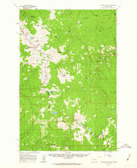
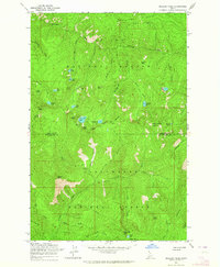
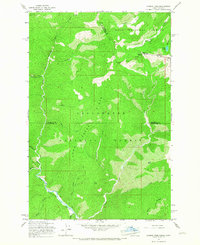
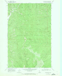
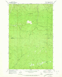
(35)- 1960 Map of Wallace
 1960 Wallace1960 Print · USGSNorthwestern Montana and the Idaho panhandle are captured in the late fifties, showing the vast Flathead Indian Reservation and the mining districts of the Bitterroot Range. Researchers can trace the rail lines of the Northern Pacific or locate early sites like the Morning Mine and the National Bison Range.
 - 1960 Map of Hamilton
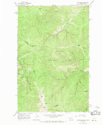
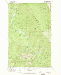
 1960 Hamilton1960 Print · USGSThe Bitterroot Valley and surrounding high country are captured here during the late fifties, showing the region's transition into a modern forest and rail corridor. Researchers can trace the path of the Northern Pacific through Missoula or locate landmarks like Fort Missoula and Lake Como.
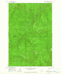
 - 1960 Map of Straight Peak, 1963 Print
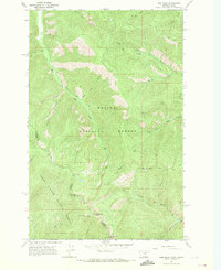
 1960 Straight Peak1963 Print · USGSThe high Bitterroots along the Idaho and Montana border are shown here as they were mapped in the late fifties. You can locate remote high-country outposts like Hole-in-the-Wall Ranch, the Clear Water Crossing Ranger Station, and the Placer Mine near the Montana line.3 unique versions available
 - 1961 Map of Fernwood, 1963 Print
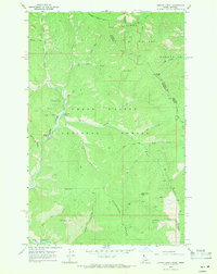
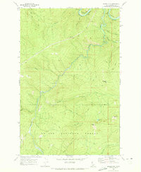
 1961 Fernwood1963 Print · USGSThe St Maries River valley and the surrounding timberlands are captured here in the early 1960s. Researchers can trace the route of the Chicago Milwaukee St Paul and Pacific railroad through Fernwood and find local landmarks like the Cem at Santa.2 unique versions available
 - 1961 Map of Bovill, 1963 Print
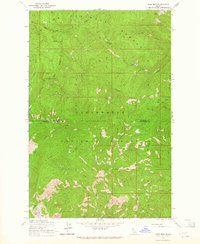
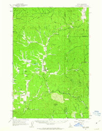 1961 Bovill1963 Print · USGSBovill and Helmer are captured during a period of active rail and mining operations in the Idaho panhandle. Researchers can trace the Milwaukee Road through the timberlands, locating the Mizpah Mine, local Claypits, and the Cem near Bovill.2 unique versions available
 - 1961 Map of Lakeview, 1963 Print
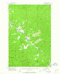
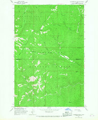
 1961 Lakeview1963 Print · USGSThe Idaho Panhandle's rugged mining interior is captured here in the early 1960s, centered on the lakeside settlement of Lakeview. Researchers can trace old mountain operations like the Keep Cool Mine or locate the Erickson Ranch and Trail Creek Work Center.2 unique versions available
 - 1963 Map of Sandpoint
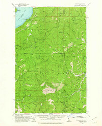
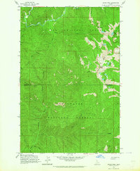
 1963 Sandpoint1963 Print · USGSNorthern Idaho and eastern Washington are shown in the early sixties as a high-country network of timber, mining, and rail. Genealogists and historians can trace the Great Northern line through Metaline Falls, Bonners Ferry, and past the Finch Mine.
 - 1963 Map of Mallard Peak, 1964 Print
 1963 Mallard Peak1964 Print · USGSThe high Idaho backcountry during the early 1960s is mapped here at the intersection of two national forests. Trace the remote ridgelines and alpine basins once monitored from Mallard Peak Lookout and Black Mtn Lookout, or locate seasonal trails like the Boundary Forest Trail.4 unique versions available
 - 1963 Map of Buzzard Roost, 1964 Print
 1963 Buzzard Roost1964 Print · USGSShoshone and Clearwater counties meet in this high backcountry during the early 1960s, where the river and national forests define the landscape. Researchers can locate remote landmarks like Chicadee Cabin, trace the Goat Ridge peaks, and follow Little North Fork Clearwater River.2 unique versions available
 - 1963 Map of Pole Mtn, 1964 Print
 1963 Pole Mtn1964 Print · USGSThe high Idaho backcountry comes into focus during the early sixties, showing the wild intersection of Shoshone and Clearwater counties. Trace old routes along a Pack Trail or locate remote alpine waters such as Cliff Lake and Steve Lake.3 unique versions available
 - 1963 Map of Bacon Peak, 1964 Print
 1963 Bacon Peak1964 Print · USGSShoshone and Clearwater Counties are shown here during the early sixties, documenting a high-elevation wilderness split by two National Forests. Researchers can trace the rugged drainages of the St Joe River and find landmarks like Bacon Peak and Five Lakes Butte.4 unique versions available
 - 1964 Map of Hamilton
 1964 Hamilton1964 Print · USGSThe Bitterroot Valley and its surrounding peaks are captured in detail during the mid-1960s, showing the early infrastructure of the Northern Rockies. Genealogists and historians can trace family roots in Hamilton and Stevensville or follow the historic Lolo Trail and Nez Perce Trail.
 - 1965 Map of Hoodoo Pass, 1967 Print
 1965 Hoodoo Pass1967 Print · USGSHigh in the Bitterroot range during the mid-sixties, this survey captures the transition between Idaho and Montana at Hoodoo Pass. Trace the historic Hoodoo Pack Trail past Hoodoo Lake and the remote drainage of Vanderbilt Gulch.3 unique versions available
 - 1965 Map of Chamberlain Mtn, 1967 Print
 1965 Chamberlain Mtn1967 Print · USGSThe high Idaho backcountry of Shoshone and Clearwater counties comes into focus in the mid-1960s, showing a landscape defined by forest service operations and mineral exploration. Researchers can trace remote mountain activity through landmarks like the Clearwater Mine, Klug Cabin, and the extensive Pack Trail network.2 unique versions available
 - 1966 Map of Taylor Peak, 1971 Print
 1966 Taylor Peak1971 Print · USGSThe Idaho-Montana borderlands are captured here in the mid-1960s, showing the high summits of the Shoshone Range. Researchers can trace old mountain routes like the Pack Trail and locate the remote Hawkseye Camp along the banks of Shoshone Creek.
 - 1966 Map of Bloom Peak, 1971 Print
 1966 Bloom Peak1971 Print · USGSThe Bitterroot and Cabinet mountain region during the mid-1960s reveals a high-country landscape of forest service lookouts and pack trails. Researchers can trace the state line through summits like Bloom Peak and locate the Lookout Tower on Minton Peak or the remote Mine near Attebury Creek.3 unique versions available
 - 1966 Map of Jordan Creek, 1971 Print
 1966 Jordan Creek1971 Print · USGSThe Idaho-Montana state line runs through this mountainous landscape in the mid-sixties, where the Shoshone Range meets the Kaniksu National Forest. You can trace backcountry routes like the Pack Trail past East Cathedral Peak and Jordan Creek Campground.2 unique versions available
 - 1966 Map of Cathedral Peak, 1971 Print
 1966 Cathedral Peak1971 Print · USGSShoshone County high country is shown in the mid-1960s, centered on the remote river valleys of the national forest. Researchers can trace forest management history and early recreational sites like the Beaver Work Center, Senator Creek Campground, and the Pack Trail network.
 - 1966 Map of Spyglass Peak, 1971 Print
 1966 Spyglass Peak1971 Print · USGSShoshone County's rugged forest interior is captured here in the mid-1960s, showing a landscape managed by the forest service and occasional prospectors. Researchers can locate the Magee Ranger Station, the Magee Landing Strip, and the Lookout Tower atop Spyglass Peak.2 unique versions available
 - 1966 Map of Pond Peak, 1971 Print
 1966 Pond Peak1971 Print · USGSShoshone County’s mountain interior is captured here in the mid-sixties, showing the rugged peaks and river valleys of the Idaho panhandle. Researchers can trace historic backcountry sites like the Rock City Cabin, the Lookout Tower on Little Guard Peak, and the Devils Elbow Campground.2 unique versions available
 - 1966 Map of Gem Peak, 1971 Print
 1966 Gem Peak1971 Print · USGSThe high Bitterroot Divide comes into focus in the mid-1960s as it marks the border between Idaho and Montana. Hikers and historians can trace high-altitude forest service infrastructure like the Gem Peak Lookout Tower, the Holliday Mine, and the Rice Draw Trail.2 unique versions available
 - 1969 Map of Bathtub Mtn, 1973 Print
 1969 Bathtub Mtn1973 Print · USGSShoshone County’s high wilderness is captured here in the late sixties, showing a landscape defined by ridgelines and pack trails. Researchers can trace the drainage of Lightning Creek or locate landmarks like Bathtub Meadows and the lookout point at Surveyors Ridge.
 - 1969 Map of Marble Mountain, 1973 Print
 1969 Marble Mountain1973 Print · USGSShoshone County high country is documented here in the late sixties, where the St Joe River meets the CM St P & P railroad. Researchers can trace historic routes like the Homestead Trail and locate the mountain settlement at Pocono.2 unique versions available
 - 1969 Map of Montana Peak, 1973 Print
 1969 Montana Peak1973 Print · USGSShoshone County’s high country is surveyed here in the late sixties, showing a wilderness landscape defined by the St Joe National Forest. Researchers can trace remote mountain geography through landmarks like Snow Peak L.O., Dismal Lake, and the winding Little North Fork Clearwater River.
 - 1969 Map of Anthony Peak, 1973 Print
 1969 Anthony Peak1973 Print · USGSShoshone and Clearwater counties are captured in the late sixties as a wilderness of timber and high-country watersheds. Researchers can locate remote landmarks like the Lookout Tower on Anthony Peak and trace early routes such as the Pack Trail and Jeep Trail.2 unique versions available
Showing maps 1-25 of 35
Top cities of Shoshone County
- Kellogg historical maps
- Pinehurst historical maps
- Osburn historical maps
- Wallace historical maps
- Mullan historical maps
- Smelterville historical maps
See more
Frequently asked questions
- What are the different types of historical maps available for Shoshone County?
- What is the oldest map of Shoshone County?
- Where can I purchase historical maps of Shoshone County for my home or office?
- Where can I download high-res historical maps of Shoshone County?
- Are there historical topographic maps available for Shoshone County?
- Is there historical aerial imagery available for Shoshone County?
- Where are historical maps of Shoshone County sourced from?