Old Maps of Shoshone County, Idaho for Academic Research
Study the evolution of Shoshone County with 567 high-resolution historic maps. Whether you're teaching, researching, or modeling changes in land use, these maps provide essential visual documentation of urban, environmental, and geographic change.
- Analyze long-term change: Track patterns in development, transportation, and natural features.
- Ideal for environmental or urban studies: Support academic projects with primary historical map data.
- Use in the classroom or lab: Educators and researchers rely on these maps to bring historical context to life.
These maps are a powerful tool for teaching, research, and visualizing how Shoshone County has changed over the decades.
Shoshone County, ID maps
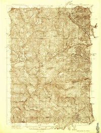
(567)- 1901 Map of Coeur D'Alene District, 1954 Print
 1901 Coeur D'Alene District1954 Print · USGSIdaho's Silver Valley hums with industrial activity at the turn of the century as silver and lead mining reach their peak. Genealogists and historians can trace the deep-vein claims of the Bunker Hill and Sullivan Mine or the narrow-canyon settlements of Burke and Mace.
 - 1903 Map of Coeur D'Alene District
 1903 Coeur D'Alene District1903 Print · USGSThe Silver Valley was at its industrial peak at the start of the century, defined by a dense network of silver and lead operations. Genealogists and historians can trace early rail lines and major works like the Standard Mines, Gem Mine, and the town of Wardner.
 - 1906 Map of Coeur D'Alene District
 1906 Coeur D'Alene District1906 Print · USGSIdaho’s Silver Valley is shown at its industrial peak in the early twentieth century, when mines and railroads saturated these steep canyons. Genealogists and researchers can trace the rail lines to remote mining camps and famous works like the Hecla Mine, Bunker Hill and Sullivan Mines, and Burke.3 unique versions available
 - 1909 Map of Cataldo, 1954 Print
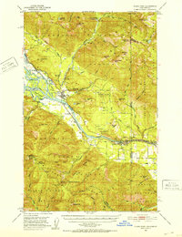
 1909 Cataldo1954 Print · USGSShoshone County was at its mining peak during the first decade of the 1900s, defined by the river-and-rail economy of the Idaho Panhandle. Genealogists can trace family roots through the silver and lead districts at Kellogg and Wardner, or find remote landmarks like Magee Ranch and the Old Mission.
 - 1911 Map of Cataldo
 1911 Cataldo1911 Print · USGSThe Idaho Panhandle's mining and timber country is documented here in the early twentieth century, showing the rail-linked settlements of the Coeur d'Alene River valley. Genealogists can trace family sites at Old Mission, Kellogg, and Magee Ranch.2 unique versions available
 - 1911 Map of Priest Lake, 1954 Print
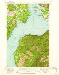
 1911 Priest Lake1954 Print · USGSThe Idaho Panhandle during the early 1900s was a landscape of deep lakes and high-altitude mining operations connected by new rail lines. Genealogists and historians can trace pioneer settlements like Port Hill and Coolin, or locate remote industrial sites such as the Queen Mine and Mountain Chief Mine.
 - 1911 Map of Lolo, 1954 Print
 1911 Lolo1954 Print · USGSThe Bitterroot wilderness at the dawn of the Forest Service era is documented here through its early camps and trail networks. Researchers can locate remote outposts like Moose City, the Clearwater Gold and Copper Company, and the historic Indian Post Office landmark.
 - 1913 Map of Lolo
 1913 Lolo1913 Print · USGSThe Bitterroot wilderness of the early 1900s is documented here through a web of mining camps, ranger stations, and high mountain passes. Genealogists and researchers can locate remote sites like Moose City, Williams Ranch, and the Clearwater Gold and Copper Company.2 unique versions available
 - 1913 Map of Priest Lake
 1913 Priest Lake1913 Print · USGSThe Idaho Panhandle was a rugged network of rail sidings and mining camps in the years before the Great War. Genealogists and historians can trace old homesteads and depots from Sandpoint up to the Continental Mine and the remote border crossing at Addie.3 unique versions available
 - 1914 Map of Avery, 1954 Print
 1914 Avery1954 Print · USGSThe Bitterroot Range was a hive of mining and rail activity when this survey was conducted. You can trace the Chicago Milwaukee and St Paul Railway route or locate early mining operations like the Snowstorm Mine and Mastodon Mine.
 - 1917 Map of Avery, 1949 Print
 1917 Avery1949 Print · USGSThe mining camps and mountain passes of the Idaho-Montana border are documented here just after the peak of the regional silver and lead boom. You can trace the path of the Milwaukee St Paul and Pacific RR or locate historic claims like the Snowstorm Mine and Monitor Mine.
 - 1918 Map of St Regis, 1946 Print
 1918 St Regis1946 Print · USGSMineral County, Montana, was a bustling corridor for mining and rail traffic during the early twentieth century. Researchers can trace the path of the Northern Pacific through St Regis or locate remote sites like the Gold Crown Mine and Gold Nugget Cabin.
 - 1919 Map of St. Regis
 1919 St. Regis1919 Print · USGSThe Montana-Idaho borderlands were a hub of mountain mining and transcontinental railroading during the early twentieth century. Genealogists and historians can locate remote settlements like DeBorgia and Henderson or trace old mining operations such as the Saltese Consolidated Mine and Gold Crown Mine.
 - 1923 Map of Washington Creek
 1923 Washington Creek1923 Print · USGSThe Clearwater and Shoshone county line area in the early 1920s shows a frontier landscape of remote homesteads and forest reserves. Genealogists can locate named residents such as Fred Forsman and James Conner or the early buildings at Headquarters.
 - 1932 Map of Trout Creek, 1955 Print
 1932 Trout Creek1955 Print · USGSThe Clark Fork River corridor in the 1930s shows a landscape of mountain rail travel and early forest management. Genealogists and historians can locate rural schools like Ayers School, local industry at Tuscor Mill, and old mining sites such as the Jack White Mine.
 - 1935 Map of Trout Creek, 1949 Print
 1935 Trout Creek1949 Print · USGSThe Clark Fork valley and the mining districts of Shoshone County are caught in high detail in the 1930s. Genealogists and historians can trace rail-side schools like Tuscor Sch, the operations at Jack Waite Mine, and old settlements from Noxon to Mace.
 - 1936 Map of Boehls Butte
 1936 Boehls Butte1936 Print · USGSThe timbered highlands of Shoshone and Clearwater counties are shown here in the mid-1930s before modern road development. Researchers can trace remote pioneer sites like Mix Cabin and identify fire-watch stations such as Bertha Hill Lookout and Boehls Butte.3 unique versions available
 - 1936 Map of Trout Creek
 1936 Trout Creek1936 Print · USGSThe Clark Fork valley and the Bitterroot mountains are captured here in the mid-1930s, showing a landscape defined by timber and mining. Researchers can trace the industrial footprint of the Tuscor Mill, remote operations like the Jack Waite Mine, and old mountain schools such as Flat Sch.2 unique versions available
 - 1943 Map of Boehls Butte
 1943 Boehls Butte1943 Print · USGSThe Bitterroot Mountains of Northern Idaho are documented here during the mid-1940s, showing a rugged landscape managed for timber and fire protection. Genealogists and historians can locate remote mountain dwellings like Mix Cabin and prominent fire towers including Boehls Butte Lookout.2 unique versions available
 - 1949 Map of Packsaddle Mtn, 1959 Print
 1949 Packsaddle Mtn1959 Print · USGSLake Pend Oreille and the surrounding national forests are captured here in the late 1940s as rail and mining operations shaped the rugged terrain. Genealogists and historians can locate old post offices like Broten PO and remote sites such as Whisky Rock or the Green Monarch Mine.3 unique versions available
 - 1950 Map of Twin Crags, 1980 Print
 1950 Twin Crags1980 Print · USGSThe high Idaho ridges of Shoshone and Kootenai counties are captured here in the early 1950s, showing a landscape of lookouts and mining claims. Trace the reach of the Palisade Mine, locate the high Frost Peak Lookout, and follow the many forks of Pine Creek.
 - 1951 Map of Packsaddle Mtn
 1951 Packsaddle Mtn1951 Print · USGSLake Pend Oreille was a hub of mining and rail transit in the early fifties, with many settlements and extraction sites lining its shores. Researchers can locate the Broten PO, trace the Northern Pacific tracks, and find operations like the Green Monarch Mine.2 unique versions available
 - 1951 Map of Clark Fork, 1952 Print
 1951 Clark Fork1952 Print · USGSThe Idaho-Montana borderlands are captured here in the early 1950s just as the river valley was preparing for major hydroelectric changes. Researchers can trace the legacy of local mining at Whitedelf Mine or locate early school sites like the River Echo Sch (Aband).4 unique versions available
 - 1952 Map of Twin Crags
 1952 Twin Crags1952 Print · USGSHigh peaks and mining claims define this Shoshone County wilderness in the early fifties, where the national forest boundaries meet at the St Joe Divide. Local historians can trace the geography of early industry at the Palisade Mine and the timbered basins of Pine Creek.
 - 1955 Map of Pullman, 1963 Print
 1955 Pullman1963 Print · USGSThe Palouse and Clearwater regions are captured here in the mid-1950s, showing the height of the rail-and-river economy. Genealogists and historians can trace rail lines like the Camas Prairie RR, find local landmarks like Whitman County Memorial Cem, and locate early academic centers at Washington State University and the University of Idaho.3 unique versions available
Showing maps 1-25 of 567
Top cities of Shoshone County
- Kellogg historical maps
- Pinehurst historical maps
- Osburn historical maps
- Wallace historical maps
- Mullan historical maps
- Smelterville historical maps
See more
Frequently asked questions
- What are the different types of historical maps available for Shoshone County?
- What is the oldest map of Shoshone County?
- Where can I purchase historical maps of Shoshone County for my home or office?
- Where can I download high-res historical maps of Shoshone County?
- Are there historical topographic maps available for Shoshone County?
- Is there historical aerial imagery available for Shoshone County?
- Where are historical maps of Shoshone County sourced from?