1980s Maps of Macoupin County, Illinois
Explore 18 historic maps of Macoupin County from the 1980s. These maps offer a rare glimpse into what life looked like during the 1980s — showing old roads, neighborhoods, homes, and landmarks that have changed or disappeared over time.
Whether you're researching your family's past, planning a metal detecting trip, or studying how Macoupin County's landscape evolved across the 1980s, these high-resolution maps are a powerful tool for exploring the history of this region.
- Focus on a specific era: All maps on this page are from the 1980s, giving you a focused view of this time period.
- See what’s changed: Compare century-old streets, trails, and buildings to today's modern landscape using overlays and satellite layers.
- Research with precision: Use these maps for genealogy, historical research, land use analysis, or educational projects.
- View, download, or print: Maps are fully viewable online in high resolution, and can be downloaded or printed for your own records.
Start exploring Macoupin County's history through authentic maps from the 1980s. This is your window into the past.
Macoupin County, IL maps
(18)- 1982 Map of Litchfield
 1982 Litchfield1982 Print · USGSThe coal and rail corridors of Central Illinois are captured here in the early eighties as the region balanced industrial mining with its agricultural roots. Researchers can trace family history through sites like Zelmer Memorial Cemetery or the grounds of Blackburn College and the Crown Mine No 1.
 - 1982 Map of Summerville
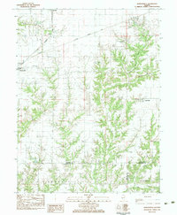
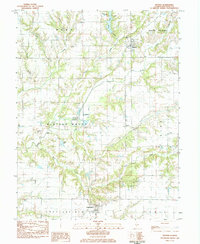
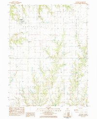
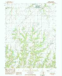
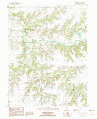 1982 Summerville1982 Print · USGSMacoupin County in the early eighties shows a landscape shaped by the winding Macoupin Creek and its many wooded hollows. Genealogists and local historians can trace rural property patterns near Summerville, Challacombe, and several country Cem locations.
 - 1983 Map of Virden North
 1983 Virden North1983 Print · USGSMidwestern prairie life is captured here in the early eighties as the rail lines through Auburn and Virden shaped local commerce. Genealogists and historians can trace family plots at Virden Cem or locate industrial sites like the Mine Shaft near Thayer.
 - 1983 Map of Franklin
 1983 Franklin1983 Print · USGSMorgan and Macoupin counties come alive in the early eighties, centered on the rail-linked town of Franklin. Genealogists can trace rural roots at Harts Prairie Ch, Providence Cem, and the small settlement of Centerville.
 - 1983 Map of Waverly
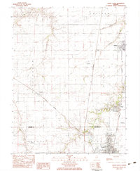
 1983 Waverly1983 Print · USGSWaverly and its surrounding townships are captured in the early 1980s as the rail-line economy of the Burlington Northern met growing utility infrastructure. Genealogists can locate several family and parish burial sites, such as St Sebastians Cem, Rogers Cem, and Conlee Cem.
 - 1983 Map of Nortonville
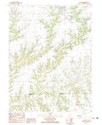
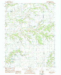
 1983 Nortonville1983 Print · USGSAgricultural life in central Illinois during the late 1970s and early 80s is defined here by its rail lines and creek valleys. Family researchers can trace deep local roots at St Bartholomew Cem, Youngblood Ch, and the town of Nortonville.
 - 1983 Map of Athensville, 1984 Print
 1983 Athensville1984 Print · USGSThe rural borderlands of Greene and Macoupin counties come into focus in the early 1980s, centered on the village of Athensville. Researchers can trace local lineage through numerous burial sites like Bivins-Mayberry Cem and visit country landmarks such as Richwoods Ch.
 - 1983 Map of Medora, 1984 Print
 1983 Medora1984 Print · USGSThe rural landscapes of Macoupin and Jersey counties are captured here in the early 1980s, centered on the village of Medora. Genealogists can locate several small family and community burial grounds including Kemper Cem, Oakland Cem, and Pruitt Cem.
 - 1983 Map of Greenfield, 1984 Print
 1983 Greenfield1984 Print · USGSGreene and Macoupin Counties are captured here in the early eighties, centered on the historic street grid of Greenfield and the surrounding farmland. Researchers can trace family history through numerous rural sites like Rose Hill Cem, Chism Cem, and St Michaels Ch.
 - 1983 Map of Brighton, 1984 Print
 1983 Brighton1984 Print · USGSBrighton and the surrounding Illinois prairie are captured in the early 1980s as the regional landscape balanced its agricultural roots with suburban growth. Genealogists can locate several family burial sites like Tribble Cem and Asbury Cem, or trace the street-level details of Brighton near Betsy Ann Park.
 - 1983 Map of Hettick, 1984 Print
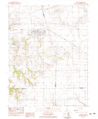
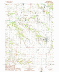
 1983 Hettick1984 Print · USGSMacoupin County in the early 1980s retains its deep rural roots and traditional township structures. Genealogists and local historians can trace family ties through numerous small burial sites like St Catherine Cem or Upton Cem and the settlement at Hettick.
 - 1983 Map of Scottville, 1984 Print
 1983 Scottville1984 Print · USGSMacoupin County in the early eighties remains a quiet network of small townships and family burial grounds. Researchers can trace ancestral sites like East Scottville Cem and Hollingsworth Cem alongside rural landmarks like Asbury Ch.
 - 1983 Map of Shipman, 1984 Print
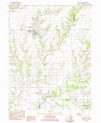
 1983 Shipman1984 Print · USGSShipman and the surrounding Macoupin County townships are shown in the early eighties as the agricultural landscape met the rail lines. Family historians can locate several rural burial sites and churches, including Miles Station Cem, St Denis Cem, and Woodburn Ch.
 - 1985 Map of St Louis
 1985 St Louis1985 Print · USGSThe St. Louis metropolitan area and its river confluences are captured here during a period of significant suburban expansion in the 1980s. Genealogists and historians can trace the development of older neighborhoods and landmarks like Jefferson Barracks, Cahokia Mounds State Park, and Washington University.3 unique versions available
 - 1985 Map of Carlyle Lake
 1985 Carlyle Lake1985 Print · USGSSouthwestern Illinois in the mid-eighties shows a landscape of growing commuter suburbs and massive water management projects. Genealogists and historians can locate family plots at Lakeview Memorial Gardens Cem or trace the early footprint of Southern Illinois Univ (Edwardsville).2 unique versions available
 - 1985 Map of Jerseyville
 1985 Jerseyville1985 Print · USGSThe confluence of the Illinois and Mississippi rivers defines this 1980s landscape of fertile bottomlands and rail-hub towns. Genealogists and historians can trace the foundations of communities like Jerseyville and White Hall alongside the Oak Grove Cem and St Mary Church.2 unique versions available
 - 1985 Map of Springfield
 1985 Springfield1985 Print · USGSCentral Illinois during the mid-eighties shows a landscape of growing state capital influence and deep historical roots. Genealogists and historians can trace family sites near Oak Ridge Cem or follow the path of the Sangamon River past Williamsville and Riverton.2 unique versions available
 - 1985 Map of Meredosia, 1988 Print
 1985 Meredosia1988 Print · USGSWest Central Illinois in the mid-eighties was a landscape of deep-rooted river towns and historic educational institutions. Genealogists and historians can trace family ties through Diamond Grove Cem, locate MacMurray College in Jacksonville, or study the river engineering at La Grange Lock and Dam.
End of results
Showing maps 1-18 of 18
Top cities of Macoupin County
- Carlinville historical maps
- Staunton historical maps
- Virden historical maps
- Gillespie historical maps
- Girard historical maps
- Mount Olive historical maps
See more
Frequently asked questions
- What are the different types of historical maps available for Macoupin County?
- What is the oldest map of Macoupin County?
- Where can I purchase historical maps of Macoupin County for my home or office?
- Where can I download high-res historical maps of Macoupin County?
- Are there historical topographic maps available for Macoupin County?
- Is there historical aerial imagery available for Macoupin County?
- Where are historical maps of Macoupin County sourced from?