1990s Maps of Macoupin County, Illinois
Explore 13 historic maps of Macoupin County from the 1990s. These maps offer a rare glimpse into what life looked like during the 1990s — showing old roads, neighborhoods, homes, and landmarks that have changed or disappeared over time.
Whether you're researching your family's past, planning a metal detecting trip, or studying how Macoupin County's landscape evolved across the 1990s, these high-resolution maps are a powerful tool for exploring the history of this region.
- Focus on a specific era: All maps on this page are from the 1990s, giving you a focused view of this time period.
- See what’s changed: Compare century-old streets, trails, and buildings to today's modern landscape using overlays and satellite layers.
- Research with precision: Use these maps for genealogy, historical research, land use analysis, or educational projects.
- View, download, or print: Maps are fully viewable online in high resolution, and can be downloaded or printed for your own records.
Start exploring Macoupin County's history through authentic maps from the 1990s. This is your window into the past.
Macoupin County, IL maps
(13)- 1990 Map of Meredosia
 1990 Meredosia1990 Print · USGSThe Illinois River valley and its surrounding farm towns are captured here in the 1990s. Trace the intricate rail lines of the Norfolk Southern Railway and find local landmarks like Diamond Grove Cem or the Meredosia National Wildlife Refuge.
 - 1990 Map of Prairietown, 1991 Print
 1990 Prairietown1991 Print · USGSMadison County's rural townships are captured here in the early nineties, showing a landscape of family farms and emerging lakeside residential life. Researchers can trace ancestral locations through several country churches and burial sites like St Johns Ch, Meyer Cem, and the Paddock Cem.
 - 1991 Map of Worden
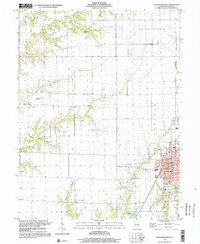
 1991 Worden1991 Print · USGSMadison and Macoupin counties in the early nineties show a landscape shaped by coal mining and rural tradition. Genealogists can trace family names through numerous burial sites like Sandrach Cem and Spangle Cem or visit Miners Memorial Park.
 - 1993 Map of Bethalto, 1996 Print
 1993 Bethalto1996 Print · USGSMadison County's residential and industrial growth is captured here in the 1990s as suburban expansion nears rural Macoupin County. Genealogists can trace family sites at Fosterburg Cem or locate the Alton Mental Health Ctr and St Louis Regional Airport.
 - 1994 Map of Alton
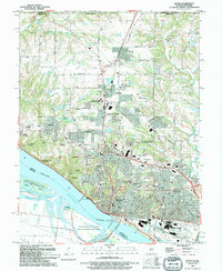 1994 Alton1994 Print · USGSThe Mississippi riverfront near Alton and Godfrey comes into focus during the 1990s as a hub of commerce and education. Trace local history at the Confederate Cem, Ursuline Convent, or the Alton Lock and Dam No 26.
 - 1998 Map of Virden North, 2002 Print
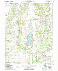
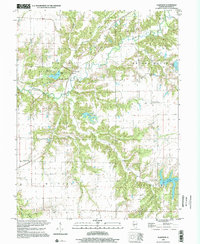
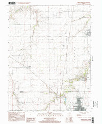 1998 Virden North2002 Print · USGSThe Sangamon and Macoupin county border area is captured here in the late 1990s, showcasing the persistent layout of historic mining and farming towns. Genealogists and local historians can trace family locations near Lowder, the West Cemetery, and the coal-era Abandoned Railroad corridor.
 - 1998 Map of Palmyra, 2002 Print
 1998 Palmyra2002 Print · USGSMacoupin County at the turn of the twenty-first century reveals a landscape balancing traditional farming with large-scale water projects. Researchers can locate numerous family cemeteries like Weller Cem and Cherry Cem or trace the Old Railroad Grade west of Palmyra.
 - 1998 Map of Carlinville West, 2002 Print
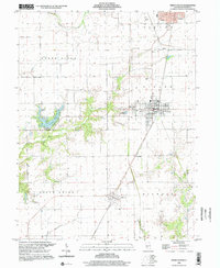
 1998 Carlinville West2002 Print · USGSMacoupin County in the late twentieth century reveals a landscape of deep-rooted agriculture surrounding the seat of Carlinville. Researchers can trace the legacy of rural life through sites like Denby Cem, Charity Ch, and an Old Railroad Grade.
 - 1998 Map of Mount Olive, 2002 Print
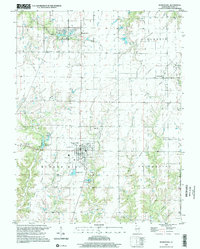
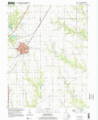 1998 Mount Olive2002 Print · USGSMount Olive and the surrounding Illinois prairie are shown here as they appeared in the late twentieth century. Researchers can trace historic family burial sites at St Johns Cem or follow the path of the Old Railroad Grade and Karnes Siding.
 - 1998 Map of Plainview, 2002 Print
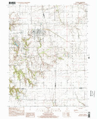
 1998 Plainview2002 Print · USGSMacoupin County at the end of the nineties reveals a landscape of enduring rural townships and significant local recreation. Genealogists and local historians can trace family ties through Hilyard Cem, Wagoner Cem, and landmarks like the Spanish Needle Community Center.
 - 1998 Map of Virden South, 2002 Print
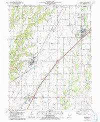
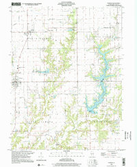
 1998 Virden South2002 Print · USGSMacoupin County at the close of the twentieth century shows a landscape of steady agricultural townships and growing lakefront areas. Researchers can trace family sites near Pleasant Hill Cemetery, explore the streets of Girard, or locate the Union Chapel and Sunset Lake shoreline.
 - 1998 Map of Bunker Hill, 2002 Print
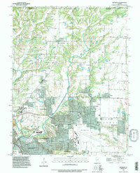
 1998 Bunker Hill2002 Print · USGSBunker Hill and its surrounding townships are captured in the late twentieth century, showing a landscape defined by prairie farming and oil extraction. Trace family roots at Wayne Cem or follow the path of the Old Grade Railroad past Dorchester.
 - 1998 Map of Waverly, 2002 Print
 1998 Waverly2002 Print · USGSWaverly and the surrounding Illinois prairie are captured here in the late nineties as a blend of agricultural tradition and modern utility infrastructure. Genealogists and local historians can pinpoint numerous rural burial sites like Conlee Cem and Pollam Cem or trace the extensive Underground Gas Storage Field.
End of results
Showing maps 1-13 of 13
Top cities of Macoupin County
- Carlinville historical maps
- Staunton historical maps
- Virden historical maps
- Gillespie historical maps
- Girard historical maps
- Mount Olive historical maps
See more
Frequently asked questions
- What are the different types of historical maps available for Macoupin County?
- What is the oldest map of Macoupin County?
- Where can I purchase historical maps of Macoupin County for my home or office?
- Where can I download high-res historical maps of Macoupin County?
- Are there historical topographic maps available for Macoupin County?
- Is there historical aerial imagery available for Macoupin County?
- Where are historical maps of Macoupin County sourced from?