1930s Maps of Macoupin County, Illinois
Explore 7 historic maps of Macoupin County from the 1930s. These maps offer a rare glimpse into what life looked like during the 1930s — showing old roads, neighborhoods, homes, and landmarks that have changed or disappeared over time.
Whether you're researching your family's past, planning a metal detecting trip, or studying how Macoupin County's landscape evolved across the 1930s, these high-resolution maps are a powerful tool for exploring the history of this region.
- Focus on a specific era: All maps on this page are from the 1930s, giving you a focused view of this time period.
- See what’s changed: Compare century-old streets, trails, and buildings to today's modern landscape using overlays and satellite layers.
- Research with precision: Use these maps for genealogy, historical research, land use analysis, or educational projects.
- View, download, or print: Maps are fully viewable online in high resolution, and can be downloaded or printed for your own records.
Start exploring Macoupin County's history through authentic maps from the 1930s. This is your window into the past.
Macoupin County, IL maps
(7)- 1931 Map of Carlinville, 1955 Print
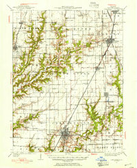 1931 Carlinville1955 Print · USGSMacoupin County in the early thirties is captured here as a bustling network of rail lines and rural school districts. Researchers can trace the paths of the Illinois Traction System and locate dozens of local landmarks like Coops Mound, Antioch Church, and Grimmett School.3 unique versions available
 - 1932 Map of Edwardsville
 1932 Edwardsville1932 Print · USGSMadison County in the early thirties was a bustling intersection of coal mining and heavy rail. Genealogists can trace family names through dozens of rural schools and landmarks like the Klondike Mine, Sunset Hills Cem, and Le Claire.2 unique versions available
 - 1932 Map of Greenfield
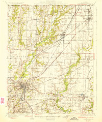
 1932 Greenfield1932 Print · USGSGreene and Macoupin counties thrive as a rail-centered agricultural heartland during the early thirties. Genealogists can trace family homesteads near numerous rural schools like Oak Hill Sch and Landreth Sch, or churches such as Mt Moriah Ch.3 unique versions available
 - 1932 Map of Jacksonville, 1965 Print
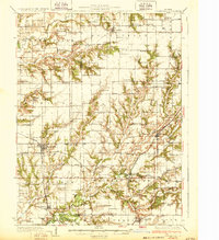
 1932 Jacksonville1965 Print · USGSCentral Illinois farm country and the growing hub of Jacksonville are captured in the early 1930s before modern highway expansion. Researchers can trace dozens of country schools and churches, including Douglas Institute, Whitlock Cem, and the rural post at Pisgah.2 unique versions available
 - 1934 Map of Alton
 1934 Alton1934 Print · USGSThe confluence of the Mississippi and Missouri rivers in the early 1930s shows a dense industrial and rail corridor centered on Alton. Genealogists and researchers can trace dozens of rural schools and landmarks like Monticello Seminary, Mt Olive Church, and the City of St Louis Farms.2 unique versions available
 - 1937 Map of Jacksonville
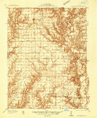
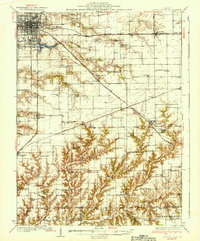 1937 Jacksonville1937 Print · USGSMid-century Morgan County thrives as a rail and education hub just before the pre-war era. Researchers can trace ancestral roots at Whitlock Cem or locate defunct schools like Sulphur Springs Sch and Prairie College Sch.2 unique versions available
 - 1937 Map of New Douglas
 1937 New Douglas1937 Print · USGSMadison and Bond counties are seen here in the late 1930s, showing a high density of rural schools and family cemeteries. Researchers can trace the grounds of Mt Calvary Sch, locate the St Vincent Cem, or follow the Shoal Creek bottomlands.2 unique versions available
End of results
Showing maps 1-7 of 7
Top cities of Macoupin County
- Carlinville historical maps
- Staunton historical maps
- Virden historical maps
- Gillespie historical maps
- Girard historical maps
- Mount Olive historical maps
See more
Frequently asked questions
- What are the different types of historical maps available for Macoupin County?
- What is the oldest map of Macoupin County?
- Where can I purchase historical maps of Macoupin County for my home or office?
- Where can I download high-res historical maps of Macoupin County?
- Are there historical topographic maps available for Macoupin County?
- Is there historical aerial imagery available for Macoupin County?
- Where are historical maps of Macoupin County sourced from?