Old Maps of Moultrie County, Illinois for Academic Research
Study the evolution of Moultrie County with 117 high-resolution historic maps. Whether you're teaching, researching, or modeling changes in land use, these maps provide essential visual documentation of urban, environmental, and geographic change.
- Analyze long-term change: Track patterns in development, transportation, and natural features.
- Ideal for environmental or urban studies: Support academic projects with primary historical map data.
- Use in the classroom or lab: Educators and researchers rely on these maps to bring historical context to life.
These maps are a powerful tool for teaching, research, and visualizing how Moultrie County has changed over the decades.
Moultrie County, IL maps
(117)- 1929 Map of Decatur, 1965 Print
 1929 Decatur1965 Print · USGSCentral Illinois during the mid-twentieth century reveals a landscape defined by the expansion of Lake Decatur and a busy rail network. Researchers can trace dozens of rural schools like Blue Door Sch and landmarks including Decatur Airport.
 - 1933 Map of Decatur
 1933 Decatur1933 Print · USGSThe rail-and-river hub of Decatur is captured here in the early thirties, showing a landscape defined by industrial growth and rural school districts. Genealogists can trace family landmarks like Antioch Ch or dozens of local schoolhouses including Blue Door Sch and Mound Sch.3 unique versions available
 - 1934 Map of Mattoon, 1967 Print
 1934 Mattoon1967 Print · USGSThe rail hubs and rural townships of East Central Illinois are captured here in the mid-1930s. Genealogists and local historians can trace the foundations of Mattoon and Neoga while locating family landmarks like Old Bethel Ch or the Little Brick Sch.2 unique versions available
 - 1935 Map of Arcola
 1935 Arcola1935 Print · USGSCentral Illinois farming communities thrived along the Illinois Central and Pennsylvania rail lines in the 1930s. Genealogists can trace family roots through numerous rural landmarks like Yoder Cem, Quinn Chapel, and Pulltight Sch.3 unique versions available
 - 1935 Map of Sullivan
 1935 Sullivan1935 Print · USGSMid-depression Moultrie County is captured here as a thriving network of small school districts and railroad sidings. Genealogists can trace family roots through dozens of local landmarks like Stringtown Sch, the Masonic Home, and Campfield Cem.3 unique versions available
 - 1937 Map of Mattoon
 1937 Mattoon1937 Print · USGSThe rail hubs of Mattoon and Neoga are shown in the late 1930s, surrounded by a dense network of country schools and family cemeteries. Trace ancestral roots at Aetna Etna PO, Johnstown, or the many rural schoolhouses like South Loxa Sch.3 unique versions available
 - 1940 Map of Sullivan
 1940 Sullivan1940 Print · USGSCentral Illinois is seen here just before the Second World War, showing a landscape defined by small townships and an extensive rail network. Genealogists and local researchers can locate dozens of country schools like Hewitt Sch and Titus Sch, or trace family sites such as Wright Cem and the Masonic Home.2 unique versions available
 - 1940 Map of Arcola
 1940 Arcola1940 Print · USGSThe Douglas and Coles County borderlands come alive in this pre-war portrait of central Illinois agricultural life. Researchers can trace dozens of rural school sites such as Pulltight Sch and Little Red Sch, alongside old rail corridors like the Illinois Central.
 - 1947 Map of Stewardson, 1965 Print
 1947 Stewardson1965 Print · USGSMid-century Shelby County is mapped here as a thriving agricultural landscape defined by its rural schools and rail junctions. Genealogists can locate family landmarks like Rincker Cem and East Salem School, or trace the rail lines through Stewardson.
 - 1949 Map of Stewardson
 1949 Stewardson1949 Print · USGSShelby and Moultrie counties thrive as a vital rail and farming hub at the close of the 1940s. Researchers can locate dozens of country landmarks like Jordan Chapel, Rincker Cem, and North Liberty Sch along the region's busy rail lines.2 unique versions available
 - 1949 Map of Dalton City
 1949 Dalton City1949 Print · USGSCentral Illinois agriculture and rail transit are documented here just after the war, showing the dense network of one-room schools and country churches. Genealogists can locate family landmarks like Sanner Chapel, New Hope Cem, and Penn Consolidated Sch.2 unique versions available
 - 1950 Map of Tuscola, 1952 Print
 1950 Tuscola1952 Print · USGSMid-century Douglas and Champaign Counties are mapped here at a time when the rural school system was fading into history. Genealogists can trace family roots through numerous markers like Stewart Sch, Macedonia Ch, and Bailey Memorial Cem.4 unique versions available
 - 1955 Map of Bement, 1956 Print
 1955 Bement1956 Print · USGSCentral Illinois prairie life revolved around rail junctions and rural townships in the mid-1950s. Genealogists can trace family footprints at Willow Branch Cem or Asbury Ch, while following the lines of the Wabash and Baltimore and Ohio railroads.2 unique versions available
 - 1958 Map of Decatur, 1971 Print
 1958 Decatur1971 Print · USGSCentral Illinois in the mid-twentieth century shows a landscape defined by industrial rail hubs and the creation of large reservoirs. Researchers can trace historic corridors like the Penn Central or locate landmarks such as Lincoln Log Cabin State Park and Lake Springfield.3 unique versions available
 - 1961 Map of Decatur
 1961 Decatur1961 Print · USGSCentral Illinois in the late fifties was a bustling corridor of rail lines and prairie commerce centered on the state capital. Genealogists and historians can trace the intricate connections between Springfield, Decatur, and dozens of smaller settlements like Nokomis and Arcola.2 unique versions available
 - 1967 Map of Long Creek, 1968 Print
 1967 Long Creek1968 Print · USGSMacon County transitioned from heavy rail-and-river industry to suburban growth in the late sixties. Researchers can trace historic family burial sites at Ridge Cem, follow the Baltimore and Ohio tracks, or locate old schools like Salem Sch.2 unique versions available
 - 1975 Map of Tuscola SW, 1977 Print
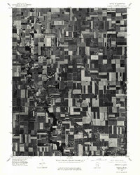 1975 Tuscola SW1977 Print · USGSMid-century Illinois farmland is captured in sharp detail during the autumn of 1975, showing the structured grid of the heartland. Genealogists and local historians can trace the exact footprints of homes and buildings in Atwood and Garrett or follow the banks of the Kaskaskia River.
 - 1975 Map of Bement SE, 1977 Print
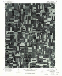 1975 Bement SE1977 Print · USGSPiatt County farmland is captured in sharp aerial detail during the mid-seventies, showing the precise layout of the central Illinois agricultural grid. Researchers can trace the development of small rural centers like Hammond and Pierson among the fields near Lake and Fork.
 - 1981 Map of Windsor, 1982 Print
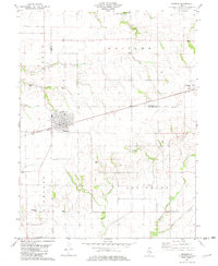 1981 Windsor1982 Print · USGSShelby and Moultrie counties are captured here in the early eighties, centered on the railroad town of Windsor. Local historians can trace family roots through numerous remote burial sites like Lookout Point Cem, Cochran Cem, and the rural community of Sexson Corner.
 - 1983 Map of Hammond
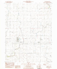 1983 Hammond1983 Print · USGSThe rural border of Piatt and Moultrie counties is captured here in the early 1980s as a landscape of grid-patterned farms and vital drainage works. Local researchers can locate Hammond Cem, the Jr High Sch in Hammond, and the small settlement of Pierson along the Baltimore and Ohio tracks.
 - 1983 Map of La Place
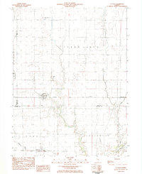 1983 La Place1983 Print · USGSThe grain-and-rail landscape of central Illinois is captured here in the early eighties. Genealogists and local historians can trace the foundations of LaPlace and Lake City, alongside rural landmarks like Turner Cem and Stringtown.
 - 1983 Map of Cooks Mills
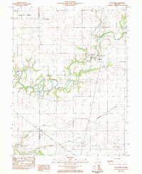 1983 Cooks Mills1983 Print · USGSColes County at the start of the eighties shows a landscape of river-bottom farms and active extraction. Researchers can locate family landmarks like Quinn Chapel and Smith Cem or trace the path of the Illinois Central Gulf railroad.
 - 1983 Map of Arthur
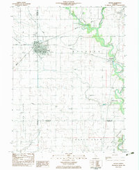 1983 Arthur1983 Print · USGSThe Douglas and Moultrie County borderlands come to life in the early 1980s, centered on the rail junction at Arthur. Researchers can trace old rural schoolhouses like Prairie Lane Sch, numerous family burial sites including Yoder Cem, and the specialized Cooks Mills Oil Field.
 - 1983 Map of Sullivan
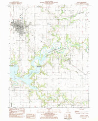 1983 Sullivan1983 Print · USGSThe town of Sullivan and the eastern shores of Lake Shelbyville are captured here in the early 1980s. Researchers can trace local heritage through the Masonic Home, Jonathan Creek Ch, and family sites like Bolin Cem and Purvis Cem.
 - 1983 Map of Lovington
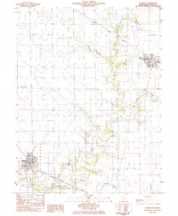 1983 Lovington1983 Print · USGSLovington and Bethany are the primary population centers of this central Illinois landscape in the early 1980s. Genealogists can locate several burial sites like Mitchell Cem and Wright Cem, or trace the path of the Illinois Central Gulf railroad.
Showing maps 1-25 of 117
Top cities of Moultrie County
- Sullivan historical maps
- Bethany historical maps
- Lovington historical maps
- Dalton City historical maps
- Gays historical maps
- Allenville historical maps
Frequently asked questions
- What are the different types of historical maps available for Moultrie County?
- What is the oldest map of Moultrie County?
- Where can I purchase historical maps of Moultrie County for my home or office?
- Where can I download high-res historical maps of Moultrie County?
- Are there historical topographic maps available for Moultrie County?
- Is there historical aerial imagery available for Moultrie County?
- Where are historical maps of Moultrie County sourced from?