Old Maps of Vermilion County, Illinois for Academic Research
Study the evolution of Vermilion County with 165 high-resolution historic maps. Whether you're teaching, researching, or modeling changes in land use, these maps provide essential visual documentation of urban, environmental, and geographic change.
- Analyze long-term change: Track patterns in development, transportation, and natural features.
- Ideal for environmental or urban studies: Support academic projects with primary historical map data.
- Use in the classroom or lab: Educators and researchers rely on these maps to bring historical context to life.
These maps are a powerful tool for teaching, research, and visualizing how Vermilion County has changed over the decades.
Vermilion County, IL maps
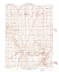
(165)- 1899 Map of Danville
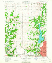
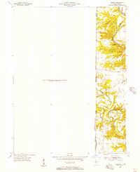
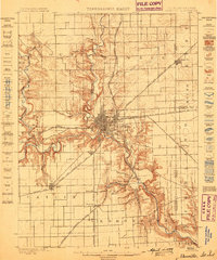 1899 Danville1899 Print · USGSDanville and the surrounding Vermilion County townships thrived at a massive rail intersection before the turn of the century. Genealogists and historians can trace the early layouts of Batestown, Catlin, and Rileysburg along the Vermilion River.
 - 1900 Map of Danville
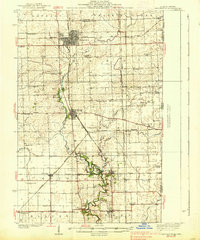
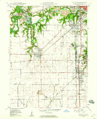
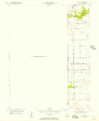
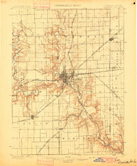 1900 Danville1900 Print · USGSVermilion County at the turn of the century is a bustling rail center defined by the junction of major freight lines and the Vermilion River. Genealogists can trace family footprints in early settlements like Westville, Batestown, and the border community of State Line.7 unique versions available
 - 1931 Map of Fithian
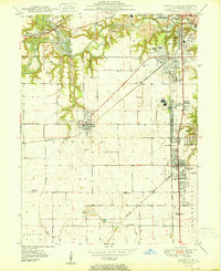
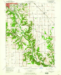
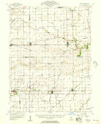
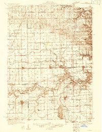 1931 Fithian1931 Print · USGSVermilion County and its neighboring townships thrive in the early 1930s as a hub of rail travel and rural education. Genealogists can trace hundreds of family sites near Knights Branch Cem, Fowler Sch, and the busy rail yards of Homer.
 - 1933 Map of Hoopeston
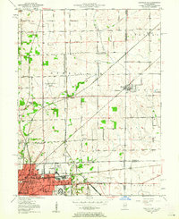
 1933 Hoopeston1933 Print · USGSVermilion County and the Illinois-Indiana borderlands are captured here in the early 1930s as a thriving rail and agricultural corridor. Genealogists can locate dozens of rural schools like White Sch and family-linked landmarks such as Ross Cem or Manns Chapel.
 - 1936 Map of Potomac
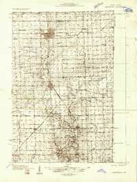
 1936 Potomac1936 Print · USGSThe rural prairie of Vermilion County thrives as a rail-and-river economy during the mid-1930s. Researchers can trace dozens of country schools and family-named landmarks like St Lawrence Ch, Rankin Union Cem, and river crossings at Bass Ford.3 unique versions available
 - 1938 Map of Hoopeston
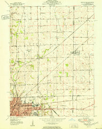
 1938 Hoopeston1938 Print · USGSEastern Illinois at the height of the rail era shows a landscape defined by busy junctions and tightly knit rural communities. Genealogists and historians can trace family roots through dozens of local landmarks like Squankum Sch, Rose Cem, and Pleasant View Ch.3 unique versions available
 - 1943 Map of Fithian
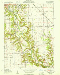
 1943 Fithian1943 Print · USGSVermilion and Champaign counties come alive in the 1940s as a hub of rail travel and small-town commerce. Genealogists and historians can trace the foundations of Fithian, Fairmount, and Homer while locating rural landmarks like Little Giant Sch and Stearns Cem.2 unique versions available
 - 1947 Map of Ridge Farm
 1947 Ridge Farm1947 Print · USGSEastern Illinois and the Indiana border appear here just after the war, showcasing a landscape of rail-connected towns and country school districts. Researchers can trace family history through dozens of landmarks like Scotland Sta, Vermilion Grove, and Harrison Consolidated Sch.3 unique versions available
 - 1948 Map of Danville NW, 1964 Print
 1948 Danville NW1964 Print · USGSVermilion County transitions from industrial rail hubs to rural township life shortly after the war. Researchers can trace the development of Danville neighborhoods and find family-named landmarks like Johnsonville, Bethel Ch, and the Spring Hill Cem.
 - 1949 Map of Danville SW, 1960 Print
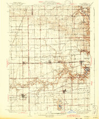
 1949 Danville SW1960 Print · USGSVermilion County's coal and rail landscape is captured here in the late 1940s, showing the tight-knit mining towns southwest of Danville. Genealogists and local historians can trace family roots through sites like the Lithuanian Cem, D Day Mine, and several rural schoolhouses like Shiloh Sch.2 unique versions available
 - 1950 Map of Danville SW
 1950 Danville SW1950 Print · USGSThe Vermilion County coalfields and rail hubs are captured here at mid-century. Researchers can trace family history through sites like Sts Peter and Paul Cem or the industrial landscape of the D Day Mine and Wabash Railroad.
 - 1950 Map of Danville NW
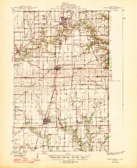
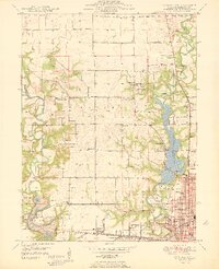 1950 Danville NW1950 Print · USGSThe northwestern outskirts of Danville and the Vermilion River valley are captured here in the mid-century, as industrial mining and new recreational parks met. Genealogists and historians can trace the New York Central rail line past Eureka Sch, Hillery, and the grounds of Kickapoo State Park.
 - 1950 Map of Danville SE, 1960 Print
 1950 Danville SE1960 Print · USGSThe Illinois-Indiana borderlands at mid-century reveal a landscape defined by the winding Vermilion River and the expansion of southern Danville. Genealogists and local researchers can trace a dense network of family landmarks and rural institutions, from Sandhill Memorial Park to the Willow Springs Sch and Morey Chapel.
 - 1950 Map of Danville NE, 1962 Print
 1950 Danville NE1962 Print · USGSDanville and the surrounding Illinois-Indiana borderlands are captured here at a mid-century peak of rail and industry. Researchers can trace family roots through numerous rural institutions like Grange Hall Sch, Spring Hill Cemetery, and the Hopewell Ch.
 - 1951 Map of Danville NE
 1951 Danville NE1951 Print · USGSThe Illinois and Indiana state line comes alive in the early 1950s as Danville's rail-and-road network reaches toward the border. Researchers can trace family history at Oaklawn Cem and Bryley Cem or locate vanished rural schoolhouses like Lamb Sch and Ash Corner Sch.
 - 1951 Map of Danville SE
 1951 Danville SE1951 Print · USGSVermilion County at mid-century reveals a landscape balancing heavy industry with deep-rooted rural communities. Genealogists and historians can trace family landmarks like Morey Chapel, the Langley Cemetery, and numerous country schools from Grape Creek Sch to Jenkins Sch.
 - 1953 Map of Danville, 1965 Print
 1953 Danville1965 Print · USGSIndiana and Illinois crossroads come to life in this mid-century survey as the interstate era begins to reshape the river-and-rail landscape. Genealogists and collectors can trace the historic paths of the Nickel Plate railroad or locate smaller communities like Veedersburg, Goodland, and Bismarck.3 unique versions available
 - 1953 Map of Indianapolis, 1965 Print
 1953 Indianapolis1965 Print · USGSCentral Indiana and the Illinois borderlands are captured in the mid-sixties, showing the growth of Indianapolis and its industrial rail corridors. Genealogists and historians can trace the development of outlying towns like Zionsville or Beech Grove and find landmarks such as Atterbury AAF and Turkey Run State Park.4 unique versions available
 - 1955 Map of Danville
 1955 Danville1955 Print · USGSThe Indiana-Illinois borderlands during the mid-fifties reveal a landscape of thriving rail hubs and university towns. Researchers can trace the legacy of Purdue University, the Tippecanoe Battlefield, and the path of the Pennsylvania RR.
 - 1955 Map of Humrick, 1956 Print
 1955 Humrick1956 Print · USGSThe Illinois and Indiana borderlands come alive in the mid-fifties along the winding Vermilion River and the tracks of the Chicago and St Louis railroad. Genealogists can trace family names at Brown Cem and Patrick Cem or explore the sharp terrain of Devils Backbone.
 - 1955 Map of Scottland, 1957 Print
 1955 Scottland1957 Print · USGSThe Illinois-Indiana state line during the mid-fifties shows a landscape of rural rail junctions and early pioneer landmarks. Trace family history and regional industry through the Old Hopewell Cem, the village of Quaker, and the Baltimore and Ohio railroad corridor.
 - 1956 Map of Danville
 1956 Danville1956 Print · USGSMid-century Indiana and Illinois are captured here as the river-and-rail economy evolved into the modern highway era. Researchers can trace ancestral roots and old transport lines through Logansport, Battle Ground, and the dams at Lake Shafer.
 - 1956 Map of Indianapolis
 1956 Indianapolis1956 Print · USGSCentral Indiana in the mid-fifties is captured during a period of industrial growth and military presence. Genealogists and historians can trace the rail networks of the New York Central or locate regional landmarks like Fort Benjamin Harrison and Camp Atterbury.
 - 1956 Map of Newman, 1957 Print
 1956 Newman1957 Print · USGSThe borderlands of Champaign and Douglas counties are seen here in the mid-fifties, when small-town rail depots still served as the region's heartbeat. Genealogists can trace family names through rural landmarks like Stutler Cem, Fairfield Ch, and the small community of Maizetown.2 unique versions available
 - 1957 Map of Indianapolis
 1957 Indianapolis1957 Print · USGSCentral Indiana in the mid-fifties is captured here as a crossroads of major rail lines and nascent federal highways. Genealogists and historians can trace family-named ridges like Poplar Ridge or locate strategic sites like Camp Atterbury and Speedway.2 unique versions available
Showing maps 1-25 of 165
Top cities of Vermilion County
- Danville historical maps
- Hoopeston historical maps
- Georgetown historical maps
- Westville historical maps
- Tilton historical maps
- Catlin historical maps
See more
Frequently asked questions
- What are the different types of historical maps available for Vermilion County?
- What is the oldest map of Vermilion County?
- Where can I purchase historical maps of Vermilion County for my home or office?
- Where can I download high-res historical maps of Vermilion County?
- Are there historical topographic maps available for Vermilion County?
- Is there historical aerial imagery available for Vermilion County?
- Where are historical maps of Vermilion County sourced from?