1980s Maps of Vermilion County, Illinois
Explore 9 historic maps of Vermilion County from the 1980s. These maps offer a rare glimpse into what life looked like during the 1980s — showing old roads, neighborhoods, homes, and landmarks that have changed or disappeared over time.
Whether you're researching your family's past, planning a metal detecting trip, or studying how Vermilion County's landscape evolved across the 1980s, these high-resolution maps are a powerful tool for exploring the history of this region.
- Focus on a specific era: All maps on this page are from the 1980s, giving you a focused view of this time period.
- See what’s changed: Compare century-old streets, trails, and buildings to today's modern landscape using overlays and satellite layers.
- Research with precision: Use these maps for genealogy, historical research, land use analysis, or educational projects.
- View, download, or print: Maps are fully viewable online in high resolution, and can be downloaded or printed for your own records.
Start exploring Vermilion County's history through authentic maps from the 1980s. This is your window into the past.
Vermilion County, IL maps
(9)- 1982 Map of Sidell, 1983 Print
 1982 Sidell1983 Print · USGSThe rural landscapes of eastern Illinois are captured here in the early 1980s, centered on the railroad village of Sidell. Genealogists and historians can trace family ties at Stunkard Cem or locate the old Jamaica High Sch along the river.
 - 1982 Map of East Lynn, 1983 Print
 1982 East Lynn1983 Print · USGSThe rural landscape of Vermilion County is captured here in the early eighties as a busy crossroads for the Norfolk and Western and Missouri Pacific railroads. Researchers can trace family roots at East Lynn Cem or locate the site of the Prairie Chapel and the settlement at Reilly.
 - 1982 Map of Allerton, 1983 Print
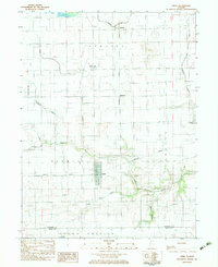
 1982 Allerton1983 Print · USGSAllerton and the surrounding prairie were surveyed in the early eighties as the railroad still connected the agricultural hubs of Vermilion and Champaign counties. Researchers can locate the small settlement of Hastings, the Sch No 6 schoolhouse, and the quiet Lost Grove Cem.
 - 1984 Map of Danville, 1985 Print
 1984 Danville1985 Print · USGSEastern Illinois and western Indiana meet here in the mid-1980s, centered on the river forks and rail lines surrounding the industrial hub of Danville. Researchers can trace old transport routes and rural landmarks like Rossville Junction, Hope Ch, and the Univ of Ill Radio Telescope.
 - 1984 Map of Penfield, 1985 Print
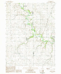 1984 Penfield1985 Print · USGSNear the Vermilion and Champaign county line in the 1980s, this landscape is defined by the winding Middle Fork Vermilion River and quiet farming hamlets. Researchers can trace family history at Tomlinson Cem and Partlow Cem, or locate landmarks in Penfield and Armstrong.
 - 1984 Map of Rankin, 1985 Print
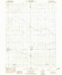
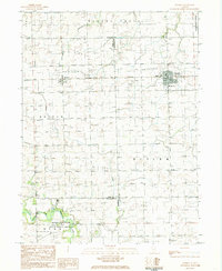 1984 Rankin1985 Print · USGSRankin and its surrounding prairie townships are captured here in the mid-1980s. Local historians can trace the rail corridor through Clarence and locate rural landmarks such as Pleasant Grove Ch, Pellville Cem, and the Middle Fork Vermilion River.
 - 1984 Map of Potomac, 1985 Print
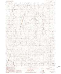
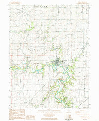 1984 Potomac1985 Print · USGSVermilion County's agricultural heartland is documented here in the mid-1980s as the river corridor shifted toward conservation. Researchers can trace rural genealogy at Wallace Chapel Cem, find the vanished rail lines at the Old Railroad Grade, and locate the old Number Ten Ch.
 - 1986 Map of Paris
 1986 Paris1986 Print · USGSThe Illinois-Indiana borderlands thrive in the mid-1980s as a hub of river-side industry and fertile farmland. Genealogists and historians can trace rail-centered settlements like Chrisman and Metcalf, or locate family sites at the Quaker Cem and Bethel Ch.2 unique versions available
 - 1987 Map of Danville, 1994 Print
 1987 Danville1994 Print · USGSThe Illinois-Indiana borderlands thrived in the 1980s as a crossroads of rail commerce and river-fed agriculture. Genealogists and historians can trace the foundations of Danville and Covington while locating landmarks like Spring Hill Cemetery or the Vermilion County Courthouse.
End of results
Showing maps 1-9 of 9
Top cities of Vermilion County
- Danville historical maps
- Hoopeston historical maps
- Georgetown historical maps
- Westville historical maps
- Tilton historical maps
- Catlin historical maps
See more
Frequently asked questions
- What are the different types of historical maps available for Vermilion County?
- What is the oldest map of Vermilion County?
- Where can I purchase historical maps of Vermilion County for my home or office?
- Where can I download high-res historical maps of Vermilion County?
- Are there historical topographic maps available for Vermilion County?
- Is there historical aerial imagery available for Vermilion County?
- Where are historical maps of Vermilion County sourced from?