Old Maps of Posey County, Indiana for Academic Research
Study the evolution of Posey County with 127 high-resolution historic maps. Whether you're teaching, researching, or modeling changes in land use, these maps provide essential visual documentation of urban, environmental, and geographic change.
- Analyze long-term change: Track patterns in development, transportation, and natural features.
- Ideal for environmental or urban studies: Support academic projects with primary historical map data.
- Use in the classroom or lab: Educators and researchers rely on these maps to bring historical context to life.
These maps are a powerful tool for teaching, research, and visualizing how Posey County has changed over the decades.
Posey County, IN maps
(127)- 1901 Map of Haubstadt, 1955 Print
 1901 Haubstadt1955 Print · USGSSouthwestern Indiana thrived as a rail-centric farming region at the turn of the century. Genealogists and historians can trace old property lines and rural crossroads like Parker's Settlement, St. Wendells, and the thriving rail hub at Haubstadt.
 - 1903 Map of Haubstadt
 1903 Haubstadt1903 Print · USGSSouthern Indiana at the start of the century shows a landscape of busy rail junctions and tight-knit crossroads. Genealogists can trace family footprints across Parker's Settlement, St. Wendells, and McCutchanville as they appeared before modern road expansion.2 unique versions available
 - 1903 Map of New Harmony
 1903 New Harmony1903 Print · USGSPosey County at the opening of the twentieth century was a landscape of thriving river towns and bustling rail junctions. Genealogists and historians can trace the early footprints of New Harmony and Poseyville, or locate vanished locales like Rapture and Solitude.3 unique versions available
 - 1903 Map of Patoka
 1903 Patoka1903 Print · USGSThe lower Wabash Valley at the start of the twentieth century was a vital crossroads of river trade and rail expansion. Genealogists can trace family roots through settlements like New Harmony and Parker's Settlement or locate the County Farm and Grand Rapids.2 unique versions available
 - 1905 Map of New Haven, 1966 Print
 1905 New Haven1966 Print · USGSThe tri-state border region along the Wabash and Ohio Rivers is captured here during the early twentieth century. Genealogists can trace family footprints in New Haven, Ridgway, and Herald, or locate historic crossings like Mackeys Ferry and Dogtown Ferry.
 - 1906 Map of New Haven
 1906 New Haven1906 Print · USGSThe Wabash River borderlands of Illinois and Indiana come to life in this early century survey of the river's winding oxbows and swampy bottoms. Genealogists can trace early homesteads near New Haven, Concord Emma P O, and the river landings at Dogtown Ferry.4 unique versions available
 - 1914 Map of Henderson
 1914 Henderson1914 Print · USGSThe Ohio River borderlands between Indiana and Kentucky are captured here in the years before the Great War. Genealogists can trace family farms near St Vincents Church or locate long-gone rural schoolhouses like Corkie School and Three Mile School.
 - 1916 Map of Henderson
 1916 Henderson1916 Print · USGSThe Ohio River borderlands between Indiana and Kentucky thrived on a mix of river commerce and rail power during the early twentieth century. Genealogists and historians can trace numerous rural districts and schools such as Corkie School, St Vincent, and the riverfront at Mc Donalds Landing.3 unique versions available
 - 1917 Map of Uniontown
 1917 Uniontown1917 Print · USGSThe Ohio River borderlands between Kentucky and Indiana were bustling with river and rail activity during the First World War. Local historians can trace dozens of rural school sites like Bethlehem School and river landmarks such as Slim Island and Hovey Lake.6 unique versions available
 - 1938 Map of New Harmony, 1958 Print
 1938 New Harmony1958 Print · USGSIndiana's southwestern tip along the Wabash River is captured here during the late thirties. Genealogists and local historians can trace family land near the Mumford Hills or locate historic rail stops in Poseyville, Stewartsville, and Griffin.
 - 1940 Map of Carmi, 1965 Print
 1940 Carmi1965 Print · USGSThe river-and-rail hub of Carmi and the surrounding White County prairies are documented here just before the mid-century. Researchers can trace rural family roots through dozens of named sites like Miller Cem, Stokes Chapel, and Williams Sch.
 - 1943 Map of Carmi
 1943 Carmi1943 Print · USGSWhite County, Illinois, is captured during the early 1940s at a critical rail and river junction. Genealogists and researchers can locate scores of rural schools and churches, from Stokes Chapel and Sylvan Glen Sch to the Baptist Orphanage near Carmi.2 unique versions available
 - 1949 Map of Paducah
 1949 Paducah1949 Print · USGSThe confluence of the Ohio, Mississippi, Tennessee, and Cumberland rivers at the close of the 1940s reveals a region bound by water and rail. Researchers can trace historic river landings, timberlands in the Shawnee National Forest, and the coal-mining infrastructure around West Frankfort and Herrin.2 unique versions available
 - 1949 Map of New Haven, 1958 Print
 1949 New Haven1958 Print · USGSSouthern Illinois and the Indiana borderlands are captured here in the late 1940s, highlighting the intricate river-and-rail landscape at the confluence of the Wabash and Ohio. Genealogists and historians can trace old homesteads and post offices like Concord Emma PO, Ridgway, and New Haven.
 - 1950 Map of Paducah
 1950 Paducah1950 Print · USGSThe confluence of the great midwestern rivers defines this mid-century landscape at the intersection of Illinois, Kentucky, and Missouri. Genealogists and historians can trace the rail-and-river economy through the hubs of Paducah, Cairo, and Metropolis or locate family roots near the Wildcat Hills.
 - 1952 Map of Mount Vernon, 1953 Print
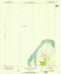 1952 Mount Vernon1953 Print · USGSThe Ohio River bend south of Mount Vernon comes into focus in the early fifties, marking the intersection of Posey, Henderson, and Union counties. Genealogists and river historians can trace the contours of Slim Island and the marshy edges of Grassy Pond.2 unique versions available
 - 1952 Map of Uniontown, 1954 Print
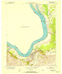 1952 Uniontown1954 Print · USGSUniontown and the surrounding river bottomlands are captured here in the early 1950s at a time of active petroleum extraction. Researchers can locate St Agnes Ch, trace the old Ferry crossing, and identify numerous Oil Wells across the landscape.2 unique versions available
 - 1953 Map of Wabash Island
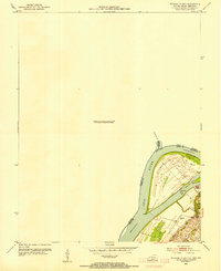 1953 Wabash Island1953 Print · USGSThe tri-state confluence of Illinois, Indiana, and Kentucky is captured here in the early fifties at a time when river transport and local industry intersected. Genealogists and researchers can locate the Reburn Ch, a Pvt Ferry crossing, and an active Oil Well on Wabash Island.2 unique versions available
 - 1954 Map of Evansville
 1954 Evansville1954 Print · USGSThe Ohio River borderlands between Indiana and Kentucky appear here during a period of robust industrial and military growth. Genealogists and researchers can trace the rail corridors of the Illinois Central and find landmarks like US Lock and Dam No 48 or Camp Breckinridge.
 - 1954 Map of Paducah
 1954 Paducah1954 Print · USGSSouthern Illinois and Western Kentucky intersect at the great river confluences during this mid-century era of rail and river industry. Genealogists and historians can trace family roots and commerce through river towns like Cairo, Metropolis, and Golconda, or along the tracks of the Illinois Central Railroad.2 unique versions available
 - 1956 Map of Vincennes, 1967 Print
 1956 Vincennes1967 Print · USGSSouthern Indiana and the Illinois borderlands are captured here in the mid-fifties, showing the region's dense network of river towns and rail lines. Researchers can trace historic river crossings along the Wabash River or locate landmarks like Wyandotte Cave and Lincoln State Park.4 unique versions available
 - 1957 Map of Vincennes
 1957 Vincennes1957 Print · USGSSouthwest Indiana and the Illinois borderlands come alive in the late 1950s, a period of heavy rail traffic and expanding state forests. Genealogists and historians can trace the riverfronts and rail lines of Vincennes, New Harmony, and the vast Crane Naval Ammunition Depot.
 - 1957 Map of West Franklin, 1959 Print
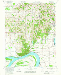 1957 West Franklin1959 Print · USGSSouthwestern Indiana and the Kentucky borderlands meet along the Ohio River in the late fifties. Genealogists can trace family names across Nashville Hollow and locate rural landmarks like St Peters Ch, West Franklin, and Diamond Island.2 unique versions available
 - 1957 Map of Caborn, 1959 Print
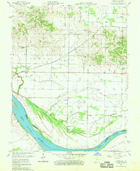 1957 Caborn1959 Print · USGSSouthwestern Indiana river life is centered on the Ohio River and the small hamlets of Bufkin and Caborn during the late fifties. Genealogists can locate family landmarks like St Johns Cem, Hartman Sch, and Mt Pleasant Ch among the complex sloughs and ditches of the river valley.2 unique versions available
 - 1957 Map of Mount Vernon, 1960 Print
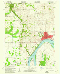 1957 Mount Vernon1960 Print · USGSMount Vernon sits at a vital mid-century crossroads where the Ohio River meets major rail lines. Researchers can trace family history at Black Chapel, St Matthews Cem, and rural outposts like Dead Mans Crossing and Upton.2 unique versions available
Showing maps 1-25 of 127
Top cities of Posey County
- Mount Vernon historical maps
- Poseyville historical maps
- New Harmony historical maps
- Cynthiana historical maps
- Griffin historical maps
Frequently asked questions
- What are the different types of historical maps available for Posey County?
- What is the oldest map of Posey County?
- Where can I purchase historical maps of Posey County for my home or office?
- Where can I download high-res historical maps of Posey County?
- Are there historical topographic maps available for Posey County?
- Is there historical aerial imagery available for Posey County?
- Where are historical maps of Posey County sourced from?