1960s Maps of Mitchell County, Kansas
Explore 12 historic maps of Mitchell County from the 1960s. These maps offer a rare glimpse into what life looked like during the 1960s — showing old roads, neighborhoods, homes, and landmarks that have changed or disappeared over time.
Whether you're researching your family's past, planning a metal detecting trip, or studying how Mitchell County's landscape evolved across the 1960s, these high-resolution maps are a powerful tool for exploring the history of this region.
- Focus on a specific era: All maps on this page are from the 1960s, giving you a focused view of this time period.
- See what’s changed: Compare century-old streets, trails, and buildings to today's modern landscape using overlays and satellite layers.
- Research with precision: Use these maps for genealogy, historical research, land use analysis, or educational projects.
- View, download, or print: Maps are fully viewable online in high resolution, and can be downloaded or printed for your own records.
Start exploring Mitchell County's history through authentic maps from the 1960s. This is your window into the past.
Mitchell County, KS maps
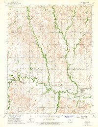
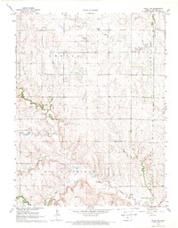
(12)- 1962 Map of Jewell SE, 1963 Print
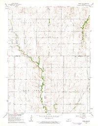 1962 Jewell SE1963 Print · USGSJewell and Mitchell counties meet along this quiet stretch of Kansas prairie in the early sixties. Researchers can trace the path of the Missouri Pacific railroad or locate family sites near Pleasant Prairie Cem and Plum Creek.
 - 1962 Map of Cawker City, 1963 Print
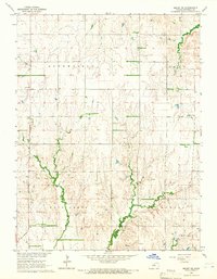
 1962 Cawker City1963 Print · USGSCawker City thrived as a rail and river hub during the early sixties, anchoring a landscape of small family farms and rural townships. Researchers can trace ancestral roots through several local burial grounds like Prairie Grove Cem and locate the historic Chandler Sch.3 unique versions available
 - 1962 Map of Glen Elder North, 1963 Print
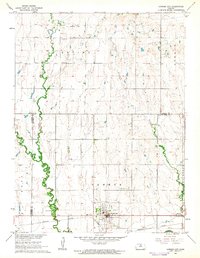
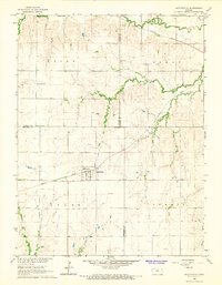
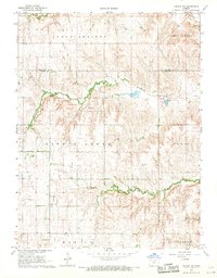
 1962 Glen Elder North1963 Print · USGSJewell and Mitchell counties are captured in the early sixties, centered on the rural hub of Glen Elder and the Athens township. Genealogists and historians can trace the foundations of this farming community through the Athens Sch, Glenwood Cem, and the Missouri Pacific rail corridor.2 unique versions available
 - 1962 Map of Jewell SW, 1963 Print
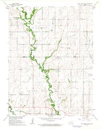
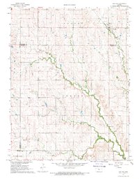
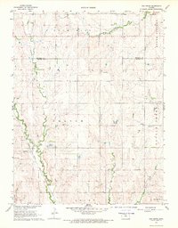
 1962 Jewell SW1963 Print · USGSThe rural borderlands of Jewell and Mitchell Counties come into focus in the early sixties, showing a landscape of high prairie and winding creek bottoms. Genealogists can locate family landmarks like Mayview Ch, Pleasant Plain Sch, and Star Cem.
 - 1964 Map of Barnard, 1965 Print
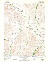 1964 Barnard1965 Print · USGSBarnard sits at the intersection of rail and river in north-central Kansas during the mid-1960s. Genealogists and local historians can trace the early township divisions and find family sites near Milo Cem, Union Valley Cem, and the winding Salt Creek.2 unique versions available
 - 1964 Map of Ada, 1966 Print
 1964 Ada1966 Print · USGSNorth-central Kansas in the mid-sixties reveals a landscape shaped by the rail-and-river economy where the Atchison Topeka and Santa Fe meets the valley of Salt Creek. Researchers can locate family roots at the Bohemian National Cem or trace the early foundations of Ada and Milo.
 - 1964 Map of Beloit SE, 1966 Print
 1964 Beloit SE1966 Print · USGSMitchell County farmland is mapped here in the mid-1960s, showing a landscape shaped by creek drainages and township lines. Genealogists can locate landmarks like Laban Sch, Green Mound Ch, and the small settlement of Saltville.
 - 1966 Map of Scottsville, 1967 Print
 1966 Scottsville1967 Print · USGSIn the mid-sixties, the prairie landscape around the Mitchell and Jewell County border was a quiet network of railroad sidings and rural townships. Researchers can trace the path of the Missouri Pacific through Scottsville or locate family plots at St Marys Cem and Lutheran Cem.
 - 1967 Map of Hunter, 1969 Print
 1967 Hunter1969 Print · USGSThe rural plains of Mitchell and Lincoln counties are captured here in the late sixties, centered on the railroad town of Hunter. Genealogists and historians can trace local family landmarks such as Greenwood Union Cem, Spillman Cem, and the winding Bacon Creek.
 - 1968 Map of Beloit SW, 1969 Print
 1968 Beloit SW1969 Print · USGSMitchell County farmland is mapped here in the late sixties, showing the rural townships of Center and Bloomfield. Genealogists and local historians can trace family locations near Elmira Cem, Pleasant View Ch, and several creekside Quarries.2 unique versions available
 - 1968 Map of Lincoln NW, 1969 Print
 1968 Lincoln NW1969 Print · USGSThe rural landscapes of Mitchell and Lincoln Counties are captured here in the late sixties, showing a world of section-line roads and winding creek beds. Genealogists can locate Prairie Grove Cem or trace the early paths of Rattlesnake Creek and Salt Cr.2 unique versions available
 - 1968 Map of Ash Grove, 1969 Print
 1968 Ash Grove1969 Print · USGSNorth-central Kansas ranching and rail lands are captured here in the late sixties as the local economy centered on the creek-side townships. Genealogists and historians can trace family locations near Bethany Ch, Patterson Cem, and the rail stop at Ash Grove.
End of results
Showing maps 1-12 of 12
Top cities of Mitchell County
- Beloit historical maps
- Cawker City historical maps
- Glen Elder historical maps
- Tipton historical maps
- Asherville historical maps
- Solomon Rapids historical maps
See more
Frequently asked questions
- What are the different types of historical maps available for Mitchell County?
- What is the oldest map of Mitchell County?
- Where can I purchase historical maps of Mitchell County for my home or office?
- Where can I download high-res historical maps of Mitchell County?
- Are there historical topographic maps available for Mitchell County?
- Is there historical aerial imagery available for Mitchell County?
- Where are historical maps of Mitchell County sourced from?