Old Maps of McCreary County, Kentucky for Metal Detecting
Plan your next treasure hunt with 129 historic maps of McCreary County. Find old homesites, ghost towns, trails, and gathering spots that may be lost to time — perfect for identifying promising metal detecting locations.
- Locate forgotten sites: Uncover places like long-lost settlements, abandoned rail lines, or gathering spots.
- Plan better hunts: Use map overlays combined with LiDAR or satellite views to narrow in on historically rich areas.
- Made for detectorists: Thousands of hobbyists use these maps to discover relics, coins, and hidden history.
Use these historic maps to boost your research and find new opportunities beneath the surface of McCreary County.
McCreary County, KY maps
(129)- 1890 Map of Williamsburg
 1890 Williamsburg1890 Print · USGSThe Kentucky and Tennessee borderlands come alive in the late nineteenth century as the coal industry and railroads expand. Genealogists can trace family roots in Williamsburgh or locate early industrial sites like Beaver Mines and Steels Mill.2 unique versions available
 - 1894 Map of Williamsburg
 1894 Williamsburg1894 Print · USGSThe Cumberland River valley and the Kentucky-Tennessee borderlands are captured here during the late nineteenth-century coal and rail expansion. Researchers can trace early industrial sites like Beaver Mines and Kensee Coal Mine or locate family roots in Whitley and Chitwood.5 unique versions available
 - 1932 Map of Burnside
 1932 Burnside1932 Print · USGSThe Cumberland River and its South Fork are captured here in the early 1930s, showing the intricate river-and-rail topography of southern Kentucky. Researchers can locate dozens of country landmarks like Roberts Mill, Lovells Chapel, and Pole Bridge Sch.2 unique versions available
 - 1934 Map of Barthell
 1934 Barthell1934 Print · USGSMcCreary County during the late 1920s reveals a landscape of industrial outposts and river-bound settlements at the edge of the Tennessee line. Researchers can trace the Kentucky and Tennessee Railway corridor or find family roots at Kidds Crossing, Cooperative, and Laurel Hill Ch.
 - 1934 Map of Pall Mall
 1934 Pall Mall1934 Print · USGSThe Kentucky-Tennessee borderlands appear in great detail during the late interwar period, showing a landscape of remote mountain hamlets and schools. Genealogists can locate family landmarks such as Edwards Chapel, Slickford, and the Parmley Sch among the cliffs and ridges.
 - 1952 Map of Hail, 1953 Print
 1952 Hail1953 Print · USGSThe Cumberland River valley and the southern reaches of the Daniel Boone Forest appear here in the early fifties. Local historians can trace the paths to Hail P O, find the site of North Mill Creek Sch, and locate remote churches like Salem Ch.
 - 1952 Map of Hollyhill, 1954 Print
 1952 Hollyhill1954 Print · USGSThe rugged coal and timber country of McCreary and Whitley Counties is captured here in the early fifties. Genealogists and historians can locate numerous rural landmarks including Hollyhill, Bear Wallow Sch, and several Strip Mine operations.2 unique versions available
 - 1952 Map of Wiborg, 1954 Print
 1952 Wiborg1954 Print · USGSMcCreary County's rugged plateau is captured in the early fifties, showing the interplay of the Southern railroad and rural communities. Genealogists can locate family landmarks such as Beulah Heights, Noah Chapel, and Pleasant Knob Ch.
 - 1952 Map of Cumberland Falls, 1954 Print
 1952 Cumberland Falls1954 Print · USGSWhitley and McCreary Counties in the early fifties reveal a landscape defined by the winding river and deep forest. Genealogists can locate family landmarks like Ridenour Cem and rural centers such as Honeybee, Pleasant Hill Ch, and Sand Hill Sch.2 unique versions available
 - 1952 Map of Whitley City, 1954 Print
 1952 Whitley City1954 Print · USGSMcCreary County during the early fifties reveals a landscape defined by the Kentucky coal industry and the timber of the national forest. Researchers can trace railroad history through the Kentucky and Tennessee line or locate family sites like Pine Knot Cem and Round Top Sch.
 - 1952 Map of Sawyer, 1954 Print
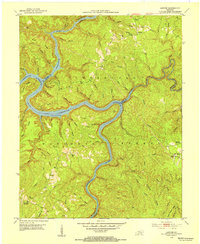 1952 Sawyer1954 Print · USGSThe confluence of the Rockcastle and Laurel Rivers in the early fifties shows a landscape of deep hollows and high ridges within the Cumberland National Forest. Researchers can trace old family sites and rural institutions like Sawyer, Franklin Sch No 2, and Poynters Ch.2 unique versions available
 - 1953 Map of Winfield, 1954 Print
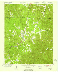 1953 Winfield1954 Print · USGSThe Tennessee-Kentucky border comes alive in the mid-1950s, centered on the railroad hub of Winfield and the surrounding timberlands. Genealogists can trace family landmarks like Chitwood Cem, Isham, and rural schoolhouses such as Upper Marsh Creek Sch.2 unique versions available
 - 1953 Map of Jellico West, 1954 Print
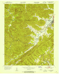 1953 Jellico West1954 Print · USGSThe Tennessee-Kentucky borderlands in the early fifties show a landscape shaped by coal and rail through the narrow valleys of the Cumberland. Trace the path of the Southern Railway past the Standard Mine and find family sites like the Black Oak Cem or the Zion Hill Sch & Ch.2 unique versions available
 - 1953 Map of Ketchen, 1955 Print
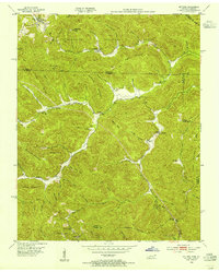 1953 Ketchen1955 Print · USGSThe Tennessee-Kentucky border comes alive in the early fifties, showing a remote landscape of ridge-top schools and creek-side settlements. Genealogists can trace family roots at Blankenship Cem, Hayes Creek Sch, or the small community of Ketchen.2 unique versions available
 - 1954 Map of Parmleysville, 1955 Print
 1954 Parmleysville1955 Print · USGSThe Wayne County highlands come into focus in the mid-1950s, showing a network of remote hollows and high knobs. Researchers can trace family history through the sites of Parmleysville Sch, Mt Pisgah, and dozens of Oil Wells dotting the ridges.2 unique versions available
 - 1954 Map of Coopersville, 1955 Print
 1954 Coopersville1955 Print · USGSSouthern Wayne County at the mid-century is captured here as a landscape of forest cliffs and river bends. Genealogists can trace family names across rural schoolhouses and churches like Big Sinking Sch, Shiloh Ch, and Kidds Crossing Cem.4 unique versions available
 - 1954 Map of Burnside, 1955 Print
 1954 Burnside1955 Print · USGSThe river loops and rugged ridges of Pulaski County are caught here in the mid-fifties, just as the Southern railroad served the timber and coal interests of the region. Researchers can locate vanished landmarks and family sites like Mt Union Sch, Owens Cem, and the old station at Sloans Valley.2 unique versions available
 - 1954 Map of Nevelsville, 1955 Print
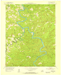 1954 Nevelsville1955 Print · USGSMcCreary and Wayne counties are shown in the mid-1950s, dominated by the winding South Fork Cumberland River. Genealogists can trace remote family sites like Jonesville, Freedom Chapel, and the Foster Sch among the bluffs and ridges.5 unique versions available
 - 1954 Map of Barthell, 1955 Print
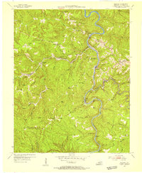 1954 Barthell1955 Print · USGSMcCreary County during the mid-1950s reveals a landscape defined by the winding South Fork of the Cumberland River and a bustling coal rail network. Trace the tracks of the Kentucky and Tennessee RR through company towns like Barthell, Blue Heron, and Worley.3 unique versions available
 - 1954 Map of Bell Farm, 1955 Print
 1954 Bell Farm1955 Print · USGSMcCreary and Wayne counties in the mid-1950s are depicted here as a landscape of isolated ridges and timber management. Genealogists can trace family homesteads near Barrier Cem, the Bell Hill Sch, or the remote settlement of Bell Farm.3 unique versions available
 - 1955 Map of Sharp Place, 1956 Print
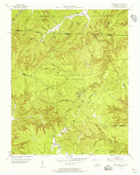 1955 Sharp Place1956 Print · USGSThe Tennessee-Kentucky borderlands come alive in the mid-fifties, showing a landscape shaped by national forests and small ridge-top communities. Genealogists can locate family sites like Akers Chapel, Sharp Place Cemetery, and the Langham School.5 unique versions available
 - 1955 Map of Oneida North, 1956 Print
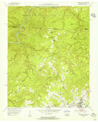 1955 Oneida North1956 Print · USGSScott County and the Kentucky borderlands come alive in the mid-fifties, showing the rail and ridge life of the plateau. Researchers can trace family history through sites like Atomic Sch, Grave Hill Cem, and the industry at the Strip Mine.4 unique versions available
 - 1955 Map of Barthell SW, 1956 Print
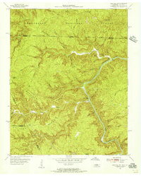 1955 Barthell SW1956 Print · USGSThe Tennessee and Kentucky borderlands in the mid-fifties reveal a landscape of deep river gorges and isolated ridge-top schools. Genealogists and historians can trace family locations along No Business Creek and find the site of the Station Camp Sch.4 unique versions available
 - 1956 Map of Corbin, 1966 Print
 1956 Corbin1966 Print · USGSThe Kentucky and Tennessee borderlands are captured here in the mid-fifties, showing the region's shift toward modern interstate travel and reservoir development. Genealogists and historians can trace old community lines near Albany and Monticello or locate early rail junctions along the Southern and Tennessee Central lines.3 unique versions available
 - 1958 Map of Corbin
 1958 Corbin1958 Print · USGSThe Upper Cumberland borderlands appear in the late 1950s as massive reservoirs and early atomic-era growth reshape the region. Trace family roots and vanished landmarks near Lake Cumberland, Oak Ridge, and the Cumberland National Forest.
Showing maps 1-25 of 129
Frequently asked questions
- What are the different types of historical maps available for McCreary County?
- What is the oldest map of McCreary County?
- Where can I purchase historical maps of McCreary County for my home or office?
- Where can I download high-res historical maps of McCreary County?
- Are there historical topographic maps available for McCreary County?
- Is there historical aerial imagery available for McCreary County?
- Where are historical maps of McCreary County sourced from?