Old Maps of Oakdale, Louisiana for Hiking & Exploration
Hike through history with 23 historic maps of Oakdale. Explore old trails, ghost towns, and forgotten backroads — perfect for outdoor adventurers and local explorers.
- Rediscover forgotten places: Map out old mining camps, roads, and footpaths that no longer exist on modern maps.
- Layer with modern tools: Combine with LiDAR or satellite views to plan hikes through historical terrain.
- Made for exploration: Popular among hikers, overlanders, and local history lovers.
Use these maps to find adventure and explore the hidden past of Oakdale.
Oakdale, LA maps
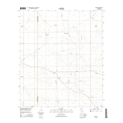
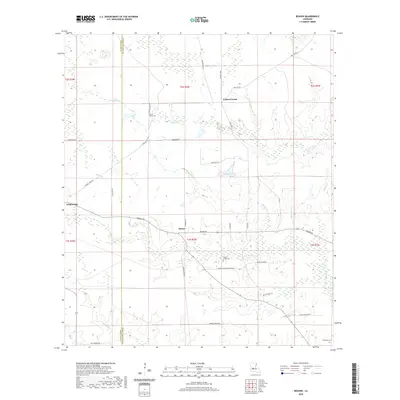
(23)- 1935 Map of Beaver
 1935 Beaver1935 Print · USGSEvangeline Parish is captured here during the mid-1930s as the era of heavy timber harvesting leaves its mark on the land. Researchers can trace the sprawling Old Logging Railroad Grade and locate old gathering places like Cypress Creek Settlement and the Beaver Sch.
 - 1935 Map of Oakdale
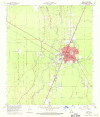
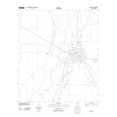
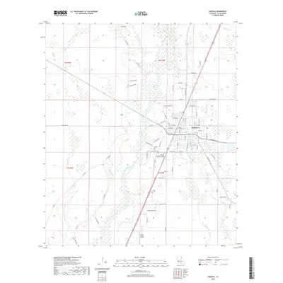
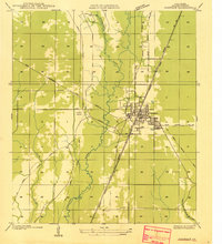 1935 Oakdale1935 Print · USGSOakdale emerges as a bustling railroad and timber hub in the mid-1930s, situated at the intersection of major rail lines and local logging routes. Genealogists and historians can trace the Oakdale townsite, the Oak Hill Ch, and the extensive Logging Railroad networks that powered the regional economy.
 - 1942 Map of Oakdale, 1964 Print
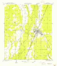
 1942 Oakdale1964 Print · USGSCentral Louisiana's timber and rail country comes to life in the early 1940s as the Calcasieu River winds through Oakdale and Glenmora. Genealogists can trace family roots through landmarks like Hargrove Farm, Cryer Cem, and Cypress Creek Settlement.
 - 1952 Map of Lake Charles
 1952 Lake Charles1952 Print · USGSSouthwest Louisiana is captured here in the mid-fifties, showing a landscape defined by the rise of the petrochemical industry and deep-water navigation. Researchers can trace family roots through numerous small-town settlements and oil developments like Nibletts Bluff, the Lockport Oil Field, and Starks.
 - 1954 Map of Beaver
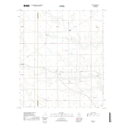
 1954 Beaver1954 Print · USGSEvangeline and Allen Parish lands appear here in the mid-1930s, showing a landscape shaped by the waning days of the timber industry. Genealogists and historians can trace the foundations of the Cypress Creek Settlement, the Beaver School, and miles of Old Logging Railroad grades.
 - 1954 Map of Lake Charles, 1964 Print
 1954 Lake Charles1964 Print · USGSSouthwest Louisiana in the mid-fifties is defined by its massive petroleum industry and its complex network of bayous and rail lines. Researchers can trace the development of the Sulphur Mines Oil Field or locate historic settlements like Longville and De Quincy.3 unique versions available
 - 1955 Map of Oakdale
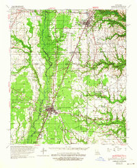
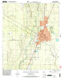
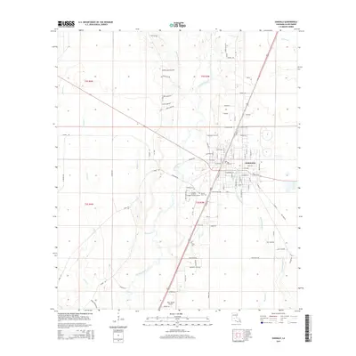
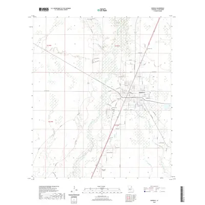
 1955 Oakdale1955 Print · USGSOakdale emerges as a bustling timber and rail center in the mid-1950s, where multiple major lines and highways converged. Researchers can trace local landmarks like Oak Hill Ch and the Oakdale Airport alongside numerous Logging Railroad spurs.
 - 1968 Map of Oakdale, 1970 Print
 1968 Oakdale1970 Print · USGSAllen Parish and Rapides Parish intersect during a period of industrial and aviation growth in the late sixties. Genealogists and local historians can trace family sites like Osburn Willis Cem, Bethany Ch, and the rural community of Union Hill.
 - 1968 Map of Oakdale, 1970 Print
 1968 Oakdale1970 Print · USGSOakdale serves as a busy rail and aviation hub in the late sixties, where the timberlands meet industrial infrastructure. Researchers can trace family roots through several local landmarks like Oak Hill Cem, Mt Vernon Ch, and the Sacred Heart Cem.3 unique versions available
 - 1968 Map of Beaver, 1970 Print
 1968 Beaver1970 Print · USGSEvangeline and Allen Parishes are captured here in the late sixties, showing a landscape defined by timber, bayous, and rural homesteads. Trace local family history at the Beaver Cem and Pecan Grove Cem, or locate the site of the Beaver Lookout Tower.
 - 1986 Map of Ville Platte
 1986 Ville Platte1986 Print · USGSCentral Louisiana in the 1980s reveals a complex landscape of pine forests and bayou networks spanning seven distinct parishes. Researchers can trace historic rail lines like the Atchison Topeka and Santa Fe RR and locate settlements such as Simmons Settlement, Redland, and Elizabeth.2 unique versions available
 - 1998 Map of Beaver, 2002 Print
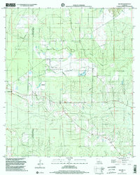 1998 Beaver2002 Print · USGSThe Allen and Evangeline Parish line runs through this piney woods landscape at the end of the nineties, just east of Oakdale. Local researchers can trace family landmarks like Beaver Cemetery or locate the Beaver Lookout Tower and Leger Landing Strip.2 unique versions available
 - 1998 Map of Oakdale, 2003 Print
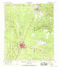
 1998 Oakdale2003 Print · USGSOakdale and the surrounding Allen Parish wetlands are documented here in the late 1990s as the community balanced industrial growth with wildlife conservation. Researchers can trace family sites at Cryer Cem and Oak Hill Ch or follow the Old Railroad Grade through the woods.
 - 2012 Map of Beaver, 2012 Print
 2012 Beaver2012 Print · USGSCovers Oakdale, including Beaver, Cypress Creek, and other nearby areas
 - 2012 Map of Oakdale, 2012 Print
 2012 Oakdale2012 Print · USGSCovers Oakdale, including Allen Parish, United States, and other nearby areas
 - 2015 Map of Beaver, 2015 Print
 2015 Beaver2015 Print · USGSCovers Oakdale, including Beaver, Cypress Creek, and other nearby areas
 - 2015 Map of Oakdale, 2015 Print
 2015 Oakdale2015 Print · USGSCovers Oakdale, including Allen Parish, United States, and other nearby areas
 - 2018 Map of Beaver, 2018 Print
 2018 Beaver2018 Print · USGSCovers Oakdale, including Beaver, Cypress Creek, and other nearby areas
 - 2018 Map of Oakdale, 2018 Print
 2018 Oakdale2018 Print · USGSCovers Oakdale, including Allen Parish, United States, and other nearby areas
 - 2020 Map of Oakdale, 2020 Print
 2020 Oakdale2020 Print · USGSCovers Oakdale, including Allen Parish, United States, and other nearby areas
 - 2020 Map of Beaver, 2020 Print
 2020 Beaver2020 Print · USGSCovers Oakdale, including Beaver, Cypress Creek, and other nearby areas
 - 2024 Map of Beaver, 2024 Print
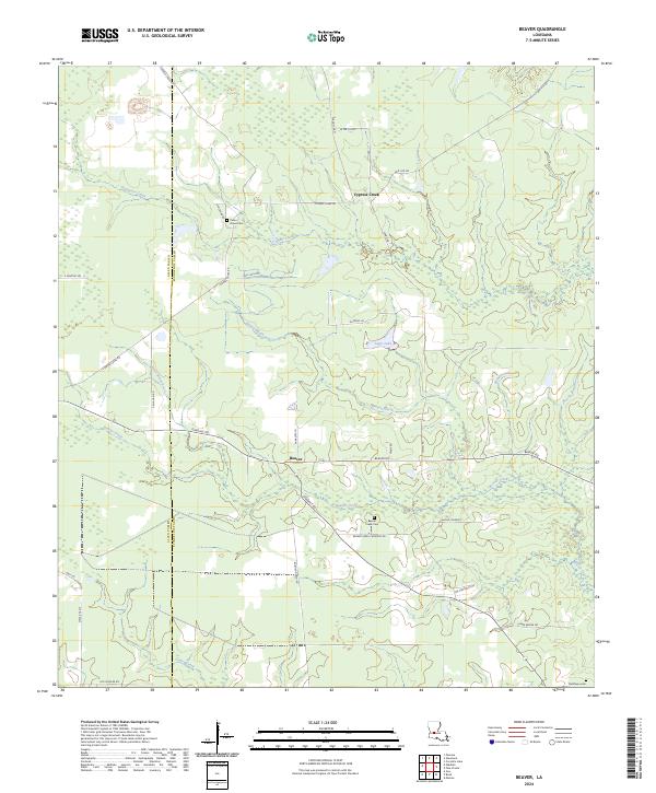 2024 Beaver2024 Print · USGSEvangeline Parish and the settlement of Beaver are shown in 2024 at the edge of the parish line. Researchers can trace family history at Beaver Creek Cem and Delafosse Cem or follow the waters of Cypress Creek.
 - 2024 Map of Oakdale, 2024 Print
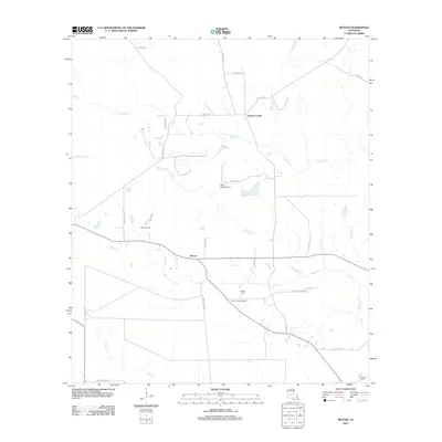
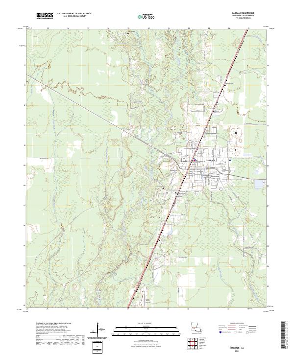 2024 Oakdale2024 Print · USGSIn the heart of Allen Parish during the early 2020s, the town of Oakdale remains a critical intersection of river geography and rural industry. Researchers can trace local lineage through sites like Resthaven Cem or follow the path of the Calcasieu River as it winds past Allen Parish Airport.
End of results
Showing maps 1-23 of 23
Top cities near Oakdale
- Mamou historical maps
- Oberlin historical maps
- Glenmora historical maps
- Pine Prairie historical maps
- Elizabeth historical maps
- Forest Hill historical maps
See more
Frequently asked questions
- What are the different types of historical maps available for Oakdale?
- What is the oldest map of Oakdale?
- Where can I purchase historical maps of Oakdale for my home or office?
- Where can I download high-res historical maps of Oakdale?
- Are there historical topographic maps available for Oakdale?
- Is there historical aerial imagery available for Oakdale?
- Where are historical maps of Oakdale sourced from?